Hike Location: Crooked Run Nature Preserve
Geographic Location: southeast of New Richmond , OH (38.79003, -84.13109)
Length: 1 mile
Difficulty: 1/10 (Easy)
Dates Hiked: June 2001, October 2015
Overview: An easy, wildlife-filled walk along the banks of the Ohio River .
Preserve Information: https://www.clermontparks.org/chilo-lock-34-park-and-river-museum-and-crooked-run-nature-preserve/
Photo Highlight:


Directions to the trailhead: From New Richmond, go east on US 52 15 miles to the town of Chilo . Where SR 222 goes off to the left, turn right. Proceed two blocks to a “no outlet” sign and turn left onto a narrow paved road. From here, follow signs first for “Chilo Lock #34 Park” then to “Crooked Run Nature Preserve.” Park in the parking lot by the superintendent’s office.
The hike: Prior to the 1920’s, the stream flowing into the Ohio River at the eastern edge of this nature preserve was known simply as Crooked Run Creek. Waters in the river were shallower at that time and backed up less than a mile into the creek. This created a small and insignificant inlet, at least by Ohio River standards.
All of that changed with the construction of Chilo Dam on the Ohio River by the Army Corps of Engineers. This dam was part of a larger project to make the river’s levels more consistent and easier to navigate. The result was to raise the river’s level at Chilo several feet, causing water to back up into Crooked Run Creek for seven miles.
Today, this section of the creek is known as Crooked Run Estuary, one of the few remaining untarnished estuaries on the Ohio River . By means of the park that bears the dam’s name, Clermont County and the State of Ohio (they jointly administer this park) plan to keep this area as a haven for wildlife and a source of recreation. The 77 acre preserve was made possible by a generous land donation by Robert and Mimi Paul. Upon her death in 1991, Mimi had lived on the land for over 55 years. Now the land is open for all of us to enjoy.
The land gift was made to the Ohio Department of Natural Resources via a life trust in 1980. The park is managed by the Clermont County Park District and includes picnic tables and a sand volleyball court in addition to the preserve. Several trails allow access to the preserve. My favorite is the Outer Loop Trail, which traces the boundary of the preserve. This trail allows views of the river, estuary, a pond, a field, and some young forest, all for only 1 mile of hiking.
 |
| Trailhead: Crooked Run Nature Sanctuary |
The outer loop trail leaves to the right of the board as the gravel road continues straight ahead. Proceed east through young forest and in 0.1 miles arrive at a trail intersection where you can go left, right, or straight. First, turn right to arrive at an Ohio River overlook. From this vantage point, you can watch for waterfowl or simply watch boats both large and small go up and down the river. A left turn at this intersection will lead on a short side trail to a wooden observation deck overlooking a 30-acre meadow. Birds such as larks, cardinals, and blue jays can be observed from this deck in addition to butterflies and other insects dashing from flower to flower in the field.
|
| Ohio River overlook |
As directed by signs, turn left on the gravel road and walk 300 feet to where the trail reenters the forest on the right. The estuary is now in view on the right, and you will soon come to the first of three bird blinds overlooking the waters. On my visit to the estuary, I saw a great blue heron, a blackbird, and a downey woodpecker, and I could hear various types of songbirds chirping away in the nearby trees.
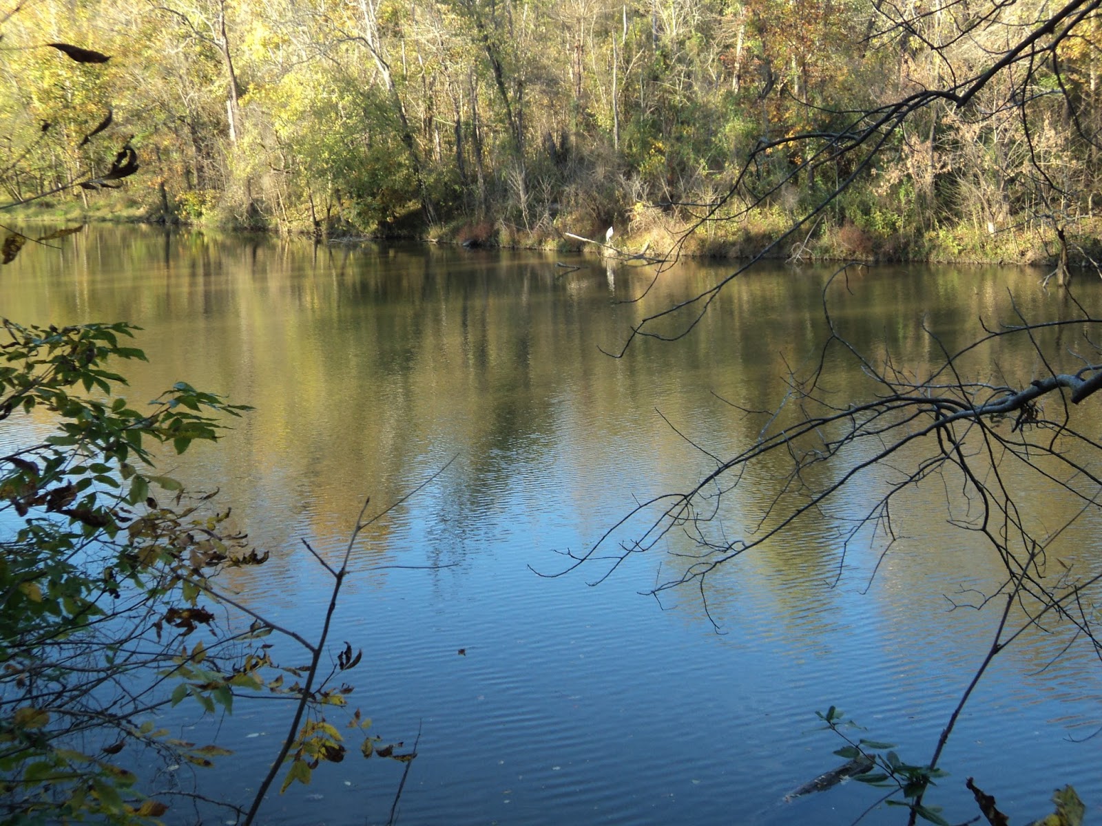 |
| Looking out into the estuary |
 |
| Hiking past the meadow |
No comments:
Post a Comment