Hike Location: Daniel Boone National Forest,
Geographic Location: southwest of London , KY (37.02899, -84.31899)
Length: 5.5 miles
Difficulty: 7/10 (Moderate)
Date Hiked: October 2011
Overview: A loop hike with one steep section featuring views of the scenic Rockcastle River
Area Information: https://www.fs.usda.gov/recarea/dbnf/recarea/?recid=84081
Hike Route Map: https://www.mappedometer.com/?maproute=940320
Photo Highlight:
Hike Route Map: https://www.mappedometer.com/?maproute=940320
Photo Highlight:
Directions to the trailhead: In southern Kentucky , take I-75 to SR 192 (exit 38). Exit and go west on SR 192. Follow SR 192 18.9 miles to its crossing of the Rockcastle River
The hike: Slicing a jagged northeast to southwest course through rural southern Kentucky , the Rockcastle River is a classic large-volume Appalachian Mountain river. Like the Cumberland, Laurel, and New Rivers, over many years the Rockcastle River
One of the few developed areas along the Rockcastle River Rockcastle River
Operated by Daniel Boone National Forest Rockcastle River
The red-blazed trail departing the rear of the day-use parking area is the Rockcastle Narrows Trail; it will be our return route. To reach the start of the Bee Rock Loop, walk back through the campground on the gravel campground road. After passing 14 campsites and 2 restroom buildings, ignore the steep east arm of the Bee Rock Loop and continue walking on the gravel road, which soon turns to blacktop. Pass the Old Sublimity Bridge
 |
| Wooden steps near beginning of trail |
 |
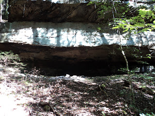
| Two-story rock house |
 |
| Pulpit rock |
1 mile into the hike, the trail turns right to leave the old roadbed and cross a small creek on a wooden bridge. For the next 0.3 miles the trail becomes increasingly hard to follow as it angles left and climbs gradually through the dense understory that encumbers the ridgetop. Some blazes would be very helpful here, but none are to be found. Just when you think you may have lost the trail, you come out onto abandoned Forest Road 5063, which is now a wide grassy path going left and right. I was glad I was hiking the Bee Rock Loop in this direction: I would have never found the unmarked turn off of the abandoned forest road if I had been walking on the road.
This hike will eventually turn left on the abandoned road to access the Rockcastle Narrows Trail, but first turn right to head for Bee Rock Overlook, the highlight of this hike. After 0.5 miles of gradual descent on the abandoned road (white blazes reappear exactly where they are unnecessary), you reach Bee Rock Overlook. The overlook gives a commanding view of the Rockcastle River
 |
| View from Bee Rock Overlook |
The trail ends at the overlook, so you next have to reverse course and climb gradually along the abandoned forest road. Note that the east arm of the Bee Rock Loop exits at a soft angle to the right just after leaving the overlook. This alternate trail provides a steep short-cut back to the campground and a hike of only 2.2 miles. Stay left at this trail fork to continue this hike.
2.8 miles into the hike and roughly 100 feet after the west arm of the Bee Rock Loop leaves the abandoned road (if you can find that intersection), the Rockcastle Narrows Trail exits to the right. This intersection is marked with a pair of brown carsonite posts, but the posts are partially obscured by vegetation. Watch carefully for the posts and turn right to begin the Rockcastle Narrows Trail, our route back to the campground. Also, watch for poison oak near this intersection.
 |
| Leaving the old road |
 |
| Cliff along trail during descent to river |
At 3.5 miles, you reach the bottom of the descent, where another brown carsonite post directs you to turn right. For the remainder of the hike the trail parallels the Rockcastle River
At 3.8 miles, the trail crosses a small tributary of the Rockcastle River
 |
| Boulders in Rockcastle River |
4.9 miles into the hike, the trail crosses a rough area that appears to have been a landslide at some point in the past. At 5.4 miles, the best close-up view of the river available on this hike opens up through a gap in the trees on your left. Several large boulders lie in the river at this point. Another 4 minutes of walking will return you to the rear of the day-use parking area, thus marking the end of the hike.
No comments:
Post a Comment