Showing posts with label Hawaii Hikes. Show all posts

Friday, July 11, 2025

Waimea Valley Botanical Garden and Waimea Falls (Blog Hike #1070)

Trails: (unnamed)
Hike Location: Waimea Valley Botanical Garden and Waimea Falls
Geographic Location: north of Waialua, HI (21.63641, -158.05447)
Length: 2.2 miles
Difficulty: 2/10 (Easy)
Date Hiked: April 2025
Overview: A modified out-and-back mostly on asphalt trail to Waimea Falls.
Park Information: https://www.waimeavalley.net/
Hike Route Map: https://www.mappedometer.com/?maproute=983720
Photo Highlight:
Hawaii Trip Video: (coming December 23)

Directions to the trailhead: Waimea Valley is located on SR 83 5.6 miles north of Waialua on the northwest side of Oahu.  Turn inland to enter the valley, and park at the only parking lot.  Alternatively, The Bus route 60 stops right outside the entrance to Waimea Valley.

The hike: Regardless of whether you arrive by city bus, tour bus, or private vehicle, at first Waimea Valley Botanical Garden screams tourist attraction.  There is the crowded parking lot and entrance plaza.  There is the mandatory concession building selling overpriced food items and souvenirs.  There is also the sky-high $25 admission fee.  But once you get away from the touristy stuff at the entrance and get into the garden itself, there is a very developed but very nice hike to be had here.  Of the 3 hikes I did on Oahu, this one may be my favorite even though it is the only one that does not lead to a beach.
            The garden is owned and maintained by Hi'ipaka LLC, a private non-profit organization created in 2003 by a collaboration of county, state, and federal agencies specifically to care for Waimea Valley.  In the previous 2 centuries, the valley saw ranching and farming, and Oahu high priests lived here.  Today a single main asphalt trail goes through the center of the garden to Waimea Falls, but an innumerable number of side trails offer access to the garden's more remote corners.  This hike goes out on the main trail and explores some of the side trails on the way back.
Information board behind ticket booth
    
        Walk through the open-air Visitor Center, pass through the ticket booth, pay the admission fee, and walk halfway around the circle behind the ticket booth to begin following the asphalt trail upstream.  Next you cross a side stream to reach an area dominated by native Hawaiian flora.  Many of the plants in this area are rare or endangered, and the ku'ula shrine, or fishing shrine, is also located here.
Native Hawaiian flora area
    
        750 feet from the parking lot, you cross the Waimea River on a bridge for the first of three times.  The river was a raging torrent due to recent rains on my visit, and the amount of water in the river will give an early indication of the amount of water in Waimea Falls.  You also reach a trail intersection here.  The trail going right leads to a dead-end loop on the south side of the river, and the trail going straight was closed on my visit.  Thus, I turned left to stay on the main blacktop trail.
Pineapple plants in Pacific garden
    
        The next segment passes through the hibiscus garden, which features seemingly every type of hibiscus from all around the world.  Tags help you identify the various flora.  Continuing upstream leads through the Central and South American garden and the Pacific garden.  The latter gives you the chance to see pineapple plants in a natural environment along with some large mango trees and a banyan tree.  I also did some nice bird-watching here that included some red-crested cardinals.  Later as I exited, some peacocks were roaming around the parking lot.
Large mango tree
    
        At 0.6 miles, you reach another major trail intersection just after passing Auntie Coco's Lei Garden.  I chose to turn left to remain on the main trail and explore the side trail going right on my return route.  The fruit, nut, and spice garden, which features some banana trees, comes next as you descend the steepest grade on this entire hike and cross another side stream.  While it seems odd to descend steeply while you are heading upstream, just keep following the paved trail: it is indeed leading to the main attraction.
Main garden trail
            You pass through the gardens featuring plants from the Mascarene Islands, Sri Lanka, and Madagascar in quick order while crossing the Waimea River twice.  Just shy of 1 mile, you reach the snack bar, amphitheater, viewing area, and swimming area for Waimea Falls.  The Hawaiian word for waterfall is wailele (pronounced like why-lay-lay), and at 45 feet tall and plenty of water volume, this wailele is quite impressive.  Swimming is allowed in the large plunge pool when the current is tolerable, which it was not on my visit.  The surrounding black-rock cliffs and green jungle-like growth make for a stark setting, and this waterfall made "wailele" my new favorite Hawaiian word.
Waimea Falls
Setting for Waimea Falls
    
        The trail ends at the wailele, so you have to reverse course through the gardens to return to the parking lot.  The return route is a good opportunity to explore the many dirt side trails that lead off into various parts of the garden and along the Waimea River.  While all of the side trails quickly come back to the main paved trail, they allow more lengthy and intimate interaction with the various gardens than the paved trail, plus they add some variety to your return route.  Also, although this is the only 1 of my 3 Hawaii hikes that does not lead to a beach, Waimea Bay Beach Park with its wide sandy beach, palm trees, and black rocks is located right across SR 83; it is accessible from the Garden by a short road walk and a pedestrian bridge.

Friday, July 4, 2025

Ahupua'a 'O Kahana State Park: Kapa'ele'ele Trail (Blog Hike #1069)

Trail: Kapa'ele'ele Trail
Hike Location: Ahupua'a 'O Kahana State Park
Geographic Location: Kahana Bay, HI (21.55636, -157.87591)
Length: 0.8 miles
Difficulty: 4/10 (Easy/Moderate)
Date Hiked: April 2025
Overview: A loop on slippery, muddy trail with views of Kahana Bay.
Park Information: https://dlnr.hawaii.gov/dsp/parks/oahu/ahupuaa-o-kahana-state-park/
Hike Route Map: https://www.mappedometer.com/?maproute=983718
Photo Highlight:
Hawaii Trip Video: (coming December 23)

Directions to the trailhead: Ahupua'a 'O Kahana State Park is located on the north side of Oahu on SR 83 14.7 miles northwest of Kane'ohe.  Enter the park, and park at either the picnic area parking lot or the park office parking lot.  Alternatively, The Bus route 60 has a bus stop just outside the park entrance.

The hike: Formerly known as Kahana Valley State Park, Ahupua'a 'O Kahana State Park protects 5300 acres above Kahana Bay on Oahu's north shore.  The park gets its name because it contains Hawaii's only publicly-owned ahupua'a, or ridgeline that separates 2 watersheds.  The ahupua'a are significant because they provide a convenient way to divide up the island's land.  The valley at this park's center remains relatively in its natural state, but 31 families still live within the park's boundaries.  Thus, this park is sometimes called a "living park."
            The park has few amenities, but it offers 2 hiking trails: the 2.5 mile Nakoa Trail named for the many koa trees found along its route and the 0.8 mile Kapa'ele'ele Trail.  I came here on my final day on the island, so I hiked the shorter trail in order to visit as many sites on the island as possible.  The Kapa'ele'ele Trail is short and easy except when the trail is muddy, which it frequently is: Kahana Bay is the wettest area on Oahu, a very wet island.  During periods of wetness, this trail becomes a slippery muddy mess, and it becomes a battle just to stay upright and avoid sliding off the trail and down the mountain.  I won that battle on my hike but not without some scary moments.
State park entrance
    
        From the park entrance, walk in the main park road to the Visitor Center on the left and the park office on the right.  Some nice palm trees grow along the road, and I saw some chickens and other fowl wandering around the parking lots.  The park road continues into the park's residential area, but the signed trailhead for the Kapa'ele'ele Trail is located to the right (northeast of) the park office.  Restrooms are also provided near the park office.
Start of Kapa'ele'ele Trail
    
        The Kapa'ele'ele Trail heads into the woods on a wide two-track dirt road.  Some large koa trees live in this forest, and the dense greenery and damp environment give this hike a strong jungle feel.  A couple of wet areas need to be negotiated on this old road, but the real mud-fest is yet to come.
Sunny grassy area
    
        Just past 0.2 miles, the trail enters a small sunny area, where the ground on either side of the trail is covered with grasses.  The trail narrows here, and after re-entering the forest you start the climb to this trail's viewpoints.  The dirt underfoot has volcanic origin, and it not only gets super slippery when wet but also cakes on your shoes.  2 ropes are provided, 1 on the uphill section and 1 on the downhill section, for hikers to grab onto and keep upright.  I made it uphill without using the rope, but I had to hold onto the downhill rope with both hands.
Climbing toward the viewpoints
    
        Just shy of 0.4 miles, you reach the first reward for your climb: a broad view over Kahana Bay with green Mount Kauhi beyond.  Next the slippery and rooty climb briefly pauses as the trail dips to pass through a boulder-filled ravine.  All roots and rocks seem to be covered with a thin slippery smear of mud, so go slowly and step carefully.  The forest here consists of java plum and octopus trees, and the hike retains its jungle feel.
First Kahana Bay viewpoint
    
        After climbing out of the ravine, you reach the Koa Kapa'ele'ele Shrine: a collection of volcanic rocks some Hawaiian peoples consider sacred.  Just past the shrine, you reach the spur trail that heads left to this hike's highest viewpoint.  Although you are higher up the hill, you can actually see more of the bay from the previous viewpoint than from this one.  Take a few minutes to rest and decide which view you like best.
Highest Kahana Bay viewpoint
    
        A super steep and super rocky unofficial trail continues past the viewpoint and goes several miles up the ridge, but next comes the most adventurous part of this hike: getting back down.  You could go back the way you came, but I hiked the entire Kapa'ele'ele Trail by continuing straight and immediately heading straight downhill.  A couple of switchbacks soon ease the grade, and the descent is steeper but less rooty than the climb.  I went slow and hung onto the rope, and I made it to the bottom of the hill without leaving my feet.
Final descent
Kahana Bay, picnic area view
    
        Just shy of 0.6 miles, the trail deposits you onto the shoulder of Kamehameha Highway, also known in this area as SR 83.  Turn right to begin the road walk back to the park entrance.  You want to walk on the left side of the road facing oncoming traffic not only for legal reasons but also to admire the picnic area and beach along Kahana Bay to the left.   The views from the side of the bay may be the most scenic views on this hike.  Use the water hose at the shoe cleaning station beside the park office to wash the cakes of mud off of your shoes before boarding The Bus or getting in your car.

Friday, June 27, 2025

Ala Moana Regional Park in Honolulu, HI (Blog Hike #1068)

Trails: (unnamed)
Hike Location: Ala Moana Regional Park
Geographic Location: downtown Honolulu, HI (21.29291, -157.85408)
Length: 2.9 miles
Difficulty: 1/10 (Easy)
Date Hiked: April 2025
Overview: An oceanfront loop on flat paved trail with views of the Pacific Ocean and of Diamond Head.
Park Information: https://pros2.hnl.info/parks/59570ad5e4ef9fe84fea45fe?d-direction=asc&d-sort=name&d-page=1&d-offset=0&d-limit=10
Hike Route Map: https://www.mappedometer.com/?maproute=983717
Photo Highlight:
Hawaii Trip Video: (coming December 23)

Directions to the trailhead: This hike starts at the northwest corner of Ala Moana Regional Park at the intersection of Ala Moana Boulevard (SR 92) and Kamakee Street.  This point is most easily reached by bus, or you could park anywhere on Ala Moana Park Drive, which parallels this hike's route for nearly a mile.

The hike: After I graduated from high school in June 1995, 3 years before even the first version of this blog existed, my mom and I took our first hiking road trip.  We lived in Cincinnati, and that trip went south to Big South Fork National River and Recreation Area on the Kentucky/Tennessee state line.  We visited and hiked in our first 2 states on that trip, and we set a goal to visit and hike in all 50 states.
            I took my mom on a cruise to Alaska in 2011 for her 75th birthday, where I hiked in my 31st state.  My mom died in 2014, having visited 45 states and having hiked in most of them.  In 2021, I hiked at Columbia Hills Historical State Park in Washington to get my 49th state.  Finally, in early April 2025, I boarded a plane that touched down in Honolulu just before sunset, thus visiting my 50th state.  I did my first Hawaii hike the next day, which is the hike described here.  This hike and the next 2 hikes are from my bucket list Hawaii trip, and while (hopefully) they are not the final hikes in this blog, they represent the culmination of an amazing 30 year journey.
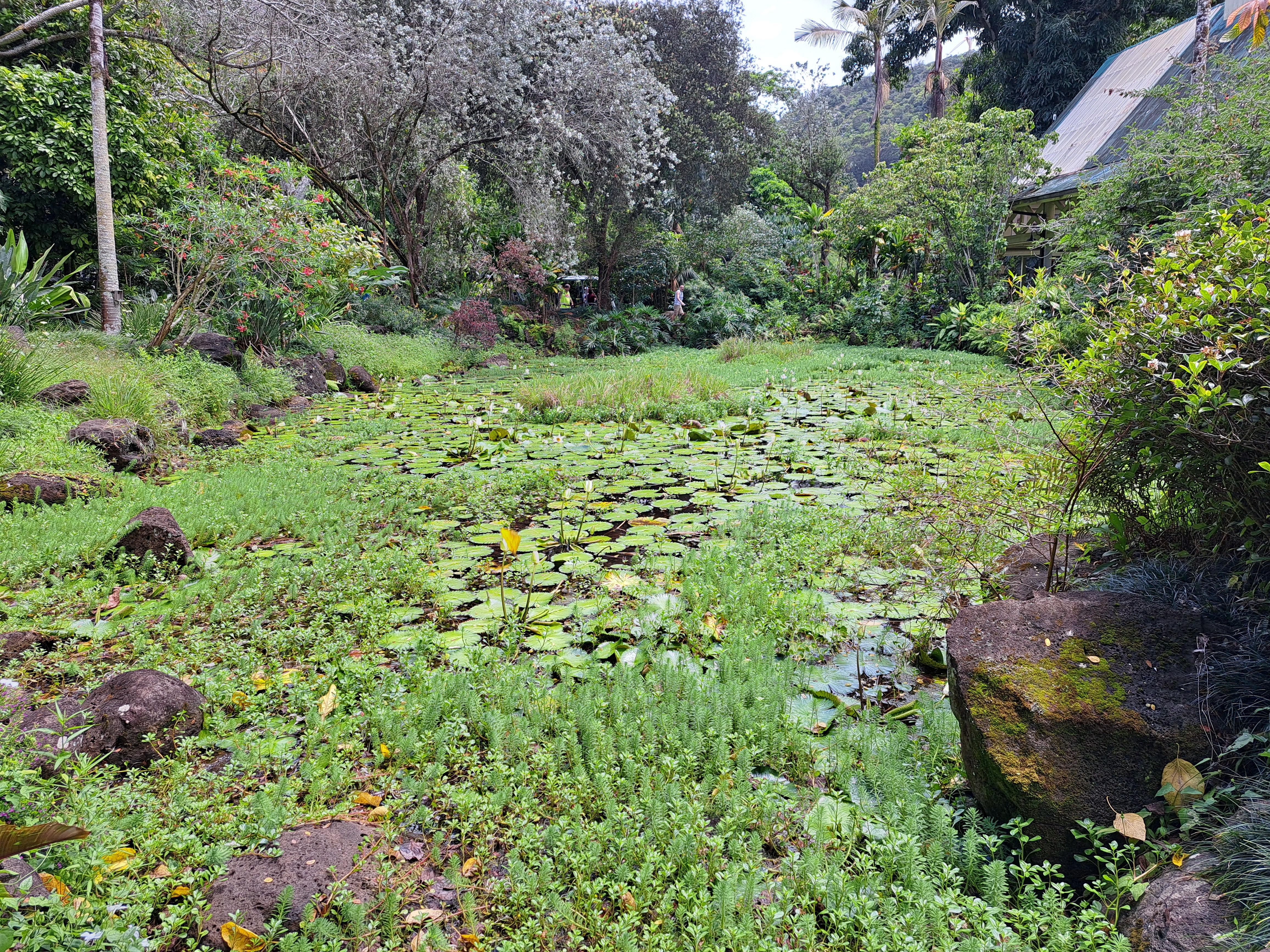
            The name Ala Moana means "path to the sea," and while the park we see today seems to be idyllic and classic Hawaii, in fact it is anything but natural.  As recently as the 1920's a swampy marshland occupied these grounds, and the wetland was used as an unofficial garbage dump.  The park's land consists mostly of dredging deposits made by the Hawaiian Dredging Company in the 1930's.  The land was used as a military staging area during World War II, and the beach opened in 1954.  The park is owned and maintained by the City of Honolulu, and its close proximity to the city means that it closes every night at 10pm to discourage the homeless population from living here.
            Most of the park's amenities were built by depression-era federal agencies such as the Civil Works Administration, and those amenities remain the park's main features today.  Amenities include tennis courts, a lawn bowling green, a sports pavilion, a beach with lifeguards, and several miles of paved trails.  The hike described here forms a loop around the entire park, and while it is on asphalt or concrete all the way, it features some of the best scenery Honolulu has to offer.
Park entrance sign at northwest corner
    
        There are several places where you could start this hike, but I rode The Bus to reach this park.  Thus, I started at the park's northwest corner, the point closest to my bus stop.  Enter the park from Ala Moana Park Drive and head east on the concrete trail with busy Ala Moana Boulevard on your left and the park's west lagoon on your right.  This part of the trail passes through a mowed-grass area dotted with trees and boulders, probably of volcanic origin.  The surroundings are pleasant, but the noise and bustle of the city are everywhere on this part of the hike.
Hiking eastbound
    
        Just past 0.1 miles, turn right to cross 
a footbridge over the water channel that connects this park's 2 lagoons, then turn left to continue your eastward course.  The next part of the hike traces the northern edge of this park's developed area.  You pass the lawn bowling green, McCoy Pavilion, and the tennis courts, all on your right.  I did some nice wildlife viewing here that included cattle egrets, golden plovers, and feral cats.  Some picnic tables make nice places to rest and admire the birds.
Cattle egret
    
        At 0.8 miles, you reach the eastern lagoon.  Some palm trees and banyan trees live here, and this lagoon is larger and more scenic than the western lagoon, thus making this part of the park more popular.  Do a loop around the eastern lagoon by continuing east until you intersect Ala Moana Park Drive, and then turn right to walk the sidewalk along the drive.  Looking to the right provides a nice view of downtown Honolulu behind the lagoon, and the lagoon's water is so clear you can see fish swimming in the lagoon.
Eastern lagoon
Honolulu behind eastern lagoon
    
        1.1 miles into the hike, turn left to cross Ala Moana Park Drive on a crosswalk and head south with a huge parking lot on your right and the Ala Wai Harbor on your left.  This trail takes you into the Magic Island part of the park.  Originally intended to be a resort, Magic Island is a peninsula consisting of dredged coral fill that juts out into the ocean.  Thus, Magic Island provides this park's best ocean views.
View southeast toward Diamond Head
    
        At 1.5 miles, you reach the southern tip of Magic Island and this park's signature view: southeast down Oahu's shore past Waikiki to Diamond Head.  The colors of the green volcanic cone, beige beach, black rocks, and blue water combine with the sounds of the waves to make this viewpoint special.  After taking in this view, continue around Magic Island by hiking west with Magic Island Lagoon to your left.  Some piles of boulders block the Pacific Ocean waves from entering Magic Island Lagoon, and the lagoon's beach was a popular place on the warm, sunny, and humid late morning that I hiked here.
Magic Island Lagoon
    
        Near 1.8 miles, you climb some steps and turn right to begin the trail that goes up Magic Island's west side.  There are no views of Diamond Head on this side, but the ocean and its waves are still enchanting, and views of downtown Honolulu emerge over Ala Moana Beach.  At 2.2 miles, you return to Ala Moana Park Drive, thus completing your tour of Magic Island.  Turn left to begin paralleling Ala Moana Park Drive and begin the final portion of our loop.
Downtown Honolulu behind Ala Moana Beach
Ala Moana Beach
    
        The trail heads west with Ala Moana Beach close on the left and Ala Moana Park Drive close on the right.  Many people who drive to this beach park along Ala Moana Park Drive, and this area retains a very crowded city-type feel.  Soon the road and trail curve right to bring you back to the northwest corner of the park, thus closing the loop.  Downtown Honolulu is just steps away, and didn't that Hawaiian beach you just passed look very attractive?