Friday, July 31, 2020

Summit Lake State Park: Trails #5 and #1 (Blog Hike #805)

Trails: #5 and #1
Hike Location: Summit Lake State Park
Geographic Location: northeast of New Castle, IN (40.02543, -85.30272)
Length: 2.4 miles
Difficulty: 3/10 (Easy/Moderate)
Date Hiked: June 2020
Overview: A lollipop loop through forest and prairie along Summit Lake.
Park Information: https://www.in.gov/dnr/state-parks/parks-lakes/summit-lake-state-park/
Hike Route Map: https://www.mappedometer.com/?maproute=940413
Photo Highlight:
Summary Video: 

Directions to the trailhead: From the intersection of SR 3 and US 36 north of New Castle, take US 36 east 4 miles to Messick Road and turn left on Messick Road; there is a small sign for Summit Lake State Park at this turn.  Messick Rd. deadends at the park entrance in 1.3 miles.  Pay the entrance fee, then turn right at the first intersection inside the gatehouse.  Drive another 0.3 miles to the parking lot for Trails #1 and #5 on the right; park here.

The hike: Consisting of 800 acres on the shore of its namesake reservoir, well-amenitied Summit Lake State Park owes its existence to the Big Blue River Conservancy District.  The District was established in 1965 to promote flood control, waterway improvement, and recreation in the Big Blue River watershed, and by 1966 plans were being made for a flood-control dam at the river's headwaters.  That dam was completed in 1980, and the reservoir that would become Summit Lake began to fill.  The District also constructed the Big Blue River Recreation Area along the reservoir's shores, and in 1988 the Recreation Area was sold to the State of Indiana and renamed Summit Lake State Park.  The lake and park are named for their locations near the Big Blue River watershed's highest points and near the highest point in Indiana.
            The park offers all of the usual amenities for a recently constructed lakeside state park, including a large developed campground, a swimming beach, fishing, boating, and canoeing on Summit Lake, some picnic shelters, and 6 hiking trails.  All 6 of the trails are less than 2 miles long, but Trails #1 and #5 share a common trailhead, and they explore the park's best prairie and forest respectively.  Combining these two trails forms the hike described here.
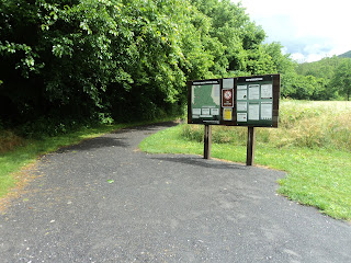
Trailhead for Trails #5 and #1
            
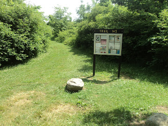
Trails #1 and #5 start on a common entrance trail, which begins at an information board.  After heading east for only a few hundred feet, you reach the trail intersection that forms the loop portion of this hike.  Trail #5 goes to the right here, and a middle trail shared by Trails #5 and #1 goes to the left.  This hike turns right and uses the left trail as its return route, thus hiking the loop counterclockwise.  
Hiking through the deep woods
    
        Trail #5 plunges into the deep woods as it continues a winding eastward course.  This dark forest is the best forest this park has to offer, and it features a collection of mature 
maple, beech, and hickory trees.  The understory contains a dense covering of mayapple and stinging nettle.  A wetland appears off to the right as the trail curves left and begins heading north.
Entering the meadow
    
        The scenery transitions from forest to meadow and the trail surface transitions from dirt to mowed-grass just before you reach a trail intersection at 0.9 miles.  If you only wanted to hike Trail #5, you could turn left here to hike the middle trail common to Trails #5 and #1 directly back to the trailhead.  To further explore the park's meadow areas, continue straight to begin Trail #1.  The trail continues north, and soon the first of several Summit Lake views emerge on the right.  Some picnic tables and benches encourage you to sit, have a trail snack, and enjoy the lake view.
Summit Lake view
    
        The trail stays within a few yards of the lake as it curves left through the meadow.  Only a smattering of black walnut trees provide shade in the meadow, so this will be a hot sunny hike in the summer.  Some wild geraniums were in bloom on my late June visit, and the open meadow makes for good bird and wildlife viewing.  I saw larks, red-winged blackbirds, deer, rabbits, and Canada geese as I walked around the meadow.
Wild geraniums in the meadow
            At 1.75 miles, you reach a complicated unsigned trail intersection.  You could go either straight or left to close this loop, but I chose to go straight and enter a young forest.  A few hundred feet later, the middle trail shared by Trails #5 and #1 enters from the left.  Angle right, and just past 2.2 miles you close the loop portion of this hike.  Turn right and retrace your steps out the entrance trail to return to the trailhead and complete the hike.  While you are here, try some of the park's other shorter trails, each of which offers an interesting and slightly different journey beside the lake.

Sunday, July 12, 2020

East Fork Riparian Preserve (Blog Hike #804)

Trails: (unnamed)
Hike Location: East Fork Riparian Preserve
Geographic Location: south of Wilmington, OH (39.23476, -83.83294)
Length: 1.7 miles
Difficulty: 2/10 (Easy)
Date Hiked: June 2020
Overview: A semiloop through various habitats with views of the East Fork of the Little Miami River.
Park Information:
http://cincywildflower.org/attachments/EastForkRiparianPreserve05222012_8x1110042012.pdf
Hike Route Map: https://www.mappedometer.com/?maproute=818973
Photo Highlight:
Hike Video: 

Directions to the trailhead: From Wilmington, take US 68 south 14.5 miles to SR 251 and turn left on SR 251.  Drive SR 251 south 1.2 miles to Kernan Road and turn left on Kernan Rd.  Kernan Rd. becomes Webertown Road when you cross back into Clinton County.  Drive a total of 2.7 miles from SR 251 to the blacktop preserve parking area on the right.  Park here.

The hike: Tucked away in the extreme southern corner of Clinton County, East Fork Riparian Preserve protects 70 acres of prairie and forest on the north bank of the East Fork of the Little Miami River.  The site is owned and managed by the Clinton County Park District, which currently maintains 5 tracts of land for public recreation in Clinton County.  The park district dates only to 2009, and the preserve's establishment in 2006 means the preserve actually predates the organization that manages it today.
            Most of the sites managed by the Clinton County Park District are small with few amenities, and East Fork Riparian Preserve is no exception.  The preserve has only a parking lot and some trails, and there are no other facilities (including restrooms) at the trailhead.  Many hiking routes are possible, but the route described here gives a nice tour of the site's riverside prairie and forest while doing minimal backtracking.  I was the only person in the preserve on the warm sunny Sunday afternoon I hiked here, and I enjoyed the simple serenity and solitude this preserve has to offer.
Trailhead at parking area
    
        From the signed trailhead at the rear of the parking lot, pick up the mowed-grass main entrance trail as it heads south through a short grass prairie.  The trails at East Fork Riparian Preserve are unmarked and unsigned, but they had recently been mowed and were easy to follow on my visit.  When I hiked here in late June, many wildflowers adorned this prairie, including wild geraniums, yellow daisies, and prairie lilies.
Wild geraniums

Prairie lilies
    
        After 700 feet, you reach a major trail intersection involving at least 4 trails.  Turn softly right and descend steeply for a short distance with private property on your right.  At the bottom of the hill, you reach another trail intersection.  We will eventually turn left to head for the river, but first continue straight and hop a small stream.  After ascending slightly, the trail forks to form its loop through the preserve's tall grass prairie.  I continued straight and used the trail going right as my return route, thus hiking the loop clockwise.

            The trail traces the perimeter of the tall grass prairie with the prairie on your right and the woods on your left.  Some woody plants including young black walnut trees were encroaching into the prairie on my visit, so some controlled burns or other invasive plant control techniques will be needed here in the near future.  Some short-cut trails exit right to go through the center of the prairie, but I stayed with the main loop on the prairie's perimeter.
Perimeter of the tall grass prairie
    
        At 0.9 miles, you close the loop around the tall grass prairie.  Turn left and re-hop the stream, then turn right to head for the river.  After a few hundred feet of level walking, you reach another intersection.  We will eventually continue straight to head around the back side of the short grass prairie, but first turn right and walk across a sketchy-looking bridge consisting of two iron beams and some old wood planks.  I made sure to keep my substantial weight near the iron beams, but the bridge got me across the creek without incident.
Sketchy-looking trail bridge

East Fork of the Little Miami River
    
        1.1 miles into the hike, you reach the East Fork of the Little Miami River.  Less than 10 miles from its source, the river runs shallow and slow here, and a bench allows you to sit and enjoy the riparian scenery.  Finish the short loop through the river's floodplain, re-cross the suspect iron/wood bridge, and then turn right to begin the final leg of this hike.  Another mowed-grass trail, this trail traces the south and east sides of the short grass prairie, and the preserve's east boundary comes very close on the right.  At 1.6 miles, the trail comes out on Webertown Road.  Turn left and walk along the road for a short distance to return to the parking area and complete the hike.

Friday, July 10, 2020

Sycamore Park and Wilson Nature Preserve (Blog Hike #803)

Trail: Outer Loop Trail
Hike Location: Sycamore Park and Wilson Nature Preserve
Geographic Location: south side of Batavia, OH (39.06756, -84.18853)
Length: 2.2 miles
Difficulty: 4/10 (Moderate)
Date Hiked: June 2020
Overview: A lollipop loop with steep sections partly along the East Fork of the Little Miami River.
Park Information: https://www.clermontparks.org/sycamore-park-and-wilson-nature-preserve/
Hike Route Map: https://www.mappedometer.com/?maproute=818761
Photo Highlight:
Hike Video: 

Directions to the trailhead: From the intersection of SR 132 and SR 222 in downtown Batavia, take SR 132 south 0.9 miles to the signed entrance for Sycamore Park on the left.  Turn left to enter the park and park in the first parking lot on the right.

The hike: Located on the south bank of the East Fork of the Little Miami River, 53 acre Sycamore Park and the adjacent 145 acre Wilson Nature Preserve form the oldest and largest park in the Clermont County Park District.  The preserve is accessible only through the park, and all of the area's amenities are located in Sycamore Park.  The park's amenities include two picnic shelters, a paved walking path, various athletic fields, and canoe access on the river.  These amenities make Sycamore Park the most heavily used county park in Clermont County.
            For visitors wanting to escaped the crowds at Sycamore Park, adjacent Wilson Nature Preserve is an appealing option.  This hike describes the preserve's Outer Loop Trail, which as its name suggests traces the perimeter of the preserve.  On a personal note, when I lived in the Cincinnati area 20 years ago, I thought of the area east of Cincinnati as a barren wasteland in terms of hiking and county parks.  Thus, Sycamore Park and Wilson Nature Preserve were a surprising and pleasant discovery for me, and I hope other visitors enjoy this park as much as I did.
Entrance to trail system
    
        Enter the trail system by walking across the iron bridge with wooden deck at the south end of the parking area.  The gravel trail curves left, passes an information board, and begins heading upstream with the river on your left, soon passing a stone monument to Mike Rash.  Where the Wildflower Loop exits right, continue straight on the gravel trail for the shortest route to the nature preserve.
Entering the nature preserve
    
        The other end of the Wildflower Loop comes in from the right just before you pass the sign that marks the boundary between Sycamore Park and Wilson Nature Preserve.  The trail surface changes from gravel to dirt here, and some rain the previous night combined with southern Ohio's 
soil type made the trail greasy/slippery on my visit.  Nevertheless, careful stepping got me around this entire loop without a single slip or fall.
            At 0.4 miles, the Outer Loop Trail splits to form its loop.  To make the climbing a little easier, I chose to continue straight and use the trail going right as my return route, thus hiking the loop clockwise.  Soon the trail dips to rock-hop a small stream.  The mouth of this stream provides this hike's best view of the river, and the river flows over a small but pleasant cascade here.
Small cascade in river
    
        Next the trail climbs gradually away from the river as traffic noise from SR 222 becomes audible across the river to the left.  The forest here is young with a dense understory of honeysuckle.  The next time the trail splits, you can go either way: the two options come back together in a few hundred feet.  The left option stays closer to the river but also requires more elevation change.
Climbing away from the river
    
        Near 1 mile, you reach the preserve's southeast corner where the trail curves sharply right and begins climbing steeply.  Some brown carsonite posts bearing orange circles mark the way, but they are few and far between.  Just past 1.1 miles, you reach the ridgetop where the trail flattens out.  Some active farm fields come in view across the park boundary to your left, and you should ignore the Yellow Trail, which enters and exits on the right.
Hiking along the ridgetop
    
        At 1.5 miles, the trail dips through a steep and rocky ravine just after the Yellow Trail exits right for the last time.  Next the trail curves right and makes a final steep descent to return to the riverside area and close the loop.  Turn left to retrace your steps to the trailhead and complete the hike.  If you want to add distance to this hike, you could add the short Wildflower Loop located near the trailhead, or you could add the asphalt 0.6 mile walking path located in adjacent Sycamore Park.

Thursday, July 9, 2020

Big South Fork NRRA: Burnt Mill Loop (Blog Hike #802)

Trail: Burnt Mill Loop
Hike Location: Big South Fork National River and Recreation Area
Geographic Location: southwest of Oneida, TN (36.38760, -84.63017)
Length: 4.2 miles
Difficulty: 4/10 (Moderate)
Date Hiked: June 2020
Overview: A loop hike, mostly along the Clear Fork River, passing many rock shelters.
Area Information: https://www.nps.gov/biso/index.htm
Hike Route Map: https://www.mappedometer.com/?maproute=818499
Photo Highlight:
Summary Video: 

Directions to the trailhead: From Oneida, take US 27 south 10 miles to Old US 27, which is reached just after crossing the New River bridge.  Turn right on Old US 27.  Drive Old US 27 1.4 winding miles to Mountain View Road.  Turn right, then immediately turn left on Mountain View Rd.  Drive Mountain View Rd. west 2.3 miles to Al Martin Road and turn right on Al Martin Rd.  0.5 miles later, angle left to begin the gravel road that leads to the Burnt Mill trailhead.  Reach the Burnt Mill trailhead after another 0.4 miles.  Park in the large trailhead and river access parking lot on the left just after crossing the Clear Fork River at Burnt Mill.

The hike: For my introduction to Big South Fork, see my previous hike on the area's popular Leatherwood Ford Loop.  Tucked away in the extreme south corner of the Big South Fork National River and Recreation Area, the Burnt Mill Loop explores the sandstone cliffs and rock shelters along a wide 180-degree bend in the Clear Fork River.  The Burnt Mill trailhead is accessible only by gravel roads, which adds to the seclusion and beauty of the area.  While this loop may not be the best or most popular trail in Big South Fork, it offers nice scenery and presents a compelling option for hikers who want a change from the area's more famous trails.
1911 Burnt Mill Bridge

Burnt Mill Bridge, side view
    
        Before you begin the hike, the old Burnt Mill Bridge at the trailhead is worth a visit.  Built around 1911, the steel bridge with wooden deck used to carry vehicle traffic over the Clear Fork River.  The bridge has an unusual half-and-half construction that features a Pratt through-truss span on the east end and a half-hip Pratt pony-truss span on the west end.  The concrete bridge you drove over to get to the trailhead replaced the wood/steel one in 2006, and some recent bridge deck repairs allow hikers and picnickers to enjoy a walk on the old bridge.
Start of Burnt Mill Loop
    
        To start a counterclockwise journey around the Burnt Mill Loop, walk out to the parking area entrance, cross the road, and pick up the trail as it heads down a steep gravel road embankment.  The Burnt Mill Loop is marked with green pieces of carsonite that bear the universal hiker symbol, but a few older red arrowhead paint blazes also mark the way.  The trail heads northwest through a narrow corridor between the Clear Fork River on the right and sandstone cliffs featuring lots of rock shelters on the left.  Some minor undulations and a few rocky areas need to be negotiated, but overall the going is fairly easy.
Short ladder
    
       At 0.4 miles, you descend a short wooden ladder that takes you down a sheer sandstone bluff.  The trail passes numerous established primitive campsites; some of these campsites sit along the river while others sit near the sandstone cliffs.  The forest consists of 
hemlock and sweet gum trees, and some dense areas of rhododendron had already bloomed on my late June visit.
Large rock shelter
    
       0.9 miles into the hike, you round the most downstream sandstone cliff on this hike and begin climbing up a side ravine away from the river.  At first the climb is gradual, but later the grade steepens and includes a couple of switchbacks.  Overall, the trail gains about 300 vertical feet of elevation over 0.4 miles.  The forest on top of the ridge features more broadleaf trees and a dense understory of ferns, and the trail follows an old road for a short distance here.
Hiking along the ridgetop
    
        At 1.3 miles, you reach the top of the ridge and a major trail intersection.  To continue the Burnt Mill Loop, angle left and cross gravel Honey Creek Road, as indicated by wooden signs.  Two long-distance backpacking trails join our route here: the John Muir Trail, which is marked by blue markers in the shape of a man's head, and the Sheltowee Trace, which is marked by blue turtle-shaped markers.
Clear Fork River
    
        After 0.4 miles of flat ridge-top walking, the trail descends steeply via several switchbacks to return to the river.  The Clear Fork River alternates between placid pools and rippling rapids, and some nice views of the river emerge to your right.  More large rock shelters are passed on the left, and the trail weaves back and forth between river and cliff line.  After following the fantastic narrow corridor between the river and cliffs for 
more than 2 miles, you return to the Burnt Mill trailhead parking area and complete the hike.  Be sure to check out the old bridge before you leave if you did not do so before.

Tuesday, July 7, 2020

Droop Mountain Battlefield State Park (Blog Hike #801)

Trails: Overlook, Horse Heaven, Cranberry Bogs, and Musket Trails
Hike Location: Droop Mountain Battlefield State Park
Geographic Location: southwest of Marlinton, WV (38.11568, -80.26875)
Length: 2 miles
Difficulty: 3/10 (Easy/Moderate)
Date Hiked: June 2020
Overview: A loop hike around the Civil War battlefield that secured West Virginia for the Union.
Park Information: https://wvstateparks.com/park/droop-mountain-battlefield-state-park/
Hike Route Map: https://www.mappedometer.com/?maproute=817026
Photo Highlight:
Hike Video: 

Directions to the trailhead: Droop Mountain Battlefield State Park is located on the west side of US 219 15.3 miles south of Marlinton or 26.5 miles north of Lewisburg.  Enter at the main park entrance, then turn right to follow signs for the museum and park office.  Park in the parking lot in front of the park office.

The hike: The Battle of Droop Mountain on November 6, 1863 was one of the largest Civil War engagements in West Virginia.  Union troops under the command of Brigadier General W.W. Averell and Colonel Thomas Harris were moving south toward the Confederate stronghold of Lewisburg with the ultimate goal of disrupting railroad traffic on the Virginia & Tennessee Railroad further south.  Confederate forces under the command of Brigadier Generals John Echols and Albert Jenkins knew that the Union troops would have to come over Droop Mountain in order to reach Lewisburg.  Moreover, Droop Mountain's high relief offered the Confederates their best chance to mount a strong defense.
            The Confederates were outnumbered more than 3 to 1, but occupying the high ground, significant artillery, and constructed fortifications allowed them to repel Union advances in the morning.  By the early afternoon, Averell outflanked the Confederates on their left, and the Confederates fled in a disorganized retreat after a brief but violent battle.  All tallied, the Confederates took 275 casualties and lost large quantities of arms and ammunition.  Union forces took Lewisburg the next day, and the Battle of Droop Mountain marked the end of organized Confederate resistance and operations in West Virginia.
            Due to the efforts of West Virginia House of Delegates' John D. Sutton, a Private in the Union army during the battle, today 287-acre Droop Mountain Battlefield State Park preserves the battle's site.  The park was dedicated on July 4, 1928 as West Virginia's first state park.  The park offers only a lookout tower, a playground, a small museum, some picnic shelters, and some hiking trails for amenities, so history and nature take center stage here.  The hike described here is not the park's longest possible hiking route, but it passes the main historic sites and amenities, thus offering a good overview of the park.
Trailhead for Overlook Trail
    
        Start at the north end of the parking area where a sign marks the start of the Overlook Trail; a large interpretive sign describing the white oak tree also stands here.  None of this park's trails are marked except at trailheads and intersections, but I found most of the trails easy to follow on my visit.  The Overlook Trail curves left and arrives at some trenches dug and occupied by Confederate forces.  Some interpretive signs tell you that these trenches are located near the area where the Confederates got outflanked.  Imagine what it would be like to hunker down in this trench with an army three times the size of yours advancing on your position.
Confederate trench
    
        The trail continues curving left, and at 0.2 miles you reach a northwest-facing overlook platform.  Droop Mountain is one of several mountains of similar height in this area, and Round Mountain stands in full view across the valley to the northwest.  A small cave called Old Bear Den is also located in this area, and the rugged Big Spring Trail leads downhill to its namesake spring.  Head south from the overlook to continue the Overlook Trail.
View northwest from Droop Mountain
    
        After passing some rock outcrops bordered by rhododendron, you reach the end of the Overlook Trail at an intersection with the Horse Heaven Trail.  Turn right to begin heading south on the Horse Heaven Trail.  The Horse Heaven Trail is the most primitive trail used by this hike, and it was somewhat overgrown and hard to follow on my visit.  The Horse Heaven Trail parallels the park road, so you can cut through the woods to the left and walk on the park road if trail conditions are too bad.
Hiking the Cranberry Bogs Trail
    
        At 0.75 miles, you reach the south end of the Horse Heaven Trail at a combined road and trail intersection.  To continue this hike, turn left and cross the road to pick up the Cranberry Bogs Trail.  The wide dirt Cranberry Bogs Trail descends gradually on a southeastward course through a dark forest dominated by spruce and hemlock trees.  Some mountain laurel in bloom brightened my path on my mid-June visit.
Cranberry bogs
    
        Ignore the Old Soldier Trail and continue to follow the Cranberry Bogs Trail as it passes its namesake wetland.  The cranberry bogs were actually fairly dry on my visit, and I saw more ferns than cranberries in this "bog."  Past the bogs, walk through a complicated trail intersection to reach an old stone trail shelter located beside the park road.  Angle left and walk up the paved spur road that leads to the park's famous lookout tower.  Steps lead to the top of the wooden lookout tower, which offers fantastic views east across the Greenbrier River valley and into the wooded hills of vast Watoga State Park.  Some picnic tables near the lookout tower beckon you to sit, rest, and take in the view.
View east from lookout tower

Lookout tower
    
        Two trails exit the lookout tower area: the Musket Trail and the Minnie Ball Trail.  Both trails lead in the general direction of your car and the park office, but this hike uses the easier, flatter, and better-maintained Musket Trail as its final leg.  The Musket Trail descends to cross the main park road only to curve right and intersect the road again at the lowest elevation of this hike.  Rather than crossing the road, the trail curves left and climbs moderately to reach the Musket Trail's north end at an intersection with the Cranberry Bogs Trail.  Turn right and hike the short final segment of the Cranberry Bogs Trail to return to the park office and complete the hike.
Saturday, July 4, 2020

Monongahela National Forest: Seneca Rocks Trail (Blog Hike #800)

Trail: Seneca Rocks Trail
Hike Location: Monongahela National Forest, Seneca Rocks National Recreation Area

Geographic Location: east of Elkins, WV (38.83414, -79.37630)
Length: 3.6 miles
Difficulty: 8/10 (Difficult)
Date Hiked: June 2020
Overview: A steep climb on well-constructed gravel trail featuring views of and from Seneca Rocks.
Area Information: https://www.fs.usda.gov/recarea/mnf/recreation/hiking/recarea/?recid=7051&actid=50
Hike Route Map: https://www.mappedometer.com/?maproute=817020
Photo Highlight:
Hike Video: 

Directions to the trailhead: From Elkins, take US 33 east 35 miles to its intersection with SR 28 in the town of Seneca Rocks.  Turn right at this intersection, and then 500 feet later turn left to enter the parking area for the Seneca Rocks Discovery Center, which is the trailhead for this hike.  Park in the lower parking area, which was the only parking area open on my visit.

The hike: Jutting more than 800 feet above the South Branch of the Potomac River, Seneca Rocks may be the most recognizable natural landmark in all of West Virginia.  The rocks are made of white/gray Tuscarora quartz, so they have a distinct bright appearance compared to the darker sandstone that underlies much of this region.  Sandstone is more easily eroded than quartz, which explains why the exposed quartz stands at the top of the ridge: the surrounding sandstone got eroded away.
            Seneca Rocks have been a local landmark for centuries, and the construction of the Seneca Rocks Discovery Center in 1998 unearthed evidence of two ancient villages.  Moreover, the ancient Seneca Trail, a road connecting the Algonquin, Tuscarora, and Seneca nations, passed the base of the rocks as it followed the Potomac River.  The Seneca Rocks Discovery Center is located near this trailhead, and it offers interesting exhibits on the area's geologic and human history.  Unfortunately, the Discovery Center was closed due to the Covid-19 pandemic on my visit.
            Today Seneca Rocks is the centerpiece of the Seneca Rocks National Recreation Area, which in turn is part of eastern West Virginia's 921,000 acre Monongahela National Forest.  Seneca Rocks is a major destination for rock climbers, but hikers can also explore the rocks by hiking the 3-mile round-trip Seneca Rocks Trail.  Combining the Seneca Rocks Trail with a short, flat journey past the Seneca Rocks Discovery Center forms the 3.6 mile out-and-back hike described here.
Trailhead at lower parking area
        From the lower trailhead parking area, start by taking the black cinder path that heads north, passing an information board.  Your first view of Seneca Rocks appears across the meadow to your right, and ascending to the back porch of the Seneca Rocks Discovery Center gives the best valley-level view of this natural monument.  Continue north across a long boardwalk/bridge that carries you over Seneca Creek.  The area's waterways were raging on my visit from heavy rains earlier in the morning, and I appreciated the well-built bridges that got me across Seneca Creek and later the Potomac River safely.
Valley view of Seneca Rocks
    
Sites Homestead

South Branch of Potomac River
    
        The wide gravel Seneca Rocks Trail leaves the east side of the picnic area parking lot and passes another information board before crossing the South Branch of the Potomac River on another long bridge.  Where the spur trail to Roy Gap Road exits right, turn left to begin the climb up to Seneca Rocks in earnest.  The climb to Seneca Rocks gains 800 vertical feet over 1.5 miles on a persistent grade.  While the climb takes some effort, five switchbacks and the improved gravel trail surface make it doable for most people.  Some interpretive signs provide good information about Seneca Rocks and offer additional incentive to stop and catch your breath on the climb up.
Climbing some wooden stairs
    
        0.8 miles into the hike, you reach the steepest part of the climb, which is negotiated by some constructed wooden stairs with a hand railing.  At the third switchback, you pass a wooden bench that is this hike's only opportunity to sit and rest.  I had driven to the trailhead in a steady rain, but as I topped the fifth and last switchback, the sun broke through the clouds for the first time in the four days I had been in West Virginia.
Still climbing
    
        At 1.8 miles, you reach the wooden observation platform located beside Seneca Rocks.  From this west-facing lookout, the town of Seneca Rocks lies directly below, and waves of ridges headed by Smith Mountain on the right and Kisamore Hill on the left roll off in the distance.  Some benches at the platform encourage you to sit, rest from your climb, have a trail snack, and take in the views.
View from Seneca Rocks
    
        Some hikers continue on an unofficial trail that leads out onto the sheer rocks, but the views do not get any better, and several people have fallen to their deaths while climbing on the rocks.  Thus, I turned around and retraced my steps downhill to the lower parking lot trailhead to complete my hike.  Right on cue, the rain began again exactly
 when I got back to parking lot.

Wednesday, July 1, 2020

Blackwater Falls State Park: Yellow Birch and Gentle Trails (Blog Hike #799)

Trails: Yellow Birch and Gentle Trails
Hike Location: Blackwater Falls State Park

Geographic Location: southwest of Davis, WV (39.10767, -79.49561)
Length: 3.7 miles
Difficulty: 5/10 (Moderate)
Date Hiked: June 2020
Overview: The back road to fantastic Blackwater Falls.
Park Information: https://wvstateparks.com/park/blackwater-falls-state-park/
Hike Route Map: https://www.mappedometer.com/?maproute=817014
Photo Highlight:
Hike Video: 

Directions to the trailhead: From Davis, take Blackwater Falls Road west 1.2 miles to the major road intersection at the entrance to Blackwater Falls State Park.  Signs direct you to continue straight to reach the falls, but to reach this trailhead turn left to follow signs for the lodge, which is reached in another 1.6 miles.  Park in the large lot in front of the lodge.

The hike: Established in 1937 as one of West Virginia's earliest state parks, 2358-acre Blackwater Falls State Park is one of the crown jewels in West Virginia's state park system.  The park is centered around 62-foot Blackwater Falls, a major waterfall on the Blackwater River's 34-mile westward journey from Canaan Mountain to the Black Fork of the Cheat River and ultimately to the Monongahela River.  The river and falls get their name from the water's tannin, which is produced by decaying spruce needles and other vegetation common in Canaan Valley, where the river originates.
            Blackwater Falls State Park offers many amenities, including a 54-room lodge, 39 cabins, a 65-site campground, and 20 miles of hiking trails.  Nevertheless, Blackwater Falls remains the park's main attraction, and the most popular way to see the falls is by descending the short series of wooden stairs on the falls' north side.  For hikers wanting to escape the crowded stairs or wanting a different view of the falls, the hike described here has appeal.  Rather than taking you to the base of the falls from the north, this hike uses lightly-trafficked trails from the south to reach an ADA-accessible overlook high above the falls.  Thus, it makes a nice alternative to the more traditional and touristy falls-viewing option.
West end of Yellow Birch Trail, near lodge
    
        From the lodge parking lot, walk back out to the main park road and then find the signed start of the Yellow Birch Trail, which is located on the south side of the main park road between the two entrances to the lodge parking lot.  Marked with yellow aluminum squares, the Yellow Birch Trail embarks on an eastbound course over rocky, rooty, and wet terrain that parallels the main park road.  Despite the rough and primitive trail surface, traffic noise from the nearby park road prevents this hike from taking on a secluded backcountry feel.
Hiking the Yellow Birch Trail
            At 0.8 miles, the trail passes through a bouldery area that forces you to either boulder scramble or wiggle through a fat-man's-squeeze.  Next a steep descent carries the trail across the paved road that leads to the park's petting zoo and down to a creek that must be rock-hopped.  After crossing the creek, you rise to reach an intersection with the Davis Trail, which goes left and right.  Continue straight to remain on the Yellow Birch Trail.  The 184-mile Allegheny Trail joins our route here, and turning right would lead south several miles on the Allegheny Trail to Canaan Valley Resort State Park, which was featured in the previous hike.
A small wet meadow
    
        The trail goes up and over another low ridge, and at 1.5 miles it traces the edge of a small wet meadow.  A boardwalk and some gravel keep your feet dry near the meadow.  Some mountain laurel was in bloom when I hiked here in mid-June, and despite the trail's name the forest here contains more spruce and hemlock trees than yellow birch trees.
Gentle Trail, approaching the overlook
    
        1.8 miles into the hike, you reach a maintenance area road that marks the east end of the Yellow Birch Trail.  Turn left to walk out to the main park road, and then turn left again to find the trailhead parking for the ADA-accessible Gentle Trail.  The asphalt Gentle Trail reaches the ADA-accessible Blackwater Falls overlook at its end in only another 500 feet.  The water tumbling over sandstone is an impressive sight.  The Blackwater River provides plenty of water to fall, and the boulder-filled canyon combines with the spruce-covered surrounding slopes to make a colorful setting.  Some benches near the overlook provide great places to rest and enjoy the area.
Blackwater Falls, from ADA-accessible overlook

Blackwater Falls, from base-level overlook
    
        F
rom this perch high above the river, you can see the wooden overlook platforms on the other side of the river at the base of the falls, but there is no way to get there from here via trail.  Thus, the best option is to turn around and retrace your steps to the lodge to complete the hike.  While you are at the lodge, the area behind the lodge is an overlook area that provides fantastic views of the Blackwater River's canyon below the falls.  Of course, the touristy falls access on the river's north side is worth a visit on your way out as well.
Canyon below Blackwater Falls