Trails: #5 and #1
Hike Location: Summit Lake State Park
Geographic Location: northeast of New Castle, IN (40.02543, -85.30272)
Length: 2.4 miles
Difficulty: 3/10 (Easy/Moderate)
Date Hiked: June 2020
Overview: A lollipop loop through forest and prairie along Summit Lake.
Park Information:
https://www.in.gov/dnr/state-parks/parks-lakes/summit-lake-state-park/
Hike Route Map:
https://www.mappedometer.com/?maproute=940413Photo Highlight:
Directions to the trailhead: From the intersection of SR 3 and US 36 north of New Castle, take US 36 east 4 miles to Messick Road and turn left on Messick Road; there is a small sign for Summit Lake State Park at this turn. Messick Rd. deadends at the park entrance in 1.3 miles. Pay the entrance fee, then turn right at the first intersection inside the gatehouse. Drive another 0.3 miles to the parking lot for Trails #1 and #5 on the right; park here.
The hike: Consisting of 800 acres on the shore of its namesake reservoir, well-amenitied Summit Lake State Park owes its existence to the Big Blue River Conservancy District. The District was established in 1965 to promote flood control, waterway improvement, and recreation in the Big Blue River watershed, and by 1966 plans were being made for a flood-control dam at the river's headwaters. That dam was completed in 1980, and the reservoir that would become Summit Lake began to fill. The District also constructed the Big Blue River Recreation Area along the reservoir's shores, and in 1988 the Recreation Area was sold to the State of Indiana and renamed Summit Lake State Park. The lake and park are named for their locations near the Big Blue River watershed's highest points and near the highest point in Indiana.
The park offers all of the usual amenities for a recently constructed lakeside state park, including a large developed campground, a swimming beach, fishing, boating, and canoeing on Summit Lake, some picnic shelters, and 6 hiking trails. All 6 of the trails are less than 2 miles long, but Trails #1 and #5 share a common trailhead, and they explore the park's best prairie and forest respectively. Combining these two trails forms the hike described here.
 |
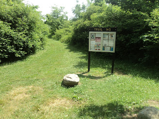
| Trailhead for Trails #5 and #1 |
Trails #1 and #5 start on a common entrance trail, which begins at an information board. After heading east for only a few hundred feet, you reach the trail intersection that forms the loop portion of this hike. Trail #5 goes to the right here, and a middle trail shared by Trails #5 and #1 goes to the left. This hike turns right and uses the left trail as its return route, thus hiking the loop counterclockwise.
 |
Hiking through the deep woods
|
Trail #5 plunges into the deep woods as it continues a winding eastward course. This dark forest is the best forest this park has to offer, and it features a collection of mature maple, beech, and hickory trees. The understory contains a dense covering of mayapple and stinging nettle. A wetland appears off to the right as the trail curves left and begins heading north.
 |
Entering the meadow
|
The scenery transitions from forest to meadow and the trail surface transitions from dirt to mowed-grass just before you reach a trail intersection at 0.9 miles. If you only wanted to hike Trail #5, you could turn left here to hike the middle trail common to Trails #5 and #1 directly back to the trailhead. To further explore the park's meadow areas, continue straight to begin Trail #1. The trail continues north, and soon the first of several Summit Lake views emerge on the right. Some picnic tables and benches encourage you to sit, have a trail snack, and enjoy the lake view.
 |
Summit Lake view
|
The trail stays within a few yards of the lake as it curves left through the meadow. Only a smattering of black walnut trees provide shade in the meadow, so this will be a hot sunny hike in the summer. Some wild geraniums were in bloom on my late June visit, and the open meadow makes for good bird and wildlife viewing. I saw larks, red-winged blackbirds, deer, rabbits, and Canada geese as I walked around the meadow. |
Wild geraniums in the meadow
|
At 1.75 miles, you reach a complicated unsigned trail intersection. You could go either straight or left to close this loop, but I chose to go straight and enter a young forest. A few hundred feet later, the middle trail shared by Trails #5 and #1 enters from the left. Angle right, and just past 2.2 miles you close the loop portion of this hike. Turn right and retrace your steps out the entrance trail to return to the trailhead and complete the hike. While you are here, try some of the park's other shorter trails, each of which offers an interesting and slightly different journey beside the lake.


No comments:
Post a Comment