Hike Location: Camp Catalpa Park
Geographic Location: east side of Richmond, KY (37.74069, -84.24936)
Length: 0.8 miles
Difficulty: 1/10 (Easy)
Date Hiked: June 2020
Overview: A short loop partly along Reba Lake.
Park Information: https://richmondky.gov/business_detail_T14_R263.php
Hike Route Map:
On The Go Map
Photo Highlight:
From the information board near the entrance to the parking lot, begin a clockwise journey around the gravel walking trail by heading uphill with the parking lot on your right. The practice basket and the first two holes on the disc golf course sit downhill to the left here. The park's grounds are typical city parkland: mowed-grass with a smattering of large trees, but some of the grassy areas needed mowing on my visit.
As you approach the picnic shelter atop the hill, the trail curves right to begin heading south with the park's east boundary on the left. Where the two shorter loops exit right, stay left to remain on the longest loop. At 0.2 miles, you reach the only significant downhill portion of this hike. The difference between maximum and minimum elevations on this hike is only about 60 feet, so the entire trail is fairly easy-going.
As you approach lake level, ignore an unofficial trail that exits left and stay with the gravel trail as it curves right. The next 0.3 miles stay close to the lake on your left, and nice views of woods and a golf course emerge across the lake. Stay left after crossing a wooden footbridge. Soon a gradual climb returns you to the information board to complete the hike.

Hike Video:
Directions to the trailhead: From the intersection of US 25/421 and SR 52 on the east side of Richmond, take SR 52 east 0.5 miles to Catalpa Loop Road. Take a soft right on Catalpa Loop Rd. The signed entrance to Camp Catalpa Park is another 0.4 miles ahead on the right. Turn right to enter the park, and park in the only paved parking lot.
The hike: Owned and maintained by the City of Richmond, tiny Camp Catalpa Park sits on the east side of Reba Lake. The park provides access to the lake for anglers and canoeists, but it also features a playground, 2 picnic shelters, an excellent disc golf course, and a gravel walking trail organized into three loops of increasing length. The hike described here takes you around the longest of the three loops, and it makes a nice leg-stretch hike if you are driving I-75 through central Kentucky.
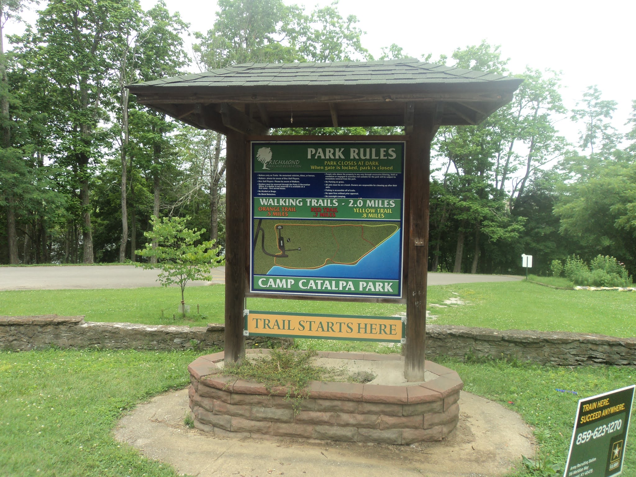 |
| Information board at parking lot |
 |
| Hiking along the park boundary |
|
| View across Reba Lake |
No comments:
Post a Comment