Saturday, February 14, 2015

Milliken Arboretum (Blog Hike #506)

Trails: (unnamed)
Hike Location: Milliken Arboretum
Geographic Location: Spartanburg, SC (34.98640, -81.95631)
Length: 1.7 miles
Difficulty: 1/10 (Easy)
Date Hiked: January 2015
Overview: A fairly flat hike through a grassy arboretum dotted by trees and duck ponds.
Hike Route Map: http://www.mappedometer.com/?maproute=387414
Photo Highlight:

Directions to the trailhead: Milliken Arboretum is located on the campus of the Milliken Corporation in suburban Spartanburg.  The arboretum is most easily accessed from Exit 5B on I-85 Business in Spartanburg.  Follow signs for visitors, and park on the southeast side of the large blacktop visitor parking area, which is located immediately southeast of the corporate campus’ main building.

The hike: Owned and operated by the Milliken Corporation, a multinational chemical/textile company, Milliken Arboretum sits on 600 acres adjacent to the company’s headquarters in Spartanburg.  The nationally-recognized arboretum is the brain-child of Roger Milliken, a former President of the Milliken Corporation and grandson of the company’s founder.  The arboretum came into its own in 1989 when it acquired a large collection of trees exotic to South Carolina due to a partnership with a nursery in Oregon.
            The arboretum is open to the public, and the weekend is the best time to visit if you want to avoid the crowd of Milliken employees who come to the headquarters on weekdays.  Also, the open grassy nature of the arboretum makes this hike a hot and sunny one during the summer, so I recommend a winter visit.  I came here on a seasonally warm Saturday in January and had a short but nice hike.
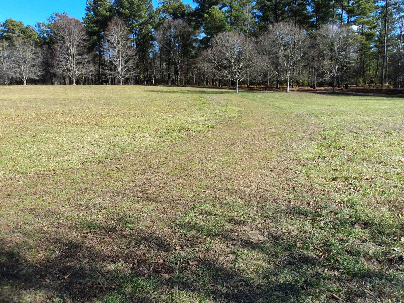
            Milliken Arboretum does contain a system of official trails, but there are no trail maps at the parking area, and the trails often blend in with the large mown grass areas.  Thus, the trails can be hard to follow.  The hike described here roughly follows the route of the longest trail, which traces the perimeter of the arboretum.  The open grassy areas make it easy to create your own route if you see fit.
Arboretum Entrance
            Enter the arboretum on a concrete path that departs the center of the southeast side of the parking lot.  The concrete quickly runs out as you top a low ridge, and the arboretum’s grounds come into full view.  A small cluster of sycamore trees can be found on this ridge.  These trees are distinctly out of place here, for in their natural environment sycamore trees are mostly found in ravines along creeks.
            A small formal garden lies to your right here.  The garden contains some dedication plaques and a fountain that shoots water 20 feet into the air.  The fountain is surrounded by a green curtain of southern magnolias that give the location an air of seclusion even though busy I-585 lies only 100 yards beyond the fountain.
Fountain in formal garden
            Back on the grassy main trail, angle right to walk around the first two of several ponds and begin the loop around the arboretum.  These ponds appear to have been dug out of the South Carolina red clay by backhoe.  As I walked along the edge of this pond, a mixed group of white, mallard, and wood ducks apparently accustomed to people feeding them swam over toward me.  This learned behavior is why most parks prohibit feeding of wild animals: a group of ducks swimming toward you looking for a meal is one thing, but a bear running toward you looking for a meal is quite another.
Ducks in pond
            The mown-grass trail heads southeast parallel to the arboretum boundary with I-585 just yards to the right.  A few groves of loblolly pines briefly keep the highway out of sight, but the noise is ever-present in this part of the arboretum.  Milliken Arboretum is a great place to bring a tree book and do some tree identification as you walk, but you will need to bring a good tree guide: the arboretum has over 70 kinds of trees, and most of them are not native to South Carolina.
            At 0.5 miles, the trail curves left to cross the earthen dam of another pond.  A couple of mallard ducks were swimming in this pond, but they made no movement in my direction.  After crossing the dam, continue straight where another trail angles left.  The outer-most trail climbs slightly as it approaches the arboretum’s southern boundary, which is marked by tall loblolly pine trees bearing no trespassing signs.
Approaching the southern boundary
            0.8 miles into the hike, you reach the easternmost pond on this property.  Turn right to walk around this pond.  When I hiked this trail late one winter afternoon, the pine trees reflected beautifully in the pond’s calm waters.
Pond reflection
            The trail stays near the arboretum’s southern boundary until, at 1.2 miles, you reach a paved road that is the SR 9 entrance to the Milliken facility.  Another grassy area lies across the road, but the official trail turns left to parallel the road as it heads back toward the main parking area.  Some ornamental trees line the road, and a natural-grass meadow area lies to the left.
            Just before reaching the main parking lot, the trail curves left at 1.5 miles to pass the last pond on the left.  Very quickly you close the loop.  A right turn and short walk over the low ridge will return you to the parking area to complete the hike.

Thursday, February 5, 2015

Seven Islands State Birding Park (Blog Hike #505)

Trails: Overlook, River Island, Secluded Bend, and Homestead Trails
Hike Location: Seven Islands State Birding Park
Geographic Location: east of Knoxville, TN (35.95403, -83.68658)
Length: 5.1 miles
Difficulty: 5/10 (Moderate)
Date Hiked: January 2015
Overview: A rolling hike through many different habitats offering good bird viewing.
Hike Route Map: http://www.mappedometer.com/?maproute=381457
Photo Highlight:

Directions to the trailhead: East of Knoxville, take I-40 to Midway Road (exit 402).  Exit and go south on Midway Rd.  Drive narrow, twisting Midway Rd. 2.6 miles to Kodak Rd. and turn left on Kodak Rd.  Drive Kodak Rd. 0.4 miles to Kelly Lane and turn right on Kelly Ln.  Kelly Ln. dead-ends at the park’s only parking lot 1 mile later.

The hike: Established only in 2013, Seven Islands State Birding Park is Tennessee’s newest state park.  The park protects 416 acres of land located inside a major bend in the French Broad River.  11 years before it became a state park, Knox County acquired the land and began managing it as Seven Islands County Park.  Before public ownership, the land was occupied by subsistence farmers.  Some of the property boundaries and barns from the farming era can still be seen on this hike today.
            The area still has the raw feel of a new park.  None of the trails are marked, there are no developed recreation facilities, there is no trail map at the parking area, and only major trail intersections have crude wooden signs.  Thus, as its name suggests, the park’s main attraction is its bird watching opportunities.  As a result, hiking the trails here feels more like hiking in an Audubon bird sanctuary than hiking in a state park.  I hope this area retains its raw, rustic feel, because I like this park the way it is.
            For a grand tour of Seven Islands State Birding Park, I recommend the 5.1 mile figure-eight route described here.  This hike proves that the park has a little of everything to offer: scenic views, secluded ponds, deep, broad rivers, historical barns, and of course good bird watching.  The land has more relief than you would expect for an area inside a major river bend, and I was pleasantly surprised by the hike I had here.
Trail starting beside old parking lot
            The unusually shaped parking area is a consequence of this park’s history.  The front dirt/grass lot built on the hillside dates to this area’s days as a county park, while the adjacent large, level gravel parking area was built by the state.  The trail that starts near the barn at the rear of the gravel parking area will be our return route.  The hike starts at the old county park parking area where a grassy trail heads uphill to the northwest.  This trail is called the Overlook Trail, but no signs at the parking area indicate such.
            The trail climbs steeply but only for a short distance as it gains 150 feet of elevation in its first 0.2 miles.  Most of the land at Seven Islands consists of old subsistence farm fields that are now covered by low shrubs and prairie grass.  Twice on this climb you pass through single rows of trees that likely mark old farmland property boundaries.  The tree rows along this trail give you your best chance to see birds, which will be plentiful in season because this park lies on the edge of two major bird migration routes.  On my visit on a cold winter morning, I saw cardinals, robins, juncos, sparrows, blue jays, chickadees, woodpeckers, and mourning doves, among others.  A full bird list is available on the park’s website.
Passing through a tree row
            At 0.2 miles, the trail makes a 180-degree left turn as it reaches its highest point, the northwest park boundary, and a bench with an interpretive sign.  On a clear day this hilltop affords an excellent southward view of the Great Smoky Mountains in general and Mount LeConte in particular.  Mt. LeConte, which is easily identified by its four distinct peaks, was readily visible on my visit, but the low-angle winter sun made photography difficult.
View of Mount LeConte
            Past the bench, the trail descends gradually as it parallels the park’s northwest boundary.  Many numbered bird boxes have been erected throughout the park, and you pass several of them up here.  Ignore a trail that exits left and continue southwest along the park boundary as the grassy trail undulates slightly.
Bird box along northwest boundary
            At 0.9 miles, the trail makes another sweeping 180-degree left turn just as you approach a wooded area.  Now heading the exact opposite direction as you were mere moments ago, you reach a major trail intersection at 1.2 miles where trails go left, right, and straight.  Turn right here as the trail briefly heads into the woods and passes a large pond downhill to the left.
            A short climb brings you to another bench and overlook.  This overlook points the same direction as the first one, but the broad French Broad River can now be seen in the foreground.  This overlook also gives a birds-eye view of the peninsula within the river bend that is explored by the second half of this hike.
French Broad River with Smoky Mountains in background
            Exit the overlook area to the right.  The trail heads moderately downhill through more of the same terrain.  Ignore a grassy trail that exits left, and enter the woods at 1.4 miles.  After entering the young forest, the trail curves left, narrows considerably, and descends steeply for just under 0.2 miles to intersect a wide dirt trail at the base of the bluff.  Turn left on the wide dirt trail, which is called the River Island Trail.
            The flat, wide, dirt River Island Trail heads southeast with a wet area to your right and more prairie to your left.  At 1.7 miles, you exit the northern lobe of the figure-eight route where a grassy trail back to the trailhead exits left.  Turning left here would reduce the hike to only 2.2 miles, but you should continue straight to head for the southern lobe.  The paved extension of Kelly Lane (closed to vehicle traffic) comes into view straight ahead and to the left here.
Start of southern lobe
            Just before you reach the paved road, the loop that forms the southern lobe begins.  Turn right to hike the southern lobe counterclockwise.  The nearly dead straight trail heads southwest as it makes a beeline for the river.  This trail is called the Seclusion Bend Trail, but like most trails here at Seven Islands no sign indicates such.  Some recently planted young trees with trunks still covered in plastic lined the trail here on my visit.
French Broad River at first bench
            At 2.1 miles, you reach a bench located on the river bank.  As I sat by the river, many birds flew directly over my head to pick off tiny fruit from nearby trees (dogwood trees, I think: trees can be hard to identify in the winter).  For the next 1.2 miles the seasonally muddy trail treads directly along the river bank as it traces the inside of the major bend in the French Broad River while steadily curving left.  The river lies to your right, and prairie land stretches out to your left.  The scenery across the river varies from old mansions to canoe lodges to imposing rock cliffs to small modern houses.
            At 3.3 miles, the trail enters a tiny corner of the park where a steep, wooded bluff pinches all of the way down to the river bank on the right.  The bluff cuts this area off from the rest of the park, so this area, reached only by the Seclusion Bend Trail, is secluded indeed.  A well-placed bench provides an opportunity to sit and enjoy the solitude.
Secluded bench on Seclusion Bend Trail
            The trail makes yet another 180-degree curve to the left to exit this tight corner, tread around the bluff, and head away from the river.  After walking through more of the meadow habitat that has become the norm for this hike, you reach an old barn at 3.7 miles.  The barn is another reminder of this land’s agricultural past, and the weathered wood and rusty roof really cause this barn to show its age.
Old barn
            A couple of trail options present themselves at the barn.  The paved extension of Kelly Lane ends at this barn, so you could turn right and walk the pavement back to the parking area.  To maximize your time off of the pavement, this hike will turn sharply right and take the mown-grass trail that heads northeast and climbs gradually toward the west side of the steep bluff you passed earlier.  This trail is called the Homestead Trail, but as you have come to expect no markings indicate such on the ground.
            The Homestead Trail takes the gradual route to the top of the bluff and, 4.3 miles into the hike, enters the woods on the blufftop.  If you look back just before entering the woods you will get a grand view of the meadows in this bend of the French Broad River.  The bluff sits over 100 feet above the river, and the land drops steeply to your right to meet the waters.  The trail is wide up here, but take care where you step nonetheless.
Meadows, as seen from blufftop
            At 4.4 miles, you reach another old barn that is now used as a park maintenance building.  Tread around the left side of the barn, and note the house uphill to your right that is now used as a ranger’s residence.  Turn left down the residence driveway and cross the paved road to close the southern lobe of the figure-eight route.  Continue straight on the grassy trail to retrace your steps about 500 feet to a trail intersection 4.6 miles into the hike.  Turn right to begin the final segment back to the trailhead.
            The last 0.5 miles climbs gradually through a small hollow with the overlook area uphill to your left and the paved road extension uphill to your right.  The scenery is the usual meadow scenery you have become accustomed to, but the lay of the land prevents any broad views from down here.  The trail comes out behind another old barn, and interpretive signs tell this land’s agricultural story.  The large gravel parking lot lies just beyond the barn, thus signaling the end of the hike.