Showing posts with label West Virginia Hikes. Show all posts

Sunday, June 21, 2026

Panther State Forest: Twin Rocks Trail (Blog Hike #1125)

Trail: Twin Rocks Trail
Hike Location: Panther State Forest
Geographic Location: southwest of Iaeger, WV (37.44761, -81.87644)
Length: 1.5 miles
Difficulty: 1/10 (Easy)
Date Hiked: April 2026
Overview: An out-and-back on an old coal tram path beside Panther Creek.
Park Information: https://wvstateparks.com/parks/panther-state-forest/
Hike Route Map:
On The Go Map
Photo Highlight:
Hike Video: (coming June 22, 2027)

Directions to the trailhead: From Iaeger in rural southwest West Virginia, take US 52 west 1.5 miles to Panther-Mohawk Road and turn left on Panther-Mohawk Rd.  Drive Panther-Mohawk Rd. west 6.1 miles to CR 3 and turn left on CR 3.  Drive CR 3 south 3.6 miles to the signed turnoff for the park office on the right.  Turn right, cross Panther Creek on a concrete bridge, and park in the gravel lot beside the park office in another 0.4 miles.

The hike: Tucked deep in the remote hills and hollows of southern West Virginia, Panther State Forest occupies 11,389 rugged acres along the West Virginia/Kentucky border.  The forest is named for its main watercourse, Panther Creek, which in turn got its name from a pioneer who supposedly killed a panther here.  The forest was established in 1940 partly as the result of a locally-organized "Pennies for Panther" campaign that raised more than $9000 in donations.
            True to its designation as a state forest rather than a state park, Panther State Forest is light on amenities.  The forest offers a tiny developed campground, hunting and fishing, a swimming pool, and 4 hiking trails totaling just over 5 miles.  I came here on a rain-filled day in late April, so I needed to keep my hike short to get it in between the rain showers.  Thus, I hiked this park's shortest and easiest trail: the Twin Rocks Trail described here.  The Twin Rocks Trail offers an out-and-back along Panther Creek that follows an old coal mining tram path.  I managed to do the out portion of this hike rain-free but got soaked on the return portion.
Trailhead a park office
    
        From the park office parking lot, walk a few feet back up to the road and turn left to begin heading southeast on the old coal mining tram path, which today makes a wide two-track treadway.  A sign designates this trail as a Mountaineer Mile Trail, a state health initiative that encourages people to walk 1 mile each day.  The trail passes through dense forest that is a mixture of pines and deciduous trees, and Panther Creek is visible and audible downhill to the left.
Wild grass field and wooden structure
    
        Near 0.4 miles, the trail curves right and gains distance from the creek.  Soon you come to a wild grass field, and if you look to the left across the field you will see an old wooden structure.  While I could not find any history on that structure, it probably predates the park.  Some large sycamore trees grow along the creek here.
First bridge over Panther Creek
Panther Creek
    
        At 0.7 miles, you reach a wooden bridge that crosses Panther Creek.  The trail map shows the Twin Rocks Trail forming a loop by continuing up the west side of the creek and crossing another bridge, but the trail becomes very overgrown past this first bridge.  Also, the second bridge was missing when I came here.  Thus, I spent a few minutes admiring the creek and some nearby rock outcrops before turning around and retracing my steps to the park office to complete the hike.

Tuesday, June 16, 2026

Chief Logan State Park: Coal Mine Trail (Blog Hike #1124)

Trail: Coal Mine Trail
Hike Location: Chief Logan State Park
Geographic Location: north of Logan, WV (37.88324, -82.02230)
Length: 3 miles
Difficulty: 5/10 (Moderate)
Date Hiked: April 2026
Overview: A loose loop around the state park campground passing numerous old coal mining sites.
Park Information: https://wvstateparks.com/parks/chief-logan-state-park/
Hike Route Map:
On The Go Map
Photo Highlight:
Hike Video: (coming June 25, 2027)

Directions to the trailhead: From the intersection of US 119 and SR 73 in Logan, take US 119 north 3.4 miles to the entrance for Chief Logan State Park on the right.  Turn right to enter the park, then turn right at the first major intersection to head for the campground.  Drive a total of 2.8 miles from the park entrance to the campground entrance on the right.  Turn right to enter the campground, and park beside the campground activities building on the left in another 0.4 miles.

The hike: Chief Logan's name appears on many counties, cities, parks, and trails across southeast Ohio and western West Virginia, but few people today know who Chief Logan actually was.  Chief Logan was the son of Iroquois Chief Shikellamy, who ruled a village in central Pennsylvania near present-day Shikellamy State Park.  Logan moved to the Ohio River region in the 1760s and became a leader of the Iroquois Confederacy there.  He gained the title Logan the Orator for a legendary lament he gave after the Shawnee lost the Battle of Point Pleasant in 1774.  Logan made the mistake of allying with the British during the American Revolution, and he was killed in a mysterious altercation near Lake Erie in 1780.
            Today Logan is commemorated in many places, not the least of which is Chief Logan State Park near the City of Logan in Logan County, West Virginia.  Established in 1969, the 3988-acre park has a fantastic set of amenities.  The Chief Logan Lodge is one of 10 West Virginia State Park lodges, and it is a full-service lodge with a fantastic restaurant and a conference center.  The park also has a cozy 25-site developed campground, a recreation center with some athletic fields, a museum with a locomotive display, and 7 picnic shelters.
            For hikers, the park offers 13 trails totaling over 18 miles, and they range in difficulty from flat 0.5 mile walks to difficult 6-mile one-way journeys over the park's steep hills and ravines.  Near the midpoint of those difficulties is the Coal Mine Trail described here.  The Coal Mine Trail takes you through the woods past some old coal mine openings.  This hike offers enough distance to make you feel like you've hiked, but it follows an old coal mining tram path for most of the way, which keeps the difficulty manageable.
Trailhead at campground activities building
    
        From the campground activities building, find the start of the Coal Mine Trail as it heads west into the woods with the campground road on your right.  A small wooden sign advertising the Rattlesnake and Coal Mine Trails marks this trailhead.  Going this direction begins a clockwise journey around the Coal Mine Trail.  The Coal Mine Trail is marked with yellow plastic diamonds, and while trail markers are not plentiful, there are enough of them to keep you on track.  The narrow trail climbs initially before levelling out about 50 feet above the campground road, which can be seen through the trees downhill to the right.
Trail markers for the Coal Mine Trail
    
        At 0.15 miles, the Rattlesnake Trail exits at a sharp angle to the left.  Angle softly right to continue the Coal Mine Trail.  The trail descends almost to road level before curving sharply left to begin the steepest climb of the hike.  This climb shows you the advantage of hiking this loop clockwise: you only gain about 100 feet of elevation, and this climb is far easier than the descent you will do at the end of the loop.
Hiking the old tram path
    
        At 0.4 miles, you reach the top of the hill, where you intersect the old coal mining tram path.  Angle right to begin following the old tram path.  For the next 1.7 miles the trail follows the old tram path as it goes in and out of as many as 8 hollows, depending on how you count hollows.  Like any old railroad grade, the tram path provides a wide treadway with a gentle grade.
Old coal tipple site
    
        Just past 0.5 miles, you pass the old coal tipple site, which today is marked by a sign and a wood/concrete construction on the edge of the hill to the right.  Tipples used gravity to sort coal by size and load it onto railroad cars heading for market.  Thus, all of the coal that came out of any of the old mine openings served by this tram would have ended up here.  The mines shut down just before the park opened in 1969.  Imagine what it would have been like to live in this hollow back then!
Disturbed area
    
        Continuing on the old tram path, the trail winds in and out of many hollows, imperceptibly climbing all the time.  Some wet areas and downed trees need to be negotiated, but overall the going is fairly easy.  At 1.4 miles, you pass an old concrete building, which is probably mine-related although I could not determine how.  I did not see any mine openings, but I did notice some disturbed areas that probably date to the park's mining days.  Outside of the disturbed areas, the trail passes through nice beech/maple forest, and this would be an excellent fall leaf peeping hike.  I saw many asters in bloom and butterflies in flight when I hiked here on a warm and humid day in late April.
End of the old tram path
    
        2.1 miles into the hike, the Wilderness Trail exits at a sharp angle to the left.  Angle softly right to stay on the Coal Mine Trail.  Very quickly you reach this hike's highest elevation and the end of the old coal mine tram path.  The trail narrows and curves right as you begin the final part of the hike.
Campsite #15
    
        The final descent to the campground may be the hardest part of this hike: you lose 220 feet of elevation over 0.3 miles, and the footing is quite bad.  The last couple hundred feet are narrow and rocky, almost like hiking in a small stream.  At 2.4 miles, you come out beside campsite #15.  Walk the paved campground road gradually downhill past the campground entrance for a total of 0.6 miles to return to the campground activity building and complete the hike.


Tuesday, June 9, 2026

Cabwaylingo State Forest: Tick Ridge Fire Tower (Blog Hike #1123)

Trails: ORV Trails #11, #29, and #10
Hike Location: Cabwaylingo State Forest
Geographic Location: south of Wayne, WV (37.98677, -82.37477)
Length: 4.3 miles
Difficulty: 5/10 (Moderate)
Date Hiked: April 2026
Overview: An out-and-back on ORV trails to a CCC-built campground and fire tower.
Park Information: https://wvstateparks.com/parks/cabwaylingo-state-forest/
Hike Route Map:
On The Go Map
Photo Highlight:
Hike Video: (coming March 19, 2027)

Directions to the trailhead: From Wayne, take SR 152 south 24 miles to CR 35.  Alternatively, you can reach this intersection by taking SR 152 north 5.7 miles from US 52 along the Kentucky/West Virginia state line.  Turn east on CR 35, and drive the winding paved road 2.9 miles to the Cabwaylingo Trailhead on the right.  Turn right to cross a stream on a bridge, then park near the park office in the large gravel parking lot that ORVs use for unloading.

The hike: Between 1863 and 1891 the Hatfield family of West Virginia and the McCoy family of Kentucky engaged in one of the most bitter and famous feuds in American history.  The feud had its roots in the American Civil War.  Although most members of both families fought for the Confederacy, Asa Harmon McCoy chose to fight for the Union, and he was killed by Hatfields and other Confederate allies on his way home from the war.
            The Kentucky/West Virginia border was a remote and lawless area in the late 1800s, and both families took justice into their own hands, causing continued escalation for many years.  The feud climaxed with the 1888 New Years Massacre and the ensuing Battle of Grapevine Creek, when a group of Hatfields went to Kentucky, surrounded the McCoy cabin, and opened fire on the sleeping McCoy family.  After such a brazen, violent, and egregiously illegal act, county sheriffs, state governors, and even the United States Supreme Court became involved to end the feud and bring peace to the area.  Many Hatfields and McCoys were tried and convicted of major crimes with the last trial ending in 1901.
            Today the feud is commemorated by a vast network of ORV trails in western West Virginia called the Hatfield-McCoy Trails, and one of the main trailheads for this system is in vast, rugged, and remote 8125-acre Cabwaylingo State Forest.  The state forest dates to the early 1930s, and the depression-era Civilian Conservation Corps (CCC) worked here to restore the forest and build the park's facilities.  The CCC's constructions include but are not limited to the park headquarters, 14 cabins, and several picnic shelters.  The forest is named for the 4 counties in which it occupies land: Cabell, Wayne, Lincoln, and Mingo.
            Cabwaylingo State Forest offers both ORV trails and hiking trails, but many of the hiking trails are poorly maintained and therefore do not make for pleasant hiking.  Thus, I chose to hike some of the ORV trails up to this park's most famous CCC construction: the Tick Ridge Fire Tower.  Built in 1935, the Tick Ridge Fire Tower is eligible for the National Register of Historic Sites.  Although the tower is not open for climbing, hiking to the fire tower not only allows you to view a piece of history, but it also passes a nice overlook and some other interesting CCC constructions.
Hatfield and McCoy Trailhead at Cabwaylingo State Forest
    
        Pick up a trail map at the park office, then head southwest down the wide gravel road with a basketball court and picnic shelter on your right.  Where the road splits, go left to start heading up the hollow that contains Wiley Branch on ORV Trail #11.  This trail is one of the main trails in the park's ORV trail system, and it is wide and easy enough that an ordinary car could traverse this part of the trail most of the time.
Exiting the developed area
    
        After passing a primitive campground, you exit the developed area and begin climbing along Wiley Branch.  B
eech and maple trees dominate the forest, and this hike would be great for fall leaf peeping.  I saw many butterflies when I came here in late April, and I saw lots of birds including a yellow-throated warbler.
Continuing to climb
    
        Just shy of 0.5 miles, the Indian Trail exits right.  The Indian Trail is a very steep and poorly maintained hiking trail that could be used to form a loop.  Unless you want a very rough and challenging hike, I recommend staying on the wide dirt/gravel ORV Trail #11 and doing this hike as an out-and-back.  The trail continues climbing, and soon ORV Trail #79 exits left.  This is another trail that could be used to form a difficult loop, but again I recommend staying with the main trail.
Picnic shelter at Tick Ridge Campground
    
        The wide gravel road continues climbing on a moderate grade via several switchbacks.  1.8 miles into the hike, you reach the Tick Ridge Campground.  Some vault toilets and an excellent CCC-built picnic shelter sit here.  To continue to the fire tower, turn sharply right on ORV Trail #29, then 0.1 miles later angle left on ORV Trail #10, which is the final leg to the fire tower.
Looking down the power line corridor
Tick Ridge Fire Tower
    
        At the only switchback on ORV Trail #10, you reach a bench that looks down a power line corridor.  While this westward viewpoint is somewhat narrow and does not overlook anything of note, it is the only ridgetop viewpoint on this hike.  A couple hundred feet later, you reach the Tick Ridge Fire Tower.  A fence and removed stairs prevent you from climbing the tower, but interpretive signs tell you about the tower and the people who built it.  The dense forest allows no views.  After viewing and learning about the tower, retrace your steps down to the park office to complete the hike.

Thursday, December 26, 2024

Tygart Lake State Park: Dogwood/Tygart Dam Loop (Blog Hike #1037)

Trails: Dogwood and Tygart Dam Trails
Hike Location: Tygart Lake State Park
Geographic Location: south of Grafton, WV (39.30469, -80.02294)
Length: 2.3 miles
Difficulty: 8/10 (Moderate/Difficult)
Date Hiked: October 2024
Overview: A loop hike, steep in areas, over a ridge and along Tygart Lake.
Park Information: https://wvstateparks.com/park/tygart-lake-state-park/
Hike Route Map:
On The Go Map
Photo Highlight:
Hike Video:

Directions to the trailhead: From the junction of US 50 and US 119 in Grafton, take US 119 south 1 mile to Barrett Street.  Turn left on Barrett Street, which becomes Knottsville Road after it leaves Grafton.  Drive a total of 3 miles from US 119 to Boyce Road and turn right on Boyce Rd.  Drive Boyce Rd. west 1.1 miles to its end at the main park road.  Angle right on the main park road, and drive the main park road 1.5 miles to Tygart Lake Lodge on the left.  Park in front of the lodge.

The hike: Tucked deep in the hills of northern West Virginia, Tygart Lake State Park protects 391 acres on the east shore of its namesake lake.  Tygart Lake came to be in 1938 when the Army Corps of Engineers built a dam on the Tygart River to control flooding on the Monongahela and Ohio Rivers downstream.  The federal government deeded the land to the State of West Virginia in 1945, and the park opened in 1953.
            Considering the park's remote location, it has an impressive list of amenities.  In terms of lodging, the park features a cozy 20-room lodge complete with a restaurant and gift shop, 11 cabins, and a 40-site partially developed campground.  The park also offers a marina and the usual aquatic activities on Tygart Lake.  For hikers, the park offers 6 trails totaling 7 miles.  This hike combines 2 of those trails and explores both the ridgetop and lakeside areas, thus sampling everything the park has to offer.
Signed start of Dogwood Trail
    
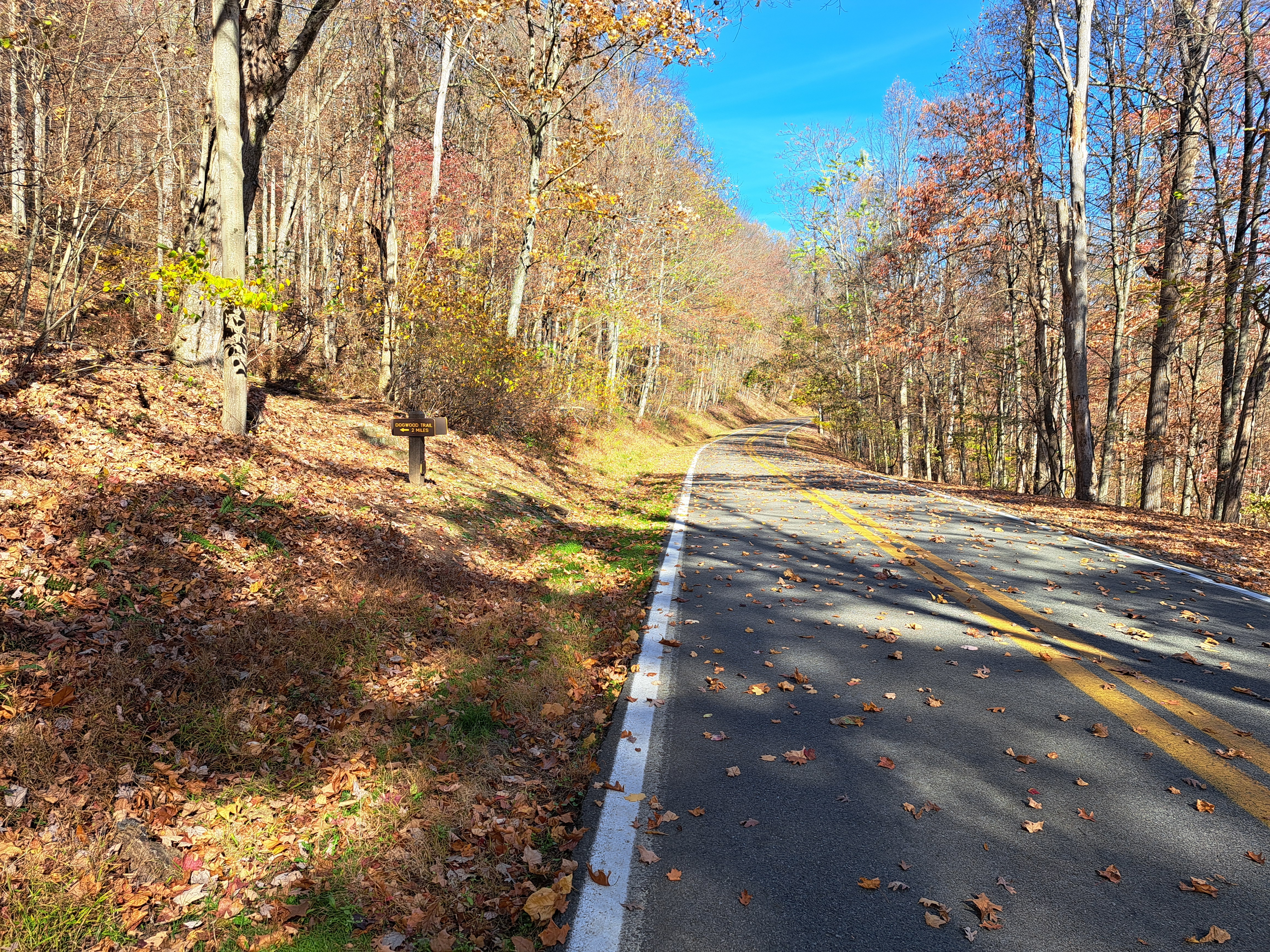
        Your first task on this hike is to find the start of the Dogwood Trail.  From the lodge parking lot, walk north on the seldom-used park road, which is back out the way you drove in if you followed the directions to the trailhead above.  After walking about 1000 feet, look for the signed start of the Dogwood Trail on the left.  The trail going right is the end of the Tygart Dam Trail, which is the final leg on our loop.
Climbing on the Dogwood Trail
    
        Marked with white plastic diamonds, the Dogwood Trail climbs the unnamed hill on a moderate to steep grade.  Three switchbacks get you to the top of the hill, and while the trail is rough and primitive, I have certainly hiked rougher and more primitive trails in West Virginia.  Some large oak trees dominate the forest, and the hiking is challenging but pleasant.
View down power line corridor
    
        At 0.7 miles, you reach the top of the hill as the trail curves left to pass under a power line.  A nice view northwest down the power line corridor 
can be had to the right.  This hilltop is about 400 feet above Tygart Lake, but Tygart Lake is not visible from here.  After reentering the woods, the trail makes a broad switchback near the top of the hill, and this switchback is the flattest part of the Dogwood Trail.
End of Dogwood Trail
    
        Just past 1 mile, the trail curves left to leave the hilltop area and heads straight down the hillside.  There are no switchbacks on this part of the trail, and therefore the descent is very steep.  At 1.2 miles, you intersect a steep gravel road that allows service vehicles to access some tanks to the right.  Turn left to walk down the gravel road and intersect the main park road.  A small alternate parking lot exists here, and the Dogwood Trail ends here.  A connector trail heads straight downhill to the Tygart Dam Trail, but this hike also visits Tygart Dam by turning right and beginning a 0.25 mile road walk.
Tygart Lake
    
        1.5 miles into the hike, you reach the Tygart Dam area, where a rustic picnic shelter overlooks the dam.  Turn sharply left to begin our return route on the Tygart Dam Trail.  Marked with yellow/orange trail markers, the Tygart Dam Trail descends steeply on a gated asphalt road to reach an area with benches overlooking Tygart Lake.  These benches feature nice views of Tygart Lake, and they make nice places to stop and have a snack with the hardest hiking behind you.
Looking uphill to the lodge
    
        At 1.7 miles, you reach a cul de sac where the gated road turns into a dirt trail.  After crossing a wooden footbridge, the connector trail you passed at the parking lot earlier comes in from the left.  The Tygart Dam Trail stays in the narrow strip of woods with the park road uphill to the left and the lake downhill to the right.  While the trail is not completely flat, it seems easy relative to the steep Dogwood Trail you hiked earlier.  At 2.2 miles, the lodge comes into view uphill to the left, and your final lake view opens up on the right.  Climb the steps to the left and walk through the lodge lobby to return to the lodge parking lot and complete the hike.

Monday, January 8, 2024

Point Pleasant Riverfront Park to Tu-Endie-Wei State Park (Blog Hike #981)

Trails: (unnamed)
Hike Location: Riverfront Park and Tu-Endie-Wei State Park
Geographic Location: Point Pleasant, WV (38.84250, -82.13919)
Length: 0.7 miles
Difficulty: 0/10 (Easy)
Date Hiked: October 2023
Overview: A flat hike, mostly on paved trail, along the Ohio River to the Point Pleasant Monument.
Park Information: https://wvstateparks.com/park/tu-endie-wei-state-park/
Hike Route Map:
On The Go Map
Photo Highlight:
Hike Video: 

Directions to the trailhead: This hike starts at the Riverfront Park floodwall door in downtown Point Pleasant.  Park in the perpendicular parking on the north side of the town's post office.

The hike: When most people think of American wars during the 1770's, the Revolutionary War is the first one to come to mind.  Yet while revolution against the British was fomenting in America's eastern cities of Boston and Philadelphia, another war was taking place on what was then America's northwestern frontier.  Named for the Royal Governor of the Virginia Colony, Lord Dunmore's War came about when forces under Shawnee Chief Cornstalk tried to stop the advance of American/British settlers in the Ohio valley.
            Lord Dunmore's War had only one major battle, namely the Battle of Point Pleasant in present-day West Virginia on October 10, 1774.  Though he was outnumbered at least 2 to 1, Chief Cornstalk advanced south to attack the Virginia militia under the command of Colonel Andrew Lewis.  Cornstalk's goal was to prevent the militia from crossing the Ohio River into present-day Ohio, thereby protecting Shawnee land along the river.  Fighting lasted all day, but the Shawnee were eventually outflanked and forced to retreat north across the river.  Later that month, Lord Dunmore led the Virginia militia deep into present-day Ohio, thus forcing the Shawnee to sign the Treaty of Camp Charlotte to end the war and surrender land claims south of the Ohio River.
            Today the Battle of Point Pleasant is commemorated by Tu-Endie-Wei State Park, a tiny 4 acre park in downtown Point Pleasant at the confluence of the Kanawha and Ohio Rivers.  The park's name comes from the Wyandot word that translates to "point between two waters," a reference to the park's confluential location.  The park's main structure is the Mansion House, a wooden structure dating to 1796 that was originally a tavern.  The City of Point Pleasant's Riverfront Park is only a short distance away, and walking the asphalt trail that joins the two parks forms the super short and super easy "hike" described here.
Point Pleasant floodwall
Riverfront Park
    
        Start by walking through the floodwall door, which brings you to the top of the amphitheater at Riverfront Park.  The amphitheater's stage is right by the Ohio River, and the "seats" are formed by a tiered wavy concrete structure.  The amphitheater looks like a small version of Cincinnati's famous Serpentine Wall, and the Ohio River bridges visible in either direction add to the scenery.
Entering Tu-Endie-Wei State Park
    
        To head for Tu-Endie-Wei State Park, turn left and begin walking downstream with the Ohio River on your right and the floodwall on your left.  A beautiful mural of pioneer life in this area adorns the floodwall, and metal statues of famous people from the pioneer era such as Sacagawea and Mad Anne Bailey line the asphalt trail.  At 0.25 miles, the asphalt trail ends where a sign welcomes you to Tu-Endie-Wei State Park.  Continue straight to walk across the mowed grass and enter the state park.
Point Pleasant Monument
Confluence of Ohio and Kanawha Rivers
    
        The state park occupies only about a city block, but there is lots to see here.  In addition to the aforementioned Mansion House, separate monuments stand to Shawnee leader Chief Cornstalk and The Magazine, where several members of the Virginia Militia are buried.  The tallest monument is the Point Pleasant Monument, a stone obelisk that stands to the battle itself.  Walking to the other (south) end of the park brings you to the confluence of the Ohio and Kanawha Rivers and allows you to see river bridges on both rivers.  After exploring the park, retrace your steps back to Riverfront Park and the floodwall door to complete the hike.

Thursday, December 28, 2023

North Bend State Park: Hibbs Cemetery and Nature Trails (Blog Hike #977)

Trails: Hibbs Cemetery and Nature Trails
Hike Location: North Bend State Park
Geographic Location: east of Parkersburg, WV (39.22497, -81.10469)
Length: 3.4 miles
Difficulty: 8/10 (Moderate/Difficult)
Date Hiked: October 2023
Overview: A loop hike over hills and along the North Fork of the Hughes River.
Park Information: https://wvstateparks.com/park/north-bend-state-park/
Hike Route Map:
On The Go Map
Photo Highlight:
Hike Video: 

Directions to the trailhead: In northern West Virginia, take I-77 to US 50 (exit 179).  Exit and go east on US 50.  Drive US 50 east 18 miles to SR 31 and turn right on SR 31.  Drive SR 31 south 5 miles, passing through the town of Cairo along the way, to Low Gap Road.  Turn left on Low Gap Rd.  Low Gap Rd. deadends at a 4-way stop at the park entrance in 3.3 miles.  Continue straight to enter the park, then drive the main park road 1.2 miles downhill to the River View Campground, where this hike begins.

The hike: Most state parks located on shores of man-made reservoirs were built at the same time as their lakes, but such is not the case with North Bend State Park.  The park dates to 1951, when the West Virginia State Legislature authorized the purchase of 1405 acres of depleted oil and natural gas fields.  The park opened a few years later, but North Bend Lake was not built until 2002.  The plain-looking concrete dam that forms the lake can be seen in the eastern end of the park today.
            In addition to aquatic activities on the lake, the park offers a cozy 29-room lodge, a 49-site developed campground, a swimming pool, a picnic area, and access to the North Bend Rail Trail, a 74-mile bike trail built atop an abandoned railroad grade.  The park also offers several miles of hiking and mountain bike trails in a part of West Virginia with few quality hiking options.  Most people view the park's Nature Trail as its best trail, and this hike combines the Nature Trail with one of its spurs to form a challenging and primitive 3.4 mile loop.  Be warned that many parts of this trail are hard to discern on the ground, so do not attempt this hike without a park trail map and good route-finding skills.
Start of Hibbs Cemetery Trail
    
        This hike starts on the Hibbs Cemetery Trail, which begins at a small wooden sign behind the River View Campground check-in building.  The Hibbs Cemetery Trail is marked with blue plastic diamonds, and it begins climbing a narrow finger ridge on a moderate to steep grade.  This finger ridge separates the developed and primitive parts of the River View Campground, so camping areas exist downhill on both sides of this ridge.
Boulders along Hibbs Cemetery Trail
    
        The trail stays near the top of the ridge as it passes some large boulders and rock outcrops.  The trail map indicates that Hibbs Cemetery sits in this area, but I either could not find it or walked past it unawares.  At 0.5 miles, you reach a trail intersection as the park's lodge comes into sight on the right.  The Hibbs Cemetery Trail ends here.  To continue this hike, turn left and cross over a small hill to reach the 
4-way stop road intersection at the park entrance; you drove through this intersection on the way in.  Walk diagonally across the intersection to pick up the Nature Trail, which you will follow for the rest of this hike.
Joining the Nature Trail
    
        Marked with orange plastic diamonds, the Nature Trail heads into a narrow strip of woods with park roads above you to the left and below you to the right.  When I hiked here, the Nature Trail as shown in the park map was overgrown and practically impassible, so I ended up hiking an unmarked and unofficial trail that stays well below the top of the ridge.  This choice reduced the length and elevation gain of this hike, but I rejoined the Nature Trail at 1.2 miles into my hike.  I have learned over the years that trail maintenance can be an issue in West Virginia's state parks, and this is one place where that issue comes to the forefront.
Hiking the Nature Trail
    
        A moderate to steep downgrade brings you to a park road crossing at 1.4 miles.  Next comes a surprisingly flat section of trail that treads through nice forest as you partially circle a low knob on the left.  Beech and maple are the most common trees in this forest, and this section of trail is really quite pleasant.
Grassy area along river
    
        Just shy of 2 miles into the hike, the flat section ends as you begin a steep switchbacking descent to the North Fork Hughes River.  This section of trail has recently been rerouted, and orange plastic diamonds seem to be everywhere here.  You cross a tiny stream without the aid of a bridge before finally making it to the river bank at 2.4 miles.  The riverside area has a thick grassy groundcover, and you will have to rely on the orange plastic diamonds to stay on the trail: it is indistinguishable from the surrounding forest in this area.
North Fork Hughes River
    
        The scenic riverside area lasts only a few hundred feet before you begin the steep climb away from the river.  Ignore the Tanker Run Spur Trail, which exits right, and keep following the orange plastic diamonds to remain on the Nature Trail.  At 2.65 miles, you reach picnic shelter #1 at the top of the ridge.  Restrooms are available here, and this shelter makes a nice place to rest and enjoy a trail snack before beginning the final leg of the hike.
Picnic Shelter #1
    
        Next the trail passes through a steep and narrow ravine to reach picnic shelter #2.  Another steep descent on narrow trail drops you below the rock cliffs and returns you to the river at 3 miles.  Some Canada geese greeted me along this section of the river.
Hiking along the river
    
        The balance of the hike uses narrow trail that treads sometimes near the river and sometimes along the bluff high above the river.  A couple parts of this trail cling perilously to the hillside.  A final switchback brings you down to the primitive campground, where a left turn on the park road will bring you back to the campground check-in station to complete the hike.


Monday, December 19, 2022

North Bend Rail Trail: Cairo to Silver Run Tunnel (Blog Hike #920)

Trail: North Bend Rail Trail
Hike Location: North Bend Rail Trail
Geographic Location: east of Parkersburg, WV (39.20856, -81.15603)
Length: 6.4 miles
Difficulty: 3/10 (Easy/Moderate)
Date Hiked: October 2022
Overview: An out-and-back on gravel rail-trail to a supposedly haunted old railroad tunnel.
Trail Information: https://wvstateparks.com/park/north-bend-rail-trail/
Hike Route Map:
On The Go Map
Photo Highlight:
Hike Video:

Directions to the trailhead: From Parkersburg, take US 50 east 18 miles to SR 31 and turn right on SR 31.  Drive SR 31 south 4.2 miles to the town of Cairo.  Park at the perpendicular street parking in downtown Cairo.

The hike: With a current population of 174, Cairo, WV is one of those kind of creepy two-thirds abandoned industrial towns that are scattered throughout West Virginia and more generally throughout Appalachia.  During the town's hay day in the early 1900's, over 650 people lived here.  Early settlers were attracted to this site by the fertile land and the abundant water provided by the North Fork of the Hughes River, which runs through town.  Later lumber and coal dominated the area, and the town's population declined along with these industries.
            Glimpses of Cairo's glory days remain, and they include the North Bend Rail Trail, which follows a former spur of the famous Baltimore & Ohio (B&O) Railroad.  Another remnant of this town's industrial past is the the two-story brick building that formerly housed the Bank of Cairo.  Built in 1897, that building is listed on the National Register of Historic Places, and it presently serves as the town's City Hall.
            The North Bend Rail Trail is regarded as one of the best bike paths in Appalachia, and it is famous for its long tunnels and mountainous scenery.  The hike described here starts in downtown Cairo and heads west on the rail trail to a particularly famous tunnel: the 1376-foot long Silver Run Tunnel.  Not only is the tunnel an impressive construction, but it is supposedly haunted by a young ghostly woman who was seen by several railroad engineers when the railroad was operating in the early 1900's.  Honestly, even though I did this hike on a cloudy damp Halloween afternoon when dense fog made the tunnel an eerie setting, I did not observe anything paranormal during my hike.
North Bend Rail Trail's Cairo trailhead
    
        From downtown Cairo, head west on the North Bend Rail Trail as it crosses the North Fork of the Hughes River on an old railroad bridge.  This bridge has been repurposed with a wooden deck to support hikers, bikers, and horses, and strategically placed boulders block vehicle access.  The historic Bank of Cairo building stands to the left here, as do an old black bell and some smaller brick buildings.
Historic Bank of Cairo building
    
        The gravel rail trail heads west with the hillside rising to your right and houses on CR 31/4 downhill to your left.  Because this route was built for trains, the grade is very gradual.  Nevertheless, you gain about 200 vertical feet of elevation between downtown Cairo and the Silver Run Tunnel.  Where steep driveways exit right or left, choose the more gradual gravel trail to remain on the North Bend Rail Trail.  Mile markers appear at 1 mile increments and help you track your progress.
Picnic table beside the trail
    
        Near 1.5 miles into the hike, you pass a picnic table that makes a nice place to rest about halfway to the tunnel.  Tall rock outcrops, probably exposed during the railroad's construction, tower over the trail to the right here.  Other subtle reminders of this trail's railroad past such as wooden posts and ties can be seen occasionally if you look carefully.  Also, CR 31/4 often stays in sight downhill to the left even though houses become fewer and further between.  The forest here is a nice mixture of pine and broadleaf trees.
Rock outcrops towering over trail
    
        At 2.6 miles, you cross gravel CR 31/4 near where it intersects CR 18/2.  The surrounding hills grow taller now, and soon the trail enters the deep rock cut that leads to Silver Run Tunnel.  At 2.9 miles, you reach the tunnel's east portal.  This long tunnel has a curve, so you can't see the other end of the tunnel from here.  Thus, a flashlight is highly recommended if you want to enter the tunnel.
East portal of Silver Run Tunnel
    
        Once you enter the tunnel, the cool subterranean air causes the warmer moister air from outside the tunnel to condense, forming fog.  Also, the brick walls cause sound to reverberate in odd ways.  Thus, I found the tunnel rather eerie even though I did not see anything paranormal while walking through the tunnel.  The rail trail continues another 23 miles to the west, but the tunnel is a good place to turn around.  Retracing your steps back to Cairo completes the hike.

Tuesday, July 7, 2020

Droop Mountain Battlefield State Park (Blog Hike #801)

Trails: Overlook, Horse Heaven, Cranberry Bogs, and Musket Trails
Hike Location: Droop Mountain Battlefield State Park
Geographic Location: southwest of Marlinton, WV (38.11568, -80.26875)
Length: 2 miles
Difficulty: 3/10 (Easy/Moderate)
Date Hiked: June 2020
Overview: A loop hike around the Civil War battlefield that secured West Virginia for the Union.
Park Information: https://wvstateparks.com/parks/droop-mountain-battlefield-state-park/
Hike Route Map:
On The Go Map
Photo Highlight:
Hike Video: 

Directions to the trailhead: Droop Mountain Battlefield State Park is located on the west side of US 219 15.3 miles south of Marlinton or 26.5 miles north of Lewisburg.  Enter at the main park entrance, then turn right to follow signs for the museum and park office.  Park in the parking lot in front of the park office.

The hike: The Battle of Droop Mountain on November 6, 1863 was one of the largest Civil War engagements in West Virginia.  Union troops under the command of Brigadier General W.W. Averell and Colonel Thomas Harris were moving south toward the Confederate stronghold of Lewisburg with the ultimate goal of disrupting railroad traffic on the Virginia & Tennessee Railroad further south.  Confederate forces under the command of Brigadier Generals John Echols and Albert Jenkins knew that the Union troops would have to come over Droop Mountain in order to reach Lewisburg.  Moreover, Droop Mountain's high relief offered the Confederates their best chance to mount a strong defense.
            The Confederates were outnumbered more than 3 to 1, but occupying the high ground, significant artillery, and constructed fortifications allowed them to repel Union advances in the morning.  By the early afternoon, Averell outflanked the Confederates on their left, and the Confederates fled in a disorganized retreat after a brief but violent battle.  All tallied, the Confederates took 275 casualties and lost large quantities of arms and ammunition.  Union forces took Lewisburg the next day, and the Battle of Droop Mountain marked the end of organized Confederate resistance and operations in West Virginia.
            Due to the efforts of West Virginia House of Delegates' John D. Sutton, a Private in the Union army during the battle, today 287-acre Droop Mountain Battlefield State Park preserves the battle's site.  The park was dedicated on July 4, 1928 as West Virginia's first state park.  The park offers only a lookout tower, a playground, a small museum, some picnic shelters, and some hiking trails for amenities, so history and nature take center stage here.  The hike described here is not the park's longest possible hiking route, but it passes the main historic sites and amenities, thus offering a good overview of the park.
Trailhead for Overlook Trail
    
        Start at the north end of the parking area where a sign marks the start of the Overlook Trail; a large interpretive sign describing the white oak tree also stands here.  None of this park's trails are marked except at trailheads and intersections, but I found most of the trails easy to follow on my visit.  The Overlook Trail curves left and arrives at some trenches dug and occupied by Confederate forces.  Some interpretive signs tell you that these trenches are located near the area where the Confederates got outflanked.  Imagine what it would be like to hunker down in this trench with an army three times the size of yours advancing on your position.
Confederate trench
    
        The trail continues curving left, and at 0.2 miles you reach a northwest-facing overlook platform.  Droop Mountain is one of several mountains of similar height in this area, and Round Mountain stands in full view across the valley to the northwest.  A small cave called Old Bear Den is also located in this area, and the rugged Big Spring Trail leads downhill to its namesake spring.  Head south from the overlook to continue the Overlook Trail.
View northwest from Droop Mountain
    
        After passing some rock outcrops bordered by rhododendron, you reach the end of the Overlook Trail at an intersection with the Horse Heaven Trail.  Turn right to begin heading south on the Horse Heaven Trail.  The Horse Heaven Trail is the most primitive trail used by this hike, and it was somewhat overgrown and hard to follow on my visit.  The Horse Heaven Trail parallels the park road, so you can cut through the woods to the left and walk on the park road if trail conditions are too bad.
Hiking the Cranberry Bogs Trail
    
        At 0.75 miles, you reach the south end of the Horse Heaven Trail at a combined road and trail intersection.  To continue this hike, turn left and cross the road to pick up the Cranberry Bogs Trail.  The wide dirt Cranberry Bogs Trail descends gradually on a southeastward course through a dark forest dominated by spruce and hemlock trees.  Some mountain laurel in bloom brightened my path on my mid-June visit.
Cranberry bogs
    
        Ignore the Old Soldier Trail and continue to follow the Cranberry Bogs Trail as it passes its namesake wetland.  The cranberry bogs were actually fairly dry on my visit, and I saw more ferns than cranberries in this "bog."  Past the bogs, walk through a complicated trail intersection to reach an old stone trail shelter located beside the park road.  Angle left and walk up the paved spur road that leads to the park's famous lookout tower.  Steps lead to the top of the wooden lookout tower, which offers fantastic views east across the Greenbrier River valley and into the wooded hills of vast Watoga State Park.  Some picnic tables near the lookout tower beckon you to sit, rest, and take in the view.
View east from lookout tower

Lookout tower
    
        Two trails exit the lookout tower area: the Musket Trail and the Minnie Ball Trail.  Both trails lead in the general direction of your car and the park office, but this hike uses the easier, flatter, and better-maintained Musket Trail as its final leg.  The Musket Trail descends to cross the main park road only to curve right and intersect the road again at the lowest elevation of this hike.  Rather than crossing the road, the trail curves left and climbs moderately to reach the Musket Trail's north end at an intersection with the Cranberry Bogs Trail.  Turn right and hike the short final segment of the Cranberry Bogs Trail to return to the park office and complete the hike.