Thursday, September 26, 2019

Chatfield Hollow State Park: Red/Orange Loop (Blog Hike #773)

Trails: Red, Purple, Blue, Orange, and Boardwalk Trails
Hike Location: Chatfield Hollow State Park
Geographic Location: west of Killingworth, CT (41.36946, -72.58882)
Length: 4 miles
Difficulty: 9/10 (Difficult)
Date Hiked: August 2019
Overview: A loop hike, mostly moderate but with occasional rock scrambling, exploring Chatfield Hollow.
Photo Highlight:

Directions to the trailhead: From the SR 80/SR 81 rotary in Killingworth, drive SR 80 west 1.2 miles to the park entrance on the right.  Turn right to enter the park, and follow the main park road 0.3 miles to the swimming area parking, where this hike begins.  Note that this park charges a $15 entrance fee for non-Connecticut residents on weekends but no entrance fee on weekdays; time your visit accordingly.

The hike: Tucked in one of the many steep-sided gorges that run north-south across south-central Connecticut, Chatfield Hollow State Park protects 412 acres in and along its namesake hollow.  Development of the park began in 1934 when the Civilian Conservation Corps (CCC) dammed Chatfield Hollow Brook to create 7 acre Schreeder Pond and planted some pine trees around the pond.  The land was designated as a state park in 1949, and Schreeder Pond still serves as the park’s swimming and fishing areas today.  Indeed, Chatfield Hollow State Park has been designated a trout park due to the high quality of its fishing opportunities.
            The park, hollow, and brook get their names from the descendants of three Chatfield brothers who built a gristmill on this brook during Colonial times.  Before the Chatfields arrived, earlier people left behind artifacts in some shallow rocky caves located near the park entrance.  This hike does not take you to these caves, but they can be accessed via the 0.25 mile Chimney Trail that could be added on to this hike.
            The park retains a rustic character, as it offers only the aforementioned swimming area, some picnic tables, and a small nature center for amenities.  For hikers, the park offers 9 trails totaling over 6 miles.  Many routes through the park’s trail system are possible, but the route described here forms a grand tour of the park that explores both the tranquil, flat streamside areas and the rocky, steep hollow rim areas.
Red Trail exiting swimming area
            From the swimming area, pick up the Red Trail as it heads east and immediately begins climbing a long series of wooden steps.  Trails at Chatfield Hollow are marked with color-coded rectangular paint blazes, and some of these trails see sufficiently little traffic that the blazes come in handy to help you find your way.  The hollow’s rim is only about 200 vertical feet above the brook, but all trails in and out of the hollow are quite steep, as you quickly learn on this initial climb.
            At 0.25 miles, you reach the hollow’s rim as a spur trail exits right to the White Trail, which in turn leads to adjacent Cockaponset State Forest.  Stay 
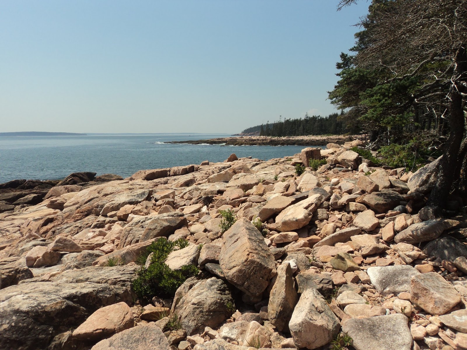
with the Red Trail as it curves left to head north along the hollow’s rim.  The rim area features a lot of boulders, and the shallow rocky soil supports only some stunted pine trees and a thick understory of shrubs and grass.
Climbing toward the hollow's rim
            The Red Trail undulates gently as it heads north with the deep and steep hollow to your left.  Near 0.5 miles, the trail treads atop a sheer rock cliff that would give nice views into the hollow during the leafless months.  All of the rock ledges at Chatfield Hollow are made of a gray metamorphic rock called Monson gneiss, and the rock’s odd color gives the area a distinctive look.
Top of a sheer rock ledge
            The going on the hollow rim is fairly easy, but when the trail dips under the cliff line the treadway becomes rough and boulder-strewn.  You may need to use your hands to keep your balance while clambering over the boulders.  Just shy of 1 mile, Chatfield Hollow Brook comes into view as the Purple Trail enters from the left.  Soon you reach a red covered bridge that spans the brook.  Do not cross the bridge now, but instead remain on the Red Trail as it stays on the east bank of the brook.
Covered bridge
            At 1.3 miles, the Red Trail ends at a small pond created by a stone dam with a waterwheel.  Some sunny picnic tables make nice places to sit, but a parking lot across the pond ensures you will not be alone here.  After enjoying this area’s tranquility, walk around the pond to reach the parking lot.
Pond at end of Red Trail
            My plan for continuing this hike was to pick up the Orange Trail at the west side of this parking lot, but I could not find the Orange Trail.  In hindsight, I looked for the Orange Trail in the wrong spot: I should have looked in a small cul de sac just north of the parking lot.  As an improvised route, I turned left on the park road that serves the parking lot and walked down the road to the covered bridge you passed earlier.  I then crossed the covered bridge and hiked the Purple Trail, the blazes of which are a very light shade of purple.  The Purple Trail offers a flat but somewhat rocky course along Chatfield Hollow Brook.  Some nice beech trees live along the brook, and this improvised route turned out to be quite pleasant.
Hiking along Chatfield Hollow Brook
            At 1.75 miles, the Purple Trail comes out at a picnic area beside the brook and the park road.  Wanting to get back on my intended course, I crossed the brook via the park road’s bridge and picked up the signed West Crest Trail, which is marked with blue rectangular paint blazes.  True to its name, the West Crest Trail climbs out of the west side of Chatfield Hollow.  The climb is gradual at first, but the grade becomes steep and rocky before you reach the hollow’s rim.
            Ignore an unmarked trail that exits left before reaching a junction with the Orange Trail at 2.1 miles.  Turn left to begin heading south on the Orange Trail.  This part of the Orange Trail offers a comparatively flat and easy trek, and some old stone walls indicate this land has been farmed in the past.  Where the Orange Trail splits, you could go either way because the two options come back together further south, but the left option is about half as long as the right option.  I chose the shorter option, but you should choose whichever one pleases you.
Hiking the Orange Trail
            3 miles into the hike, traffic on SR 80 comes within earshot on the right as a tall, stark, nearly vertical gneiss rock outcrop can be seen ahead.  Now comes the hardest part of the hike: the trail circles around to the back of the outcrop and climbs its bare rock ledges.  Whereas you may have needed to use your hands to navigate the boulders earlier on this hike, you will definitely need to use your hands to climb and descend these ledges.  I met some rock climbers/rappellers here who were enjoying this cliff for their sport, and their climbing route was much longer and sheerer than mine.  Some nice views to the west might emerge here in the leafless months.
            The trail traces the cliff line before curving right and descending the back (east) side of the rock outcrop.  This descent is steep and rocky but more manageable than the way you came up.  At 3.5 miles, you reach the south end of the Orange Trail when you intersect the park exit road.  Cross the road to begin the Paul F. Wilderman Boardwalk, which is named for its designer.
Paul F. Wilderman Boardwalk
            Made of real wood, the boardwalk carries you over a shallow wetland formed by a broad section of Chatfield Hollow Brook.  Interpretive signs describe the wetland’s rich flora and fauna, but the greenery is sufficiently dense to make wildlife viewing difficult.  The east end of the boardwalk comes out at a gravel parking lot near the park entrance road.  Turn left and walk the park road back to the swimming area to complete the hike.  Alternatively, if you have more time and energy you could turn right to reach the start of the Chimney Trail and explore the park's caves.

Saturday, September 21, 2019

Baxter State Park: Appalachian Trail to Big Niagara Falls (Blog Hike #772)

Trail: Appalachian Trail
Hike Location: Baxter State Park
Geographic Location: northwest of Millinocket, ME (44.32004, -68.25303)
Length: 2.6 miles
Difficulty: 4/10 (Moderate)
Date Hiked: August 2019
Overview: An out-and-back to Big Niagara Falls with a view of Mount Katahdin.
Park Information: https://baxterstatepark.org/
Photo Highlight:


Directions to the trailhead: From Millinocket, drive Baxter Park Road 17.1 miles to the park’s Togue Pond Entrance Gate, where you will need to pay your entrance fee ($15 for non-Maine residents on my visit) and tell the park rangers what part of the park you wish to visit.  The road surface turns to gravel at the entrance gate.  Follow the narrow and winding Park Tote Road 10 miles to the signed turnoff for Daicey Pond.  Turn left and drive the narrower Daicey Pond driveway to the Daicey Pond day use parking area on the right.  Park here.

The hike: The words Katahdin and Baxter are legendary in hiking circles.  As the northern terminus of the Appalachian Trail (AT), northbound AT through-hikers spend months making their way over mountain after mountain to reach the final mountain, Mount Katahdin.  Katahdin is also the highest point in Maine, and its huge multi-peaked steep-sided pinnacle dominates the landscape for miles around.  On point, the 5269 foot mountain stands 4288 feet above its highest adjacent valley.
            Katahdin remains the icon it is today partly due to the foresight of Percival Baxter, the Governor of Maine from 1921-1925 for whom this park is named.  Baxter set aside 30,000 acres of land for this park, and each parcel of land he donated came with a deed of trust that gave instructions for how to care for the land and an endowment.  Thus, although Baxter is a state park, it is operated and funded separately from the rest of Maine’s state park system.
            Baxter’s instructions were to keep the land wild and untouched by man, and those instructions are carried out in the park we visit today.  The vast 209,644 acre park features no amenities except trails, picnic shelters, and tent campgrounds, and all roads in the park are narrow, curvy, gravel roads.  Thus, although the road distance from the park entrance gate to this trailhead is only 10 miles, it will take about 45 minutes to drive that distance.  Plan your visit accordingly.
            Options for hikers at Baxter State Park are almost unlimited.  Of course Mount Katahdin’s summit is the dream destination, but all trails that lead to the summit are very long and strenuous with several thousand feet of elevation gain.  For people who cannot make such a trek, the park has numerous locations that offer postcard views of Mount Katahdin.  One of the most famous of these views can be had at Daicey Pond (pronounced like DAY-see), and this hike combines this postcard view with a short journey along the AT to a pair of high-volume waterfalls.
Mt. Katahdin across Daicey Pond
Katahdin's Baxter Peak across Daicey Pond
            Because Mount Katahdin is the center of everybody’s attention in this area, you may as well start by getting your postcard view.  From the day use parking area, continue walking down the campground entrance road and climb slightly to reach Daicey Pond Campground.  The pond is located right behind the campground’s well-volumed library (yes, this campground has an actual building full of ink-and-paper books), and Mount Katahdin looms large across the pond.  Mount Katahdin actually has several peaks, and this view features the southwest Abol face of Baxter Peak, the mountain’s highest point.  The moment I saw Mount Katahdin across Daicey Pond was the highlight of my summer 2019 Maine hiking trip, which included visits to both of Maine’s top-tier hiking destinations: Baxter State Park and Acadia National Park.  I hope you enjoy this view as much as I did.
Information kiosk at AT trailhead
            After savoring the view, walk back down to the day use parking area, and then turn left to begin heading southbound on the AT.  An information kiosk and vault toilet stand here, and a sign gives distances to Big and Little Niagara Falls among other more distant destinations.  After tracing the south edge of a sunny meadow, the trail curves left to pass through a wetland area.  A series of rocks and wooden planks keep your feet mostly dry, but the careful stepping you need to do here makes this section the hardest part of the hike.
Major trail intersection
            At 0.3 miles, you reach a major signed trail intersection.  The option going straight is the Daicey Pond Nature Trail, which leads back to Daicey Pond.  Turn right to continue southbound on the AT, following the AT’s famous white rectangular paint blazes.  A gradual descent through pine and birch trees ensues, and the smooth dirt treadway makes for easy going.  At 0.75 miles, you pass an interesting pine tree with roots stretched down over a boulder.
Tree growing over boulder
            Just shy of 1 mile, you reach the signed spur trail to Little Niagara Falls.  Turn right and hike the short rocky spur to the falls.  While calling either of the waterfalls on this hike Niagara requires quite a bit of embellishment, Little Niagara Falls is more of a rocky cascade than a fall.  Nevertheless, Nesowadehunk Stream provides a lot of water to cascade, and a large streamside boulder makes the perfect spot to catch the aquatic action.
Little Niagara Falls
            Return to the AT and turn right to continue southbound.  The trail descends moderately over a somewhat rocky course to reach the signed spur trail to Big Niagara Falls.  Turn right for the steep, rocky, and rooty descent to the side of Big Niagara Falls.  Though only about 20 feet high, Big Niagara Falls is more of a true waterfall than Little Niagara Falls, and the surrounding rocks make for a stark setting.
Big Niagara Falls
            The AT continues downstream along Nesowadehunk Stream for several more miles, but there are no more waterfalls nearby.  Thus, most hikers turn around here and retrace their steps to the Daicey Pond parking area.  Other nice dayhikes at Baxter State Park include a 4-mile hike along the AT to Katahdin Falls, another nice waterfall with Katahdin-fed waters, and a 6.5 mile hike to Katahdin Lake, which features a view of Mount Katahdin from the side opposite of Daicey Pond.

Tuesday, September 17, 2019

Acadia National Park: Jordan Pond Loop (Blog Hike #771)

Trail: Jordan Pond Loop Trail
Hike Location: Acadia National Park
Geographic Location: south of Bar Harbor, ME (44.32004, -68.25303)
Length: 3.5 miles
Difficulty: 4/10 (Moderate)
Date Hiked: July 2019
Overview: A nearly flat circumnavigation of Jordan Pond with great views of the surrounding mountains.
Photo Highlight:

Directions to the trailhead: This trailhead is most easily accessed using the Island Explorer shuttle bus.  From the Hulls Cove Visitor Center, ride the Jordan Pond route to the Jordan Pond House shuttle stop, which is the trailhead for this hike.

The hike: For my introduction to Acadia National Park, see my hike at the park’s Beech Mountain.  The Jordan Pond Loop Trail described here is my favorite short hike in Acadia National Park.  The hike features scenic views across Jordan Pond to the rocky mountains that surround it, and the pondside route passes through a variety of environments including some meadows, a wetland with a long boardwalk, some shady dry forest, and even a rugged sunny boulder field.  Indeed, this hike provides a sample of all the great sights Acadia’s interior ponds have to offer.
Trailhead near Jordan Pond House
            From the Jordan Pond House shuttle stop, walk to the left (west) of Jordan Pond House, and then angle right to head for Jordan Pond.  A gradual descent through a sunny meadow brings you to the south corner of Jordan Pond.  The view across the pond to the bare rock mountains called the Bubbles may be the best view on this hike, so make sure you do not miss it.
The Bubbles across Jordan Pond
            Upon reaching the pond’s shore, turn left to begin a clockwise journey around the Jordan Pond Loop Trail.  Next you pass a small concrete dam called Water Company Dam.  Owned by the Seal Harbor Water Company, Water Company Dam dates to 1920, and it combined with glacial debris constrain the water in Jordan Pond.  The Jordan Pond Loop Trail briefly joins a carriage road to cross Jordan Pond’s main outlet stream on the carriage road bridge.  After crossing the bridge, turn right to leave the wide two-track carriage road and return to the single-track Jordan Pond Loop Trail.
Hiking the boardwalk
            The trail heads north along the heavily forested west bank of Jordan Pond.  Soon you reach the start of a long two-plank boardwalk that carries you over an extensive seasonal wetland along the pond’s west bank.  This boardwalk was in the process of being reconstructed on my visit, and the new sections had some nice wide passing areas where you could step to the side and let oncoming hikers pass.  These passing zones come in handy due to the narrowness of the boardwalk and the high traffic volume this trail receives.
Clambering through a boulder field
            Just past 1 mile, you finish the boardwalk and begin a rocky section that forms the hardest part of the loop.  Although the elevation change on this loop is minimal, you will probably need to use your hands to clamber over the boulders on this section of trail.  As you approach the end of the rocky section, nice views emerge down the length of Jordan Pond with massive Pemetic Mountain across the pond to the left.
Pemetic Mountain across Jordan Pond
            At 1.5 miles, the trail to Penobscot and Sargent Mountains exits left.  Stay right to cross one of Jordan Pond’s main feeder streams on an interesting wooden bridge.  When I passed through here, a common loon was nesting in the wetlands along this stream, and I saw several frogs poking their eyes above the water.
Bridge at north end of Jordan Pond
            Where the trail to the Bubbles exits left, stay right to round the north end of Jordan Pond.  Now heading south along the pond’s east shore, views of rocky Penobscot Mountain to the west appear across the pond.  Most of the trail on this side of the pond is paved with gravel, and these areas are wide and smooth enough for a stroller to cross.  However, a few small streams are crossed on rough stepping stones.
Rocky Penobscot Mountain
            3 miles into the hike, you reach a trail intersection where the trail to The Triad and Pemetic Mountain exits left.  Turn right to cross an inlet of Jordan Pond on a stone dam-like structure.  Where the trail splits after crossing the inlet, you can go either way:  the left route provides a slightly shorter route back to the trailhead, but the right route stays along the shore of Jordan Pond.  Both routes return to the Jordan Pond House, where the park shuttle bus and perhaps a nice lunch or dinner in the House’s restaurant await you after your hike.

Saturday, September 14, 2019

Acadia National Park: North Ridge Trail to Cadillac Mountain (Blog Hike #770)

Trails: North Ridge and Cadillac Mountain Loop Trails
Hike Location: Acadia National Park
Geographic Location: south of Bar Harbor, ME (44.37949, -68.23227)
Length: 5.1 miles
Difficulty: 10/10 (Difficult)
Date Hiked: July 2019
Overview: A rocky, occasionally steep out-and-back with short loop to the summit of Cadillac Mountain.
Photo Highlight:

Directions to the trailhead: This trailhead is most easily accessed using the Island Explorer shuttle bus.  From the Hulls Cove Visitor Center, ride either the Jordan Pond route or the Loop Road route to the North Ridge shuttle stop, which is the trailhead for this hike.

The hike: For my introduction to Acadia National Park, see my hike at the park’s Beech Mountain.  With an elevation of 1530 feet, Cadillac Mountain is the highest and perhaps most popular point in Acadia National Park.  The mountain’s popularity is partly due to its accessibility: the 3.5 mile Cadillac Mountain Summit Road allows visitors to drive to the summit’s fantastic views.  Also, due to Cadillac Mountain’s elevation and its location on the east coast, for most of the year the first rays of sunlight to strike the United States hit the top of Cadillac Mountain.  Thus, hiking or driving up the mountain in the dark and timing your summit arrival to coincide with daybreak has become a traditional activity for Acadia visitors.
            Geographically speaking, Cadillac Mountain consists of an oblong lump of granite that runs from north to south.  Thus, of the multiple hiking trails that lead to the mountain’s summit, the harder trails ascend the mountain’s steep east and west sides while the easier ones ascend the more gradual north and south sides.  Although the vast majority of visitors drive to the summit, hiking to the summit provides the opportunity to earn your views and allows you to get up close and personal with the mountain’s rocky environment.
Two classic hiking routes make their way to the summit: the 2.2 mile North Ridge Trail and the 3.5 mile South Ridge Trail.  Because the summit road also ascends the north side of the mountain, many experts view the South Ridge Trail as the preferred route of ascent for hikers.  Nevertheless, the North Ridge Trail described here has several advantages: it is more than a mile shorter each way, it has 400 fewer feet of elevation gain, and its trailhead is served directly by the park’s shuttle busses.  Also, the nearby summit road can serve as a bailout option if the trail proves too steep and rocky.  Truth be told, I hiked up the mountain on the North Ridge Trail and hiked back down along the summit road.
Trailhead at North Ridge shuttle stop
From the North Ridge shuttle stop, the single track dirt trail heads into the forest on an eastward course.  After several hundred feet of gradual climbing, you reach the shoulder of the Park Loop Road where the Kebo Brook Trail exits left.  Angle right to cross the road and reach the official beginning of the North Ridge Trail.
The grade intensifies as the trail alternates between exposed rock outcrops and shady pine forest.  Blue rectangular paint blazes mark the trail, as do some interesting rock cairns.  Each cairn consists of three rocks, one long flat rock placed atop two shorter rocks that act as support pillars.  Take care not to knock over the cairns, and also refrain from building new cairns that might confuse hikers who come after you.
Climbing the north ridge
At 0.5 miles, the grade eases but the rockiness continues as you top a small knob some maps call Great Pond Hill.  1 mile into the hike, the summit road comes close on the right for the first time as you get your first clear eastward view toward the Atlantic Ocean.  Next the grade intensifies again, and perhaps the hardest part of the climb ensues.  This part of the trail becomes a creek after a heavy rain, and the terrain is both steep and rocky.
Climbing on rocky trail
Just shy of 1.5 miles, you leave the shady pine forest for good and break out onto the open rock ledges.  You will need to use your hands to get up some of these ledges, and the sunny bare granite was scorching hot on the late morning in late July that I hiked here.  The top of the first ledge offers an expansive view to the east.  The summit road comes close on the right again, and a small parking area near this spot ensures that plenty of drivers from the summit road also come here.
More jagged ledges will need to be scrambled over, and some slickrock granite will need to be clambered up as the North Ridge Trail continues to climb.  At 2.3 miles, the trail comes out at the summit area near where the summit road enters the summit parking lot.  To tour the summit area, angle left and walk through the parking lot to reach the start of the paved Cadillac Mountain Loop Trail.  Head southeast from the parking lot to begin a counterclockwise trip around the summit loop trail.
View at Cadillac Mountain summit
Throughout the loop unimpeded views can be had to the east and southeast.  The views were fantastic on my 2019 visit, but on my 2004 visit the summit was covered by clouds.  The trail descends slightly from the summit to a point that offers a great view down Cadillac Mountain’s south ridge.  As you continue around the loop, Dorr and Champlain Mountains rise below you and to the east, and Bar Harbor comes into view to the northeast.
Looking down Cadillac Mountain's south ridge

View over Bar Harbor
At 2.7 miles, you finish the Cadillac Mountain Loop Trail and return to the summit parking area.  Now all that remains is to get back down.  The shuttle busses do not run to the Cadillac Mountain summit, and the shortest route to a shuttle stop is to retrace your steps back down the North Ridge Trail.  For a longer and harder route, you could descend one of the other trails such as the South Ridge Trail.  If you have had enough of scrambling over rocky ledges, you could walk back down the summit road, but this option will mean constant dodging of cars.  Whichever way you go down, the views going down are just as good as they were coming up.

Tuesday, September 10, 2019

Acadia National Park: Ship Harbor Nature Trail (Blog Hike #769)

Trail: Ship Harbor Nature Trail
Hike Location: Acadia National Park
Geographic Location: southwest of Southwest Harbor, ME (44.23164, -68.32560)
Length: 1.3 miles
Difficulty: 3/10 (Easy/Moderate)
Date Hiked: July 2019
Overview: A lollipop loop partly along Acadia’s rocky shore.
Photo Highlight:

Directions to the trailhead: The signed parking area for the Ship Harbor Nature Trail is located on the south side of SR 102A 4.4 miles from its eastern end or 2.3 miles from its western end; both ends are at SR 102.

The hike: For my introduction to Acadia National Park, see the previous hike.  The southern tip of Mount Desert Island’s western half features two short and easy trails that lead to Acadia’s rocky shore: the Ship Harbor Nature Trail and the Wonderland Trail.  I hiked the Wonderland Trail on my 2004 visit, so I returned to this area to hike the Ship Harbor Nature Trail on my 2019 visit.  While both trails offer nice hikes, I prefer the variety of the Ship Harbor Nature Trail to the more monotone nature of the Wonderland Trail.
Trailhead: Ship Harbor Nature Trail
            From the roadside parking area, the gravel trail heads southeast across a sunny meadow that is dotted with pine trees.  In only about 600 feet, the trail forks to form its loop.  To save the best aquatic views for last, I chose to turn left here and use the right trail as my return route, thus hiking the loop clockwise.
Hiking through large trees
            Now in a forest that features some nice large pine trees, the trail undulates gently as it continues southeast.  Just past 0.3 miles, you reach a trail intersection with a wooden post standing in the middle of it.  The two options to the right are the return route for this hike, so angle left to continue heading toward the coast.
            The trail climbs moderately over some log steps to soon reach the highest elevation on this hike.  After crossing a three-plank boardwalk through an area with a dense understory, a gradual descent brings you to the coast at 0.6 miles.  Great Gott Island and other islands can be seen straight ahead, but perhaps the best view is to the west across the entrance to Ship Harbor.  Jumbled chunks of pink granite make off-trail movement difficult, but many people wander around this scenic spot to take in the views.
Acadia's rocky shore
            Past the oceanside spot, the trail curves right to head away from the coast and toward Ship Harbor.  The trail surface becomes rockier, but careful stepping will get almost anyone safely over the rocks.  1 mile into the hike, you return to the trail intersection with the wooden post.  Turn left to continue the return route.
Ship Harbor
            The last part of the loop traces the east shore of shallow Ship Harbor, which opens up to the left.  Though not large or deep, Ship Harbor cuts far enough inland to provide safety for small ships in most storms.  At 1.25 miles, you close the loop.  Turn left to retrace your steps back out the entrance trail to the parking lot to complete the hike.

Saturday, September 7, 2019

Acadia National Park: Beech Mountain and Beech Cliff Loop Trails (Blog Hike #768)

Trails: Beech Mountain and Beech Cliff Loop Trails
Hike Location: Acadia National Park
Geographic Location: southwest of Somesville, ME (44.31517, -68.34360)
Length: 2.3 miles
Difficulty: 8/10 (Moderate/Difficult)
Date Hiked: July 2019
Overview: A pair of rocky loops featuring spectacular clifftop views.
Photo Highlight:

Directions to the trailhead: Where SR 102 splits to form its loop on the north side of Mount Desert Island, head west to go counterclockwise around the loop.  In 0.3 miles, turn left on Beech Mountain Road.  Beech Mountain Rd. dead-ends at the Beech Mountain trailhead parking area, where this hike begins.

The hike: The land known today as Acadia National Park has a long history as parkland.  The land first came under federal protection in 1916 when President Woodrow Wilson created Sieur de Monts National Monument.  A spring in the eastern part of the present-day park still bears the Sieur de Monts name, and the area around the spring forms almost a park within the park.  The Monument was redesignated Lafayette National Park by an act of Congress in 1919, when it became the first national park east of the Mississippi River and the only national park in New England.  The name was changed to Acadia National Park in 1929 to remember a French colony from the 1700’s that included southeast Maine.
            On a personal level, my first visit to Acadia came in 2004 when I spent a single day at the park and did a quick tour of the park’s highlights including Cadillac Mountain, Ocean Path and Sand Beach, and Southwest Harbor.  I was impressed by the park’s vast areas of bare granite rock back then, and in 2019 I returned for 3 days to dig deeper into the park’s abundant hiking opportunities.  The next four hikes are the product of that visit, and despite the fact that my visit occurred on the hottest days of the summer with temperatures north of 90 degrees, I had a great time in Acadia.
            Acadia National Park’s main area lies on Mount Desert Island, which is divided into eastern and western halves by Somes Sound.  The eastern half features the park’s most popular areas, while the western half is more secluded.  For the first of my four Acadia hikes, I went to Beech Mountain, the heart of the western half of Mount Desert Island.  Several trails start at the Beech Mountain trailhead, two of which are described here.  These two trails combine to form a manageable but rocky dayhike that leads to excellent clifftop views.
Trailhead for Beech Mountain Trail
            The Beech Mountain Trail is the harder of the two trails that make up this hike, so I decided to hike it first.  From the northwest corner of the parking lot, the signed Beech Mountain Trail heads into the woods and quickly forks.  Both options lead to the summit of Beech Mountain, but the left option takes a shorter, steeper, and rockier route than the right one.  Not being the nimblest hiker around, I angled right to choose the easier route.
            The smooth gravel treadway soon gives way to a mix of rocks and roots as the climb up Beech Mountain begins in earnest.  The bare rock outcrops were brutally hot on the sunny late-July morning I hiked here, and although this route is easier than the alternative you passed earlier, it still presents some challenge.  On the bright side, great views of sparkly Long Pond several hundred feet below you and to the west emerge as you climb the mountain.
Looking down at Long Pond
            At 0.6 miles, the steep and rocky Beech Mountain West Ridge Trail exits right.  Stay left to begin the final push to the summit, which takes you up a series of rock and log steps.  Just shy of 0.75 miles, you come out at the fire tower that marks the summit of Beech Mountain.  This fire tower is the only fire tower still standing in Acadia National Park, but it is closed to visitors.  Nevertheless, excellent views emerge from Beech Mountain’s bare rock summit, and on a clear day you can easily see all the way to the Atlantic Ocean.
View southeast from Beech Mountain
            After taking in the views at the summit, I chose to turn around and retrace my steps to the parking lot using the same trail I came up.  If you are more adventurous than I, you could take the shorter route to the parking lot that heads due north, or you could form a much longer and harder loop by taking the Beech Mountain South Ridge Trail down to the Valley Trail and then turning left to get back up to the parking lot.
Start of Beech Cliff Loop Trail
            Back at the parking lot, walk over to the northeast corner of the parking lot to begin the Beech Cliff Loop Trail, the second part of this hike.  The gravel trail climbs on a gradual to moderate grade through more of the birch/pine forest that dominates Acadia.  1.6 miles into the hike, you reach a trail intersection in a high saddle.  The option going right is the Canada Cliff Trail, and it leads to a rough clifftop loop that features several ladders.  The options going straight and left form the Beech Cliff Loop.  To get to the best views faster, I continued straight to hike the loop counterclockwise.
            Very soon you arrive at Beech Cliff and the views that make it famous.  The dark waters of Echo Lake lie several hundred feet below at the base of Beech Cliff, as does the soft sand of Echo Lake Beach.  Across Echo Lake stand Acadia and St. Sauveur Mountains, and the view around the mountains extends all the way to Somes Sound.  This viewpoint is my favorite one on this hike, so take some time to see what you can see.
Echo Lake Beach and St. Sauveur Mountain

Echo Lake, as seen from Beech Cliff
            The Beech Cliff Loop Trail forms a loop atop its namesake cliff, and while the loop is short you will probably need to use your hands while scrambling up and down some of the rocks.  The second half of the loop leaves the cliff edge and offers limited views.  Just past 2 miles, you close the loop.  Turn right to retrace your steps to the parking lot and complete the hike.

Monday, September 2, 2019

Mariaville Falls Preserve (Blog Hike #767)

Trails: New and Fisherman Trails
Hike Location: Mariaville Falls Preserve
Geographic Location: east of Bangor, ME (44.79694, -68.38401)
Length: 1.4 miles
Difficulty: 2/10 (Easy)
Date Hiked: July 2019
Overview: An out-and-back to powerful Mariaville Falls.
Photo Highlight:

Directions to the trailhead: From the intersection of SR 9 and SR 181 east of Bangor, take SR 181 south 3 miles to the signed access road for Mariaville Falls Preserve on the right.  The small blue sign is easy to miss, so look for it carefully.  Turn right and drive the narrow and somewhat rough gravel access road to the first gravel parking area on the right.  Park here.

The hike: Owned and maintained by the Frenchman Bay Conservancy, a private not-for-profit land conservation organization based in nearby Hancock, Mariaville Falls Preserve (pronounced like “muh-RY-uh-vill”) protects 123 acres on the east shore of the West Branch of the Union River.  The Conservancy operates 22 preserves in the area southeast of Bangor, and Mariaville Falls is its northern-most property.  The preserve is quite new: its grand opening was only in October 2015.
The falling water of Mariaville Falls was appreciated for its industrial applications long before it was appreciated for its scenery.  In the early 1800’s, William Bingham of Philadelphia founded the town of Mariaville Falls here.  A dam, two timber mills, a tannery, and a boardinghouse once stood here, and as many as 50 families lived in the town.
            No traces of the town remain, and today only a scenic waterfall in a natural setting awaits visitors.  The preserve has no amenities other than a parking area and a couple of trails.  Two trails take you to the falls: an older route called the Fisherman Trail that starts in an old gravel pit close to the river and a newer route that starts from a signed trailhead closer to the main road.  The well-constructed newer route is the preferred route to the falls today, and it forms the out-and-back described here.
New trailhead at Mariaville Falls Preserve
            From the wooden information kiosk that marks the trailhead, the single-track dirt trail heads north into a forest that is dominated by many types of pine trees.  The trail is marked by blue plastic diamonds nailed to trees, but it was clear and easy to follow on my visit.  Only minor elevation changes are encountered until 0.2 miles, where the trail dips through a ravine while crossing its creek on a nice double plank bridge.
Double plank bridge
            The trail curves left and follows the rim of the ravine for a short distance before descending steeply via two switchbacks to reach the bank of the river.  The older trail from the gravel pit enters from the left here, but you need to turn right to head upstream toward the falls.  After a brief riverside jaunt, the trail climbs a riverside bluff on a moderate grade.
Mariaville Falls
            At 0.7 miles, you reach the blufftop overlook for Mariaville Falls.  Mariaville Falls is a stair-step waterfall that only measures about 10 feet high, but the river supplies plenty of water to fall.  A bench makes a great place to sit, rest, and enjoy the aquatic entertainment.  When you are ready, retrace your steps to the trailhead to complete the hike.  Note that you could return on the older trail through the gravel pit to form a semi-loop, but I do not recommend that route because it requires walking on the narrow gravel entrance road, which puts you in the way of vehicle traffic with no shoulder for escape.