Friday, March 26, 2021

Sebastian Inlet State Park: Hammock Nature Trail (Blog Hike #838)

Trail: Hammock Nature Trail
Hike Location: Sebastian Inlet State Park
Geographic Location: south of Melbourne, FL (27.87607, -80.45696)
Length: 1 mile
Difficulty: 0/10 (Easy)
Date Hiked: January 2021
Overview: A flat lollipop loop around a palmetto-filled hammock.
Park Information: https://www.floridastateparks.org/parks-and-trails/sebastian-inlet-state-park
Hike Route Map: https://www.mappedometer.com/?maproute=853857
Photo Highlight:
Hike Video: 

Directions to the trailhead: The trailhead for the Hammock Nature Trail is located on the west side of SR A1A 17 miles south of US 192 in Indialantic or 8.6 miles north of SR 510 in Wabasso Beach.  Park in the sand/gravel parking lot close to the road.  The trail starts near the picnic tables at the back left corner of the parking lot.

The hike: As I drove down Highway A1A and approached the parking lot for this hike, I was shocked to see a jam-packed parking area with nearly 50 cars.  I felt lucky to find a spot to park, and then I braced myself for the throng of people I would encounter on this nature trail.  As it turns out, everybody else parked here was surfing the Atlantic Ocean at the beach across the road, and I had the nature trail entirely to myself.
            Known mainly as a surfing and fishing destination, Sebastian Inlet State Park protects 755 acres on the barrier islands that straddle its namesake inlet.  The surfing is superb here because the contour of the ocean floor rises up, so the waves form long lines when the surf is up, thus giving the surfer a long ride.  According to 2010 state visitor records, this park is the second most visited state park in Florida.
            In terms of amenities, the park features a 51-site developed campground, several jetties and bridges for fishing, a marina with multiple boat ramps, and of course the beach for swimming and surfing.  Also, the McLarty Treasure Museum near the park's south boundary features loot from a Spanish pirate fleet that wrecked here in 1715, and the Sebastian Fishing Museum showcases the area's fishing history.  For people wanting to explore the park's natural side, the park offers several mountain bike trails and the short Hammock Nature Trail described here.
Trailhead for Hammock Nature Trail
    
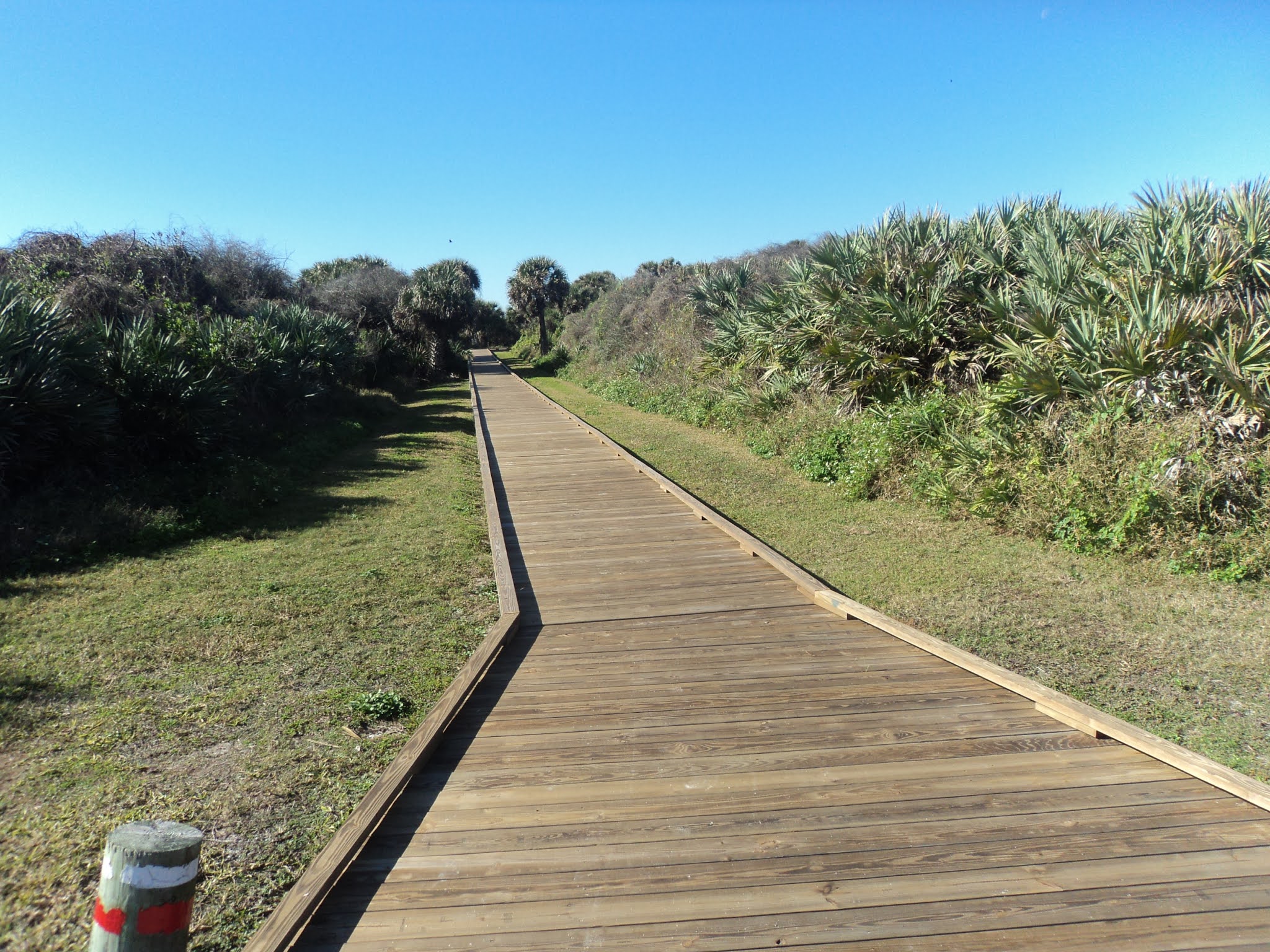
        From some picnic tables and an information board at the southwest corner of the parking lot, the single track sandy dirt trail heads into the dense forest.  True to its nature trail name, a large number of interpretive signs identify and describe common flora in this forest.  Some gnarley live oaks and palm trees dominate the canopy, while large amounts of holly, resurrection fern, and saw palmetto populate the understory.  Distance markers update your progress in 0.1 mile increments.
Hiking through the hammock
    
        At 0.3 miles, you reach a T-intersection with an old road that forms the loop portion of this hike.  To follow the distance markers in increasing order, I turned right and used the trail going left as my return route, thus hiking the loop counterclockwise.  Soon the mountain bike trail enters from the right; it leads to the state park marina.  Angle left to leave the old road and stay on the Hammock Nature Trail, which is marked with white paw prints painted on posts.
Leaving the old road
    
        The Hammock Nature Trail next heads into a wet area dominated by mangroves, but this portion of the trail was closed on my visit.  Thus, I had to detour on the mountain bike trail and rejoin the nature trail on the other side of the mangrove section.  The meandering trail curves more left than right, and soon traffic noise from Highway A1A can be heard through the trees on the right.
            At 0.7 miles, you intersect the old road again.  Highway A1A is visible past a vehicle gate to the right, but this hike turns left to begin heading west on the old road.  A few hundred feet later, you close the loop.  Turn right and retrace your steps back to the parking lot to complete the hike.  While you are here, be sure to check out the famous surf and the interesting museums, both of which can be accessed with minimal additional entrance fees.

Saturday, March 13, 2021

Lake Okeechobee Scenic Trail: Nubbin Slough to Henry Creek (Blog Hike #837)

Trail: Lake Okeechobee Scenic Trail
Hike Location: north shore of Lake Okeechobee
Geographic Location: south of Okeechobee, FL (27.19279, -80.76406)
Length: 7.3 miles
Difficulty: 4/10 (Moderate)
Date Hiked: January 2021
Overview: A flat dike-top hike on asphalt trail following the north shore of Lake Okeechobee.
Trail Information: https://www.saj.usace.army.mil/LOST/
Hike Route Map: https://www.mappedometer.com/?maproute=853730
Photo Highlight:
Hike Video: 

Directions to the trailhead: This hike starts at the Lake Okeechobee Trail's Nubbin Slough Access, which is located on the south side of US 98/441 6.7 miles south of the town of Okeechobee.  Drive up and over the dike, and park in the large sand/dirt parking lot on the lake side of the dike.

The hike: Comprising the vast watery middle of the mainly swampy south Florida, Lake Okeechobee is the largest freshwater lake in Florida and the second largest lake (behind only Lake Michigan) located entirely within the contiguous 48 states.  The lake covers 730 square miles, but the average depth is only 9 feet, making it extremely shallow for its size.  Historically the lake has been the primary water source for the Everglades, but these days most of the lake's water is used for municipal water supply and agricultural irrigation via a system of man-made canals.
            The lake was surrounded by only a low mud dike until the late 1920's, when two major hurricanes caused massive flooding that killed at least 2500 people.  At that time, the State of Florida teamed with the Army Corps of Engineers to build a new 35-foot dike around the lake.  Later named Herbert Hoover Dike after then President Hoover, the dike has been effective: several large hurricanes in the early 2000's caused no major flooding around Lake Okeechobee.
            Herbert Hoover Dike is also the main route of the Lake Okeechobee Scenic Trail, which is known by the acronym LOST.  Administered by the Army Corps of Engineers, the 109 mile multiuse trail circumnavigates the lake, and it is divided into east and west sections.  This hike gives a sample of what LOST has to offer by describing a 3.6 mile segment along the lake's northeast shore.  Be warned that the elevated dike offers no protection from the elements or shade from south Florida's intense sun.  Try to plan a winter visit, and be sure to wear a hat and sunscreen on this hike throughout the year.
Heading east from Nubbin Slough Access
    
        From the parking lot at the Nubbin Slough Access, walk back up to the top of the dike, and then turn right to begin heading east on the asphalt Lake Okeechobee Scenic Trail.  After walking around a vehicle gate, you walk past the lake's water control structure at Nubbin Slough, after which your dike-top journey begins.  On one hand, the huge lake makes for unique water-everywhere scenery.  On the other hand, the terrain is dead flat, and the view with the lake on one side and lagoon on the other will not change for this entire hike.  While I enjoyed adding this hike to my been-there-done-that list, I would not have started this blog 
if all hiking was like this trail.
Lake Okeechobee scenery
    
        Near 1.5 miles, you pass the first of two sheltered wooden benches on this hike.  These shelters are the only shade you will find on this hike, and they make nice places to sit, rest, rehydrate, and observe the lake.  I did some nice waterfowl viewing here that included 
egrets, cormorants, herons, and pelicans.  Some road noise from busy US 441/98 will be your constant companion on this hike, but the wide lagoon separates the dike and the road in this area.  Thus, the road noise is not as bothersome on this hike as on some other sections of the LOST.
Egrets

Heron
    
        Distances are painted on the asphalt trail in 1 mile increments, and soon you pass milepost 51E.  The mile numbers decrease as you hike from north to south, and the E indicates that you are on the eastern arm of the LOST.  Near 2.5 miles, you reach the second sheltered wooden bench; it offers a view similar to the first one.
Sheltered bench

Lake Okeechobee

Lock at Henry Creek
    
        At 3.6 miles, you reach the lock at Henry Creek.  The water level in Lake Okeechobee is actually 3 feet higher than the lagoon to the north, and I got to watch several small boats enter the lock and be raised up to lake level.  The 
LOST continues for another 50 miles in this direction, so you can basically hike as far as you want while minding your stamina and daylight.  I chose to turn around at the Henry Creek lock; a parking area here could be used to create a car shuttle if you have multiple cars with your hiking group.

Sunday, March 7, 2021

Canaveral National Seashore: Apollo Beach Area Trails (Blog Hike #836)

Trails: Turtle Mound, Eldora House, Eldora Hammock, and Castle Windy Trails plus beach walk
Hike Location: Canaveral National Seashore, Apollo Beach Area
Geographic Location: south of New Smyrna Beach, FL (28.92789, -80.82368)
Length: 2.7 miles (including a short beach walk)
Difficulty: 1/10 (Easy)
Date Hiked: January 2021
Overview: A sequence of short nature trails exploring the wide variety of scenery at Canaveral National Seashore.
Seashore Information: https://www.nps.gov/cana/index.htm
Hike Route Map: https://www.mappedometer.com/?maproute=853581
Photo Highlight:
Hike Video: 

Directions to the trailhead: The entrance to Canaveral National Seashore's Apollo Beach Area is located at the end of SR A1A 9.4 miles south of the intersection of SR A1A and US 1 in New Smyrna Beach.  The first nature trail starts at the parallel parking area for Turtle Mound.  This parking area is located on the right 0.6 miles south of the National Seashore entrance station, where you will need to pay your entrance fee.

The hike: When most people think of Cape Canaveral, they think of the launching point for space shuttles, rockets, and satellites, and the home of the United States Space Force.  Yet just up the coast from the space center lies the longest stretch of undeveloped beach on Florida's east coast.  That beach is forever protected as part of Canaveral National Seashore, a fantastic nature-oriented destination in a very developed and touristy part of Florida.
            Created in 1975 by an act of Congress, Canaveral National Seashore protects over 57,000 acres on the barrier island separating the Indian River lagoon system and the Atlantic Ocean.  The park's crown jewel is its 24 miles of undeveloped Atlantic Ocean beach, but the entire width of the barrier island falls under its protection.  More than 1000 plant species and 300 bird species have been identified here, making this park a major destination for bird watchers and naturalists.
            The national seashore is organized into several areas, and this blog entry features the Apollo Beach Area, which includes the park's long and famous beach.  Other than a walk along the beach, there are no extended hiking opportunities in the Apollo Beach Area, but four short nature trails showcase the history and variety this barrier island has to offer.  These nature trails start at separate trailheads, and this blog entry describes them consecutively from north to south, the order in which most visitors would encounter them as they drive through the park.  All trails start at well-marked parking areas, and while I chose to drive from one trailhead to the next, you could also bike between trailheads if you have the time and energy.
Start of Turtle Mound Trail
    
        The first trail is the Turtle Mound Trail, and its signed trailhead is located at a parallel parking area on the right (west) side of the main road 0.6 miles south of the entrance station.  The Turtle Mound Trail is entirely on boardwalk, and the boardwalk goes west directly away from the road before turning right to ascend Turtle Mound.  Built by the Timucuan people between 800 and 1400 AD, the large shell mound known as Turtle Mound seems to be the highest point in the national seashore.  An observation platform provides fantastic views in all directions, and some birds including turkey vultures soared past my head high above the surrounding area.
View from top of Turtle Mound

Soaring turkey vultures
    
        After taking in the view, retrace your steps to the parking area at 0.2 miles, then drive south 1.8 miles to Eldora Village and the start of the second short nature trail.  Eldora Village is not located on the main park road but on the narrow one-way Eldora Loop Road just west of the main road.  A small signed parking area is provided.
Start of trail to Eldora Village
    
        Two trails lead from the parking area to Eldora Village: a two-track sandy dirt road on the right and a single-track dirt trail on the left.  I hiked the dirt trail to the village and hiked back to the parking area on the dirt road.  The trail heads into a dense forest dominated by saw palmetto and mangroves before crossing a deep, sunny creek on a wooden footbridge.
Crossing a sunny creek
    
        After less than 5 minutes of walking, you reach the historic Eldora Village.  Between 1877 and 1900 up to 100 people lived here, and the village was large enough to have its own post office and school.  Today all that remains is Eldora's "State House," an impressive white two story house that dates to 1913.  Palm trees dot the State House's yard, and a pier nearby offers fishing and crabbing opportunities on Mosquito Lagoon.  Pass an interpretive sign that marks the site of some older defunct structures and walk the sandy dirt road back to the trailhead to complete the second nature trail.
Eldora State House
    
        The third nature trail is the Eldora Hammock Trail, which has a separate parking area a few hundred feet down the one-way Eldora Loop Road on the right.  A hammock is an island of land that has slightly higher elevation than the land around it, and that small difference in elevation allows less flood-tolerant plants to thrive.  From the signed trailhead, the narrow dirt trail heads into the dense forest.
Start of Eldora Hammock Trail
    
        Where the trail forks to form its loop, I angled left to hike the loop clockwise.  Interpretive signs are supposed to point out common plants in the hammock, but these interpretive signs had seen their better days on my visit.  
Some gnarly live oaks dominate the canopy, and saw palmetto dominates the understory.
Hiking around the hammock
    
        In just under 0.5 miles, you close the loop.  Angle left to return to the parking area and complete the Eldora Hammock Trail.  To get to the Castle Windy Trail, the last and longest nature trail in the Apollo Beach Area, drive out to the main road, turn right, and drive south just under a mile to beach parking area #3 on the left.  The signed trailhead is located to the west across the road from the parking area.
Start of Castle Windy Trail
    
        Dead straight for its entire 0.5 mile length, the Castle Windy Trail is the only trail to cross the entire width of the barrier island from the Atlantic Ocean to Mosquito Lagoon.  Numbered posts correspond to a trail guide available from a dispenser at the trailhead, and they point out interesting plants including airplants and sour oranges, which look exactly like real oranges but
 taste nothing like them.  I spotted an armadillo and some lizards on my hike here.
Armadillo on the trail
Mosquito Lagoon at Castle Windy
    
        0.5 miles from the trailhead, you arrive at a small picnic area at Castle Windy, another (smaller) Timucuan shell mound.  This area is located on the bank of Mosquito Lagoon, and the brackish water emitted a pungent odor on my visit.  After exploring the Castle Windy area, retrace your steps to the parking area to complete the Castle Windy Trail.
Walking along the Atlantic Ocean

Pelican in the ocean
    
        Of course no visit to Canaveral National Seashore would be complete without a trip to the famous 24-mile-long beach, and the Castle Windy Trail's start at beach parking area #3 provides the perfect opportunity to add a beach walk to the end of this hike.  Just walk over the short boardwalk heading east and head down the wooden steps to the beach.  I saw several pelicans on my beach walk, and I really enjoyed my experience on the natural side of Florida's touristy east coast.