Friday, June 30, 2023

Trace State Park: Nester Trail (Blog Hike #951)

Trail: Nester Trail
Hike Location: Trace State Park
Geographic Location: west of Tupelo, MS (34.26021, -88.88655)
Length: 4.7 miles
Difficulty: 4/10 (Moderate)
Dates Hiked: April 2023
Overview: A semiloop on the east side of Old Natchez Trace Lake.
Park Information: https://www.mdwfp.com/parks-destinations/state-parks/trace/
Hike Route Map: https://www.mappedometer.com/?maproute=935531
Photo Highlight:
Hike Video: 

Directions to the trailhead: From the intersection of Gloster Street and Main Street in downtown Tupelo, take Main St. west 10 miles to Faulkner Road and turn right on Faulkner Rd.  Drive Faulkner Rd. north 2.1 miles to the state park entrance.  Pay the entrance fee, and park in the parking lot to the left (south) of the entrance station.

The hike: Located in northeast Mississippi less than 10 miles off of I-22, Trace State Park protects many acres of succession forest around its namesake Trace Lake.  Both the park and the lake are named for the historic Natchez Trace, which runs north-south about 7 miles east of here.  Yet the Trace is not this park's only claim to history: Davy Crockett lived on this property for a short time in the 1830's when he worked as a horse trader with the Chickasaw.
            The park has some nice amenities that include aquatic recreation on Trace Lake, one of the best disc golf courses in Mississippi, a 76-site developed campground, 5 cabins, 3 cottages, and more than 35 miles of trails.  Although most of the trails were built by mountain bikers for mountain bikers, they are also open to hikers, and they see sufficiently little traffic that encountering other users of any type is rare.  I chose to hike the Nester Trail described here because it is one of this park's few trails to have a dedicated parking lot.  Thus, the trail is easy to find, and it offers a nice woodland journey with occasional views of Trace Lake.
Nester Trail trailhead
    
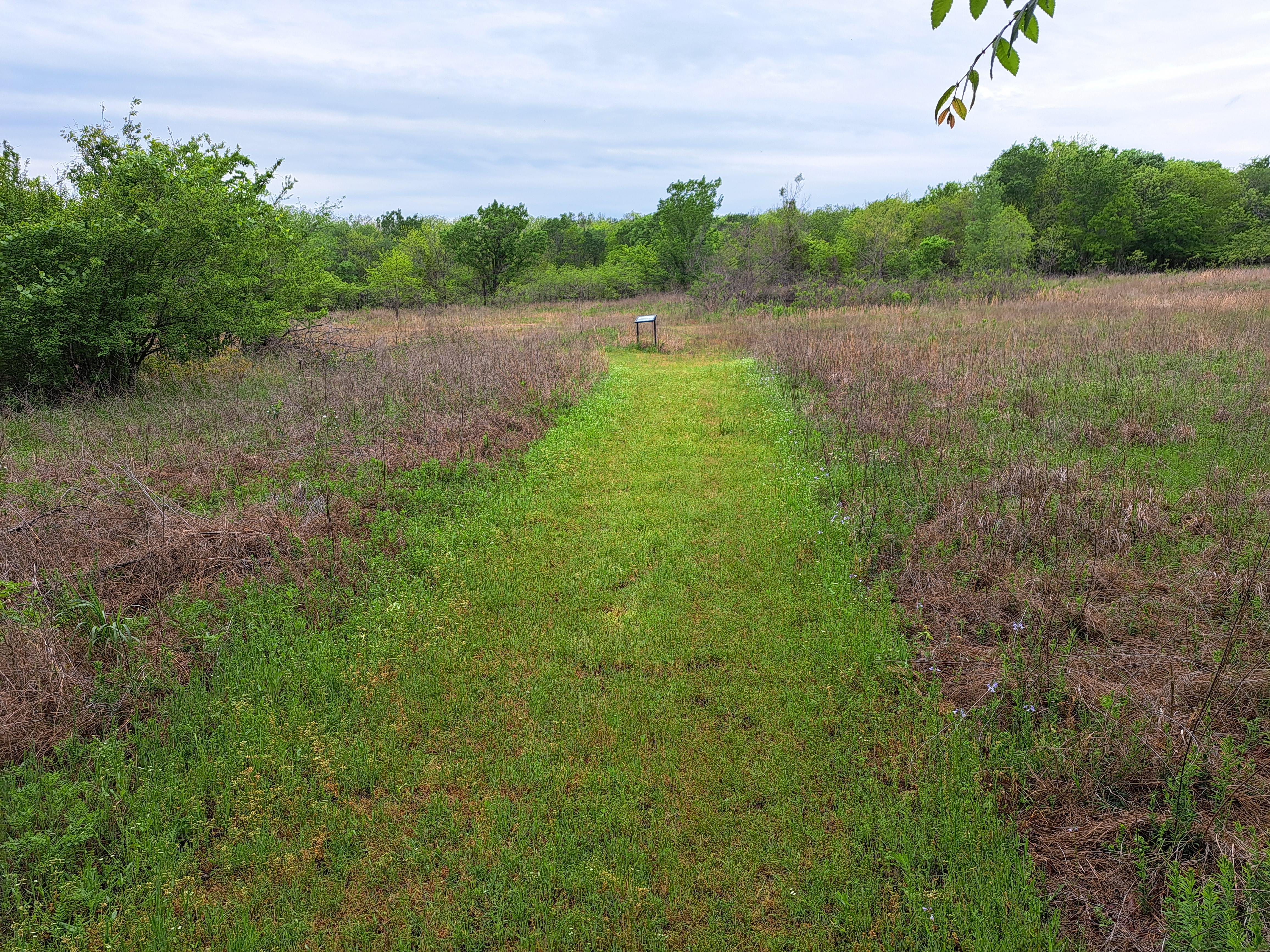
        A small brown metal sign marks the start of the Nester Trail, which immediately heads into the woods.  As I mentioned in the introduction, this trail was designed by mountain bikers for mountain bikers, so it has more twists and turns than usual for a hiking trail.  Although it is not immediately obvious, you are heading clockwise around the Nester Trail's loop.  The trail on the ground can be faint, but there are enough trail markers to keep you on track.  The relatively young forest here is dominated by oak, hickory, and sweet gum trees with a few pines mixed in.
1 mile marker
    
        Just past 0.5 miles, the park entrance road comes in sight through the trees to the left.  Blue diamond mileage markers appear at 0.5 mile intervals.  You cross several minor ups and downs, but the trail is designed to keep grades gradual enough to ride a bike comfortably.  Moreover, the overall terrain here is pretty flat.  I encountered only 1 other user (a hiker) during my hike here.
Red cedar thicket
    
        At 1.5 miles, you cross a gated dirt road.  Next you pass through a dense red cedar forest before treading around a sunny meadow area.  After more winding through the woods, you reach the east end of the dam that forms Trace Lake at 2.4 miles.  You can walk out on the dam to get a good lake view if you wish, but there is a better lake view 
from the trail coming up in another 0.5 miles.
Dam that forms Trace Lake
    
        Now on the west arm of the loop, the trail winds its way north with Trace Lake visible through the trees to the left.  2.9 miles into the hike, you pass through a sunny meadow area that provides the aforementioned nice lake view.  The trail continues to wind its way north passing through ravine after ravine and topping ridge after ridge, each one looking similar to the previous one.  Wooden bridges get you over most of the creeks in these ravines.
View across Trace Lake
    
        Near 4 miles, you pass through another red cedar thicket.  One final hill and a couple of final turns deposit you on the shoulder of the park road at 4.6 miles.  Turn right and walk a short distance along the road to return to the parking lot and complete the hike.

Friday, June 23, 2023

Lake Dardanelle State Park: Meadowbrook Trail (Blog Hike #950)

Trail: Meadowbrook Trail
Hike Location: Lake Dardanelle State Park
Geographic Location: west side of Russellville, AR (35.28450, -93.20275)
Length: 1 mile
Difficulty: 1/10 (Easy)
Date Hiked: April 2023
Overview: A short flat campground loop through young forest.
Park Information: https://www.arkansasstateparks.com/parks/lake-dardanelle-state-park
Hike Route Map: https://www.mappedometer.com/?maproute=935473
Photo Highlight:
Short Video: (coming date TBD)

Directions to the trailhead: In western Arkansas, take I-40 to US 64 (exit 78).  Exit and go east on US 64.  Drive US 64 east 1.8 miles to SR 326 and turn right on SR 326.  Drive SR 326 south 2.9 miles to the state park entrance on the right.  Turn right to enter the park, then turn right at the first intersection.  Park in the long parking spaces on the right next to the red and blue sign for the Meadowbrook Trail.

The hike: Occupying 40,000 acres in western Arkansas, Lake Dardanelle is one of the largest reservoirs on the Arkansas River.  Dardanelle Dam was built by the Army Corps of Engineers (COE) between 1957 and 1969, and it includes navigable locks and a power plant.  The dam and lake are part of the McClellan-Kerr Arkansas River Navigation System, which ensures the river is navigable by barges all of the way from the Mississippi River up to the Tulsa Port of Catoosa in northeastern Oklahoma.
            Located on the lake's north/east shore is Lake Dardanelle State Park, which dates to 1966.  The park is popular due to fishing and boating on Lake Dardanelle, its 74-site developed campground, and large Visitor Center with aquariums.  For hikers, the park offers only one trail, the short campground nature trail described here.  While not a destination hike, this trail makes for a nice easy leg-stretcher hike while you are driving I-40 across western Arkansas, and I was glad I stopped here.
Southern trailhead
    
        Marked with round aluminum markers, the Meadowbrook Trail is laid out as a loop with spur trails to the north and south.  This description starts on the southern spur where a blue and red sign marks the trailhead.  Heading north, the trail immediately heads into the woods, which is younger forest dominated by sweet gum and red cedars.  In less than 500 feet, the trail splits to form its loop.  For no particular reason, I turned right to start heading around the loop counterclockwise.
Trail bridge over stream
    
        Traffic noise from SR 326 enters your ears from the right as you continue to head north.  Ignore some spur trails that exit left.  When I hiked here on a Saturday afternoon in late April, it had rained hard the night before.  Water in this very flat forest has nowhere to drain, so I had to step around quite a few muddy areas with standing water.  Fortunately, wooden bridges get you over the worst of the wet areas.
Overlook platform
    
        At 0.4 miles, you reach the north end of the loop.  We will eventually take the trail going sharply left to get back to the south trailhead, but first turn right to head up the north spur, which leads to 2 points of interest.  In a very short distance, you reach a wooden overlook platform.  This platform is quite boring: it overlooks nothing but some forest with a few birdhouses.  Continuing north brings you to the campground amphitheater at 0.5 miles.  This amphitheater sits in a nice grove of large pine trees, and it makes a nice place to rest and have a trail snack at the midpoint of this hike.
Campground amphitheater
Large oak tree
    
        The amphitheater marks the northern terminus of the Meadowbrook Trail, so now you need to head back south.  For a little variety, where the trail splits to form its loop, turn right and hike the loop's western arm for your return journey.  This side of the loop features some large old oak trees known as wolf trees.  Wolf trees have branches close to the ground, indicating they once grew in a sunny area.  At the close of the loop, angle right to return to the south trailhead and complete the hike.  While you are here, be sure to check out the park's Visitor Center, which features some interesting aquariums and some scenic views across Lake Dardanelle from its rear entrance.

Tuesday, June 20, 2023

Greenleaf State Park: Greenleaf Lake Hiking Trail to Dam (Blog Hike #949)

Trail: Greenleaf Lake Hiking Trail
Hike Location: Greenleaf State Park
Geographic Location: north of Gore, OK (35.62516, -95.16731)
Length: 1.8 miles
Difficulty: 2/10 (Easy)
Date Hiked: April 2023
Overview: An out-and-back with side loop to the dam that forms Greenleaf Lake.
Park Information: https://www.travelok.com/state-parks/greenleaf-state-park
Hike Route Map: https://www.mappedometer.com/?maproute=935471
Photo Highlight:
Hike Video: 

Directions to the trailhead: From the intersection of SR 10 and SR 100 in Gore, take SR 10 north 8.5 miles to the signed entrance for Greenleaf State Park on the right.  Turn right to enter the park and drive the main park road 1.1 miles to the small gravel parking lot for the Greenleaf Lake Hiking Trail on the right.  Park here.

The hike: At first glance 565-acre Greenleaf State Park looks like another state park on another lake, but first looks can be deceiving.  For one, this lake and park were built starting in 1939 by the depression-era Civilian Conservation Corps (CCC), Works Progress Administration (WPA), and by German prisoners of war.  This history makes this park one of the oldest state parks in Oklahoma.  Also, the park is surrounded by Camp Gruber, a training camp for the Oklahoma National Guard.  The park's 18-mile backpacking trail goes onto adjacent camp land, and the camp insulates the park from the usual development that surrounds many state parks.
            In addition to the backpacking trail, which is one of the few multi-day backpacking options in Oklahoma, the park offers the usual aquatic recreation on Greenleaf Lake, 14 small cabins, multiple developed campgrounds with 158 sites total, and an unusual "cabin on the lake," which was one of the first ADA-accessible cabins in the country.  When I came here on a damp Saturday morning, I only wanted a short hike before I began my long drive east, so I chose to hike the part of the backpacking trail that goes down to the dam and back.  I had a nice hike, and I can see why this park has the high reputation it does.
Main trailhead
    
        From the signed trailhead and trail register, the single-track dirt trail heads into the woods, which is dominated by oak and hickory trees with a few pines mixed in.  The trail goes first gradually up and then gradually down as the steep hillside persistently rises to the right.  The lake and campground road sit downhill to the left, but they are out of sight through the trees.  Some interesting layered rock outcrops remind you that this land was under a shallow sea many millennia ago.
Rock outcrop
Dam and spillway
    
        Just shy of 0.5 miles, the trail splits.  The option going right leads to SR 10 and the rest of the backpacking trail, so I turned left to start hiking out the earthen dam.  The dam was somewhat muddy on my visit, and some dense greenery prevented any broad lake views.  Nevertheless, I got some nice partially obstructed views of the interesting spillway at the other side of the dam, and I saw a lot of birds in the spillway area.
Canada geese on Greenleaf Lake
    
        After enjoying the spillway area, retrace your steps to the trailhead.  On your way back, to add a little variety and get some broad lake views, take a detour into the campground and walk down to the lake's marina area.  Not only did I enjoy the lake views here, but I also saw a Canada goose and her goslings swimming in the shallow area of the lake.

Monday, June 19, 2023

Natural Falls State Park: Ghost Coon/Dripping Springs Loop (Blog Hike #948)

Trails: Ghost Coon and Dripping Springs Trails
Hike Location: Natural Falls State Park
Geographic Location: west of West Siloam Springs, OK (36.17549, -94.66769)
Length: 1.4 miles
Difficulty: 5/10 (Moderate)
Date Hiked: April 2023
Overview: A loop hike, mostly easy but with a couple of steep areas, that forms the long route to Natural Falls.
Park Information: https://www.travelok.com/state-parks/natural-falls-state-park
Hike Route Map: https://www.mappedometer.com/?maproute=935410
Photo Highlight:
Hike Video: (coming May 3, 2024)

Directions to the trailhead: From West Siloam Springs, take US 412 west 5.5 miles to N4680 Road and turn left on N4680 Rd.  Drive N4680 Rd. south 0.2 miles to E578 Road and turn left on E578 Rd.  Drive E578 Rd. east 0.1 miles to the state park entrance on the right.  Turn right to enter the park, then turn left immediately after passing the park office to reach the parking area for Natural Falls.

The hike: Consisting of only 120 acres, Natural Falls State Park is one of the smallest state parks in Oklahoma.  Before it became a state park, the site was privately owned and operated as a roadside attraction known as Dripping Springs.  The property featured a swimming pool and gardens, and it appeared in the 1974 film Where the Red Fern Grows.  The site was purchased by the State of Oklahoma for its state park system in 1990, making it Oklahoma's newest state park.
            The site's centerpiece is and has always been the 77-foot waterfall, which is tied with Turner Falls in southern Oklahoma for the tallest waterfall in the state.  The park today features a 46-site developed campground, several yurts, an above-average disc golf course, some picnic areas, and several short hiking trails.  The route suggested here provides one of the longest possible routes to the waterfall, and it passes several other points of interest including the campground, a rocky gorge, and a small lake.
Hiking through the formal garden
            From the parking area, head downhill (south) through the formal garden.  The plants in bloom here vary throughout the season, and some irises were in bloom when I came here in late April.  At the bottom of the formal garden, the ADA-accessible trail to the top of Natural Falls continues straight.  We will return on that trail, but for now turn left to walk along a park road, cross a creek on a low water ford, and look to the right for the signed start of the Ghost Coon Trail.  Turn right to begin the Ghost Coon Trail, which is named after the legendary raccoon from Where the Red Fern Grows.
Start of Ghost Coon Trail
    
        The Ghost Coon Trail heads into the woods and climbs gradually.  At 0.2 miles, the trail enters a sunny grassy area with what appears to be a wastewater treatment pond on the left.  At 0.3 miles, you reach the park's yurt area access road, which is actually a continuation of the road you walked on earlier.  Turn left to walk a short distance on the road, then look to the right for the signed continuation of the Ghost Coon Trail.
Trail reenters woods
    
        After another short distance in the woods, the trail traces the perimeter of the large tallgrass prairie that also contains the park's yurt area.  The yurts can be seen across the prairie to the right.  Ignore side trails that exit left into the woods; they quickly become indiscernible.
Yurts across prairie
    
        0.7 miles into the hike, you pass under a power line to reach the park's yurt area.  The route through the yurt area is unmarked and confusing.  You want to keep the yurts to your right until you reach a gravel road that was recently paved with fresh gravel on my visit.  Turn sharply left on the gravel road and begin a steep descent to reach a dam with old rusty controls that forms a small algae-covered lake.  Turn right to begin hiking along the shore of the lake, and pass through a fishing area that contains a few benches.  Some scenic rocky cliffs stand on the other shore of the lake.
Dam that forms small lake
    
        Now on the Dripping Springs Trail, at 0.9 miles you cross a metal bridge with wooden deck that spans the upper reaches of the small lake.  Next comes the hardest part of the hike: the trail heads steeply uphill through a tight rocky gorge.  Numerous roots and rocks need to be negotiated, and you have to watch your footing.  A fall into the gorge to the right would likely result in serious injury.  Ignore the Bear Trail, an even more treacherous trail that exits left.
Natural Falls, base view
    
        1.1 miles into the hike, the difficult rocky area mercifully ends when you reach some concrete steps, which go uphill to the left and downhill to the right.  Go downhill first to reach the viewing platform at the base of Natural Falls.  This ledge-type waterfall features a large but shallow plunge pool, and the vertical lumpy rock walls make for an imposing setting.  Notice the bridge at the top of the falls to the right and the platform at the top of the falls to the left.
Natural Falls, platform view
    
        Next climb all of the concrete steps to reach the ADA-accessible waterfall overlook platform, which provides a top-down view of the rocky bowl you stood in moments ago.  These concrete steps are in rough shape and will need to be rebuilt at some point, but they still get the job done for now.  After taking in this view, walk along the ADA-accessible path to reach the formal garden, and then walk uphill through the formal garden to return to the parking lot and complete the hike.

Thursday, June 15, 2023

Grand Lake State Park, Bernice Area (Blog Hike #947)

Trails: (unnamed)
Hike Location: Grand Lake State Park, Bernice Area
Geographic Location: east of Bernice, OK (36.62679, -94.89905)
Length: 1 mile
Difficulty: 1/10 (Easy)
Date Hiked: April 2023
Overview: A short, flat loop along the shore of Grand Lake.
Park Information: https://www.travelok.com/state-parks/bernice-area-at-grand-lake-state-park
Hike Route Map: https://www.mappedometer.com/?maproute=935409
Photo Highlight:
Hike Video: 

Directions to the trailhead: From Bernice, take SR 85A east 1 mile, crossing an arm of Grand Lake in the process, to the entrance for the Bernice Area of Grand Lake State Park.  Turn right to enter the park, drive through the campground, and follow signs for the Nature Center, where this hike begins.

The hike: Located in northeast Oklahoma, the Grand Lake o' the Cherokees, usually called Grand Lake for short, is one of the oldest reservoirs in Oklahoma.  Authorities were considering a dam project on the Grand River even before Oklahoma became a state in 1907.  In 1935, the state created the Grand River Dam Authority to manage the project.  The dam on the Grand River was completed in 1940, and at 5145 feet in length it is claimed to be the longest multiple arch dam in the world.
            Grand Lake's main purpose is hydroelectric power generation, and the lake was originally conceived as a power source for the Cherokee Nation.  The lake also helps with flood control on the Arkansas River and provides abundant aquatic recreation.  Unlike most reservoirs in Oklahoma, Grand Lake lies in the foothills of the Ozark Mountains.  Therefore, Grand Lake is a deep rocky lake averaging more than 36 feet in depth.
            Several Oklahoma state parks were built on the shores of Grand Lake, and today they are managed as distinct areas of the combined Grand Lake State Park.  Many of these areas offer only a campground and lake access, but the Bernice Area featured here also offers a nature center and a short system of hiking trails.  While not a major hiking destination, this park offers a nearly flat lakeside hike partially on asphalt trail, so it makes a nice option during bad weather when other hiking trails are too muddy.
Trailhead at Nature Center
    
        Start by picking up the asphalt trail that heads east from the Nature Center.  A Heart Healthy Trail sign marks this trailhead, and while there is a maze of dirt trails in the wooded area east of the Nature Center, there is only 1 asphalt trail.  The asphalt trail winds its way east through a forest consisting of oak, hickory, and black walnut trees with a dense grassy understory.
Grand Lake
    
        In only a few hundred feet, you reach the first spur trail exiting right to Grand Lake.  The gently sloped rocky lakeshore is a good place to do some birdwatching, and I saw 
lots of common birds, ducks, and a woodpecker here.  Continuing east on the asphalt trail, you next pass 2 "treehouses," or wooden platforms and shelters built some 10 feet above the forest floor.  The first treehouse overlooks the lake, while the second treehouse stands in the drier woods.
"Treehouse" on Grand Lake
    
        At 0.5 miles, you reach the east end of the asphalt Heart Healthy Trail at a secondary parking lot near the intersection of East 270 Road and South 550 Road.  There are several ways to get back to the Nature Center from here.  Of course you could retrace your steps along the asphalt trail, but for a little variety turn left to leave the asphalt and start walking due west along a power line corridor.  This dirt/gravel trail is the old East 270 Road, and it offers good footing even if it has rained recently, as it had on my visit.
Hiking back on dirt/gravel trail
    
        The old arrow-straight county road actually goes past the Nature Center 
to the campground, but you can escape the power lines by turning left on a dirt trail just before you reach the park's maintenance area on the right.  This short trail takes you through a small prairie opening before returning you to the asphalt trail.  A right turn then takes you back to the Nature Center to complete the hike.

Wednesday, June 14, 2023

Tenkiller State Park: Whispering Leaves Trail (Blog Hike #946)

Trail: Whispering Leaves Trail
Hike Location: Tenkiller State Park
Geographic Location: northeast of Gore, OK (35.60139, -95.03545)
Length: 1.6 miles
Difficulty: 1/10 (Easy)
Date Hiked: April 2023
Overview: A semiloop on asphalt trail through the park's developed area.
Park Information: https://www.travelok.com/state-parks/tenkiller-state-park
Hike Route Map: https://www.mappedometer.com/?maproute=935328
Photo Highlight:
Short Video: 

Directions to the trailhead: In eastern Oklahoma, take I-40 to SR 82 (exit 297).  Exit and go north on SR 82.  Drive SR 82 north 9 miles to SR 100 and turn left on SR 100.  Drive SR 100 west 3.4 miles to the park entrance on the right.  Turn right to enter the park, and follow signs for the park office.  Park in the parking lot in front of the park office.

The hike: Known officially as Tenkiller Ferry Lake, 12,900 acre Lake Tenkiller was formed in 1952 when the US Army Corps of Engineers (COE) completed the Tenkiller Dam on the Illinois River.  The dam was constructed for the purposes of flood control, recreation, water supply, and hydroelectric power generation, and the COE operates several recreation areas on the lake's shore.  The lake is named for the Tenkiller family, a prominent Cherokee family who sold the land and ferry that now lie under the lake.
            Tenkiller State Park is located on the east shore of its namesake lake near the dam.  The park opened in 1953, and it has many nice amenities including a scuba diving area, many athletic fields and courts, the usual aquatic recreation on Tenkiller Ferry Lake, 39 cabins, and a developed campground.  For hikers, the park offers only two short trails, and the one described here is a somewhat unexciting asphalt trail that spends most of its time in the developed area of the park.  That said, there are some interesting things to see on this trail.  Also, the asphalt can be welcome: I had a good hike here at the end of a very wet and rainy day when the other trail was too wet and muddy for pleasant hiking.
Trailhead near park office
    
        The trail starts at the north side of the parking lot in front of the park office; look for the small white sign that says "Whispering Leaves Trail."  The dirt Lakeview Trail quickly exits left; angle right to stay on the asphalt.  Perhaps surprisingly, the asphalt path curves right and crosses the park road you drove in on before descending slightly into a narrow strip of woods.  After passing behind the park's Nature Center, the trail traces around a sunny mowed grass area with a beautiful stone picnic shelter to the left.  Structures such as this shelter are usually only found in parks dating to the 1930's, so appreciate the existence of this picnic shelter here.
Stone picnic shelter
    
        Next you pass the east end of the park's cabin area before crossing a small bridge near a small pond.  This pond was nearly empty of water on my visit, and I suspect it completely evaporates during dry spells.  At 0.4 miles, you reach a trail intersection.  We will take the asphalt trail going left eventually, but for now continue straight to head for the overlook area.
Small pond
    
        The trail curves right and passes through the park's disc golf course before it splits to form its short loop through the overlook area.  I chose to turn right, and I quickly descended to reach a bench that overlooks Tenkiller Dam.  This overlook was becoming quite overgrown on my visit, but I could still see the dam and a cliff on the other side of Tenkiller Ferry Lake.
Tenkiller Dam
    
        After finishing the loop, retrace your steps to the previous trail intersection and turn right.  After crossing the main park road, you need to angle left and walk a short distance through the grass to get to the campground access road, where the asphalt trail continues.  Next you walk between a basketball court and a volleyball court before starting a short loop through a picnic area.
Approaching the park road
    
        Upon completing the picnic area loop, walk back to the park office 
to complete the hike, either by walking around the Nature Center and retracing your steps or by walking along the park road.  While you are here, be sure to check out the scuba diving area.  Not only is a scuba diving area unusual for a land-locked state such as Oklahoma, but it also provides nice views across deep water in Tenkiller Ferry Lake.

Friday, June 9, 2023

Sequoyah State Park: Fossil/Fitness Loop (Blog Hike #945)

Trails: Fossil, Fort Gibson, Fitness Trails
Hike Location: Sequoyah State Park
Geographic Location: east of Wagoner, OK (35.89644, -95.24145)
Length: 1.9 miles
Difficulty: 4/10 (Moderate)
Date Hiked: April 2023
Overview: A loop hike featuring fossils along and views of Fort Gibson Lake.
Park Information: https://www.travelok.com/state-parks/sequoyah-state-park
Hike Route Map: https://www.mappedometer.com/?maproute=935151
Photo Highlight:
Hike Video: 

Directions to the trailhead: From the intersection of SR 51 and SR 16 on the east side of Wagoner, take SR 51 east 7.2 miles to the entrance for Sequoyah State Park on the right.  Turn right to enter the park, and drive the main park road 2.8 miles to the Three Forks Nature Center.  Park in the parking lot across the street from the front of the Nature Center.

The hike: Located on a narrow peninsula jutting south into Fort Gibson Lake, 2200 acre Sequoyah State Park began its life in 1948 as Western Hills State Park.  The park offers fantastic amenities including swimming, fishing, and boating on Fort Gibson Lake, a short 9 hole golf course, a group camp, 10 cabins, and multiple developed campgrounds.  Perhaps the park's best amenity is its Lodge at Sequoyah State Park, which is the largest state park lodge in Oklahoma.
            For hikers, the park offers 12 miles of hiking trails that wind throughout the park.  Many routes long and short through the trail system are possible, but I came here on a Tuesday morning with rain closing in from the west.  Thus, I needed to keep my hike short.  The route described here meets my distance criterion, but it also passes some of the most interesting and scenic points in the trail system.
Start of Fossil Trail near Nature Center
    
        Start to the left (east) of the Nature Center, where a sign directs you to the Fossil Trail.  Marked with orange rectangular paint blazes, the single-track dirt trail descends to reach an intersection with the Three Forks Trail, which goes left.  Angle right to keep following the Fossil Trail.
Descending on the Fossil Trail
    
        The Fossil Trail becomes very rocky as it gets close to the shore of Fort Gibson Lake, but these rocks are the ones that contain the fossils.  You will need to look carefully and have some idea what you are looking for in order to find the fossils: they are small, and none of them are specifically marked or labeled.  The rockiness also makes footing difficult, so make sure you watch where you step as you hike and look for fossils.
End of Fossil Trail near lodge
    
        Keep heading south with the lake on your left, and at 0.6 miles you reach the end of the Fossil Trail.  To continue the hike, turn right, walk through the parking lot in front of the Lodge at Sequoyah State Park, then turn left to walk past the lodge entrance.  Descending slightly on a concrete path called the Fort Gibson Trail brings you to Inspiration Point, which sits on the very southern tip of the peninsula that contains this park.  While the lake views from this Inspiration Point are quite nice, most viewpoints named Inspiration Point offer more to see than just a lake.  I did see many small birds in this area, and some benches and tables here make for nice places to sit, rest, and have a snack near the midpoint of this hike.
Inspiration Point
View from Inspiration Point
    
        Retrace your steps back past the lodge entrance, then look to the left for the start of the Fitness Trail.  Although the asphalt Fitness Trail does not make for the most inspiring hiking, you have to get back to the Nature Center somehow, and this option beats retracing your steps on the Fossil Trail or walking along the park road.  Some fitness stations challenge you to do more than just hike on this trail, and the gradual uphill might get your heart going as well.  As you pass the golf course on the left, the Nature Center comes into view across the park road to the right, indicating the end of the hike.  If you have more time in this area, check out similarly-named Sequoyah Bay State Park and its 5 Nations Monument across the lake to the west.

Sunday, June 4, 2023

Sequoyah Bay State Park: Spirit Trail (Blog Hike #944)

Trail: Spirit Trail
Hike Location: Sequoyah Bay State Park
Geographic Location: southeast of Wagoner, OK (35.88576, -95.27791)
Length: 1.4 miles
Difficulty: 1/10 (Easy)
Date Hiked: April 2023
Overview: A lollipop loop through lakeside forest.
Park Information: https://www.travelok.com/state-parks/sequoyah-bay-state-park
Hike Route Map: https://www.mappedometer.com/?maproute=935148
Photo Highlight:
Short Video:

Directions to the trailhead: From the intersection of SR 51 and SR 16 on the east side of Wagoner, take SR 16 south 4.3 miles to E 100 Street N and turn left on E 100 Street N.  Drive E 100 Street N east 4.7 miles to the entrance for Sequoyah Bay State Park.  The gravel parking lot for the Spirit Trail is on the right just before you reach the Five Nations Monument at the main park entrance.

The hike: Often overlooked in favor of its better-amenitied cousin Sequoyah State Park across the lake, Sequoyah Bay State Park protects 303 acres on the west shore of Fort Gibson Lake.  The park offers swimming, fishing, and boating on Fort Gibson Lake and several campgrounds with 367 sites total.  Some picnic areas and athletic fields round out the amenities.
Five Nations Monument
    
        Perhaps the park's most famous site is the Five Nations Monument, which stands near the park entrance and within sight of this trailhead.  The monument displays the flags of five nations: Cherokee, Chickasaw, Choctaw, Creek, and Shawnee, all of which have lands in Oklahoma.  The park has only 1 short hiking trail, the Spirit Trail described here.  As its name suggests, this trail also has connections to the five nations, and its best feature is the numerous interpretive signs that describe the human and natural history this land possesses.
Trailhead for Spirit Trail
    
        The trailhead is marked with a large white sign that contains a trail map and some background information about this trail.  The grass/dirt trail heads south into the woods, which is the usual cross timbers mix of 
oak, hickory, and red cedar with a dense understory.  Where the trail splits to form its loop, I continued straight and used the trail going right as my return route, thus hiking the loop clockwise.
Entering the prairie
    
        Quickly the trail curves right and enters a prairie area.  Interpretive signs describe common plants in the grassy prairie, and I saw several deer, which tend to frequent transition areas between prairie and forest.  Next the trail enters a lowland forest and crosses a couple of streams on wooden bridges.  This part of the trail was rather muddy on my visit, and the grass on the trail was somewhat long here.  I managed to complete the loop in spite of the trail conditions, but I was sure to check myself for ticks after I finished.
Hiking through the forest
    
        Just past 0.8 miles, a spur trail continues straight to quickly reach the road you drove in on.  Turn right to continue the loop and cross a bridge made out of several logs.  The final leg of trail heads southeast through more cross timbers forest and past another small prairie opening.  After closing the loop, turn left to return to the parking lot and complete the hike.

Friday, June 2, 2023

Lake Eufaula State Park: Chinkapin Trail (Blog Hike #943)

Trails: Savanna Loop and Chinkapin Trails
Hike Location: Lake Eufaula State Park
Geographic Location: southwest of Checotah, OK (35.40005, -95.60532)
Length: 3.8 miles
Difficulty: 3/10 (Easy/Moderate)
Date Hiked: April 2023
Overview: A fairly flat hike to a picnic area and views of Lake Eufaula.
Park Information: https://www.travelok.com/state-parks/lake-eufaula-state-park
Hike Route Map: https://www.mappedometer.com/?maproute=935066
Photo Highlight:
Hike Video:

Directions to the trailhead: In eastern Oklahoma, take I-40 to SR 150 (exit 259).  Exit and go south on SR 150.  Drive SR 150 south 5.4 miles to the state park Visitor Center on the left.  Park in the lot beside the Visitor Center.

The hike: Formerly known as Fountainhead State Park, Lake Eufaula State Park sits on a wide peninsula that juts south into its namesake lake.  The dam that creates the lake was built by the Army Corps of Engineers (COE) in 1964 for the purposes of flood control and hydroelectric power generation.  Eufaula Dam holds back water from the Canadian River, and Lake Eufaula is the largest lake by water volume in Oklahoma.
            Lake Eufaula State Park offers some fantastic amenities that include swimming and boat ramps on the lake, a disc golf course and a ball golf course, 3 yurts, 2 developed campgrounds with nearly 150 sites total, some picnic shelters, and several hiking trails.  The hike described here takes you through some nice cross timbers forest to a picnic area and good lake views.  To be honest, I was not very excited about coming here when I left my lodging, but I ended up having a nice hike at a nice park.
Trailhead near park office
    
        From the park office, walk across SR 150 to find the trailhead, which is marked by a small information kiosk.  This trailhead serves both the Chinkapin Trail and the Savanna Loop with the former being an extension of the latter.  The wide dirt/grass trail heads into the woods, which is the usual cross timbers mix of oak, hickory, and red cedar with a dense understory.
Passing a savannah
    
        At 0.2 miles, the trail splits to form the Savanna Loop.  I chose to continue straight and use the trail going left as my return route, thus hiking the loop counterclockwise.  The land remains remarkably flat, and soon you pass a few sunny grassy pockets in the forest that could be called savannahs.  A few old yellow trail markers are in rough shape, but the trail was wide and easy to follow when I came here.
            Next you dip slightly to enter a lowland forest.  Mud could be a problem here if it has rained recently, but I had no mud problems on my visit.  At 0.6 miles, you reach a signed trail intersection where the Chinkapin Trail exits right.  We will continue the Savanna Loop later, but for now turn right to begin the Chinkapin Trail.
Hiking the Chinkapin Trail
    
        Named for the chinquapin oak trees that are numerous in this forest, the Chinkapin Trail is another wide dirt/grass trail that undulates gently through lowland forest.  Near 0.8 miles, you pass a small pond on the left.  Several iron bridges with wooden decks are crossed, and they saved me from getting my feet wet several times.
Crossing a trail bridge
    
        At 1.6 miles, you intersect what appears to be an old road: an eroded, graded strip that runs through a steep trough perpendicular to your current route.  Though no trail markers indicate such, you want to turn left and begin hiking uphill on the old road.  This point is the only place on the entire hike where I found route-finding a bit challenging.
Intersecting the old road
    
        1.7 miles into the hike, you reach a major intersection with a newer two-track dirt road going left and right and the old road you have been hiking continuing straight.  We will go all 3 directions eventually, but first turn right to hike down to the best lake view, which is reached at 1.8 miles.  Lake levels were fairly low when I came here, leaving a wide exposed rocky shore.  The wind buffeted me as I looked across the lake, and I saw several birds here including a blue heron.
Lake Eufaula
    
        Next retrace your steps to the major intersection and continue straight (left from the way you originally came in) to quickly arrive at a campground and picnic area.  Some interesting round concrete picnic tables sit here, and this area makes a nice place to rest and have a snack near the midpoint of this hike.  Finally, continue down the old road you hiked in on to reach the yurts and amphitheater in the park's Longhorn Area.  A sign warns you that the trail is not maintained beyond this point, and although you can see the lake ahead, that lake view is inferior to the one you got earlier.
Longhorn Area
    
        After exploring the Longhorn Area, retrace your steps to the Savanna Loop.  Turn right to continue the Savanna Loop.  Passing a couple more savannahs brings you to the close of the Savanna Loop.  Turn right to retrace your steps to the park office and complete the hike.  While you are here, the park has an excellent disc golf course, and the Hummingbird Beach Trail 
starting near the park's Nature Center offers an interesting hike through forest and prairie.