Monday, January 30, 2017

Frank Jackson State Park (Blog Hike #617)

Trails: Honeysuckle, Azalea, Dogwood, and Magnolia Trails
Hike Location: Frank Jackson State Park
Geographic Location: west of Opp, AL (31.30073, -86.27211)
Length: 2 miles
Difficulty: 2/10 (Easy)
Date Hiked: January 2017
Overview: An interesting figure-eight route that includes two boardwalks and an island in W.F. Jackson Lake.
Hike Route Map: http://www.mappedometer.com/?maproute=578378
Photo Highlight:

Directions to the trailhead: From downtown Opp, drive Main Street north 0.6 miles to Jeffcoat Avenue.  Turn left on Jeffcoat Ave., which turns into Opine Road after you leave town.  Drive a total of 1.1 miles from Main St. to the park entrance on the right.  Turn right to enter the park, and pay the park entrance fee at the gatehouse.  Immediately after passing the gatehouse, turn right to head for the swimming parking area.  Park in the swimming parking area, which is the lot on the left as you approach the lake.  A playground and picnic shelter are also located here.

The hike: Consisting of 2050 acres in south-central Alabama, Frank Jackson State Park is centered around Lake Jackson, a 1037 acre impoundment of Lightwood Knot Creek.  The park opened as Lightwood Knot Creek State Park in 1970, but in the 1980’s it was renamed for Walter Frank Jackson, this area’s long-serving member of the Alabama House of Representatives who was instrumental in establishing the park.  The park is a major fishing destination due to the lake’s bass, bream, crappie, and catfish, and it hosts fishing tournaments regularly.  A 32-site campground, swimming area, playground area, boat ramp, and 3 camper cabins round out the park’s amenities.
            For hikers, the park offers 4 short trails that total about 3 miles.  The trails vary from lakeside to upland forest environments, and this park makes a nice add-on if you are hiking at the much larger Conecuh National Forest 20 miles to the southwest.  The route described here uses parts of all 4 trails and forms a figure-eight double loop with the trailhead at the pinch.
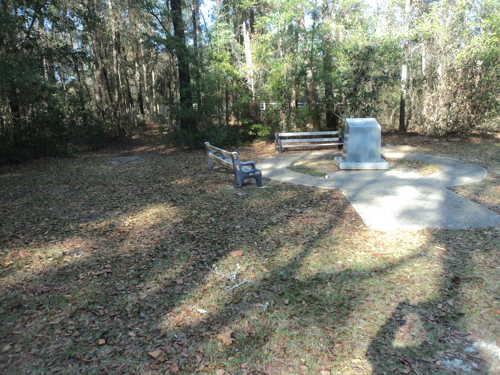
Start of Honeysuckle Trail
            Perhaps the park’s best trail is the Honeysuckle Trail, which forms a 0.7 mile loop around an island in Jackson Lake and the northern lobe of our figure-eight route.  To start with the Honeysuckle Trail, walk downhill toward the lake and angle right to cross a wooden footbridge, the only dry-foot access to this island.  An information kiosk on the mainland side of the bridge tells you that this is the G. Cleve Pierce Memorial Footbridge, and a small green sign announces this route as the Honeysuckle Trail.  An angler was trying his luck from this bridge when I crossed it.
            Upon reaching the island, ignore a trail that continues straight beside another information kiosk and turn right to begin a counterclockwise journey around the perimeter of the island, passing through a small picnic area en route.  The largest trees on this island are pines, but some yaupon lives in the wetter areas.  At 0.45 miles, you reach a grassy area on the southwestern tip of the island.  Some benches offer nice views of the lake, which was very calm when I hiked here about an hour before sunset.
W. Frank Jackson Lake
            Angle left to leave the grassy area and walk along the south side of the island.  A couple of new wooden bridges carry you over wet areas.  At 0.65 miles, you close the island loop when you return to the long footbridge over the lake.  Turn right to cross back to the mainland and complete the north lobe of the figure-eight.
            If you only wanted to hike around the island, the parking lot that contains your car sits just uphill.  To explore some of the park’s other trails, turn right and walk along the lake shore to pick up the Azalea Trail, which enters the woods behind the playground equipment.  Some interpretive signs describe birds commonly seen near the lake including bald eagles, herons, and hawks.
Seth Hammett Walkway
            At 0.9 miles, you reach the east end of the Seth Hammett Walkway, another long footbridge that crosses an inlet of Jackson Lake.  Turn right to walk across the walkway.  Looking to the right will yield a nice view of the island you just walked around.  After crossing the walkway, you come to an unsigned trail intersection with the Dogwood Trail.  The option going right leads only to the campground, so unless you are camping here you should turn left to head away from the lake.  A wetland appears downhill to the left as the trail passes under some power lines.
            1.1 miles into the hike, you reach the park entrance road you drove in on.  To continue this hike, angle left and use the road’s bridge to cross a small unnamed creek, then look for the unsigned Magnolia Trail on the right.  Turn right to leave the road before turning left to begin a short climb on the gravel Magnolia Trail.  The forest here features a dense understory of honeysuckle.
Starting the Magnolia Trail
            After passing back under the power lines, the camper cabins come into view as you top the hill.  Instead of going directly back to the parking area, the trail curves right to make a final loop through the woods east of the camper cabins.  A gradual descent delivers you to the lake shore, where a sharp left turn brings you on a westward course.  Soon a picnic shelter comes into view, which signals the end of the Magnolia Trail.  Walk around the picnic shelter and across the boat ramp parking lot to return to the swimming parking lot and complete the hike.

Monday, January 23, 2017

Lakewood Park and Florida's Highpoint (Blog Hike #616)

Trail: Red Trail
Hike Location: Lakewood Park
Geographic Location: Florida side of Florala, AL (30.98613, -86.28107)
Length: 0.7 miles
Difficulty: 0/10 (Easy)
Dates Hiked: January 2017, December 2020
Overview: A short loop around the highest point in Florida.
Photo Highlight:
Hike Video: 

Directions to the trailhead: From Florala, take Alabama SR 54 east 2.3 miles to CR 285.  Turn right on CR 285.  Very quickly you will enter Florida.  Drive CR 285 south 0.9 miles to signed Lakewood Park on the right.  Park in the only parking lot.

The hike: If you like the satisfaction of reaching a state highpoint but climbing a 13,000+ foot mountain seems beyond your ability, then maybe a visit to Florida’s state highpoint is in order.  At only 345 feet in elevation, Britton Hill is the highest point in Florida but the lowest of the 50 state highpoints.  The hill is contained in tiny Lakewood Park, which is owned and operated by Walton County.
Florida highpoint monument
            In terms of amenities, Lakewood Park offers only a few picnic tables and a short trail system consisting of three trails: the Yellow Trail, the Blue Trail, and the Red Trail.  Each trail forms a loop, but the longest loop is the Red Trail at only 0.7 miles long.  Thus, while Lakewood Park is not a pure hiking destination, if you come to visit the state highpoint you may as well take a short walk in the woods while you are here.
Trailhead beside highpoint monument
            All three loops start to the left of the highpoint monument where an unmarked trail heads into the woods.  The trails at Lakewood Park are mostly unmarked, but they are wide and easy to follow.  Very quickly you reach the park’s northern boundary, where a curve to the left brings you on a westward course.  Oak trees are prominent near Florida’s highpoint, and a layer of acorns covered the trail’s sandy soil on my early January visit.
            Soon the trail curves left and passes a pair of benches to reach a trail intersection.  The yellow and blue trails exit left here in short order, and they are marked by painted tips on arrow-like wooden planks.  Continue straight to stay on the longer Red Trail.
Hiking around the highpoint
            Now you enter the southern part of the park, which features some younger forest with a dense honeysuckle understory.  A dirt road comes into view across the park boundary to the right.  At 0.5 miles, you reach another trail intersection where the Blue Trail comes in from the left.  A confusing red-tipped wooden arrow could make you think you want to turn left, but in fact you need to continue straight to remain on the Red Trail.
            As traffic noise from the county road comes within earshot, the trail curves sharply left to begin treading along what appears to be a man-made wetland on the right.  After tracing three sides of the wetland, you come out at a small shelter with a single picnic table in the developed area of the park.  Your car sits in the parking lot just beyond the shelter.

Friday, January 20, 2017

Blackwater River State Forest: Bear Lake Loop Trail (Blog Hike #615)

Trail: Bear Lake Loop Trail
Hike Location: Blackwater River State Forest, Bear Lake Recreation Area
Geographic Location: northeast of Milton, FL (30.86214, -86.83311)
Length: 3.7 miles
Difficulty: 3/10 (Easy/Moderate)
Date Hiked: January 2017
Overview: A mostly flat circumnavigation of Bear Lake.
Hike Route Map: https://www.mappedometer.com/?maproute=732128
Photo Highlight:

Directions to the trailhead: From Milton, take SR 87 north 15.8 miles to SR 4.  Turn right on SR 4.  Drive SR 4 east 12.4 miles to Bear Lake Road; there is a sign for Bear Lake Campground at this intersection.  Turn left and drive Bear Lake Road to its end at the campground’s day use parking area, which is located near the boat launch.  There is a nominal fee to enter the day use area.  Alternatively, you can reach Bear Lake Campground from the east by taking SR 4 west out of Crestview, FL.

The hike: I was forced to cut my recent hiking trip to southern Alabama short by one day in order to get home ahead of an ice storm.  Without enough days to do all of the hikes I had intended, I had to choose between making a planned excursion into northwest Florida and focusing exclusively on southern Alabama.  I decided to make the journey into Florida and forego a few Alabama hikes, and my resulting visit to Blackwater River State Forest’s Bear Lake Recreation Area provided probably the best hike of the trip.
            Not to be confused with the much smaller adjacent Blackwater River State Park,  vast Blackwater River State Forest comprises over 210,000 acres in the Florida panhandle’s Santa Rosa and Okaloosa Counties, Florida’s second and third western-most counties.  When combined with Alabama’s Conecuh National Forest to the north and Florida’s Eglin Air Force Base to the south, the forest forms the world’s largest contiguous area of longleaf pines and wiregrass habitats.  The forest gets its name from the region’s Blackwater River, which is one of the few shifting sand-bottomed streams to remain undeveloped for most of its length.
            Being a state forest as opposed to a state park, Blackwater River State Forest is managed for the dual purposes of timber production and recreation as opposed to a pure recreation focus.  Nevertheless, the forest has several campgrounds and recreation areas, one of the more popular of which is the Bear Lake Recreation Area.  Constructed in the early 1960’s, the Bear Lake Recreation Area features a 40 site lakeside campground, a 6 mile mountain bike trail, a picnic area, access to 107 acre Bear Lake, and a hiking trailhead that accesses a couple of trails.  This entry describes the Bear Lake Loop Trail, which circumnavigates its namesake lake.
            Before you leave the trailhead area, be sure to note the large colorful trail map posted on the back of the information board where you paid your entrance fee.  The forest provides no paper trail maps, so you will want to either download a trail map from the forest’s website or take a picture of the one posted here.  Truth be told, you may not need a trail map: the Bear Lake Loop is surprisingly well-marked, well-maintained, and well-improved with many bridges and boardwalks given that it is a state forest as opposed to a state park trail.
Trailhead area near dam
            Start a clockwise journey around Bear Lake by walking north across the dam that forms the lake.  The Bear Lake Loop is marked with copious white rectangular paint blazes, the first few of which are found near the dam area.  After crossing the dam, you reach a signed trail intersection that contains a digital information kiosk with audio recordings accessible by push-button playback.  The 1.3 mile orange-blazed Sweetwater Trail exits left here and heads to the Krul Lake Recreation Area, another developed site in Blackwater River State Forest.  Although the Sweetwater Trail does not form a loop and is not described in this blog, it is noteworthy for its nice boardwalk that is more than 0.5 miles in length.  Thus, the Sweetwater Trail makes a nice side trip if you have some extra time and energy.  This hike turns right to stay on the Bear Lake Loop.
Longleaf pines
            For the next 0.7 miles the trail heads northeast parallel to the lake’s north shore through this area’s signature longleaf pine forest.  A few wet areas are encountered, but some nice wooden bridges and boardwalks carry you over the worst of the wetness.  The boardwalks on this trail have ADA-style side rails in spite of the fact that it would be nearly impossible to get a wheelchair down the rest of the trail.
View from backwater observation platform
            Just shy of 1 mile, you pass a wooden observation platform that overlooks the backwaters of Bear Lake.  I heard a woodpecker here but saw little activity.  Soon the trail curves right to cross one of Bear Lake’s main sources on another wooden bridge before climbing slightly to resume its course through longleaf pines.  All elevation changes on the Bear Lake Loop are very subtle, and the difference between maximum and minimum trail elevations is only about 15 feet.
            After crossing another bridge over another shrubby inlet, you reach a signed primitive campground along the lake shore at 1.6 miles.  Some picnic tables beckon you to enjoy the longleaf pines and rest near the midpoint of this hike.  The next inlet bridge is the longest on the Bear Lake Loop, and I passed the only other person on this hike while she was sitting here on a shady bench.
Bridge over lake inlet
            At 2.2 miles, you reach a second primitive campsite, where some careless campers had left smoldering undoused wood from a camp fire on my visit.  The red-blazed Bear-Jackson Connector Trail exits left here.  As its name implies, the Bear-Jackson Connector Trail heads east 2 miles to the Jackson Red Ground Trail, a 16.5 mile backpacking trail that is also a spur of the Florida Trail.  This hike follows the white blazes to the right to stay on the Bear Lake Loop.
Primitive campsite
            After a gradual climb away from the lake, you reach a wooden post with faint arrows and engravings.  Another arm of the Bear-Jackson Connector Trail used to exit left here, but that route is no longer maintained.  Thus, the only feasible option is to turn right and continue the Bear Lake Loop.
            The next section of trail is the only part of the hike that goes more than a couple hundred feet away from the lake.  Traffic noise from SR 4 may become audible through the pines to the left.  At 2.8 miles, you get back to the lake shore and walk through a clearing that appears to be an old logging landing.  Watch for the white blazes to ensure you stay on the trail.
Bear Lake view from pier
            3 miles into the hike, you pass a pier that juts out into the lake on the right.  This pier provides the best lake views, and the longleaf pines reflecting in the water make a pretty sight on a sunny winter day.  One final lake inlet is walked around and one final bridge is crossed before you return to the picnic, campground, and trailhead area to complete the hike.

Saturday, January 14, 2017

Conecuh National Forest: Conecuh Trail, Blue Spring and Open Pond Loops (Blog Hike #614)

Trails: Conecuh Trail, Blue Spring and Open Pond Loops
Hike Location: Conecuh National Forest, Open Pond Recreation Area
Geographic Location: south of Andalusia, AL (31.09178, -86.54516)
Length: 7.1 miles
Difficulty: 4/10 (Moderate)
Date Hiked: January 2017
Overview: A long rolling double loop past several ponds and Blue Spring.
Hike Route Map: https://www.mappedometer.com/?maproute=943138
Photo Highlight:

Directions to the trailhead: From Andalusia, take US 29 south 10.6 miles to SR 137.  Take a soft left on SR 137.  Drive SR 137 south 5.4 miles to Open Pond Road; there is a sign for Open Pond Recreation Area at this intersection.  Turn left on Open Pond Rd.  Drive Open Pond Rd. 0.6 miles to the signed recreation area entrance on the right.  Turn right to enter the recreation area, and drive the entrance road past the watch tower to the fee station, where a $3 day use fee was required on my visit.  Pay the fee, then turn left to reach the picnic area parking lot.  Park here; the trail starts on the left side of the lot across from a beautiful CCC-built wooden picnic shelter.

The hike: Located in extreme southern Alabama flush against the Florida state line, Conecuh National Forest comprises 84,000 acres of coastal plain pine woodlands.  The forest was established in 1936 to buy up land that had been cut over by loggers and burned over by forest fires.  The land has recovered from being overlogged nicely, and today it features some of the region’s best examples of longleaf pine forest and shallow pond habitats.
            Conecuh National Forest offers several recreation areas, the most developed of which is the Open Pond Recreation Area with its pondside 74-site campground.  For hikers, the forest’s only offering is the eponymously named Conecuh Trail, but it extends for more than 20 miles and is organized into 3 loops: the 13.2 mile North Loop, the 6.1 mile Blue Spring Loop, and the 1.8 mile Open Pond Loop.  The North Loop is too long for a comfortable dayhike (especially on the short days of winter when hiking in south Alabama is most appealing), but the latter two loops combine nicely to form the 7.1 mile figure-eight route described here.
Trailhead at picnic area
            The trailhead is marked by only a brown carsonite post and a sign bearing the universal hiker symbol.  The trail heads downhill and almost immediately forks.  This fork forms the Open Pond Loop.  To get to the more scenic Blue Spring Loop faster, this description will turn right and use the left trail as an eventual return route, thus hiking the Open Pond Loop clockwise.
            After passing through a cul de sac near the picnic area, you intersect a dirt road near where it crosses a man-made ditch.  Although no signs indicate such, the dirt road is also the connector trail to the Blue Spring Loop, which this hike goes around before continuing the Open Pond Loop.  To find the start of the Blue Spring Loop, turn left, walk toward the wooden fishing pier in scenic Buck Pond, and look for the large white plastic diamond and brown carsonite post to the right.  For the most part the Conecuh Trail is marked with copious plastic white diamonds, but this is the one spot where the route is not obvious.
Start of Blue Spring Loop

Buck Pond
            The trail traces the south bank of Buck Pond before curving left and heading toward its slightly smaller cousin Ditch Pond.  I spotted what appeared to be a beaver lodge in Buck Pond.  All of the ponds in this area are fed from natural water sources, so their size and depth depend on recent rainfall.  My visit came just two days after some heavy thunderstorms, so all ponds were full of water.  The ponds can nearly dry up during a drought.
Ditch Pond
            Upon reaching the south bank of Ditch Pond, the trail curves right and climbs slightly to reach the signed trail split that forms the Blue Spring Loop.  For no particular reason, this description will continue straight and use the trail going left as a return route, thus hiking the Blue Spring Loop counterclockwise.  The trail climbs a little more to enter the longleaf pine forest through which most of the Blue Spring Loop passes.  Some of the understory is very dense, and my approach sent a large number of woodland songbirds deeper into the shrubs.
            After passing the highest elevation on this hike, the trail drops to cross a seasonal creek before rising again into more longleaf pine forest.  The terrain is not rugged by almost any standard, but it is hillier than you might expect for south Alabama.  At 1.9 miles, you cross gravel FR 348A and begin a more serious descent, losing more than 130 feet over the next 0.2 miles.  As you get closer to Five Runs Creek, some wet areas will appear in the trail if it has rained recently.
Descending toward Pond Creek
            2.5 miles into the hike, you cross gravel FR 337 and begin the easternmost portion of the Blue Spring Loop, the portion that features Blue Spring.  This area has the lowest elevation of the hike and passes beside scenic Five Runs Creek and its tributary Pond Creek.  When I hiked this trail after recent heavy rains, both creeks had flooded this section of trail with several feet of water.  Thus, although I got within a few hundred feet of Blue Spring, I never actually made it to Blue Spring, the highlight of this loop.  The closest river gauge is on the Blackwater River in Baker, FL.  If that gauge registers over 11 feet, then Blue Spring is probably underwater.  In that case, you can cut off the easternmost portion of the Blue Spring Loop by hiking north on FR 337 and turning left on the north arm of the Blue Spring Loop, which is well-signed and easy to find if you are looking for it.
Blue Spring under water
            Now heading west on the loop’s north arm, the trail climbs the steepest hill of the hike to exit the low area along Five Runs Creek.  After recrossing FR 348A, the trail descends moderately, curves right, and crosses gravel FR 348.  A brushier and wetter area now appears below you to the right.
            At 4.3 miles, the trail curves left and crosses a short leaf-covered boardwalk that spanned flowing water on my visit.  A brushy wildlife clearing is passed on the right as some higher ground is obtained.  Just shy of 5 miles, you reach a trail intersection on the north bank of tiny but scenic Alligator Pond.  The option going right leads to the Blue Pond Recreation Area and the Conecuh Trail’s North Loop, so you need to turn sharply left to continue the Blue Spring Loop.  Any alligators in Alligator Pond were dormant and out of sight on my winter visit, but I did see numerous turtles sunning on logs.
Alligator Pond
            After tracing the east and south sides of Alligator Pond, the trail climbs slightly to recross FR 348 just before closing the Blue Spring Loop.  Turn right and retrace your steps past Ditch and Buck Ponds to get back to the Open Pond Loop, then turn left to continue the Open Pond Loop.  After passing up and over a low ridge, you cross a creaky wooden bridge over a wet area adjacent to Open Pond.  Immediately after crossing the bridge, look for the white plastic diamonds where the Open Pond Loop turns right; the option going straight leads a very short distance to Open Pond Recreation Area’s campground.
Open Pond
            For the next 0.5 miles the trail traces the south bank of Open Pond with the campground immediately to your left.  Two fishing piers stretch out over the pond’s open waters, which are much more expansive than any of the ponds you passed earlier.  Just shy of 6.5 miles, the trail crosses the paved campground entrance road at the campground registration station.  Look for a brown and yellow sign that says “HIKER TRAIL” to find where the trail reenters the woods on the other side of the road.
Hillside above Open Pond
            You climb slightly and curve right to begin treading a pine-covered hillside with the campground entrance road and Open Pond downhill to the right.  Next comes a gradual descent as you pass under the power line that serves the campground and near a couple of small roadside picnic areas.  After curving left, a short climb brings you to the paved recreation area road you drove in on, which the trail crosses.  Shortly after reentering the woods on the other side, you close the Open Pond Loop.  A right turn brings you back to the picnic area parking lot to complete the hike.

Monday, January 9, 2017

Kreher Preserve and Nature Center (Blog Hike #613)

Trails: (numerous)
Hike Location: Kreher Preserve and Nature Center
Geographic Location: north side of Auburn, AL (32.65999, -85.48791)
Length: 1.8 miles
Difficulty: 2/10 (Easy)
Date Hiked: January 2017
Overview: A short rolling loop featuring historic and natural points of interest.
Preserve Information: http://wp.auburn.edu/preserve/
Hike Route Map: http://www.mappedometer.com/?maproute=578356
Photo Highlight:

Directions to the trailhead: From Montgomery and points south, take I-85 to US 29/SR 147 (exit 51).  Exit and turn left.  Drive SR 147 north 8.4 miles (making several turns along the way to stay on SR 147) to the signed Kreher Preserve and Nature Center on the right.  Park in the gravel parking lot.  From Atlanta and points north, reach the same parking lot by taking I-85 to US 280 west (exit 58), turning right on US 280, and driving US 280 6.9 miles to SR 147.  Turn left on SR 147, and the parking lot will be 1.3 miles ahead on the left.

The hike: Established in 1993, Kreher Preserve and Nature Center owes its existence to a land donation made by Dr. Louise Kreher Turner to Auburn University’s School of Forestry and Wildlife Resources.  Dr. Turner was an Associate Professor of Health, Education, and Recreation at Auburn University who later became known as a writer.  Most of the land has been left in its natural state, and the preserve’s only amenities are a playground, a pavilion with an open-air amphitheater, and a system of hiking trails.
            The Kreher Preserve packs many miles of trails into its 120 acres, so many different hikes are possible.  The preserve designates three color-coded loops through its trail system: a 1 mile blue loop, a 2 mile green loop, and a 2.6 miles circuitous yellow loop.  This hike combines parts of all three of the designated routes to form this 1.8 mile loop that explores almost every major point of interest in the preserve.
Trailhead area
            Start your loop on Wax Myrtle Lane, which departs the rear of the parking lot.  An interpretive sign here gives information about the preserve, and a black mailbox nearby may contain some trail maps.  The preserve’s trails are unmarked except for the color-coded loops, but major trail intersections are signed.  The trail heads into the woods and quickly passes the playground on your right to reach the pavilion.  Restrooms and some interpretive pamphlets are available at the pavilion.
            Stay left of the pavilion and pick up the blue loop as it follows a trail called Pond Way.  Pond Way heads north toward the longleaf pine demonstration forest, which is reached at 0.25 miles.  A sign tells about the three kinds of pines that grow at the Kreher Center (longleaf, shortleaf, and loblolly) and how to distinguish them.  Some hinged tree identification markers allow you to guess what kind of tree you are looking at and then flip up the cover to check your guess.
Longleaf pine demonstration forest
            The trail now curves right and climbs slightly to enter a power line corridor that cuts through the middle of the preserve.  While I have seen plenty of deer and other wildlife in open areas such as this one, preserve managers have constructed a wooden wildlife observation blind that looks very out of place in this power line clearing.  After crossing the power line corridor, several trails exit left to head for the Cemetery Trail, the next major segment of this hike.  While each of these trails offers its own rewards, I recommend passing up the first two and turning left on the third, which is called the Ridge Path.  At this point you leave the blue loop and begin following the green loop.
Small natural spring
The Ridge Path climbs gradually past an area that features numerous small natural springs.  At 0.55 miles, the Ridge Path ends at an intersection with the Cemetery Trail.  Turn right to continue our loop, and quickly pass a modern cemetery on private property to the left.  When the trail next forks, you could go either way because the two forks re-converge in only a few hundred feet.  I prefer the option going right because it passes some interesting boulders, offers a nice bench overlooking a ravine, and stays further from noisy Farmville Road.
Barn from old homestead
            Soon you reach the preserve’s northern boundary, where a right turn is required to begin paralleling Farmville Rd.  At 0.75 miles, you reach an old rustic barn, all that remains of a homestead that predates the preserve.  The homestead was owned by Jacob Bartow Cooper before it burned down in the early 1940’s.  Pass in front of the barn, then angle right to pick up the Barn Trace, which descends on a gradual to moderate grade.
Turtle Pond
            0.9 miles into the hike, the Barn Trace ends at the north shore of Turtle Pond, which did indeed contain a few turtles on logs when I came here on a seasonally warm winter afternoon.  The Pond Way goes right to head directly back to the pavilion, but this route turns left to trace the north and east banks of the pond.  Rather than walking across the earthen dam that forms the pond, angle left to begin following the yellow loop, which climbs slightly around an old parking area.  Look for a yellow marker on a large magnolia tree that marks where the trail reenters the woods.
Large magnolia tree
            Upon reaching the unsigned Northeast Pass Trail, turn right to begin heading south along the preserve’s eastern boundary.  After passing back under the power line, you reach an area known as Azalea Place at 1.3 miles.  Continue straight to begin a trail called Tree Walk.
            A housing development appears to the left as the Tree Walk heads due south.  Upon reaching the southeast corner of the preserve, the trail curves right just before it splits.  Either option will take you to the Rill & Dell Trail, the final segment of our hike, so the choice is yours.  I prefer the Fern View Trail going left because it passes a nice creekside area with lots of ferns.  Upon reaching the Rill & Dell Trail, turn left.  A final rolling segment returns you to the parking lot to complete the hike.