Trail: Red Trail
Hike Location: Lakewood
Park
Geographic Location: Florida
side of Florala , AL (30.98613, -86.28107)
Length: 0.7 miles
Difficulty: 0/10 (Easy)
Dates Hiked: January 2017, December 2020
Overview: A short loop around the highest point in Florida .
Park Information: http://www.co.walton.fl.us/Facilities/Facility/Details/28
Hike Route Map:
Photo Highlight:


Hike Video:
Directions to the trailhead: From Florala, take
Alabama SR 54 east 2.3 miles to CR 285.
Turn right on CR 285. Very
quickly you will enter Florida . Drive CR 285 south 0.9 miles to signed Lakewood
Park
The hike: If you like the satisfaction of reaching a
state highpoint but climbing a 13,000+ foot mountain seems beyond your ability,
then maybe a visit to Florida ’s
state highpoint is in order. At only 345
feet in elevation, Britton Hill is the highest point in Florida
but the lowest of the 50 state highpoints.
The hill is contained in tiny Lakewood
Park Walton County
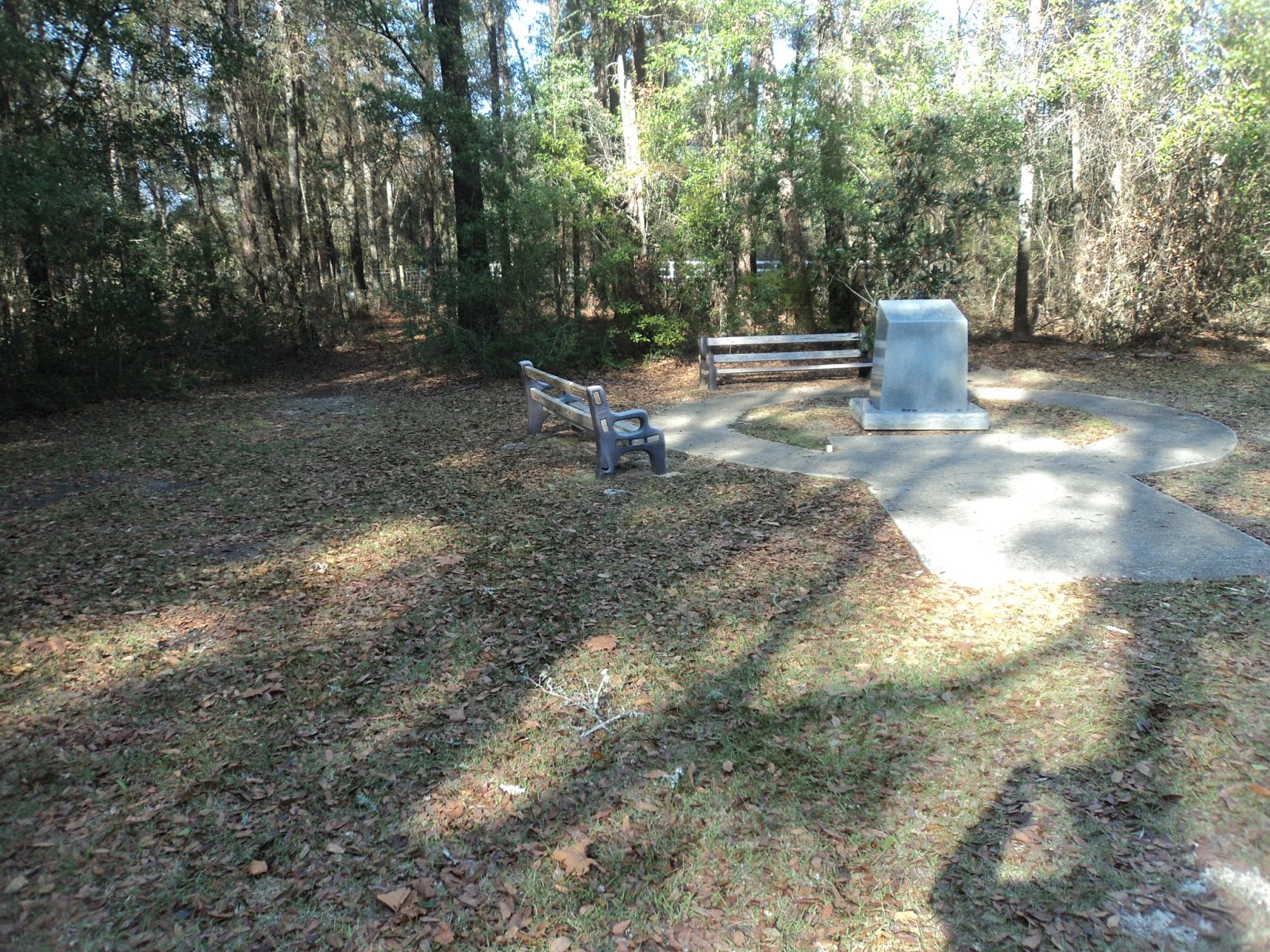
|
| Florida highpoint monument |
In terms of
amenities, Lakewood Park Lakewood Park
 |
| Trailhead beside highpoint monument |
All three
loops start to the left of the highpoint monument where an unmarked trail heads
into the woods. The trails at Lakewood
Park Florida ’s
highpoint, and a layer of acorns covered the trail’s sandy soil on my early
January visit.
Soon the
trail curves left and passes a pair of benches to reach a trail
intersection. The yellow and blue trails
exit left here in short order, and they are marked by painted tips on arrow-like
wooden planks. Continue straight to stay
on the longer Red Trail.
 |
| Hiking around the highpoint |
As traffic
noise from the county road comes within earshot, the trail curves sharply left
to begin treading along what appears to be a man-made wetland on the
right. After tracing three sides of the
wetland, you come out at a small shelter with a single picnic table in the
developed area of the park. Your car
sits in the parking lot just beyond the shelter.
No comments:
Post a Comment