Trails: Beach, Black Forest , and South Trails
Hike Location: Chickasabogue Park
Geographic Location: north side of Prichard , AL (30.78616, -88.10185)
Length: 7 miles
Difficulty: 4/10 (Easy/Moderate)
Date Hiked: January 2011
Overview: An long but flat forest hike along Chickasaw Creek and an old sand pit.
Park Information: https://www.mobilecountyal.gov/government/departments/parks/chickasabogue-park/
Hike Route Map: http://www.mappedometer.com/?maproute=116132
Photo Highlight:
Park Information: https://www.mobilecountyal.gov/government/departments/parks/chickasabogue-park/
Hike Route Map: http://www.mappedometer.com/?maproute=116132
Photo Highlight:
Directions to the trailhead: In southwest Alabama , take I-65 to SR 213 (exit 13). Exit and go south on SR 213. Take SR 213 2.2 miles to Whistler St. and turn left on Whistler St. Take Whistler St. 0.8 miles to Aldock Rd. and turn left on Aldock Rd. Take Aldock Rd. 0.8 miles to the signed park entrance on the left. Turn left to enter the park. Pay the nominal fee at the entrance gate and park in the large beach parking lot at the very end of the main park road.
The hike: Owned and operated by Mobile County Chickasabogue Park
In the late 1700’s, the Spanish settled the area, and numerous Spaniards were granted land on the north and south banks of the creek. During the Civil War, the park’s swamps offered refuge for the residents of nearby Whistler when Union soldiers captured their village. After the war, a sawmill and a gristmill operated on the site until 1903. After the mills closed, numerous campgrounds and recreational facilities were built along the banks of the Chickasaw. The same sandy creek beaches that attract visitors today attracted visitors then.
In 1969, the Scott Paper Company donated the park’s original 750 acres of land to the county. Current recreational facilities include a developed creekside beach, several athletic fields, a campground, and over 11 miles of trails open to hiking and mountain biking. The only downside to hiking at Chickasabogue Park
 |
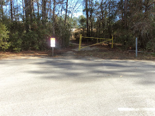
| Trailhead |
In a very short distance, the trail appears to fork, but the branch continuing straight ends at the creek bank in less than 200 feet. Thus, you should angle right to pass over a wet area on boardwalk. Some wire fencing has been attached to the top of the boardwalk to provide extra traction on the damp wood.
 |
| Bridge over wet area |
At 0.3 miles, another side trail marked “Cypress Beach
 |
| Beach on Chickasaw Creek |
The trail crosses a couple more small bridges before beginning a serpentine course up the side of a low hill. In the mountains, broad switchbacks such as these are used to ease the grade, but in low relief areas such as here they simply serve to lengthen the trail. The curves are sufficiently tight that you can frequently see the next or previous passing of the trail to your left or right. All trails at Chickasabogue Park
2 miles into the hike and after an especially winding section of trail, you pass through a short loop labeled “Misery,” as indicated by a wooden trail sign. Like the blazes, the trail signs in this park are red in one direction and yellow in the other. Contrary to its name, the “Misery” trail is quite pleasant with its young pine forest.
 |
| End of "Misery" loop |
At the end of the Misery Loop, the trail intersects an old road where an arrow directs you to turn left. 700 feet later, you reach a major trail intersection for the first of two times. The trail leaving sharply right heads directly back to the parking lot. We will take that trail later; taking it now would shorten this hike to 3.2 miles. The trail leaving at a soft angle to the right will be our way back to this intersection roughly 2 hours from now. This trail description will take the trail leaving at a soft angle to the left and head for the old sand pit.
After passing through a sharp dip called “Nosedive,” the trail arrives at another trail intersection where you should bear left. You are now heading east through dense pine forest over sandy soil with noisy I-65 slowly fading behind you. At 2.4 miles, you reach the start of the Black Forest Trail, as indicated by another yellow, wooden trail sign. Angle left to begin the Black Forest Trail. Note that the intersection you see just ahead here is the end of the Black Forest Trail, where you will be in roughly an hour.
 |
| Start of Black Forest Trail |
 |
| Hiking the Black Forest Trail |
After walking around a couple of broad switchbacks, you come to the edge of a most unusual sight for flat southern Alabama : a cliff! This 15-foot “cliff” consists of clay dirt rather than rock, and it marks the edge of the old sand pit. The sand pit has been reclaimed by small pine trees and other brush, so no real views can be had from the cliff top. As you proceed along the edge of the sand pit, you eventually come to a point where you can look down the edge of the pit and see the “cliff” itself.
 |
| Edge of old sand pit |
At 5.2 miles, you arrive at Half-Pipe as it is marked on the map or Collarbone Canyon
After nearly reaching the southern boundary of the park, the trail curves right to begin heading northwest. The freeway sounds become louder again. Ignore side trails named 265 Loop , Coaster, and Dead Man’s Run to remain on the main South Trail. Yellow signs reading “Out” now point your way, indicating you are heading into the home stretch.
 |
| Heading "Out" |
No comments:
Post a Comment