Hike Location: Chaparral Prairie State Nature Preserve
Geographic Location: north of West Union , OH (38.84032, -83.57379)
Length: 0.75 miles
Difficulty: 1/10 (Easy)
Dates Hiked: June 2001, October 2015
Overview: An easy walk through one of the largest xeric prairies in the region.
Preserve Information: https://ohiodnr.gov/wps/portal/gov/odnr/go-and-do/plan-a-visit/find-a-property/chaparral-prairie-state-nature-preserve
Directions to the trailhead: From West Union, go north on SR 247 0.7 miles to Chaparral Rd. The street sign was obscured by bushes when I drove to the trailhead, so be on the lookout. Turn left on Chaparral Rd. Take Chaparral Rd. 2.7 miles to its intersection with Hawk Hill Rd. Take a very soft right onto Hawk Hill Road , as Chaparral Rd. curves sharply to the left. Go 0.2 miles on Hawk Hill Rd. to the preserve maintenance building and trailhead on the left. Park in the blacktop lot. The trail begins at an information kiosk behind the maintenance building.
The hike: At first glance, the rolling, barren land of Chaparral Prairie State Nature Preserve
In reality, nothing could be further from the truth. For starters, making its debut in 1984, Chaparral Prairie is one of the newest additions to Ohio ’s nature preserves. The fact that the land was farmed only shortly before the acquisition explains the absence of large old-growth trees. In fact, the forests found along the trail here are some of the youngest forests described in this blog. I would recommend returning every two or three years and watching this forest grow and gradually proceed through the various stages of field succession.
The forest is not the main attraction at Chaparral, though. Chaparral harbors one of the largest prairie openings in Ohio , and that is the focus of this hike. The preserve offers an excellent opportunity to learn about the plants and wildlife of the prairie through several small, black interpretive signs scattered throughout the trail. I suggest a late summer visit, as this is when the prairie will show its best color.
 |
| Information kiosk at trailhead |
 |
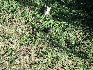
| Tiny turtle on the trail |
The trail soon passes underneath a power line and climbs into the preserve’s young forest before making a sharp right turn. Most of the forest is still red cedar, one of the first hardwood species to move into a reverting field. Over time, juniper, ash, and black cherry will begin the broadleaf invasion, followed by maple, hickory, oak and beech.
 |
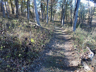
| Hiking through the woods |
 |
| Hiking through the prairie |
First the old barn, then the modern maintenance building come into view uphill on the horizon, signaling we are approaching the end of the hike. Just before closing the loop, notice an old hand water-pump near the back of the barn. Only 50 yards later, the trail comes out at the blacktop maintenance road behind the building, thus completing the hike.
No comments:
Post a Comment