Hike Location: Spring Valley Wildlife Area
Geographic Location: northeast of Waynesville , OH (39.56393, -84.01824)
Length: 2.5 miles
Difficulty: 1/10 (Easy)
Dates Hiked: February 2001, August 2016
Overview: A flat loop hike offering outstanding wildlife viewing opportunities.
Area Information: https://ohiodnr.gov/go-and-do/plan-a-visit/find-a-property/spring-valley-wildlife-area
Photo Highlight:

Directions to the trailhead: From the traffic light in Waynesville, go north on US 42 for 5.5 miles to Roxanna-New Burlington Road . Turn right and drive 1.5 miles to Township Rd. 238. There is a sign for the Frontier Campground at this intersection. Turn right again and follow this road past the campground until it deadends at a large blacktop parking lot in the wildlife area. Park here.
The hike: Tucked away in the very northeastern corner of Warren County
The land itself is not particularly attractive. The area is flat, contains no mature forest, and some 70% of the area inside the loop trail is submerged throughout the year. Yet, the water, cattail marsh, and small trees make for ideal nesting and therefore attract all types of birds. The combination of jurisdiction, water, and elevated observation platform make Spring Valley Wildlife Area one of the best places for wildlife viewing in Greater Cincinnati.
There are no marked trails through the area, but a set of wide two-track dirt paths provide access to the marsh area. The main 2 mile path described here encircles the lake with several paths leading away from the lake to various parking areas. To follow the main path counterclockwise, simply stay left at every intersection. Insect repellent is a good idea in the warmer months. As I mentioned above, the area is open to hunting. If you are hiking in the fall or winter, wear bright orange or red clothing to help avoid accidents. Above all things, do not hurry. Getting the most out of wildlife viewing requires careful observation. If nothing appears to be around, just wait for a few minutes. Look for any rustle or movement and listen for any sound. A cattail moving could just be the wind, or it could indicate the presence of a hidden bird, frog, turtle, insect, or duck.
 |
| Trail starts beside lake |
Stop at a duck blind on the left to view some of these waterfowl. Some benches along the trail provide respite on a warm, sunny, summer day. As the trail reaches the shallow, cattail-covered north end of the lake, it angles to the right to top a small rise and intersect a side trail leading right to a parking area along Township Road #238. Stay left and immediately descend back to the lake and another intersection. We will eventually take the trail to the right around the north end of the lake, but for now continue straight.
 |
| Marsh at Spring Valley |
The trail heads out into the marsh, first on an earthen dike, then on a sturdy boardwalk. Watch the cattails for any rustle that could identify the presence of a bird, duck, or frog. The boardwalk ends by climbing steps to an elevated platform that overlooks the entire area. Binoculars are handy here, as they will allow you to view waterfowl and other birds that could be flying over the water hundreds of yards away.
 |
| Walking out the boardwalk |
Back on the boardwalk, observe the water around the pussywillows, cattails and green algae for tadpoles seeing their first sunlight in the spring. Back at the intersection, turn left and head around the north end of the marsh. Bypass another side trail that goes right and cross one of the main feeder streams for the marsh. Now out of the forest, the trail is elevated about one foot over marsh bordering closely on either side.
|
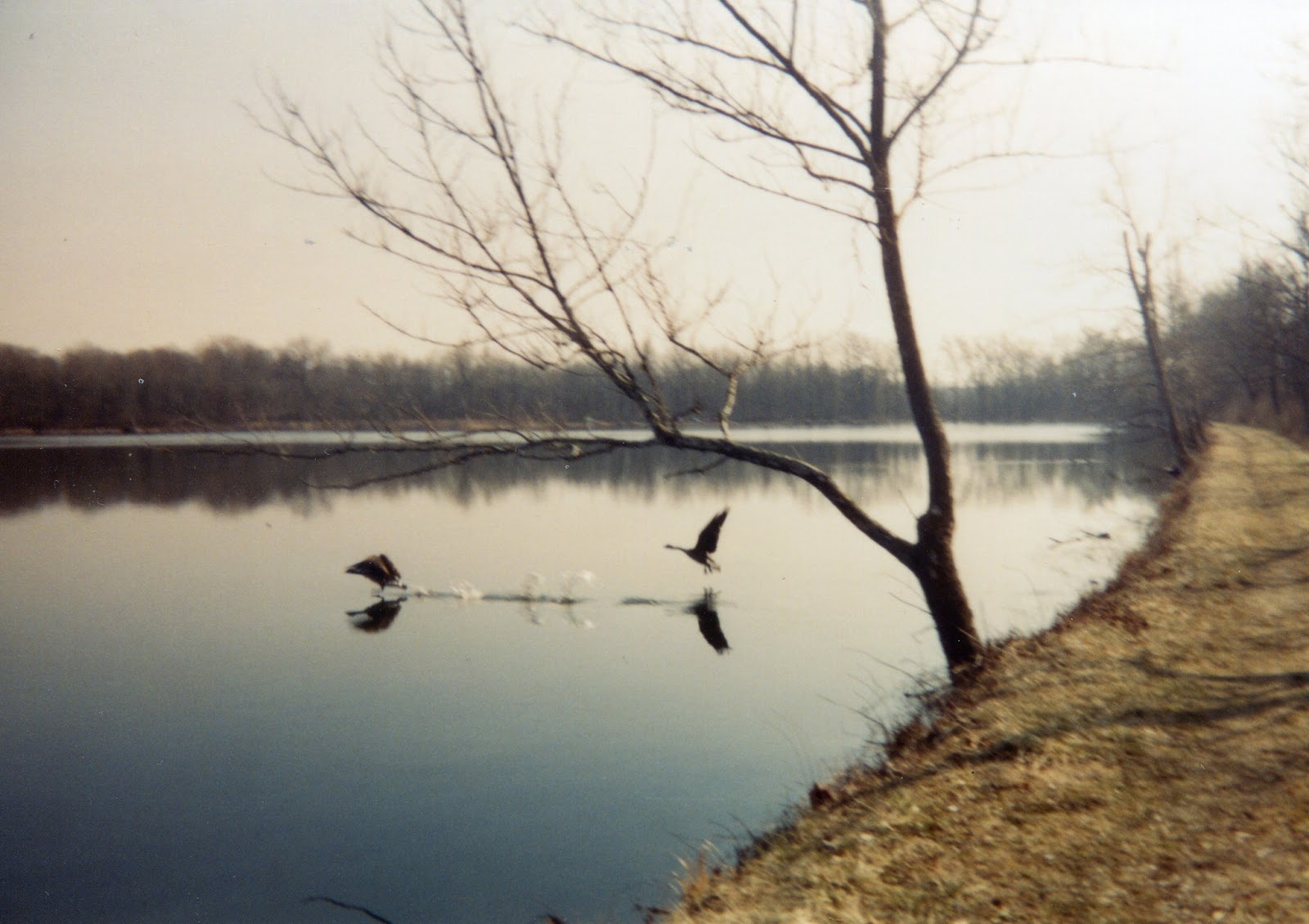
| Geese taking off across lake |
Angling left again, the trail heads south to begin the journey back down the west side of the lake. Do not be surprised to share the trail with geese, as I did one afternoon. Still out of the forest and with the lake bordering the trail on the left, pass a short side trail leading to the Little Miami Scenic Trail. This 50-mile paved bike path follows the former route of the Penn Central Railroad. This corridor along the Little Miami River became one of the state's major Rails-to Trails projects in the early and mid 1990's. All along the west side of the lake the results of their efforts can be seen across the marsh to the right of our trail. Round the southern end of the lake, pass a popular fishing spot, and go through a metal turnstile to return to the parking lot and close the loop.
No comments:
Post a Comment