Hike Location: Moraine View State Recreation Area
Geographic Location: north ofLe Roy , IL (40.40276, -88.72615)
Length: 2 miles
Geographic Location: north of
Length: 2 miles
Difficulty: 1/10 (Easy)
Dates Hiked: July 2010, July 2017
Overview: An easy hike with tall trees on possibly the shortest backpack trail inAmerica .
Dates Hiked: July 2010, July 2017
Overview: An easy hike with tall trees on possibly the shortest backpack trail in
Area Information: https://dnr.illinois.gov/parks/park.moraineview.html
Directions to the trailhead: Between Bloomington and Champaign , take I-74 to exit 149 (this is Chestnut Street ). Exit and go north, heading for Le Roy. Take Chestnut St. 0.7 miles to US 150 and turn left on US 150. Follow US 150 0.5 miles to West Street and turn right on West St . West St. becomes CR 2600E when it leaves Le Roy. Notice the gentle hill you climb just north of Le Roy. Take CR 2600E north 4.1 miles to CR 900N and turn right on CR 900N. Where CR 900N deadends at the park, turn right on the loop road around Dawson Lake
The hike: Located just off of I-74, Moraine View State Recreation Area is the perfect leg-stretch destination when you are tired of seeing corn and soybean fields along the interstate. Truth be told, this area used to be fields as well, but the soil here was too poor and dry to be sustainable as farmland. Thus, in 1959 the State of Illinois purchased the initial 760 acres, and in 1963 Dawson Lake
The “moraine” feature of this area is the main reason this land was unsustainable as farmland. A moraine is a ridge of rock and dirt left by glaciers from the last Ice Age. This park sits on the Bloomington Moraine, one of the largest moraines in the United States . In fact, the gentle hill you drove up on the way in is the edge of this moraine. The higher land on the moraine is dryer and hence less suitable for farming.
There are three short trails in the park for you to explore. The 0.5 mile Tanglewood Nature Trail (not described here) is located at a picnic area near the north end of the lake. The two trails located on the south end of the lake are the ones described here. The 1.5 mile Tall Timber Trail is a backpack trail complete with 12 reservable tent sites. The 0.5 mile Timber Point Trail is wheelchair accessible and provides good views of the lake.
 |
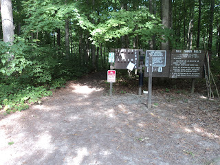
| Trailhead: Tall Timber Trail |
 |
| Hiking the Tall Timber Trail |
At 0.3 miles, the trail crosses a small gravel-bottomed stream on a wide wooden bridge with railings. The stream held minimal water on my visit, but the steep eroded banks told me that lots of water comes down this channel after a heavy rainstorm. Across the stream, the trail climbs gradually for what turns out to be the hardest climb of the hike. The park brochure describes this terrain as moderate, but this land is pretty flat in my opinion.
 |
| Crossing a small stream |
Continuing on the Tall Timber Trail, at 1.25 miles you arrive at the west bank of Salt Creek, which is much larger than the one you crossed earlier. Just upstream from here is the dam that forms Dawson Lake
A short drive back toward the park entrance will take you to the Timber Point Trail, which departs from a small restroom building at the rear of the parking area. Note that you could walk the 0.2 miles along the road to the Timber Point picnic area, but due to the narrow, curvy road with nonexistent shoulder, such a walk is not recommended. The gravel trail immediately forks at the restroom building. For no reason in particular, I took the right trail and used the left one as a return route.
 |
| Dawson Lake |
No comments:
Post a Comment