Saturday, June 22, 2013

Eno River State Park: Cole Mill Access (Blog Hike #295)

Trails: Cole Mill, Bobbitt Hole, Pea Creek, and Dunnagan Trails
Hike Location: Eno River State Park, Cole Mill Access
Geographic Location: north side of DurhamNC (36.05773, -78.98026)
Length: 5.6 miles
Difficulty: 6/10 (Moderate)
Dates Hiked: January 2010, March 2016
Overview: A quartet of moderate loops alternating between ridgetop and riverside trails.

Directions to the trailhead: Take I-85 to Cole Mill Rd. (exit 173).  Exit and go north on Cole Mill Rd.  Follow Cole Mill Rd. for 2.8 miles to the signed Cole Mill Access park entrance on the left.  This entrance is located at a traffic light just after crossing the Eno River.  Turn left to enter the park.  Park in the first of two parking areas on the right.

The hike: As odd as it seems today, most of the area now protected by Eno River State Park almost ended up under water...permanently.  In 1965, the city of Durham proposed the building of a reservoir in this valley to promote future development.  Fortunately, a group of concerned citizens formed the Association for the Preservation of the Eno River Valley and proposed that the land be set aside as parkland.  Thanks to their efforts, in 1972 the State of North Carolina agreed to establish a park, and in 1975 Eno River State Park opened.
            Located only 10 miles northwest of Durham, the park today contains over 1000 acres along the river.  Signs of human development can be seen everywhere in this park, but the park still provides an excellent recreation area for the people of Durham.  Canoeing the river is perhaps the most popular activity, and the park features several river access points for canoeists.  The park also features numerous picnic areas and, of course, over 23 miles of trails.
            The park is divided into five main areas called accesses.  Going from west to east, the accesses are named Few’s Ford, Pleasant Green, Cabe Lands, Cole Mill, and Pump Station.  The rippling river makes for great canoeing, and all five accesses offer canoe launch points.  Also, all of these areas except Pleasant Green have nice, well-developed trail systems.  The trails in the Cole Mill Access are described here because they offer a good balance between scenery and difficulty.
            The four loop trails in the Cole Mill Access lie end to end like a chain with the trailhead in the very middle.  My favorite trails here are the Dunnagan Trail and the Bobbitt Hole Trail, but they are the two extreme links on the chain.  Thus, to reach these trails you also have to hike the other two trails in the middle.  Of course, you could hike the western and eastern halves separately, but since they share a common trailhead, the two halves combine nicely to form this 5.6 mile hike.
Cole Mill Trail trailhead
            Begin by picking up a trail map from the brown, metal dispenser marked “Trail Maps” at the trailhead.  After turning left at the small restroom building, the trail forks.  The trail continuing straight just leads to the second parking area, so you should turn right and begin the yellow-blazed Cole Mill Trail.  The first part of this trail passes through a nice forest with lots of tall pine trees that leave a soft cushion of needles under foot.  Soon the trail drops to pass through the first of several small ravines.  All of the major creeks crossed by trails in this park have bridges, but some smaller streams such as this one will require either a good jump or stepping in an inch of water when water tables are high.
Durham-Orange County line
            At 0.3 miles, just after crossing the Durham-Orange County line, you arrive at the beginning of the red-blazed Bobbitt Hole Trail, which exits to the right. Turn right to begin the Bobbitt Hole Trail.  Note that if you wanted to hike just the 1.2 mile Cole Mill Trail, you would continue straight here and soon arrive at the river, where you would rejoin this description later in the hike.
Starting the Bobbitt Hole Trail
            After passing under a high-voltage power line and through a particularly steep ravine, the trail climbs to the highest point on this hike.  The pine trees are a distant memory now as the trail passes through an area of mostly young forest with a few large beech trees.  After 0.2 miles of relatively level walking, the trail curves left, passes under the power lines again, and begins the descent to Eno River in earnest.
            1 mile into the hike, the trail passes through the Piper Creek Primitive Campground where a number of side trails lead to campsites.  Reservations are required to camp here, so you should follow the red blazes to stay on the main trail.  Soon after crossing pleasant Piper Creek on a small wooden footbridge, you will arrive at an intersection at which red-blazed trails go both straight and left.  The trail going left continues the loop, and we will take it later.  For now, continue straight on the short spur trail to Bobbitt Hole.
            Very quickly you will arrive beside Bobbitt Hole at a log which forms a makeshift bench and a sign that says “End of Trail.”  Water rolls into the hole over a small cascade before making a 90-degree right hand turn around a tall rock outcrop.  Most of the river is shallow, but this hole has been measured to 18 feet deep.  If you look on the near bank at the foot of the hole, you will see a large collection of logs and other debris, a testament to this river’s power during times of flood.
Eno River entering Bobbitt Hole
            After spending some time at the hole, continue the hike by retracing your steps to the trail intersection mentioned above and turning right to continue the loop.  For the next mile the trail stays in the floodplain very close to the river bank.  Some large sycamore trees beside the river give good shade, in season.  For the most part, the trail stays right beside the river, but a few areas have been relocated a few feet up the hillside due to landslide issues.
Where the Bobbitt Hole Trail ends at an intersection with the Cole Mill Trail, continue straight to remain by the river and pick up the Cole Mill Trail.  On the chilly Saturday when I was hiking this trail, some park volunteers were working on the other side of the river building a new trail the old fashioned way: by hand.  They were working on a westward extension of the Laurel Bluffs Trail (not described here) which, when finished, will connect the Cole Mill Access to the Cabe Lands Access upstream.  Hopefully, in a few years I can make a return trip to Eno River and personally enjoy the fruits of their work.
Hiking along the Eno River 
            At 2.4 miles, you will arrive at a confusing smattering of boulders right beside the river.  A path appears to lead straight directly beside the river, but it peters out in a couple hundred feet.  The real trail turns left and makes a brief climb away from the river to reach a couple of picnic tables.  300 feet later, you will reach an information board beside a blacktop parking area.  This is the second parking area mentioned in the Directions to the Trailhead.
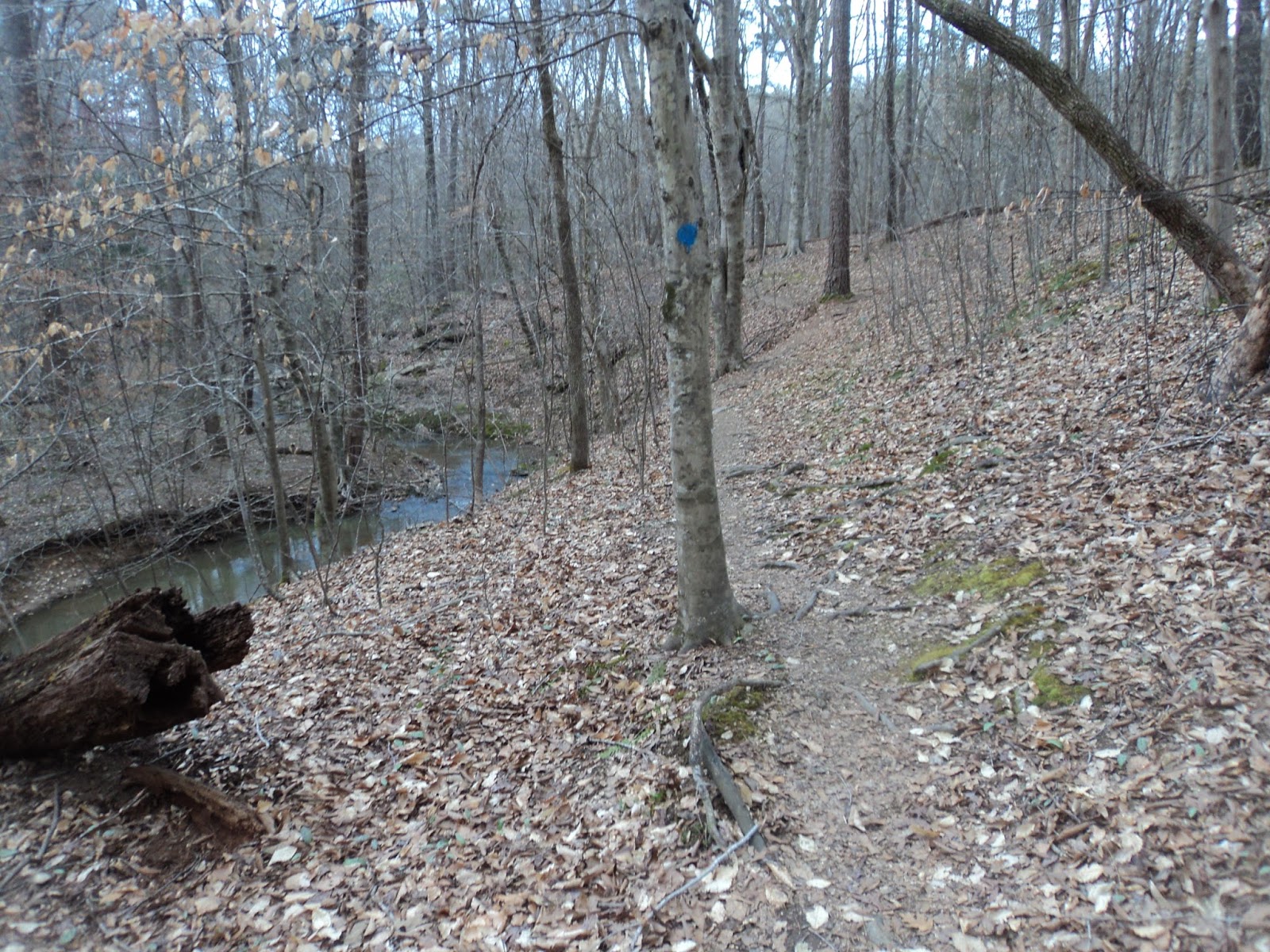
The Cole Mill Trail ends at the information board.  If you wanted to hike just the 2.5 mile western half of the trail system, you could walk up the road from here to reach the first parking area, the one containing your car.  To continue to the eastern half, pick up the blue-blazed Pea Creek Trail, which exits the information board area in the opposite direction as the Cole Mill Trail came in.
Start of Pea Creek Trail
            After passing a couple of picnic tables, the trail descends some gradual steps to arrive back at river level where the Cole Mill Road overpass comes into view in front of and above you.  Ignore some steps that lead left up to the road and walk under the overpass, staying close to the river.  An increase in rocks and mud, particularly noticeable near the bridge, make the eastern half of the trail system a shade harder to hike than the western half, but only a shade.
2.8 miles into the hike, the trail forks to form the Pea Creek Trail loop.  Since I had been hiking along the river for awhile, I decided to opt for a change of scenery and turn left here, using the right trail along the river as my return route.  The trail makes a brief steep climb to exit the floodplain before passing under the high voltage power lines again.
Approaching Pea Creek
            At 3 miles, Pea Creek comes into view at the bottom of a steep ravine in front of you.  The trail carefully makes its way to the base of the ravine to arrive at a trail intersection beside Pea Creek.  We will eventually continue around the Pea Creek Trail loop, which continues straight ahead, but for now, turn left to begin the red-blazed Dunnagan Trail, which crosses Pea Creek on a wooden footbridge.  When I hiked this trail, one of the two wooden beams that support this bridge had broken, causing part of the bridge to tilt severely from right to left.  Nevertheless, I was able to cross the bridge safely and without getting wet.
Just after crossing the bridge, the trail forks to form the Dunnagan Trail loop.  To keep with my ridgetop theme, I chose to angle left here and use the right trail as the return route.  The trail climbs gradually away from Pea Creek through a nice broadleaf forest with some older beech trees.  This area has some of my favorite forest on this hike.
Start of Dunnagan Trail
            Nearly 4 miles into the hike, the trail enters the site of the former Dunnagan homestead.  The first thing you will notice is a white headstone dated 1914 inscribed with the name “P Dunnagan” sitting to the right of the trail.  Just past this small cemetery, you will pass a couple piles of stones to the left of the trail.  These stones, collapsed chimneys, are all that remain today of the Dunnagan homestead.  Notice how this area of forest looks different than what you have been walking through, a result of the land being cleared to build the homestead.
Upland forest on the Dunnagan Trail
              Past the homestead site, the trail dips through a steep ravine.  After climbing the other side, ignore an unmarked trail which exits left and angle right, as directed by an arrow inscribed in a wooden post.  Now the trail descends moderately to arrive back at the river near a deep area known as Bob’s Hole.  This is the farthest point from the trailhead, and the trail makes a sharp right turn here to begin heading back upstream.
Just after the turn comes the most challenging part of the hike: a climb up the stone walls of Durham’s first pumping station.  The wall is only a few feet high, but the climb is over bare rock and it is right beside the river.  If you take care not to lose your balance and fall in the river, you should make it up the wall with no problem.
Eno River
           The remainder of the hike is a pleasant but mostly uneventful walk upstream along the Eno River, which flows to the left.  At 4.9 miles, the trail briefly angles inland to close the Dunnagan Trail loop and re-cross Pea Creek on the same damaged bridge.  Once across the bridge, turn left to continue around the Pea Creek Trail loop.  In another 0.4 miles along the river and after passing under the high voltage power lines for the last time, you will close the Pea Creek Trail loop.  Retracing your steps another 0.3 miles, passing under the Cole Mill Road bridge in the process, will return you to the information board at the second parking area.  Turn right and walk along the road to the first parking area, where your car is parked, to complete the hike.

No comments:

Post a Comment