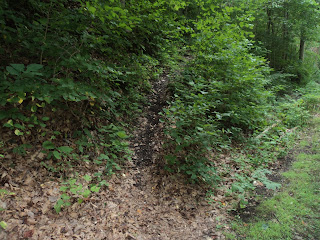
Trail: Quarry Rim Trail
Geographic Location:
east of Newark OH (40.0558, -82.21859)
Length: 5.2 miles
Difficulty: 5/10 (Moderate)
Dates Hiked: Summer 2000
Overview: An interesting tour of historically and geologically
significant Blackhand Gorge.
Preserve Information: https://ohiodnr.gov/wps/portal/gov/odnr/go-and-do/plan-a-visit/find-a-property/blackhand-gorge-state-nature-preserve
Directions to the trailhead: From Newark Toboso Rd. Licking River .
The hike: The Blackhand Gorge on the Licking River is one of those special spots in Ohio Muskingum River in Zanesville Licking
River flows through a cool
damp gorge with vertical blackhand sandstone cliffs towering 100 feet
overhead. In addition to the scenery, the gorge has several historical
tales to tell. The blackhand sandstone is not black, but it receives its
name from a dark, hand-shaped Indian petroglyph that was found on the walls of
this gorge. Historians think the symbol was a primitive boundary marker,
signaling that the land beyond the hand was neutral ground for all tribes.
The gorge also has a part in Ohio Miami-Erie Canal Scioto River
Today, the gorge is protected as a state nature preserve. The gorge is accessible
by a 4.25 mile one-way blacktopped hike/bike trail and several nature
trails. This hike passes all of the items mentioned above, as well as the
site of an old sandstone quarry, a scenic and unusual feature in the
surrounding landscape.
 |
| East trailhead: Blackhand Gorge |
The trail starts by the restrooms at the parking lot, passes beside a stone
wall made of sandstone mined from the gorge, and begins following the blacktop bike
path. After 0.25 miles, pass a sunny area good for summer wildflowers on
the left. Just past this spot the dirt Quarry Trail goes off to the left. Trail intersections at Blackhand Gorge are
identified by letters, and signs bearing trail maps are found at major trail
intersections. This intersection is
called point B. Turn left to begin the narrow dirt trail.
 |
| Leaving the bike path |
After a few minutes of hiking through young maple/beech forest, arrive at a
wooden overlook of Buttonbush Swamp
 |
| Buttonbush Swamp |
The trail passes through a couple of shallow ravines and an overlook of the
gorge. You are standing on top of a sandstone cliff with the blacktop
bike path some 50 feet directly below you. Past the overlook, the
trail soon arrives at the rim of the old sandstone quarry. The vertical
sandstone walls drop 75 feet to the water-filled quarry. Hemlocks, often
a sign of cliffs nearby, cling to the edge of the sandstone. Overlooks guarded
by wooden handrails offer views of the quarry at several points, and even
though the quarry is not natural, it provides for some very interesting scenery.
 |
| The quarry |
The trail descends around the rim of the quarry, going down some stairs to
cross a stream before coming out at the bike path. Turning right here
would take you directly back to the trailhead, but to also hike the Chestnut
Trail, the preserve’s other nature trail on the south
side of the river, turn left and hike the bike trail under an active railroad trestle. The dirt Chestnut Trail leaves the left side
of the bike trail 0.1 miles later at point F.
 |
| Starting the Chestnut Trail |
The Chestnut Trail
ascends steeply to the south rim of Blackhand Gorge using a pair of
switchbacks. The trail now assumes a westerly
course with the vertical cliff some 20 yards to your right and a gently sloping
hillside climbing to the left. You are surrounded by young beech/maple
forest with a dense understory of paw paw, honeysuckle, blackberry briars, and
unfortunately a little poison ivy.
 |
| Hiking the Chestnut Trail |
After
dipping through a ravine and climbing steeply via a single broad switchback,
the trail passes through an area of recent storm damage. Numerous
good-sized trees have been blown over by either straight-line winds or even a
small tornado. Several downed trees were blocking the trail, and small
gaps had to be cut in the wood so hikers could pass. The fallen trees
have left a gap in the canopy, allowing a dense shrub layer in the understory
to develop. It should be interesting to watch this area recover in the
next few years.
Past the open area, the Chestnut Trail keeps a constant elevation on the
hillside until descending back to the bike path via a slightly steep and rocky
switchback. 3 miles into the hike, you
reunite with the bike path at point G. The
bike path going left leads another 2 miles to an alternate western trailhead,
but it passes no other points of interest. Thus, I recommend turning right to begin the
journey back to the east trailhead.
The entire bike path is a scenic walk with sandstone cliffs to
the south and the Licking
River to the north. On
the way back to the trailhead, the bike trail passes the other side of the
quarry and a section where the sandstone has been cut through for the bike path
(an old railroad grade) to pass. This cool shady section features 75 foot
sandstone walls rising on either side of the trail.
 |
| Rock cut on old railroad grade |
 |
| Licking River and construction remnants |
After passing through the walls, don't miss a short side trail that goes off to
the left toward the river. This trail gives a view of the sandstone cliff
on which the black hand I mentioned at the beginning of the hike was
inscribed. Looking across the river, the most obvious feature seen on the
cliff today is the legacy of the canal construction. Sandstone blocks lie
stacked as a wall at the base of the cliff, and grooves created by the
construction’s blasting can be seen further
up. After returning to the bike path, a 0.7 mile level walk remains to
return you to the trailhead.
No comments:
Post a Comment