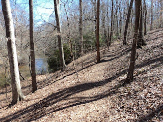
Trail: South Fork Trail
Hike Location: Watson Mill Bridge State Park
Geographic Location: north of Lexington , GA (34.02589, -83.07476)
Length: 1.5 miles
Difficulty: 1/10 (Easy)
Dates Hiked: September 2007, March 2015, January 2023
Overview: An easy hike along the South Fork River
Park Information: https://gastateparks.org/WatsonMillBridge
Hike Route Map: https://www.mappedometer.com/?maproute=720092
Hike Route Map: https://www.mappedometer.com/?maproute=720092
Hike Video:
Directions to the trailhead: From Lexington , take SR 22 north 11 miles to Watson Mill Bridge Road and a brown sign for the park. Turn right on Watson Mill Bridge Road . From Comer, take SR 22 3 miles south to this same intersection and turn left. Drive Watson Mill Bridge Rd. east 3 miles to the park entrance. Immediately before reaching the covered bridge, turn right onto the campground road. Park in a small paved pullout on the right immediately after making this turn. If the pullout is full, you can park in the fisher’s parking lot on the left before reaching the bridge.
The hike: Like much of the land in central Georgia , the land today comprising Watson Mill Bridge State Park Madison County Watson Mill Bridge Georgia still in its original location.
 |
| Watson Mill Bridge |
The park today provides 1005 acres of solitude and recreation. Located just 15 miles east of Athens , the park is close enough to a city to make it accessible to a lot of people but far enough away so that it does not get too crowded. Several picnic shelters dot the park map as well as a playground for kids, a campground offering both primitive and developed camping, a bridle center with 10 miles of horse trails, and the South Fork River
 |
| Trailhead: South Fork Trail |
Continuing downstream, ignore some wooden steps heading across the raceway and down toward the river on your left. These steps lead to a seldom-used trail that leads through the river bottom. River views are no better than you will find elsewhere, and the trail is somewhat overgrown making for more uncomfortable hiking. Instead, remain on the South Fork Trail as it stays on the high ground with the standing water of the raceway on your left and the hillside on your right.
 |
| Hiking along the raceway |
 |
| Power house ruins |
 |
| Hiking above the river |
The South Fork Trail now leaves the river behind and heads south along gentle Big Cloud Creek. At 1.2 miles, pass underneath an abandoned steel bridge, too rusted and broken down to hold traffic any more, and arrive at a campground parking area in a gravel road. Directly across the parking area is Pioneer II, another primitive campground.
 |
| Abandoned bridge |
No comments:
Post a Comment