Trail: Twin Arches Trail
Hike Location: Big South Fork National River
Geographic Location: northeast of Jamestown , TN (36.54431, -84.74169)
Length: 1.4 miles
Difficulty: 6/10 (Moderate)
Dates Hiked: Summer 2001, October 2017
Overview: A short hike to one of the major attractions in the Big South Fork.
Trail Information: http://www.nps.gov/biso/planyourvisit/tntrails.htm
Hike Route Map: https://www.mappedometer.com/?maproute=717474
Photo Highlight:
Hike Route Map: https://www.mappedometer.com/?maproute=717474
Photo Highlight:
Directions to the trailhead: The Twin Arches Trailhead sits in an isolated section of the park accessible only by a complex network of narrow gravel roads. Some of the roads are not very well marked, so follow the last portion of these directions carefully. From Jamestown , go north on Tennessee SR 154 and reach SR 297. From this intersection, continue north on SR 154 for another 1.9 miles to Divide Road, a gravel road going off to the right. Turn right on Divide Road . Where the road forks in 0.8 miles, stay left on Divide Road . In another 2.8 miles, Twin Arches Road goes to the right. Turn right here. Twin Arches Road terminates at a small parking lot for the trailhead and an adjacent small picnic area.
The hike: By any account, Twin Arches are the major arch landforms in the Big South Fork. If North Arch and South Arch were taken as a single landform they would be the biggest arch in the world. Depending on how you measure, one could say that either of the Twin Arches are bigger than the famous Natural Bridge of Virginia. The Virginia bridge is higher and thicker, but these arches are both wider at the base. These arches are somewhat more difficult to access, but that only adds to the appeal. Natural Bridge Virginia
Numerous hiking trails access the Twin Arches. The 4.9 mile Twin Arches loop (described elsewhere in this blog) traverses difficult terrain while passing Charit Creek Lodge, a rustic housing accessible only by trail. Another trail connects the arches to Slave Falls
Although Twin Arches are a wondrous sight any time of year, I would recommend a winter visit. Remember that these arches remain in a natural setting, which includes a lush patch of trees. In winter, leaves are off the trees, allowing you to view the arches from further away, thereby allowing more chances to take photographs. Also, insects are not a problem in winter, and poisonous rattlesnakes and copperheads are hibernating safely underground. Of course, winter can also present icy trail conditions and unusually cold weather. Take the weather into consideration, watch your step, and dress appropriately.
 |
| Twin Arches Trailhead |
 |
| Trail forks to form loop |
Now following the base of the cliff on the right and more downhill on the left, the trail proceeds east along the finger ridge, crossing several small streams via wooden bridges. Be especially careful along this section of trail in winter, as icicles can break off of the cliff above you and come crashing down like spears on your head.
0.3 miles after the trail intersection North Arch comes into view up and to the right. Although the smaller of the two arches, North Arch still measures a respectable 51 feet high and 93 feet wide. Standing under the arch, you can admire the massive amounts of sandstone over you and on either side. Try singing your favorite song toward one of the sides of the arch and listen as your voice echoes off of the rocks.
 |
| Looking up at North Arch |
 |
| North Arch |
Measuring 70 feet high and 135 feet wide, South Arch is the larger of the two arches. Still, their similar size and appearance make the two arches unmistakably twins. Both arches were formed by water and wind eroding away the softer sedimentary rock that had been formed underneath the harder sandstone that remains. Orange sand once part of the arch covering the ground beneath the arches testifies to the power of nature in changing the landscape.
 |
| South Arch |
 |
| South Arch |
 |
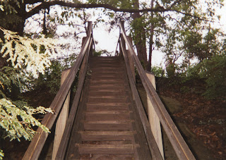
| Wooden steps to top of arches |
 |
| Walking across the top of North Arch |
No comments:
Post a Comment