Trail: Bandy Creek Campground Loop
Hike Location: Big South Fork National River
Geographic Location: west of Oneida , TN (36.48992, -84.70207)
Length: 1.8 miles
Difficulty: 1/10 (Easy)
Dates Hiked: February 2005, May 2015
Overview: An easy walk on gravel trail skirting the facilities at Bandy Creek.
Area Information: http://www.nps.gov/biso/planyourvisit/tntrails.htm
Area Information: http://www.nps.gov/biso/planyourvisit/tntrails.htm
Hike Route Map:
On The Go Map
On The Go Map
Photo Highlight:

Directions to the trailhead: Oneida , head west on SR 297 and pass through the gorge of the Big South Fork. Immediately after ascending the west bank of the gorge, turn right on the marked park road for the Bandy Creek Visitor Center
The hike: For my general comments on Big South Fork, see the previous hike. This trail is suitable for people that just desire a short, easy walk in the woods or for those that are not physically able to hike some of the longer trails at Big South Fork. In addition, this trail gives you a good introduction to the facilities in the Bandy Creek developed area of Big South Fork.
 |
| Trailhead for campground loop |
 |
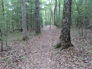
| Hiking south toward amphitheater |
The trail soon begins turning to the left as it rounds the southern end of the developed area. Numerous pine trees that had been infected with the Southern Pine Beetle have been cut down in this area to prevent them from falling over the trail on a windy day. Swarms of termites enjoying the fresh supply of wood greeted me as I walked this section of trail on a warm sunny spring morning. At 1 mile, look to the right for a view east toward the nearby gorge during the leafless months. There are no overlooks on this trail, but this view gives you a more distant view unlike those you will find on the gorge rim.
|
| Hiking near the Visitor Center |
No comments:
Post a Comment