Trails: Overlook and Spring Branch Trails
Hike Location: Ozark National Scenic Riverways, Alley Spring and Mill
Geographic Location: west of Eminence, MO (37.15150, -91.44282)
Length: 2 miles
Difficulty: 4/10 (Easy/Moderate)
Date Hiked: May 2021
Overview: A semiloop around and above fantastic Alley Spring and its adjacent historic mill.
Mill Information:
https://www.nps.gov/ozar/learn/historyculture/alley-mill.htm
Hike Route Map:
https://www.mappedometer.com/?maproute=872819Photo Highlight:
Directions to the trailhead: From Eminence, take SR 106 west 6 miles to the signed Alley Spring and Mill picnic area on the right. Park in the large paved lot for the picnic area.
The hike: Established by an Act of Congress in 1964, Ozark National Scenic Riverways protects 80,000 acres along two rivers in southern Missouri: the Current River and the Jacks Fork River. Experts rank these two rivers among the best float rivers in the Midwest, and canoeing and kayaking are two of the park's most popular activities. The park receives more than 2 million visitors per year, and it is a fabulous scenic destination in the heart of a very scenic region.
One of the reasons for the rivers' quality is the quality of this region's springs. Indeed, the collection of springs found in Ozark National Scenic Riverways surpasses any others found north of Florida and east of the Rockies. One of the Ozarks' best springs is Alley Spring, which is the destination featured here. Alley Spring discharges 81 million gallons of fresh water each day, and water travels up to 15 miles through the area's vast underground cave network before exiting the spring.
Perched on the bank of Alley Spring is Alley Mill, a red Ozarks icon that appeared as part of the U.S. Mint's America the Beautiful Quarter Series in 2017. The grain-grinding gristmill was built by George Washington McCaskill in 1894, and it was part of a larger community that included a school, store, and blacksmith shop. Many visitors come just to see the mill and spring, but the area also offers a short, well-developed, frontcountry trail system. The route suggested here forms the longest possible route with minimal retracing of steps, and it offers views of the spring and mill from many different angles.
 |
| Trailhead at picnic area |
From the main parking lot, head up the concrete path toward the mill with the spring's runoff channel on the right and the Alley Picnic Pavilion uphill to the left. An information kiosk offers an area map and a trail map. Next you pass the old white school building that served the Alley Mill Hamlet. At its height in 1903, this small school enrolled 42 students, and it also served as a meeting place for church services.
 |
| Historic Alley Schoolhouse |
Angle right at the next parking lot and cross a bridge to reach the iconic red, wooden, spring-side structure that is Alley Mill. The mill has a total of 4 floors including the basement and attic, and the mill is open for tours at selected times. Unfortunately, the mill was closed due to the Covid-19 pandemic on my visit, so I had to admire the mill from the outside.
 |
| Alley Mill |
Behind the mill stands the brown metal road sign that marks the mill/spring area's main trailhead. Turn left to begin a clockwise journey around the Overlook Trail. The wide gravel trail climbs using a large number of tight switchbacks. Although the hillside is rather steep, the switchbacks keep the grade gradual to moderate. Also, several benches provide opportunities to rest for the weary and winded, so this climb is about as easy of a climb as you can get.
 |
| View from Alley Mill overlook |
Just past 0.5 miles, you reach the overlook for which this trail is named. Trees are starting to encroach on the view during the leafy months, but a narrow view can still be had of the mill and spring nearly 200 vertical feet below. Rolling hills extend off in the distance, and interpretive signs tell you about the mill's and community's history.
 |
| Descending on Overlook Trail |
Past the overlook, the trail embarks on a pleasant ridgetop course for 0.4 miles before beginning its descent back to spring level. As with the climb, this descent uses numerous switchbacks to ease the grade. At 1.3 miles, the Overlook Trail ends at an intersection with a gravel road. Turn right on the gravel road, but before you cross the vehicle bridge that leads back to the parking lot, turn right again to begin the Spring Branch Trail, the final leg of this hike.
 |
| Spring Branch |
 |
| Cliffs beside trail |
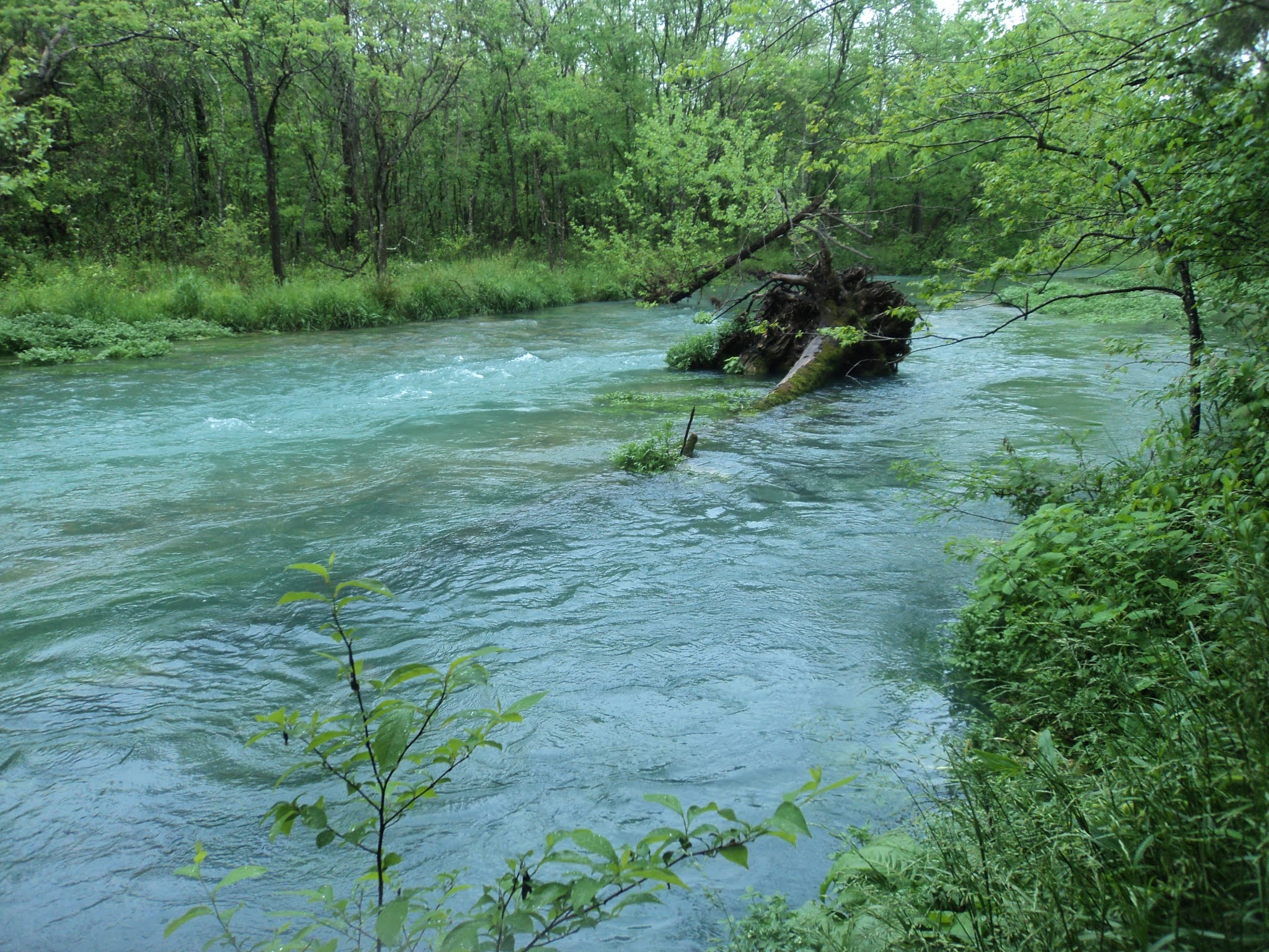
True to its name, the Spring Branch Trail follows the north side of Spring Branch to its source, Alley Spring. Spring Branch was a deep, wide, rolling watercourse on my visit, and the volume and clarity of the stream's turquoise-colored water testify to the size and quality of Alley Spring. As you approach the spring, limestone cliffs start to squeeze the trail on the right, and some wooden steps get you over some rocky areas.
 |
| Alley Mill across Alley Spring |
At 1.7 miles, you reach Alley Spring. The trail goes along the base of the cliffs around the spring, and the red mill surrounded by green trees across the light blue spring makes for postcard-quality photographs. After circling the spring, you arrive back at the mill to close the loop. Retrace your steps out the concrete path to the parking lot to complete the hike.


No comments:
Post a Comment