Hike Location: Croatan National Forest, Cedar Point
Recreation Area
Geographic Location: Cape Carteret, NC (34.69184, -77.08637)
Length: 1.5 miles
Difficulty: 1/10 (Easy)
Date Hiked: March 2020
Overview: A lollipop loop beside the White Oak River tidal
marsh.
Trail Information: https://www.fs.usda.gov/r08/northcarolina/recreation/trails/tideland-national-recreation-trail
Hike Route Map:
On The Go Map
Photo Highlight:

Directions to the trailhead: From the intersection of
SR 24 and SR 58 in Cape Carteret, take SR 58 north 0.7 miles to VFW Road and
turn left on VFW Rd. Drive VFW Rd. west
0.5 miles to the entrance for Croatan National Forest’s Cedar Point Recreation
Area on the left. Turn left on the paved
national forest road and drive it 0.8 miles to the picnic area parking lot at
the road’s end. Park here.
The hike: For my introduction to Croatan National
Forest, see the previous hike. Whereas the previous hike
explored the backcountry pinewoods wetlands traversed by the Neusiok Trail,
this hike describes a short frontcountry nature trail that explores the area
around the White Oak River tidal marsh. The
trail’s length, scenery, and location near popular beach destinations mean it
sees plenty of traffic, so do not expect to be alone on this hike.
 |
| Tideland Trail trailhead |
From the
signed trailhead near the picnic area’s restroom building, the gravel trail
heads northwest into a forest of cedar trees and live oaks. Numerous signs describe the flora and fauna
of the tidal marsh area, but some of the signs were faded and hard to read on
my visit. After only a few hundred feet,
the trail splits to form its loop. To
save the best views of the tidal marsh for last, I chose to turn right and use
the route continuing straight as my return route, thus hiking the loop
counterclockwise.
 |
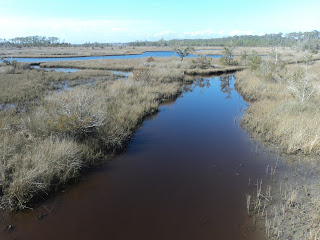
| Hiking along the tidal marsh |
The gravel
trail skirts the fringe of the tidal marsh as it curves more left than
right. Numerous benches offer
opportunities to sit and rest if you are so inclined. At 0.4 miles, the short loop exits left and
heads onto a boardwalk. Angle right to
stay on the longer loop and get the full tour.
Next the
trail passes around a shallow inlet that offers your first tidal marsh
view. At 0.7 miles, you reach an
unsigned trail intersection. The trail
going right leads to the recreation area entrance road, so you need to turn
left to continue the loop.
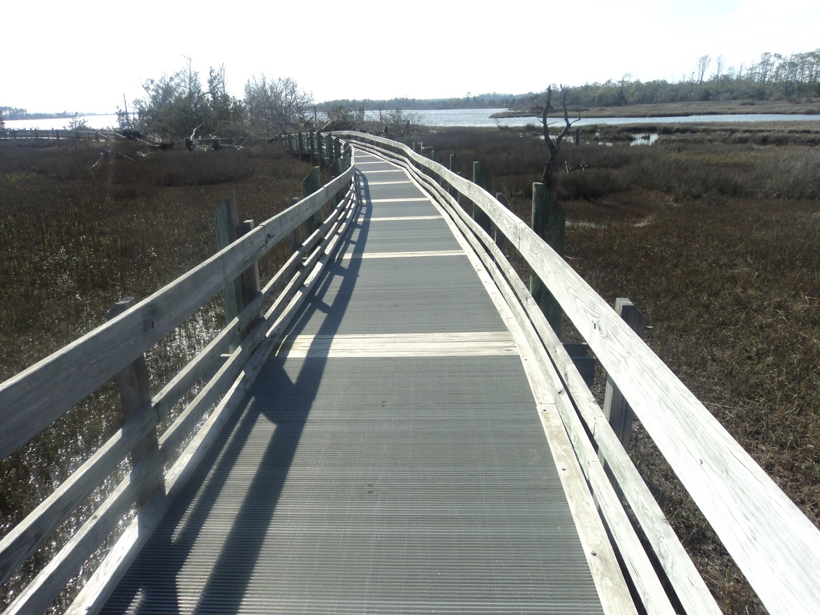 |
| Boardwalk over tidal marsh |
 |
| View from elevated boardwalk |
Just past the trail intersection, you
head out over the tidal marsh on a fantastic highly elevated wooden boardwalk
with metal grate deck. Expansive views appear
in all directions from this sunny boardwalk.
When I looked down into the marsh, I saw dozens of tiny crabs crawling
around in the mud.
 |
| Standing on edge of White Oak River |
The trail
surface goes back and forth between boardwalk and gravel, and two side trails
exiting right take you to the White Oak River’s edge. Excellent views appear up and down the watery
expanse. At 1.3 miles, the short loop
enters from the left, and at 1.4 miles you close the long loop. Retrace your steps 500 feet back to the
parking area to complete the hike.
No comments:
Post a Comment