Trails: Young Hawk and Little Soldier Loops
Hike Location: Fort Abraham Lincoln State Park
Geographic Location: south of Mandan, ND (46.76526, -100.84591)
Length: 3.2 miles
Difficulty: 4/10 (Moderate)
Date Hiked: July 2018
Overview: A lollipop loop featuring the site of a former
infantry post.
Park Information: https://www.parkrec.nd.gov/fort-abraham-lincoln-state-park
Directions to the trailhead: On the west bank of the
Missouri River, take I-94 to Mandan Avenue (exit 153). Exit and go south on Mandan Ave. Drive Mandan Ave. south 0.6 miles to Main
Street and turn right on Main St. Drive
Main St. west 0.3 miles to SR 1806 and turn left on SR 1806. Drive SR 1806 south 7 miles to the signed
park entrance on the left. Turn left to
enter the park, pay the park entrance fee, and park in the blacktop lot in
front of the Visitor Center.
The hike: The year
was 1872 when companies B and C from the United States’ 6th Infantry
built an infantry post along the future route of the Northern Pacific Railroad
near where it would cross the Missouri River in North Dakota. The post was originally called Fort McKeen,
but less than six months after its construction the name was changed to Fort
Abraham Lincoln to honor the recently assassinated President. Soon a cavalry post was added, and about 650
men were stationed at the fort, which consisted of 78 separate buildings. The fort’s first commander was Lt. Col.
George Custer, who used the fort as a base during the American Indian Wars including
the Battle of Little Bighorn, where Custer was famously killed.
As the
Indian Wars subsided, the fort lost its importance, and it was abandoned in
1891. The fort’s site was deeded to the
State of North Dakota by President Theodore Roosevelt in 1907, and starting in
1934 the Civilian Conservation Corps (CCC) began building park infrastructure
on the site. Today Fort Abraham Lincoln
State Park is one of the best state parks in North Dakota. In addition to the historic sites, the park
offers a 114-site campground, 2 cabins, and 2 tipis for lodging.
In terms of
trails, the park contains 7 miles of trails most of which are open to hikers,
mountain bikers, and horses. All of the
lodging and historic sites are accessible by trail, though some of them are
hard to incorporate into a single nice loop.
The lollipop loop described here takes you through the site of the
infantry post while offering a tour of the park’s more remote areas and
excellent views from some of the park’s highest land. Note that most of this hike is exposed to the
sun, so wear sun protection and drink plenty of water during the warmer months.
 |
| Trailhead at Visitor Center parking lot |
Start on
the asphalt bike trail that departs the southwest corner of the Visitor Center
parking lot. The trail crosses the main
park road, curves right, and begins to climb.
Although the trail is paved, this initial segment is actually the
steepest climb of the hike. Ignore an
old road that exits left through a vehicle gate and heads toward the cavalry
post.
At 0.2
miles, you reach the signed start of the Interpretive Trail (also signed as the
Scout Trail), which exits left. Turn
sharply left to leave the asphalt and begin the dirt Interpretive Trail. The climb continues but on a more gradual
grade as the trail works its way around the hill on which the infantry post
stands.
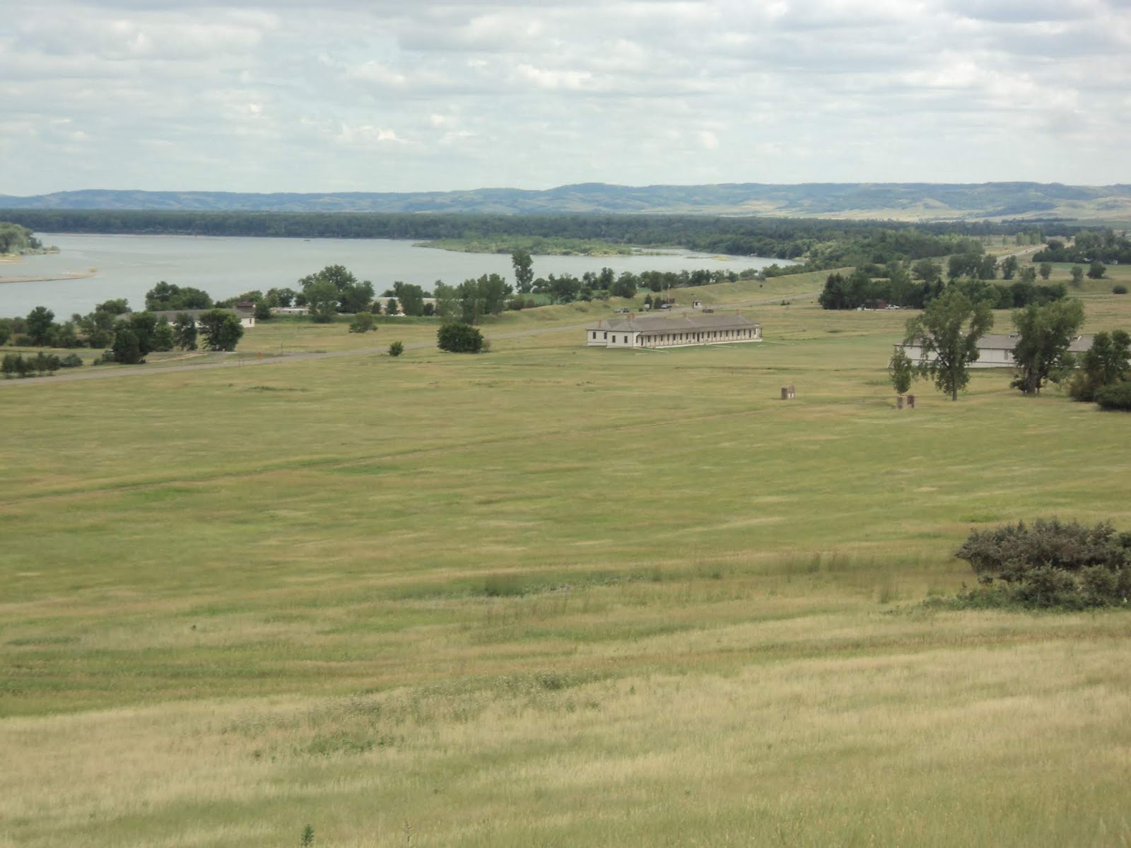 |
| Cavalry post and Missouri River |
Views of the cavalry post and the
Missouri River to the south get better the more you climb; the breeze may
intensify as well. The treadway on this
part of the hike was somewhat narrow and rutted, but the route was easy to
follow on my visit. Numbered carsonite
posts suggest the existence of an interpretive guide though none were available
at the trailhead.
 |
| Climbing toward the infantry post |
At 0.7
miles, you reach a trail intersection near carsonite post #13 where you need to
turn sharply right to remain on the Interpretive Trail; the option going
straight leads to a cemetery and deeper into the trail system. The trail next crosses the steep asphalt road
that gives vehicles access to the infantry post, and soon the infantry post’s reconstructed
blockhouses come into view. Walk up to
the southern-most of the three blockhouses and climb the steep ladder to its
top for a 360-degree view. These
blockhouses were rebuilt by the CCC in 1935, and they provide great views from
the highest point on this hike.
 |
| Approaching the first blockhouse |
After
climbing the first blockhouse, take the concrete sidewalk-like trail to the
northeast that heads to the next blockhouse.
The former sites of some other buildings are signed, and in some cases
remnants of the foundations are visible.
At 1.2 miles, you reach the second blockhouse and the northern end of
the infantry post site. Take the grass/dirt
trail to the right of the blockhouse to continue north, exit the infantry post
site, and re-enter the park’s natural area.
 |
| Site of former infantry post structure |
Now on the
Little Soldier Loop, the sidehill trail descends gradually with the top of the
finger ridge on the right and a ravine falling to the left. Prairie plants dominate the northern part of
the park, and some bright red honeysuckle berries brightened my path on the
seasonally cool July evening that I hiked here.
Mountain bikes also traverse this part of the trail system, so step off
the trail and let them pass if people riding bikes approach.
Just past
1.5 miles, you reach a trail intersection where you need to angle right to
remain on the Little Soldier Loop. Now
approaching the park’s northern boundary, the trail makes a sweeping 180-degree
right turn around the north end of the finger ridge. A nice view of the North Dakota State Capitol
and downtown Bismarck over the Missouri River emerges to the northeast.
 |
| View northeast toward Bismarck |
Now heading
south, a gradual climb precedes a gradual descent as the Heart and Missouri
Rivers appear below you ahead and to the left.
Near 2.5 miles, you enter a grove of cottonwood trees that constitutes
the only wooded portion of this hike.
The asphalt Mandan-Fort Lincoln Bike Trail can be seen downhill to the
left.
 |
| Hiking through the cottonwood grove |
At 2.8
miles, the Little Soldier Loop ends where you reach a stone CCC-built picnic
shelter with a nearby vault toilet and drinking fountain. Angle left to walk out toward the main park
road, then turn right on the asphalt bike path.
Walking along the bike path for 0.3 miles returns you to the Visitor
Center parking lot to complete the hike.
Before you
leave the park, there are at least two other places you should visit. Located behind the Visitor Center, the
On-A-Slant Village recreates a Mandan Indian village that was inhabited on this
site between the late 1500’s and the late 1700’s. The village gives a nice flavor of what life
was like here during the pre-fort days.
Also, while this hike explored the infantry post, the cavalry post is
located near the park entrance; it features Lt. Col. George Custer’s house
among other structures. The park offers
daily tours of both of these historic places, so get the most out of your park
entrance fee by seeing all the historic sites the park has to offer before
leaving.
No comments:
Post a Comment