Friday, May 31, 2013

Clifton Gorge State Nature Preserve (Blog Hike #11)

Trails: John Rich and North Rim Trails
Hike Location: Clifton Gorge State Nature Preserve
Geographic Location: north of CedarvilleOH (39.79499,-83.82842)
Length: 2.6 miles
Difficulty: 5/10 (Moderate)
Dates Hiked: 1997, 2004, August 2016, October 2002
Overview: A moderate hike along and through the beautiful, vertical rock walls of Clifton Gorge.
Photo Highlight:
Hike Video:

Directions to the trailhead: From Cedarville, take SR 72 north to the village of Clifton.  Turn left on Water Street, the first street in the village.  Go two blocks to where Water Street ends at Jackson Street and take a right on Jackson Street.  The gravel parking area for the gorge is less than a block from this intersection on the left.

The hikeClifton Gorge is perhaps the most scenic area in southwestern Ohio.  For 0.5 miles, the Little Miami River bubbles through sheer 40-foot dolomite limestone walls.  At one point, they are less than 6 feet wide.  The narrowest portion of the Little Miami gorge, located just west of Clifton, has been granted state nature preserve status.  The nature preserve gives the land more protection than John Bryan State Park, which is located just downstream.
            This trail takes you along the rim past the narrowest sections of the gorge as well as giving you an up close view of the river in the gorge.  If possible, you should plan a trip to this area on a weekday, as the area gets very crowded, even overflowing, with people on warm-weather weekends.
Trailhead at Village of Clifton
            The trail begins as a gravel path exiting the rear of the parking lot.  This is the John Rich Trail, named for a professor who played a big role in establishing the preserve.  Almost immediately the hiker comes to the first of several overlooks of the gorge.  This one gives you a nice view of a rapid in the river some 40 feet below you amid the dolomite walls.  The trail continues through a thin strip of mixed maple-oak forest with the gorge on your left and some houses on the right. 
            The next overlook, the Patterson Mill Overlook, is worth noting for its location.  The mill that once stood here was wiped out by a flood over 100 years ago, but a square hole in the rock where the pier supporting the mill once stood is visible in the gorge just right of the overlook.
Little Miami River deep in gorge
            The trail crosses a couple of newly constructed wooden bridges before arriving at an overlook of the narrowest portion of the gorge.  Also visible are the Falls of the Little Miami, a large, powerful waterfall located deep in the gorge.  Tradition has it that Cornelius Darnell, an early pioneer in the area during the late 1700's, once jumped across the gorge at this point.  He had been taken prisoner by Shawnee Indians and was being pursued after having escaped from their custody.  When faced with the decision of jumping the gorge or sure death by torture, Darnell chose the first option.  He successfully escaped and proceeded to BoonesboroughKentucky to warn settlers of an impending Indian attack.
            In addition to the oak and maple, some cedars are mixed into the forest here as well as some hemlocks.  The red cedars found here are typical of second-growth forest, but the white cedars found along the cliff side are somewhat rarer.  They were brought to Ohio from their native Canada during the last ice age.  The trail next crosses two streams near noisy SR 343 before coming to Bear's Den, a trail intersection and meeting place for hikers. 
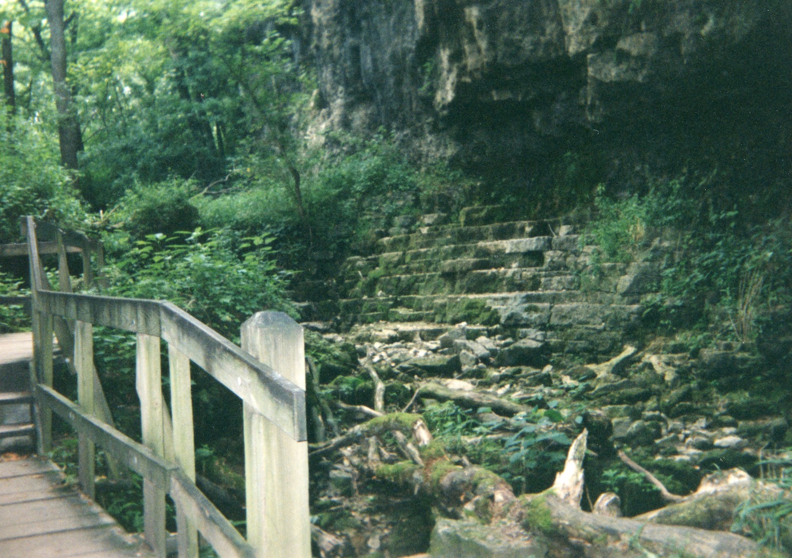
Old quarry site in Clifton Gorge
            Look on the left side of this area for a set of stairs leading into the gorge.  Descend these stairs, a combination of wooden and stone steps, to the north bank of the Little Miami River.  There are only about 25 yards separating the sheer cliff on the right and the river on the left.  The floor of the gorge is littered with talus fallen from the cliff.  One large boulder fell upside-down in the river and is called Steamboat Rock for its appearance.  Just downstream from this is a point where the limestone appears to have been quarried at some point in the past.  The next point of interest is Blue Hole, a wide, calm section of the river that has inspired many artists in its time.
Blue Hole
            The trail continues about 0.4 miles past Blue Hole to arrive at the edge of the preserve.  Trails continue straight into adjacent John Bryan State Park, but our hike turns right to climb out of the gorge using one switchback.  This is the only major climb of the hike.  At the top of the hill, the trail intersects the North Rim Trail, which goes right and left.  Turn right on this trail, which follows the rim of the gorge.
            A few nice views of the river and the opposite hillside are afforded, but they are limited due to the thick canopy of trees growing in the gorge.  Whenever a side trail goes off to the right or left, stay on the gravel trail that continues to follow the rim.  After 0.6 miles, the trail arrives back at Bear's Den.  Continue straight for another 0.5 miles, retracing your steps on the John Rich Trail to your car in the village of Clifton.

No comments:

Post a Comment