Trails: Caddo Forest, Pine Ridge, and Pine Ridge Spur Trails
Hike Location: Caddo Lake State Park
Geographic Location: northeast of Marshall, TX (32.69384, -94.17656)
Length: 1.4 miles
Difficulty: 4/10 (Moderate)
Date Hiked: December 2021
Overview: A loop hike exploring the hollows and ridges above Big Cypress Bayou.
Park Information: https://tpwd.texas.gov/state-parks/caddo-lake
Hike Route Map: https://www.mappedometer.com/?maproute=895775
Photo Highlight:
There are a couple of places from which you could start this hike, but I chose to start from the Caddo Forest Trailhead, which shares a parking lot with the park's canoe/boat launch. From the south end of this parking lot, head into the forest on the signed Caddo Forest Trail and cross several small streams on nice wooden footbridges. Bear right at the first 4 trail intersections, but at the 5th intersection turn left to begin the Pine Ridge Loop. The second sign you will encounter for the Pine Ridge Loop marks this intersection.
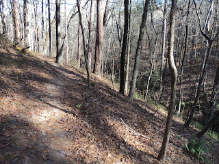
True to its name, the Pine Ridge Loop begins climbing moderately up a ravine that leads to its namesake ridge. This area features more relief than you might expect for east Texas. The nice forest at Caddo Lake State Park is a mix of oaks and sweetgum with some loblolly pines on the ridgetops.
At 0.6 miles, you reach the ridgetop and intersect the park road. The Pine Ridge Loop turns left to stay on the east side of the road, but first walk across the road to browse the historic cabins that date to the 1930's. These CCC-built structures served as barracks and a recreation hall to house and entertain the CCC's workers; they were later converted to park cabins.
Back on the Pine Ridge Loop, the wide trail heads northeast to descend gradually on what appears to be an old farm road. Notice the rusty barbed wire fence on the right, a relic from this land's pre-park days. Where the Pine Ridge Loop turns left, continue straight on the old road to begin hiking the Pine Ridge Spur. Just shy of 1 mile, the trail curves sharply left to leave the old road; a trail sign marks this turn. An old structure of some sort seems to stand just beyond this turn, but the trail leading to it was closed on my visit.
The descent steepens and the Caddo Forest Trail enters from the left just before you reach the CCC Pavilion, a rentable stone shelter that was built by the CCC. Past the pavilion, descending some concrete steps takes you back to the bottomland, and three more wooden footbridges bring you back to the trailhead to complete the hike. Before you leave this small but beautiful park, walk across the parking lot to the boat launch on Big Cypress Bayou, which offers some picnic tables among the bayou's scenic bald cypress trees.
Hike Location: Caddo Lake State Park
Geographic Location: northeast of Marshall, TX (32.69384, -94.17656)
Length: 1.4 miles
Difficulty: 4/10 (Moderate)
Date Hiked: December 2021
Overview: A loop hike exploring the hollows and ridges above Big Cypress Bayou.
Park Information: https://tpwd.texas.gov/state-parks/caddo-lake
Hike Route Map: https://www.mappedometer.com/?maproute=895775
Photo Highlight:
Hike Video:
Directions to the trailhead: From Marshall, take SR 43 north 15.7 miles to FM 2198 and turn right on FM 2198. Drive FM 2198 east 0.4 miles to the signed park entrance on the left. Turn left to enter the park, pay the park entrance fee, and drive the main park road to the canoe launch parking lot at its end, where this hike begins.
The hike: Straddling the Texas/Louisiana state line east of Dallas, Caddo Lake on Big Cypress Bayou is the second largest non-oxbow natural lake in the South. Most geologists believe the lake was formed at least 200 years ago as a consequence of the "Great Raft," a 100-mile long log jam on the Red River. Water backed up from the Red River, the outlet of Cypress Bayou, and flooded an existing low-lying basin. The lake is named for the Caddo people, who lived here for 12,000 years until they were forcibly removed in the 1800's.
Caddo Lake's level fell over 10 feet when the Great Raft was cleared by Henry Shreve in the 1830's, but new logjams continued to form until the Army Corps of Engineers cleared and dredged the river in 1871. Dams constructed in 1914 and 1971 changed the shape of the lake again, and in 1911 the first over-water oil drilling platform was built on Caddo Lake. The well reached down 2185 feet and produced 450 barrels of oil per day.
In 1931, the Texas Legislature dedicated state property along the lake as a public park, thus forming Caddo Lake State Park. The park was developed by the Civilian Conservation Corps (CCC) between 1933 and 1937, and today the 468-acre park features a 46-site developed campground, several historic cabins, fishing and paddling in Cypress Bayou, and 4 hiking trails totaling 1.8 miles. This hike forms the longest possible loop through the trail system that avoids retracing your steps, and it explores the park's bottomland, ridgetops, and historic structures, thus sampling everything the park has to offer.
 |
| Caddo Forest Trailhead |
 |
| Left turn onto Pine Ridge Loop |
 |
| Climbing on Pine Ridge Loop |
 |
| CCC-built "cabins" |
 |
| Hiking an old road |
|
| CCC Pavilion |
 |
| Big Cypress Bayou |
No comments:
Post a Comment