Hike Location: Petersburg National Battlefield
Geographic Location: east side of Petersburg, VA (37.23261, -77.35437)
Length: 3.1 miles
Difficulty: 3/10 (Easy/Moderate)
Date Hiked: May 2018
Overview: A loop hike through the eastern half of a Civil
War siege site.
Battlefield Information: https://www.nps.gov/pete/index.htm
Hike Route Map:
On The Go Map
On The Go Map
Photo Highlight:


Directions to the trailhead: The entrance to
Petersburg National Battlefield is located on SR 36 2.4 miles east of I-95 exit
52 or 3.4 miles west of I-295 exit 9B.
Enter the battlefield, stop at the Visitor Center to pick up a trail
map, and drive the one-way auto tour road to stop #3, where this hike begins.
The hike: Most
Civil War battles lasted a few hours or a few days, but the Siege of Petersburg
started on June 15, 1864 and lasted until April 2, 1865. After several direct assaults from the north failed
to take Richmond, the Confederacy’s capital, Union General Ulysses S. Grant
turned his focus south of Richmond to the industrial center of Petersburg. The objective was to capture the manufacturing
and transportation facilities that were supplying Confederate General Robert E.
Lee’s army, thus forcing him to abandon Richmond and ultimately surrender.
After an
initial assault on Petersburg failed, Grant’s army began the process of
building fortifications and cutting railroad lines. The outnumbered Confederates withstood
another noteworthy assault on July 30, 1864 (see the end of this post), but
months of continuous shelling, skirmishing, and supply deprivation took their
toll. On March 25, 1865, a desperate Confederate
attempt to break the siege failed, and on April 2, 1865 Lee ordered the
evacuation of Petersburg and Richmond.
This evacuation was the beginning of the end of the Confederacy, as
Grant forced Lee’s surrender at Appomattox Court House only 7 days later.
Today important
battle sites are preserved as Petersburg National Battlefield, and the national
battlefield’s largest contiguous area is the eastern front where the majority
of Grant’s men were stationed. Like most
national battlefields, a tour road passes many of the battle’s important sites,
but unlike most national battlefields the eastern front also has an extensive trail
system for hikers, mountain bikers, and horses.
The loop described here features the area east of Harrison Creek, an
important line of defense during the battle, but it can be extended to tour
more of the battlefield if you wish.
 |
| Trailhead, auto tour stop #3 |
Three
trails depart the parking area at stop #3 on the tour road. Because trail markings at Petersburg National
Battlefield are color-coded based on allowed users, all three trails are marked
with red paint blazes, meaning only hikers and mountain bikers are
allowed. (For reference, green blazes
mean hikers only, and yellow blazes mean hikers, mountain bikers, and horses
are allowed.) The trail on the right
will be our return route, and the trail in the middle leads to adjacent Fort
Lee, an active military base. Thus, you
want to take the trail on the far left, which a sign identifies as the Jordan
Point Road.
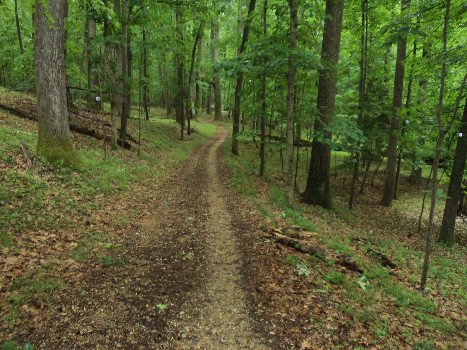
The
two-track gravel trail heads east through some nice forest consisting of tulip
poplar, sweet gum, maple, oak, and beech trees.
Although parts of the national battlefield consist of sunny grassy
areas, most of this hike stays in the shady forest. All of the battlefield’s trails are wide and well-maintained,
making for pleasant hiking even on the trails that allow horses.
 |
| East end of Jordan Point Road |
|
| Follow the yellow blazed trail |
Just past
0.5 miles, you reach the highest elevation of this hike at point I. Turn left to head away from the road and
continue the loop. The trail map calls
this trail the Battery 7 Trail (named for a Confederate gun battery that was
stationed here early in the battle), but no signs on the ground indicate such.
The Battery
7 Trail makes a gradual descent through the northeast corner of the
battlefield. Ignore red-blazed side
trails that exit left and stick with the wider yellow-blazed trail. More traffic noise from SR 36 can be heard to
your right, and a light to moderate rain started to dampen my clothes but not
my spirit at this point in my hike.
 |
| Crossing the tour road |
After crossing a small creek on a
nice wooden footbridge, you cross the asphalt tour road at 1.2 miles. Next comes the steepest part of the hike, a
winding descent into the ravine that contains Harrison Creek. Early in the battle, Harrison Creek separated
the Union soldiers to the east and the Confederate soldiers to the west before
the Union made small westward advances.
Also, the Confederate’s desperate attempt to break the siege on March
25, 1865 stalled at Harrison Creek. As
you walk along this creek, think of the soldiers who fought here many years ago
and what they were fighting for.
The trail parallels Harrison Creek
with a steep hillside rising to your left.
At 1.7 miles, you reach the lowest elevation on this hike (40 feet above
sea level) and point M, a trail intersection where both options are marked with
yellow blazes. If you wanted to extend
your hike and explore the western half of the eastern front, you could turn
right here and cross Harrison Creek.
This hike angles left to continue following the creek’s east bank.
 |
| Hiking near Harrison Creek |
The next 0.3 miles stay very close
to Harrison Creek and pass several battlefield interpretive signs that are
worth stopping to read. At 1.9 miles,
you cross the asphalt tour road for the second and final time. Soon thereafter the trail curves left and begins
a winding gradual climb away from the creek.
At 2.2 miles, you reach point Q and
another decision. The shortest route
back to the trailhead would be to turn left on the red-blazed Water Line Trail,
but as its name suggests this trail is dead straight and not very scenic. Thus, I recommend angling right at point Q
and then turning left at nearby point R to remain on the Harrison Creek Trail
for as long as possible.
The Harrison Creek Trail stays on
the high ground as it curves sharply left to begin an eastward course. 2.8 miles into the hike, you reach point B,
where you need to turn left. Another 0.3
miles of flat walking on wide trail returns you to the trailhead to complete
the hike.
 |
| The Crater |
 |
| Tunnel dug by Pennsylvania coal miners |
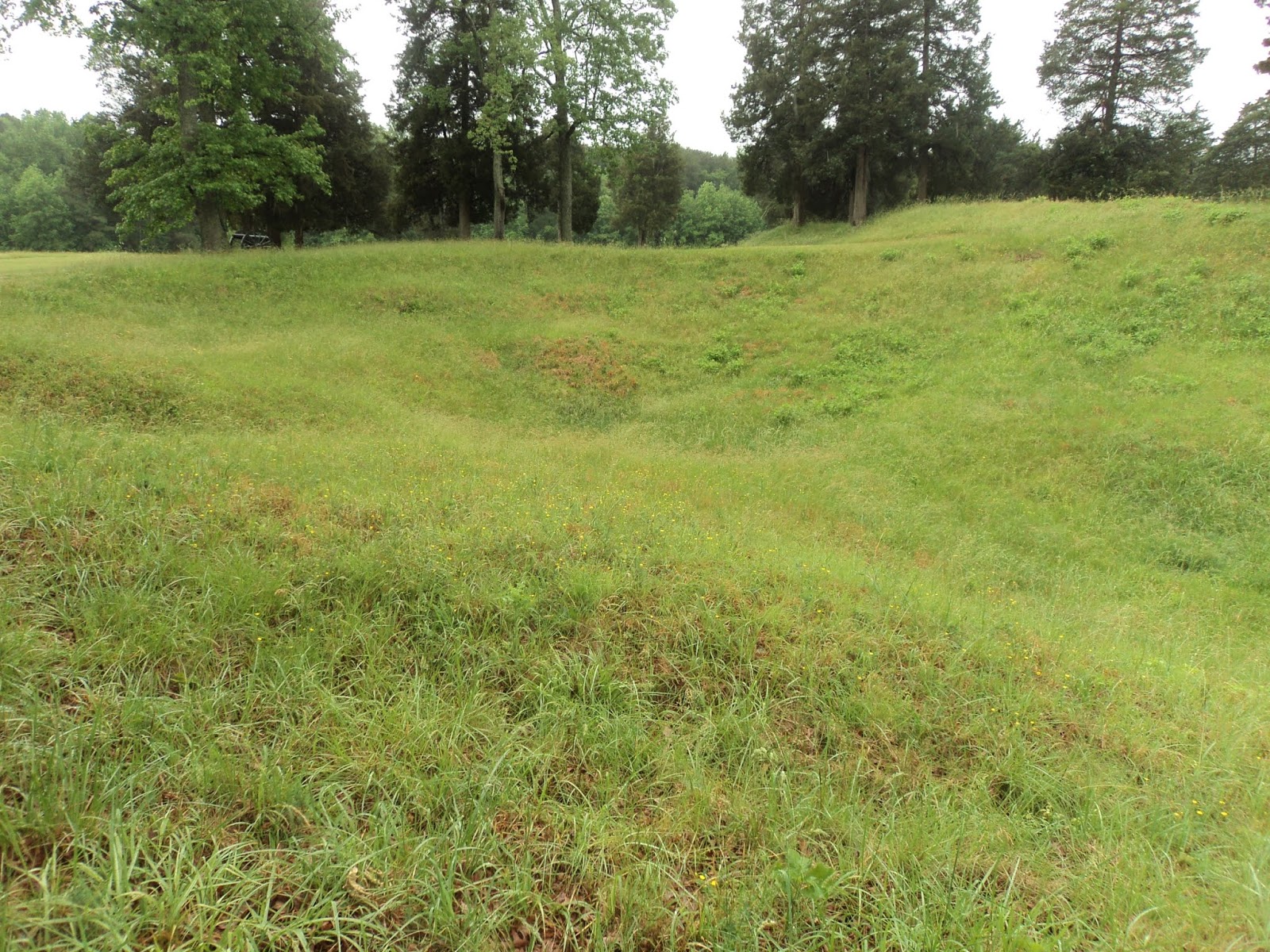
As you drive the rest of the
one-way auto tour road to exit the national battlefield, there is at least one other
tour road stop that merits your time and attention. Tour road stop #8 features an interesting
site called the Crater, a Union attempt to blast its way into Elliott’s
Salient, a Confederate stronghold. A 0.4
mile paved interpretive trail tells the story of some Pennsylvania coal miners
who dug a tunnel under the salient and packed the tunnel with gunpowder. Although the gunpowder was successfully
detonated on July 30, 1864, the result was a crater that proved just as
effective at stopping the Union advance as did the original earthwork. This site makes a nice way to wrap up your
day of hiking and historical meditation at Petersburg National Battlefield.
No comments:
Post a Comment