Sunday, June 4, 2023

Sequoyah Bay State Park: Spirit Trail (Blog Hike #944)

Trail: Spirit Trail
Hike Location: Sequoyah Bay State Park
Geographic Location: southeast of Wagoner, OK (35.88576, -95.27791)
Length: 1.4 miles
Difficulty: 1/10 (Easy)
Date Hiked: April 2023
Overview: A lollipop loop through lakeside forest.
Park Information: https://www.travelok.com/state-parks/sequoyah-bay-state-park
Hike Route Map:
On The Go Map
Photo Highlight:
Short Video:

Directions to the trailhead: From the intersection of SR 51 and SR 16 on the east side of Wagoner, take SR 16 south 4.3 miles to E 100 Street N and turn left on E 100 Street N.  Drive E 100 Street N east 4.7 miles to the entrance for Sequoyah Bay State Park.  The gravel parking lot for the Spirit Trail is on the right just before you reach the Five Nations Monument at the main park entrance.

The hike: Often overlooked in favor of its better-amenitied cousin Sequoyah State Park across the lake, Sequoyah Bay State Park protects 303 acres on the west shore of Fort Gibson Lake.  The park offers swimming, fishing, and boating on Fort Gibson Lake and several campgrounds with 367 sites total.  Some picnic areas and athletic fields round out the amenities.
Five Nations Monument
    
        Perhaps the park's most famous site is the Five Nations Monument, which stands near the park entrance and within sight of this trailhead.  The monument displays the flags of five nations: Cherokee, Chickasaw, Choctaw, Creek, and Shawnee, all of which have lands in Oklahoma.  The park has only 1 short hiking trail, the Spirit Trail described here.  As its name suggests, this trail also has connections to the five nations, and its best feature is the numerous interpretive signs that describe the human and natural history this land possesses.
Trailhead for Spirit Trail
    
        The trailhead is marked with a large white sign that contains a trail map and some background information about this trail.  The grass/dirt trail heads south into the woods, which is the usual cross timbers mix of 
oak, hickory, and red cedar with a dense understory.  Where the trail splits to form its loop, I continued straight and used the trail going right as my return route, thus hiking the loop clockwise.
Entering the prairie
    
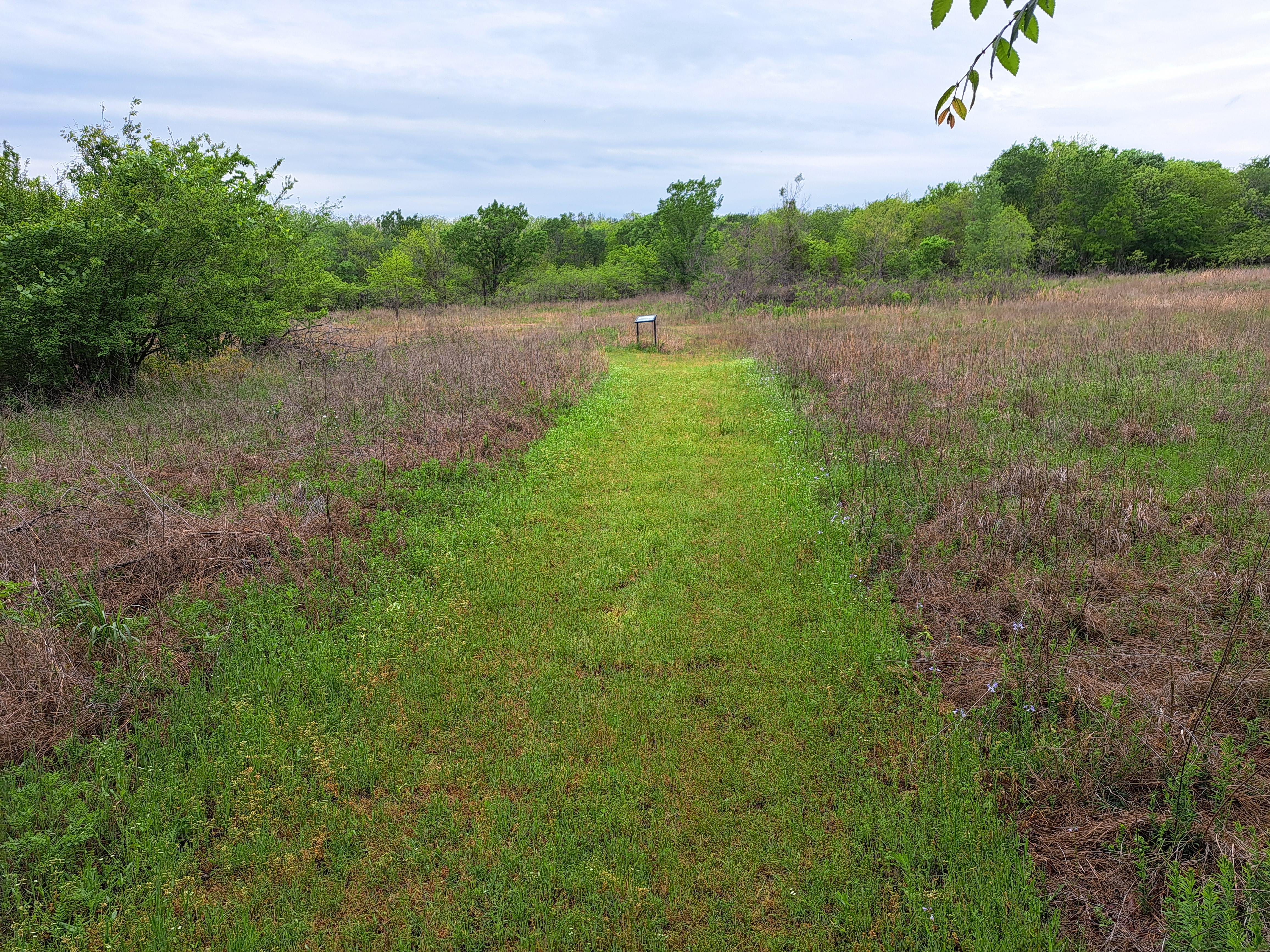
        Quickly the trail curves right and enters a prairie area.  Interpretive signs describe common plants in the grassy prairie, and I saw several deer, which tend to frequent transition areas between prairie and forest.  Next the trail enters a lowland forest and crosses a couple of streams on wooden bridges.  This part of the trail was rather muddy on my visit, and the grass on the trail was somewhat long here.  I managed to complete the loop in spite of the trail conditions, but I was sure to check myself for ticks after I finished.
Hiking through the forest
    
        Just past 0.8 miles, a spur trail continues straight to quickly reach the road you drove in on.  Turn right to continue the loop and cross a bridge made out of several logs.  The final leg of trail heads southeast through more cross timbers forest and past another small prairie opening.  After closing the loop, turn left to return to the parking lot and complete the hike.

Friday, June 2, 2023

Lake Eufaula State Park: Chinkapin Trail (Blog Hike #943)

Trails: Savanna Loop and Chinkapin Trails
Hike Location: Lake Eufaula State Park
Geographic Location: southwest of Checotah, OK (35.40005, -95.60532)
Length: 3 miles
Difficulty: 3/10 (Easy/Moderate)
Date Hiked: April 2023
Overview: A fairly flat hike to a picnic area and views of Lake Eufaula.
Park Information: https://www.travelok.com/state-parks/lake-eufaula-state-park
Hike Route Map:
On The Go Map
Photo Highlight:
Hike Video:

Directions to the trailhead: In eastern Oklahoma, take I-40 to SR 150 (exit 259).  Exit and go south on SR 150.  Drive SR 150 south 5.4 miles to the state park Visitor Center on the left.  Park in the lot beside the Visitor Center.

The hike: Formerly known as Fountainhead State Park, Lake Eufaula State Park sits on a wide peninsula that juts south into its namesake lake.  The dam that creates the lake was built by the Army Corps of Engineers (COE) in 1964 for the purposes of flood control and hydroelectric power generation.  Eufaula Dam holds back water from the Canadian River, and Lake Eufaula is the largest lake by water volume in Oklahoma.
            Lake Eufaula State Park offers some fantastic amenities that include swimming and boat ramps on the lake, a disc golf course and a ball golf course, 3 yurts, 2 developed campgrounds with nearly 150 sites total, some picnic shelters, and several hiking trails.  The hike described here takes you through some nice cross timbers forest to a picnic area and good lake views.  To be honest, I was not very excited about coming here when I left my lodging, but I ended up having a nice hike at a nice park.
Trailhead near park office
    
        From the park office, walk across SR 150 to find the trailhead, which is marked by a small information kiosk.  This trailhead serves both the Chinkapin Trail and the Savanna Loop with the former being an extension of the latter.  The wide dirt/grass trail heads into the woods, which is the usual cross timbers mix of oak, hickory, and red cedar with a dense understory.
Passing a savannah
    
        At 0.2 miles, the trail splits to form the Savanna Loop.  I chose to continue straight and use the trail going left as my return route, thus hiking the loop counterclockwise.  The land remains remarkably flat, and soon you pass a few sunny grassy pockets in the forest that could be called savannahs.  A few old yellow trail markers are in rough shape, but the trail was wide and easy to follow when I came here.
            Next you dip slightly to enter a lowland forest.  Mud could be a problem here if it has rained recently, but I had no mud problems on my visit.  At 0.6 miles, you reach a signed trail intersection where the Chinkapin Trail exits right.  We will continue the Savanna Loop later, but for now turn right to begin the Chinkapin Trail.
Hiking the Chinkapin Trail
    
        Named for the chinquapin oak trees that are numerous in this forest, the Chinkapin Trail is another wide dirt/grass trail that undulates gently through lowland forest.  Near 0.8 miles, you pass a small pond on the left.  Several iron bridges with wooden decks are crossed, and they saved me from getting my feet wet several times.
Crossing a trail bridge
    
        At 1.6 miles, you intersect what appears to be an old road: an eroded, graded strip that runs through a steep trough perpendicular to your current route.  Though no trail markers indicate such, you want to turn left and begin hiking uphill on the old road.  This point is the only place on the entire hike where I found route-finding a bit challenging.
Intersecting the old road
    
        1.7 miles into the hike, you reach a major intersection with a newer two-track dirt road going left and right and the old road you have been hiking continuing straight.  We will go all 3 directions eventually, but first turn right to hike down to the best lake view, which is reached at 1.8 miles.  Lake levels were fairly low when I came here, leaving a wide exposed rocky shore.  The wind buffeted me as I looked across the lake, and I saw several birds here including a blue heron.
Lake Eufaula
    
        Next retrace your steps to the major intersection and continue straight (left from the way you originally came in) to quickly arrive at a campground and picnic area.  Some interesting round concrete picnic tables sit here, and this area makes a nice place to rest and have a snack near the midpoint of this hike.  Finally, continue down the old road you hiked in on to reach the yurts and amphitheater in the park's Longhorn Area.  A sign warns you that the trail is not maintained beyond this point, and although you can see the lake ahead, that lake view is inferior to the one you got earlier.
Longhorn Area
    
        After exploring the Longhorn Area, retrace your steps to the Savanna Loop.  Turn right to continue the Savanna Loop.  Passing a couple more savannahs brings you to the close of the Savanna Loop.  Turn right to retrace your steps to the park office and complete the hike.  While you are here, the park has an excellent disc golf course, and the Hummingbird Beach Trail 
starting near the park's Nature Center offers an interesting hike through forest and prairie.