Trails: Byrd Lake, Pioneer Short Loop, Cumberland Plateau, and Byrd Creek Trails
Hike Location: Cumberland Mountain State Park
Geographic Location: south of Crossville, TN (35.90051, -84.99724)
Length: 4.9 miles
Difficulty: 4/10 (Easy/Moderate)
Date Hiked: September 2021
Overview: A fairly flat loop along Byrd Lake and Byrd Creek.
Park Information:
https://tnstateparks.com/parks/cumberland-mountain
Hike Route Map:
On The Go MapPhoto Highlight:
Directions to the trailhead: West of Knoxville, take I-40 to SR 101 (exit 322). Exit and go south on SR 101. Where SR 101 turns right at US 70, continue straight on SR 392. Drive a total of 2.8 miles from I-40 to US 127 and turn left on US 127. Drive US 127 south 3.3 miles to SR 419 and turn right on SR 419, which is also the main park road. Take SR 419 west 0.2 miles to the park office on the right, and park in the small parking lot near the park office.
The hike: Consisting of 1720 acres on the Cumberland Plateau west of Knoxville, Cumberland Mountain State Park has its roots in the Great Depression. The park was originally built as a recreation area for residents of the Cumberland Homesteads Project, a federal initiative established in 1934 to relocate impoverished subsistence farmers to a planned community south of Crossville. The remnants of these homesteads are located at the intersection of US 127 and SR 68 just north of the park, and the homesteads are listed on the National Register of Historic Places.
Although the planned community failed, the park survived, and in 1938 the park was transferred to the State of Tennessee to form Cumberland Mountain State Park. The park is centered around Byrd Lake, a man-made lake on Byrd Creek that also dates to the 1930's. The park offers almost every recreation opportunity imaginable including a 140-site developed campground, 11 historic Civilian Conservation Corps-era cabins, the Homestead Harvest Restaurant, a golf course, and fishing and paddling on Byrd Lake.
For hikers, the park offers nearly 14 miles of trails that explore areas along Byrd Creek and the surrounding ridges. When I came here on a weekend morning in mid-September, my goal was to minimize my elevation gain while maximizing my distance. Thus, this hike features creekside habitats as it forms a long skinny loop along Byrd Lake and Byrd Creek.
 |
| Trailhead at park office |
From the park office, head south on the Byrd Lake Trail, an asphalt ADA-accessible trail that crosses SR 419 and winds down to the lake. The wide asphalt trail heads south along the east shore of long but narrow Byrd Lake, although some trees between you and the lake preclude any clear lake views. Some benches provide opportunities to stop and enjoy the lakeside setting.
 |
| Boat rental area across Byrd Lake |
After crossing a couple of lake tributaries on nice iron bridges, you reach a trail intersection where the asphalt ends at 0.5 miles. A wooden bridge leads to the boat rental area on the other side of the lake, and we will be over there in just under an hour. To continue this hike, pick up the dirt Pioneer Short Loop Trail as it continues south along the east shore of Byrd Lake; the wooden steps going uphill to the left lead to the park's swimming pool and recreation lodge.
 |
| Hiking along Byrd Lake |
Marked with white paint blazes and shield-shaped trail markers, the Pioneer Short Loop follows a rooty course through dense rhododendron that stays close to the lake. Some gaps in the trees allow nice views across placid Byrd Lake, and you pass a couple of small waterfalls in the lake's tributaries. As you get upstream from the lake, some low cliffs appear to the left of the trail.
 |
| Cliffs along Pioneer Short Loop |
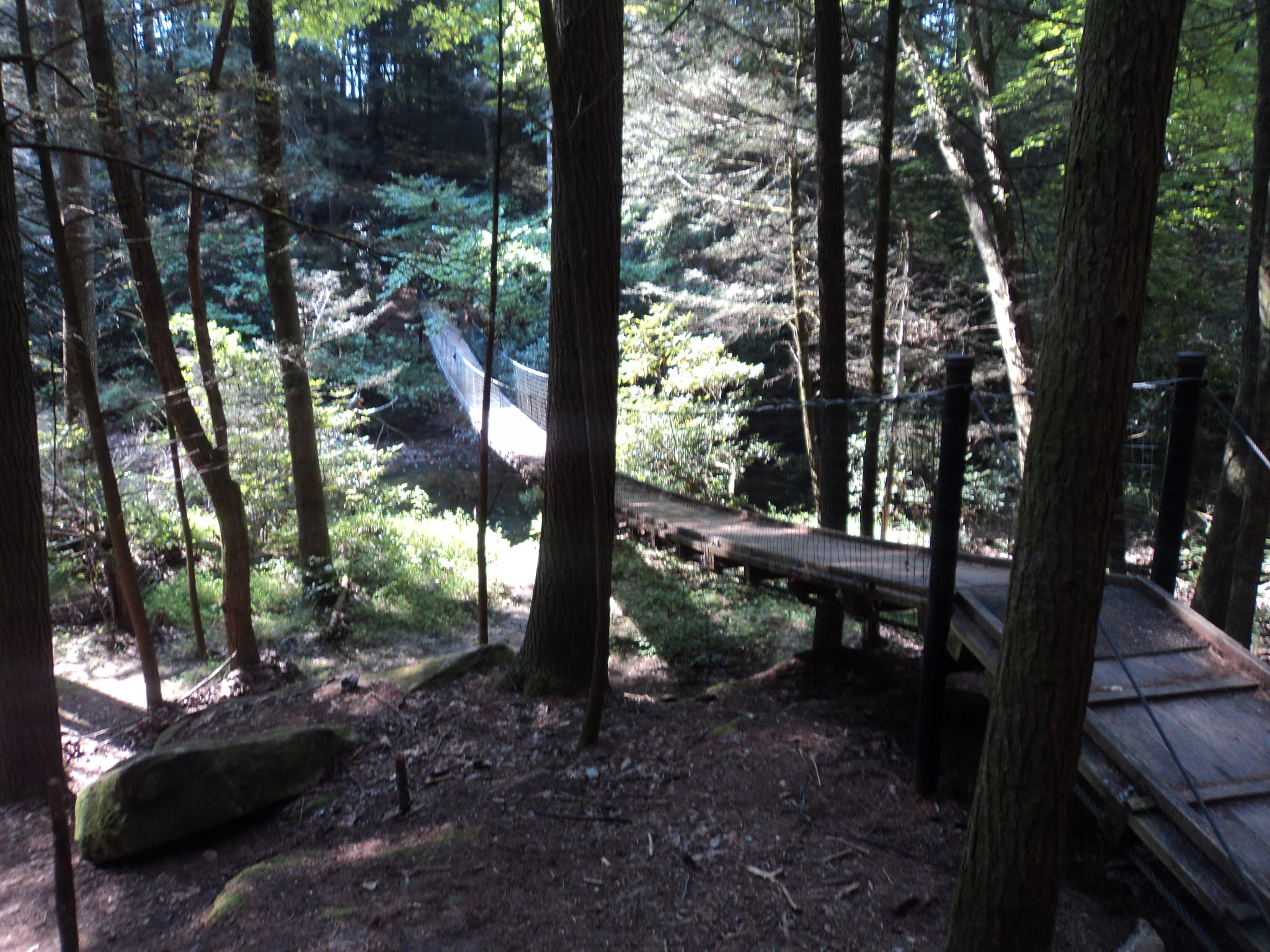
At 1.4 miles, you reach a trail intersection at a kiosk with a trail map. The Pioneer Short and Long Loops part ways here, and I angled right to stay on the Short Loop and avoid some steeper areas further upstream. The trail descends some wooden steps and crosses Byrd Creek on one of the swinging bridges for which Tennessee State Parks are famous.
 |
| Swinging bridge over Byrd Creek |
Now on the west side of Byrd Creek, the Pioneer Long Loop enters from the left as the trail curves right to head downstream back toward Byrd Lake. After hiking some narrow trail through dense mountain laurel, you reach a rock outcrop that offers a nice view over Byrd Lake at 1.9 miles into the hike. This outcrop would be a nice place to stop and take a break, but there is no nice place to sit here.
 |
| View of Byrd Lake from rock outcrop |
Continuing downstream, the trail passes the park's cabin area to the left before reaching the boat rental area at 2.3 miles. Some benches here make for nice places to sit and rest near the midpoint of this hike. Next comes a short walk through the park's developed area. Start by turning left and crossing the park road's bridge over a creek, but then turn right to walk behind the park's restaurant on a stone paver path. This path leads to the park's signature view of the multi-arched SR 419 bridge over Byrd Lake dam, a view I shared with a large flock of Canada geese. |
| Multi-arched SR 419 bridge |
Upon reaching the park exit at SR 419, cross SR 419 to find the signed trailhead for the Cumberland Plateau Nature Trail, which heads into the woods. Where the trail splits, turn left to hike the higher west arm of the nature trail's loop and thus avoid the steeper east arm. Some old wooden posts with metal numbers indicate the presence of an interpretive guide for this trail, but none were available at the trailhead when I hiked here.
 |
| Hiking the Cumberland Plateau Nature Trail |
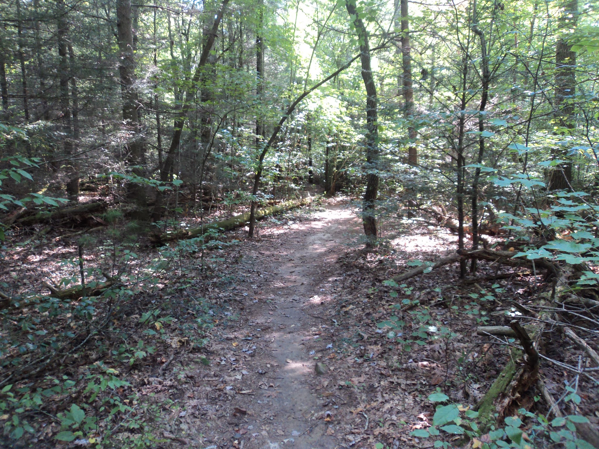
After meandering and descending gradually to reach the bank of Byrd Creek, you reach another trail intersection at a kiosk with a trail map. The Cumberland Plateau Nature Trail continues to the right, but this hike turns left to head further downstream on the Byrd Creek Trail. Marked with yellow shield-shaped plastic markers, the Byrd Creek Trail stays close to its namesake creek on the right for the next 0.5 miles. Although a few muddy areas need to be negotiated, overall the terrain is flat and the hiking pleasant.
 |
| Interesting footbridge |
You cross an interesting wooden hobbit-like footbridge just before reaching a trail intersection at 3.5 miles. The blue-blazed Overnight Trail, a backpacking trail, continues straight here, but this hike stays on the Byrd Creek Trail as it turns right. In only a few hundred feet, you pass the other end of the Overnight Trail and come out at an old paved road. Turn right on the paved road, cross Byrd Creek on the old road's bridge, and then turn right again to leave the pavement and reenter the woods. |
| Byrd Creek |
The balance of the hike heads south along the east bank of Byrd Creek. Traffic noise from US 127 can be heard at first, but soon the noise fades behind you, leaving just you and the creek. After the campground comes in sight on the left, you enter a brushy area where the trail climbs away from the creek. The trail exits the woods at the campground's dump station, which is only a couple hundred feet from the park office and your car.


No comments:
Post a Comment