Hike Location: Robert O. Cook Memorial Arboretum
Geographic Location: northwest side of Janesville, WI (42.71520, -89.05369)
Length: 3.5 miles
Difficulty: 5/10 (Moderate)
Date Hiked: May 2019
Overview: A lollipop loop with a mixture of creekside and
ridgetop hiking passing an historic log cabin.
Trail Information: https://www.iceagetrail.org/
Hike Route Map:
On The Go Map
On The Go Map
Photo Highlight:


Directions to the trailhead: Near Janesville, take I-90
to US 14 (exit 171B). Exit and go west
on US 14. Drive US 14 west 4.5 miles to
Washington Street. Turn left on
Washington St. and drive south 1.3 miles to the signed trailhead parking for
the Ice Age Trail on the left. This gravel
parking lot is reached just after passing under a railroad bridge.
The hike: Winding
for nearly 1200 miles around central and southern Wisconsin, the Ice Age Trail
is one of the nation’s premier long-distance backpacking trails. The trail is the brainchild of Milwaukee
attorney and conservationist Ray Zillmer, and its route roughly traces the furthest
advance of glaciers during the most recent ice age, hence the trail’s
name. With 600 miles of trail
constructed, the Ice Age Trail is about half complete, and work continues to
reroute the remaining segments off of roads and onto dedicated trails.
Like most long-distance backpacking
trails, the Ice Age Trail is divided into segments. The Ice Age Trail’s Arbor Ridge Segment is
featured here. The relatively gentle
Arbor Ridge Segment passes through the Robert O. Cook Memorial Arboretum, which
is owned by the City of Janesville and maintained by the Janesville Public
School District. By using some of the
arboretum’s trails, you can form a lollipop loop that gives a taste of Ice Age
Trail hiking without forcing you to retrace your steps for the entire distance. Such is the route described here.
 |
| Ice Age Trail trailhead |
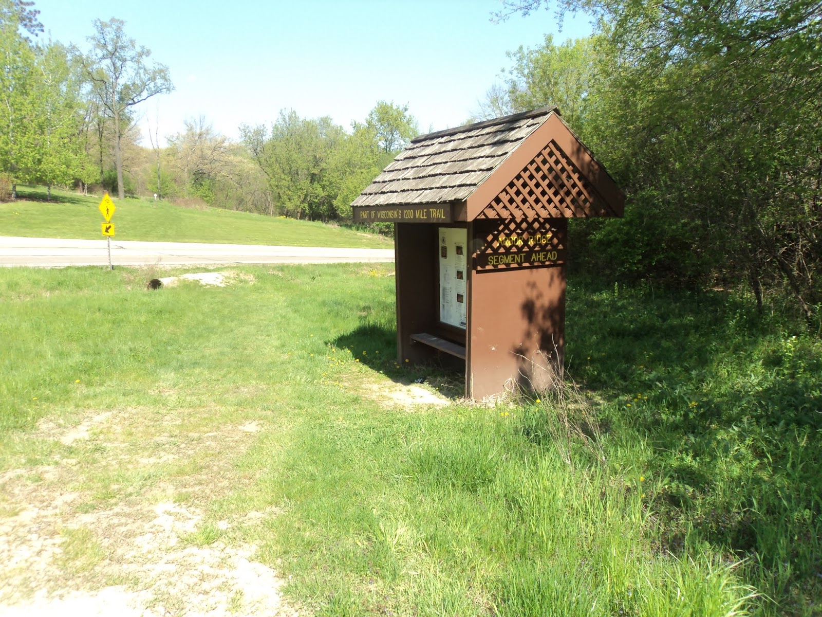
The Ice Age Trail’s trailhead on
Washington St. serves both the Arbor Ridge Segment to the west and the Devil’s
Staircase Segment to the east. The
Devil’s Staircase Segment quickly leads to its namesake rock formation along
the Rock River, and it is worth exploring if you have more time than I
did. To find the Arbor Ridge Segment,
walk northwest across Washington St. to find the wooden post bearing the
official Ice Age Trail shield that marks the start of the segment.
 |
| Start of the Arbor Ridge Segment |
The mowed grass trail heads
northwest with Northridge Drive on the left and a railroad track on the
right. After briefly following the
shoulder of Northridge Drive, the trail curves right to head into a narrow
strip of woods. The Ice Age Trail is
marked with yellow rectangular paint blazes, and this segment of the trail is
very well-marked and well-maintained. My
thanks go to the Ice Age Trail Alliance for building and maintaining such a
high-quality track.
Soon the trail surface changes from
mowed grass to single-track dirt, and the railroad track is replaced by a
pleasant flowing stream called Marsh Creek that features some nice but small
cascades. After some gentle undulations,
at 0.8 miles you enter the arboretum and approach a meadow. This meadow contains the trail intersection
that forms the loop portion of this hike.
The signed East Boundary Trail going left will be our return route. This hike continues straight to remain on the
Ice Age Trail, thus hiking the loop counterclockwise.
 |
| Marsh Creek |
On the other side of the meadow, you
reach a nice area with benches overlooking a scenic ripple in Marsh Creek. Next the trail curves left and heads away
from the creek by climbing up a wide ravine on a gradual to moderate grade. Overall, the trail gains just over 150 vertical
feet in 0.4 miles. Metal and wood
interpretive signs point out common plants in the forest, which include
cottonwood and oak trees. The trees were
just starting to put out leaves on my visit in mid-May, and some redbuds in
bloom brightened my path.
 |
| Hiking the Ice Age Trail |
Several trails go up this ravine,
but you can simplify your route-finding task by just following the Ice Age
Trail’s yellow blazes. As you approach
the top of the hill, the arboretum’s amphitheater comes into view through the
trees on the right, and the trail passes through an outdoor classroom designed
for use by elementary school students.
Some blue aluminum circles nailed to trees mark a short loop that you
could add-on if you wanted to extend your hike by a few tenths of a mile.
Just shy of 2 miles, you intersect an asphalt trail as you approach the
north end of the arboretum. We will
eventually turn left here, but first look to the right to see a piece of Wisconsin
history: the Hornby Log Cabin. Built in
the 1850’s by James Hornby, the cabin was purchased by the Janesville Public
School District and moved from its original site in Liberty Pole, WI (a small
town in southwest Wisconsin northeast of Prairie du Chien) to here in
2001. The cabin represents a typical
Wisconsin homestead during the period, and some interpretive signs give
information about the cabin’s history and the people who built it.
|
| Hornby Log Cabin |
The asphalt trail continuing west past the cabin leads to the arboretum
parking lot and the end of the Ice Age Trail’s Arbor Ridge Segment. To continue our loop, leave the Ice Age Trail
by heading east on the asphalt trail.
Less than 500 feet later, the asphalt trail ends at a gated intersection
with Arbor Ridge Way, a residential street.
Turn left and walk downhill a few hundred feet on Arbor Ridge Way to
find the start of the East Boundary Trail, which is marked by a sign and
another brown metal gate.
 |
| Start of the East Boundary Trail |
For its entire 0.7 mile distance the East Boundary Trail follows under
a power line as it heads north in a straight line. Thus, the East Boundary Trail does not make
for the most scenic hiking. On the
bright side, this route reduces the retracing of steps, some nice views to the
north appear down the power line clearing, and I saw many songbirds including
goldfinches in the prairie under the power lines.
 |
| Looking down the East Boundary Trail |
After a steep descent, you close the loop at 2.8 miles. Turn right and retrace your steps along the
Ice Age Trail 0.8 miles to the Washington St. trailhead to complete the
hike. If you have some more time, check
out the Devil’s Staircase Segment of the Ice Age Trail, which starts from this
same trailhead but goes the opposite direction from this hike.
No comments:
Post a Comment