Trail: Black Canyon Trail
Hike Location: Santa Fe
National Forest Black
Canyon
Geographic Location: east of Santa Fe , NM (35.72806, -105.83930)
Length: 2.1 miles
Difficulty: 5/10 (Moderate)
Date Hiked: July 2014
Overview: A lollipop loop through the upper reaches of Black
Canyon
Trail Information: http://www.fs.usda.gov/recarea/santafe/recreation/hiking/recarea/?recid=75606&actid=50
Directions to the trailhead: On the northeast side of
Santa Fe , take Paseo de Peralta to Bishops
Lodge Road .
Turn north (outbound) on Bishops Lodge Rd. Drive Bishops Lodge
Rd. 0.2 miles to Artist
Road and turn right on Artist
Rd. Artist
Rd. becomes SR 475 and Hyde Park Road
as you leave Santa Fe . Drive SR 475 a total of 6.9 miles to the
Black Canyon Campground entrance on the right.
Turn right to enter the campground, then immediately turn left to park
in the signed hiker (as opposed to camper) parking area. Vault toilets are available at this parking
area.
The hike: What a difference 1000 feet makes. At 7260 feet, Santa Fe ,
NM Santa
Fe National Forest
Many people
seem to have discovered the pleasures of Black Canyon Campground, as every
campsite was either occupied or reserved on the Monday morning I came
here. Fortunately, you do not need to
reserve a campsite to hike this trail, so anyone can schedule a daytime visit
to this slice of mountain paradise. If
you are here only to hike, make sure you park in the signed hiker parking area
so that you do not block any campsites.
Before
starting the hike, I should clarify one thing about the trail length. The difference in trail length between what I
have posted here and the official 1.5 miles listed by the forest service is due
to a difference in starting point. The
forest service starts at the Black Canyon Trail trailhead, which is located at
the rear of the campground. I started
this hike at the hiker parking area, which is located at the front of the
campground.
 |
| Black Canyon Trail trailhead (at rear of campground) |
As the
previous paragraph implies, this hike starts with a walk through the
campground. Follow the paved campground
road uphill, gaining about 100 feet of elevation between the parking area and
the trailhead. Where the road forks to
form the campground loop, you can go either way. The signed trailhead is located at the very
rear of the campground between campsite #24 and a vault toilet.
The Black
Canyon Trail proper heads up the canyon with steep but not vertical canyon
walls on either side. At first the grade
is gradual, but it becomes more moderate as you climb. This section of trail appears to follow an
old dirt road.
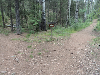
 |
| Trail forks to form loop |
 |
| Climbing along the canyon wall |
After
climbing a pair of switchbacks, you reach the trail’s highest point as you
reintersect the old road near 1 mile into the hike. Turn slightly right to continue the loop. Note that turning left here would take you
over the hill and into the watershed that supplies Santa
Fe ’s drinking water, an area strictly forbidden to hikers.
As the old
saying goes, it’s all downhill from here.
The trail descends moderately using a single broad switchback. A few partially obstructed views can be had
through the pine trees, but you will need to visit adjacent Hyde Memorial State Park
if you want any real vistas.
 |
| Hiking through an aspen grove |
As you reenter the main stem of the
canyon, the pine trees briefly give way to aspen trees. The slightly higher water tables in the main
canyon allow aspen trees to grow down here.
This section of trail would be fantastic when aspen leaves are changing
color in the fall. At 1.5 miles, you
close the loop. 0.6 miles of easy
downhill hiking remain to complete the hike.
No comments:
Post a Comment