Saturday, April 26, 2025

Enchanted Rock State Natural Area: Summit Trail (Blog Hike #1053)

Trail: Summit Trail
Hike Location: Enchanted Rock State Natural Area
Geographic Location: north of Fredericksburg, TX (30.49772, -98.82019)
Length: 1.5 miles
Difficulty: 9/10 (Difficult)
Date Hiked: February 2025
Overview: A steep out-and-back, mostly over bare granite, to the top of Enchanted Rock.
Park Information: https://tpwd.texas.gov/state-parks/enchanted-rock
Hike Route Map: https://www.mappedometer.com/?maproute=980298
Photo Highlight:
Hike Video: (coming December 26)

Directions to the trailhead: From Fredericksburg, take RM 965 north 16.8 miles to the signed park entrance on the left.  Turn left to enter the park, pay the entrance fee, and park in any of the parking lots near the main trailhead.

The hike: Just as Colorado has Pikes Peak, Yosemite has Half Dome, and Georgia has Stone Mountain, no landform screams Texas like Enchanted Rock.  The bare granite dome's location nearly 20 miles from the closest town typifies the wide open rural landscape that much of Texas is known for.  Yet in spite of its remote location, Enchanted Rock State Natural Area annually ranks as one of the most popular state parks in Texas.  Of the 11 state parks I visited on my February 2025 hiking trip to Texas Hill Country, Enchanted Rock is the only one that required me to buy a timed entrance permit.
            The park's reputation is well-earned: a steep but manageable climb up bare granite rock leads to spectacular 360-degree views as far as the eye can see.  The park was established in 1978 when the State of Texas bought 1640 acres from Charles Moss via The Nature Conservancy, and today Enchanted Rock is a National Natural Landmark.  True to the land's designation as a state natural area rather than a state park, the site has limited amenities that include only a 35-site primitive campground and a few picnic tables.
              What Enchanted Rock State Natural Area lacks in amenities it makes up for in trails: 8 trails totaling over 11 miles.  The park offers several noteworthy hikes, but the park's signature hike is the Summit Trail described here; it is the only trail that leads to the top of Enchanted Rock.  Though only 0.75 miles one-way, the Summit Trail involves climbing over steep bare rock, and you should allow at least 2 hours to hike the trail and take in the view from the top.  This hike will be a hot and sunny one during the warmer months, so dress and hydrate accordingly.
Trailhead for Summit Trail
    
        From the restroom building and picnic shelter at the rear of the parking lot, pick up the signed Summit Trail, which begins as a wide dirt track.  The Summit Trail descends some steps to dip through a wash that is dry much of the year before beginning its climb of Enchanted Rock.  The scenery is very desert in nature with a few cedar/juniper trees and some prickly pear cactus, but the surroundings feature more rocks than plants throughout this hike.
Dirt/rock trail below the bare granite
    
        After climbing some stone steps through a rocky area, you reach the smooth bare granite at 0.4 miles.  The Echo Canyon Trail exits left to cut across the corner of the bare rock, but our hike heads straight up the bare rock, as indicated by a wooden sign.  The first 20 feet on the rock are the steepest of the climb; step slowly and make sure 1 step is solid before taking the next one.  The park closes this trail after rain because wetness makes the rock too slippery for safe hiking, and shoes with good traction are necessary at all times.
Entering the bare granite
Low cliff ahead
    
        There are no blazes or trail markings on the rock, so you have to get to the summit using whatever route seems most feasible; just keep heading up.  
Looking ahead after the first steep section, you can see a low cliff that you will have to get around.  You could go around the cliff on either side, but switchbacking around the left side is slightly less steep and direct.  Thus, I chose the left option.
US Coast and Geodetics Survey marker
    
        After climbing another steep section above the cliff, the grade moderates, indicating that the summit is near.  Just shy of 0.75 miles, you reach the US Coast and Geodetics Survey metal disc marker that marks Enchanted Rock's summit.  The summit is surprisingly flat given how hard you worked to get here, and it provides 360-degree views across the heart of Texas Hill Country.  Lower bald granite domes dominate the foreground, including Little Rock to the west and Freshman Mountain to the east.  Larger mountains stand in the distance.  Some vernal pools dot the summit area, and the park brochure warns you not to disturb those fragile habitats.  These are some of the best views in Texas, so take some time and enjoy them.
View west from summit
View north from summit
    
        There is only 1 trail to Enchanted Rock's summit, so the only way down is the way you came up.  Do not underestimate the descent: the vast majority of hiking accidents occur when the hiker is going downhill.  Also, remember that there are no trail markings, and it is easy to get headed the wrong way on the bare rock.  Keep an eye on the dirt trail below the rock leading back to the restroom building and picnic shelter, and walk downhill in the general direction of that trail to stay oriented in the right direction.

Wednesday, April 23, 2025

Longhorn Cavern State Park: Backbone Ridge and Karst Discovery Trails (Blog Hike #1052)

Trails: Backbone Ridge, Warbler Walk, and Karst Discovery Trails
Hike Location: Longhorn Cavern State Park
Geographic Location: southwest of Burnet, TX (30.68469, -98.35052)
Length: 1.3 miles
Difficulty: 2/10 (Easy)
Date Hiked: February 2025
Overview: A short, mostly flat loop on the roof of Longhorn Cavern.
Park Information: https://tpwd.texas.gov/state-parks/longhorn-cavern
Hike Route Map: https://www.mappedometer.com/?maproute=980233
Photo Highlight:
Hike Video: (coming February 10, 2026)

Directions to the trailhead: From Burnet, take US 281 south 4.9 miles to Park Road 4 and turn right on Park Road 4.  Drive Park Road 4 west 6 miles to the signed entrance for Longhorn Cavern State Park on the left.  Turn left to enter the park, and park in any of the parking lots near the Visitor Center.

The hike: Formed when an ancient underground river eroded its surrounding limestone, Longhorn Cavern's history as an important site dates to at least the mid 1800's.  Confederates mined bat guano here to make gunpowder during the Civil War, and in the 1920's the cavern's main room was used as a dance hall and music venue.  The State of Texas acquired the cavern and surrounding land from private owners between 1932 and 1937, and the Civilian Conservation Corps (CCC) worked to build this park from 1934 until 1938.  The park opened in 1938, and the cavern was declared a National Natural Landmark in 1971.
            The CCC's buildings still serve the park well today, and the cavern remains the park's main attraction.  While cave tours start at $25, hiking here is free.  The park offers 2 short trails, and this hike combines both of them to form the longest possible route without retracing your steps.  This hike traverses classic arid Hill Country scenery, and it forms a nice tour of this park's above ground scenery either before or after your cave tour.
Main entrance to Longhorn Cavern
    
        If you do not plan to take a cave tour, then either before or after your hike you should visit the main entrance to Longhorn Cavern.  Walk behind the left (east) side of the Visitor Center and descend more than 50 stone steps to arrive at the locked gate that blocks the entrance.  The cave opening is impressive, but even more interesting are the limestone rock bridges that tower over your head when you stand in front of the entrance.  Take a few minutes to enjoy the scenery and shade at this site.
Trailhead behind Visitor Center
    
        After seeing the cave entrance, return to the right (west) rear of the Visitor Center to find the signed start of the Backbone Ridge Nature Trail.  The wide dirt trail heads southwest through fairly flat terrain with the limestone bedrock close to the surface.  Juniper/cedar trees are everywhere, and interpretive signs help you identify common plants in the forest.
Hiking the Backbone Ridge Trail
    
        Where a short-cut trail exits right to head for the park road at 0.3 miles, turn left to continue the Backbone Ridge Nature Trail.  A few hundred feet later, you reach a very short add-on loop called the Warbler Walk.  The Warbler Walk is less than 500 feet long, and it features interpretive signs that identify common birds in the area.
Limestone bedrock
    
        0.5 miles into the hike, you reach another major trail intersection.  A sign tells you that the Backbone Ridge Nature Trail goes right, and you could go that way if your cave tour time is almost here.  To extend the hike, turn left to begin the Karst Discovery Trail.
Rocky section of Karst Discovery Trail
    
        As its name suggests, the Karst Discovery Trail takes you through a drier and rockier area with lots of prickly pear cactus in the understory.  This trail also takes you through the deepest ravine in the park, which is about 45 feet deep.  At some points all of the rocky surroundings look the same, so pay attention to the yellow and blue paint blazes on the rocks to stay on track.  I thought I might see some sinkholes or alternate cave entrances in this area, but any of those features that are here blended into the rockiness.
Observation tower and picnic shelter
    
        At 1.1 miles, you reach the end of the Karst Discovery Trail where it intersects the park's picnic area loop road.  Usually the interesting part of the hike would be over here, but this picnic area contains possibly the most interesting thing on this hike other than the cave: a collection of CCC-built buildings including picnic shelters, a cabin, and an observation tower.  The combination observation tower and picnic shelter requires climbing a narrow winding stairway to reach the observation deck, but the tower's location on the highest land in the park ensures a nice view.  Walk through the picnic area to return to the Visitor Center and complete the hike.

Saturday, April 19, 2025

Inks Lake State Park: Devils Waterhole to Bird Blind (Blog Hike #1051)

Trails: Devils Waterhole, Valley Spring Creek, and Devils Backbone Nature Trails
Hike Location: Inks Lake State Park
Geographic Location: west of Burnet, TX (30.74577, -98.36058)
Length: 3.8 miles
Difficulty: 7/10 (Moderate)
Date Hiked: February 2025
Overview: An out-and-back with some rocky sections passing Devils Waterhole and leading to a bird blind.
Park Information: https://tpwd.texas.gov/state-parks/inks-lake
Hike Route Map: https://www.mappedometer.com/?maproute=980232
Photo Highlight:
Hike Video: (coming January 23, 2026)

Directions to the trailhead: From Burnet, take SR 29 west 9.1 miles to Park Road 4 and turn left on Park Road 4.  Drive Park Road 4 south 3.2 miles to the signed park entrance on the right.  Turn right to enter the park, pay the park entrance fee, then turn right to drive north through the campground.  Park at the small campground parking lot for the Devils Waterhole Trailhead, where this hike begins.

The hike: Anchoring the northern end of Texas' fine collection of Hill Country state parks, Inks Lake State Park consists of 1201 acres on the east shore of its namesake lake.  Inks Lake was formed in 1938 when the Lower Colorado River Authority built Inks Dam on the Colorado River for the purposes of flood control and hydroelectric power generation.  It should be noted that there are multiple Colorado Rivers in the western United States.  This Colorado River is the one that flows entirely through Texas, not the one that flows through Arizona's Grand Canyon.
            The Civilian Conservation Corps (CCC) began working to build this park after they finished nearby Longhorn Cavern State Park in 1940, but the project was abandoned with the start of World War II.  After the war, the State of Texas finished the park, and it opened in 1950.  The CCC only built a couple of structures in this park, but they did build scenic Park Road 4 that you drove to get here.
            Inks Lake State Park offers many amenities, which include a 160-site developed campground and 22 cabins.  Additional amenities include the usual aquatic recreation on Inks Lake, several picnic areas, and 9 miles of hiking trails.  The hike described here features Devils Waterhole, which most people think is the most scenic site in the park.  Yet it also traverses some classic desert/arid terrain and leads to a bird blind that offers great bird viewing, thus allowing you to sample all of the scenery the park has to offer.
Devils Waterhole Trailhead
    
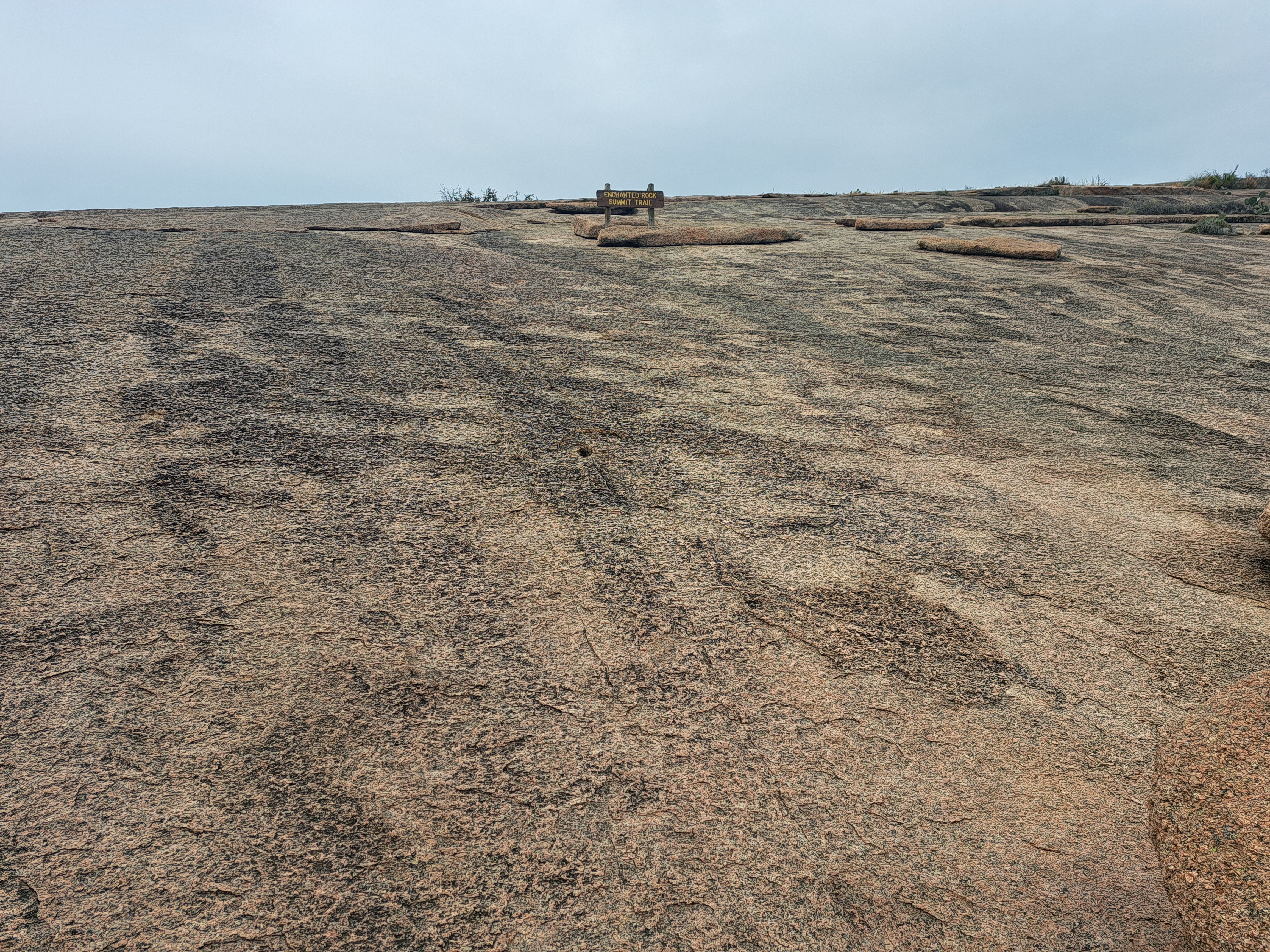
        From the Devils Waterhole Trailhead, head north on the Devils Waterhole Trail as it descends on a wide dirt track toward its namesake site.  Lots of juniper/cedar trees grow in this area, and many arid desert flora grow here including yuccas and prickly pear cacti.  After losing about 30 feet of elevation, you reach Devils Waterhole at 0.2 miles.  This scenic corner of Inks Lake gets its name from the gneiss cliffs that come all the way down to the water; it marks the point where Spring Creek enters Inks Lake.  Take some time to enjoy this rocky scenic spot.
Devils Waterhole
    
        A few steps past Devils Waterhole, you reach a trail intersection that marks the end of the Devils Waterhole Trail and the start of the Valley Spring Creek Trail, which forms a loop.  The trail going up the bare rock to the left will be our return route, but you want to continue straight to climb more gradually on the loop's south arm and begin a counterclockwise journey around the Valley Spring Creek Trail.  The trail gains about 80 feet of elevation as it crosses the highest point on this hike, and traffic noise from Park Road 4 comes in through the trees to the right.
Start of Devil's Backbone Nature Trail
    
        Near 0.7 miles, you reach another trail intersection.  The trail going left is the Valley Spring Creek Trail's north arm, and we will go that way later as our return route.  For now continue straight to begin the Devil's Backbone Nature Trail, which is marked with a wooden sign.  The trail descends over some small rock ledges before rock-hopping Spring Creek in the shadow of Park Road 4's bridge over the creek.  Interpretive signs describe some common plants in the area.
Devils Waterhole overlook
    
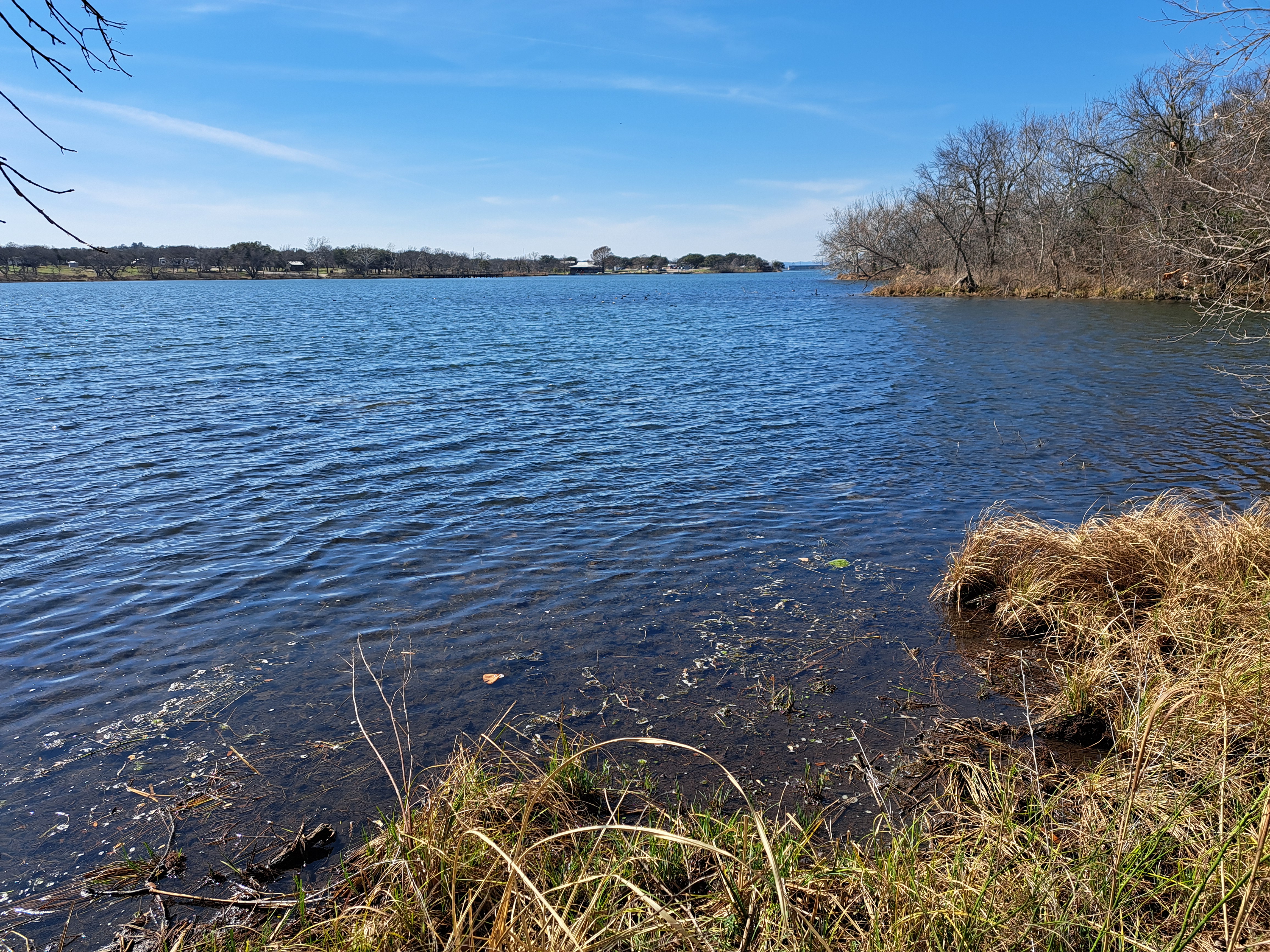
        Now comes the hardest part of the hike: the trail heads west through a rocky area with many boulders to climb over and around.  The elevation is about 50 feet above Spring Creek, and just past 1 mile you pass a fantastic overlook of Devils Waterhole.  After a rocky descent, the trail surface turns back to dirt as you come alongside Inks Lake.  I saw a group of coots on the water on the windy morning that I hiked here.
Inks Lake
    
        At 1.6 miles, the Devil's Backbone Nature Trail ends where it intersects a park road.  Some people turn around here, but if you angle left, walk a short distance on the park road, and then continue past a small parking area, you will reach a stocked bird blind.  I saw many cardinals and goldfinches at this blind, and some signs help you identify common birds.  This bird blind is a nice place to sit, rest, and rehydrate near the midpoint of this hike.
View from bird blind
Valley Spring Creek Waterfall (dry)
    
        After watching the birds, retrace your steps the full length of the Devil's Backbone Nature Trail, and then turn right to begin the north arm of the Valley Spring Creek Trail.  The balance of the Valley Spring Creek Trail passes through a rocky area high above Spring Creek.  Valley Spring Creek Waterfall can be seen downhill in the creek to the right, but there was insufficient water to fall when I came here.  A final rocky descent returns you to Devils Waterhole to complete the Valley Spring Creek Trail.  A soft left turn takes you back up the Devils Waterhole Trail to the campground trailhead, thus completing the hike.

Wednesday, April 16, 2025

Colorado Bend State Park: Tie Slide Trail (Blog Hike #1050)

Trail: Tie Slide Trail
Hike Location: Colorado Bend State Park
Geographic Location: southeast of San Saba, TX (31.05847, -98.50094)
Length: 2.9 miles
Difficulty: 6/10 (Moderate)
Date Hiked: February 2025
Overview: A loop hike through arid desert terrain to a fantastic blufftop Colorado River overlook.
Park Information: https://tpwd.texas.gov/state-parks/colorado-bend
Hike Route Map: https://www.mappedometer.com/?maproute=980190
Photo Highlight:
Hike Video: (coming February 17, 2026)

Directions to the trailhead: From San Saba, take US 190 east 3.2 miles to FM 580 and turn right on FM 580.  Drive FM 580 east 14 miles to the town of Bend.  Where FM 580 turns left to cross the Colorado River in Bend, continue straight on CR 442, which dead-ends at the park entrance in another 3.8 miles.  Pay the park entrance fee, then drive another 0.3 miles to the first park road on the left.  Turn left and drive a short distance to the Gorman Trailhead where this hike begins.  Take it easy on this last road: it is unpaved and rough but passable in an ordinary sedan.

The hike: The narrow winding county road you have to drive to get to Colorado Bend State Park passes through a pasture with free-roaming cattle, which gives a first indication of just how wild, remote, and rustic this park is.  The park's 5328 acres straddle the Lampasas/San Saba county line, and it occupies the sites of 2 former ranches: the Gorman Ranch and the Lemons Ranch.  The former ranchland was acquired by the State of Texas in 1984, and the park opened in 1988.  The park's name comes from the fact that a sweeping bend of the Colorado River forms most of this park's eastern boundary.  (Aside: there are multiple Colorado Rivers in the western United States.  This Colorado River is the one that flows southeast through Texas to the Gulf of Mexico/America, not the one that flows southwest through the Grand Canyon.)
            True to its rustic nature, the park's campground offers only 43 primitive campsites with no RV hookups available, and most of the park is managed as a wilderness that is accessible only by trail.  As such, hiking takes centerstage here, and the park offers 14 main trails totaling over 31 miles.  The park's most popular trail is the 1.5 mile each-way Gorman Falls Trail, which takes you to its namesake waterfall in the Colorado River's canyon.  I arrived here late in the day and did not have time to hike to the waterfall, so I decided to hike to the Tie Slide Overlook instead.  The Tie Slide Overlook is the park's best canyon overlook, and this hike offers some classic arid desert hiking in addition to fantastic Colorado River canyon views.
Gorman Trailhead
    
        From the information board at the rear of the parking lot, follow the sign that directs you to turn left to begin the narrow Tie Slide Trail.  The wider trail going straight is the Gorman Falls Trail, and it will be our return route.  The narrow and somewhat rocky Tie Slide Trail heads north through a dense forest of cedar trees, which are also called juniper trees.  The trail descends gradually, but most of this loop passes through terrain that is fairly flat.
Hiking through cedar forest
    
        At 0.3 miles, you come alongside Tie Slide Creek, a seasonal stream that sits in a scenic but rocky ravine 10 feet below you to the left.  Tie Slide Creek eventually flows into the Colorado River, but the trail gradually curves right and begins heading east away from the creek.  The park's remote location should lead to good wildlife viewing.  Although I did not see much wildlife on my evening hike, I saw plenty of paw/hoof prints and scat, indicating that there is indeed plenty of wildlife in this area.
Tie Slide Creek
    
        The trail undulates with small elevation changes as it meanders east toward the Colorado River.  Several old dirt ranch roads cross the trail, so you have to watch the trail markers to stay on the narrow track.  While there are plenty of trail markers, the markers are not consistent.  I saw red paint blazes, blue metallic squares, and brown carsonite posts marking this same trail at various points.  Large amounts of prickly pear cactus and yuccas live here, and the hike has very much an arid desert feel.
Crossing an old dirt ranch road
    
        Just past 1.5 miles, you reach a signed trail intersection.  The Tie Slide Trail turns sharply right, and we will go that way eventually.  First angle softly left to head to this hike's main attraction: Tie Slide Overlook.  A brief rocky and steep descent brings you to the overlook platform.  The Colorado River appears a couple hundred feet below you, and while I have read that you can see Gorman Falls downstream from here, the waterfall blended into the long shadows when I came here.  Take some time to admire the blufftop view.
View north from Tie Slide Overlook
View south from Tie Slide Overlook
    
        After taking in the overlook, retrace your steps to the trail intersection and angle left to continue the Tie Slide Trail.  The trail climbs gradually through more of the same cedar forest and arid scenery you saw on the way out to the overlook.  At 2.3 miles, the Tie Slide Trail ends at a signed intersection with the Gorman Falls Trail, which goes left and right.  Turn right to begin the final leg back to the trailhead.
Returning to the trailhead
    
        The meandering Gorman Falls Trail heads the general direction of west.  The scenery is similar to what you have already seen, but the trail is smoother and wider than most of the trails you have hiked so far.  An old dirt ranch road comes in from the left just before you return to the trailhead to complete the hike.  As I stood outside my car just a few minutes before sunset, I enjoyed a rare experience in today's world: a moment of total silence.  Remote and rustic parks have their advantages, some of which are very quiet.

Sunday, April 13, 2025

Fort Parker State Park: Springfield and Bur Oak Trails (Blog Hike #1049)

Trails: Springfield and Bur Oak Trails
Hike Location: Fort Parker State Park
Geographic Location: south of Mexia, TX (31.59675, -96.53630)
Length: 2.7 miles
Difficulty: 2/10 (Easy)
Date Hiked: February 2025
Overview: A double loop through the historic Springfield town site and along Fort Parker Lake.
Park Information: https://tpwd.texas.gov/state-parks/fort-parker
Hike Route Map: https://www.mappedometer.com/?maproute=980132
Photo Highlight:
Hike Video: (coming November 28)

Directions to the trailhead: From Mexia, which is east of Waco, take SR 14 south 7 miles to the signed state park entrance on the right.  Turn right to enter the park, pay the entrance fee, and drive the main park road to the park's nature center.  Park in the perpendicular parking lot on the left just before reaching the nature center.

The hike: Built between 1935 and 1942 by the Civilian Conservation Corps (CCC), Fort Parker State Park protects 1459 acres along the Navasota River about 90 miles south of Dallas.  The park is named for old Fort Parker, which was built by Mexican/Texan settlers a couple of miles to the south in 1834.  The fort was destroyed on May 19, 1836 when a group of Comanche, Kiowa, Wichita, and Caddo people raided the settlement.  The CCC reconstructed Fort Parker near its original site, but their reconstruction is operated by a private not-for-profit organization; it is not located within the park's boundaries.
            Fort Parker State Park offers a cozy 35-site developed campground, the usual aquatic recreation on Fort Parker Lake, and 5 hiking trails totaling over 7 miles.  Many excellent hikes are possible at this park.  The hike described here passes several CCC sites that date to the 1930's in addition to the historic Springfield town site, which dates to the 1840's.  Thus, this hike allows you to explore the area's history while taking in some nice lakeside scenery.
Main trailhead at picnic area
    
        From the parking lot, walk downhill through the picnic area to the east to find the wooden sign that marks the trailhead.  The Navasota River Trail goes left, and it leads 1.9 miles northwest along the lakeshore.  Continue east to cross a floating bridge over an arm of Fort Parker Lake, following signs for the Bur Oak and Springfield Trails.
Bur Oak and Springfield Trails split
    
        In only a few hundred feet, the Bur Oak and Springfield Trails part ways.  We will hike both trails eventually, but for now angle left to begin following the yellow blazes of the Springfield Trail.  The wide single-track dirt trail climbs gradually through shrubby forest dominated by cedar and oak trees.
Climbing gradually on the Springfield Trail
    
        Just shy of 0.5 miles, you reach the historic Springfield Cemetery.  Dedicated in 1838, this cemetery is all that remains of Springfield, which was once the county seat of Limestone County.  Headstones in this cemetery date to the 1840's, and interpretive signs describe the history of the town.  Springfield flourished until it was bypassed by the railroad in 1870, and a devastating fire in 1873 sealed its fate.  A bench here lets you rest and contemplate this area's history.

Springfield Cemetery
    
        A trail intersection at the cemetery forms the loop portion of the Springfield Trail.  I continued straight and used the trail going left across the main park road as my return route, thus hiking the loop counterclockwise.  At 0.6 miles, you come out at a park road near some athletic fields.  Turn right and then left to keep heading southeast on the Springfield Trail.
Fort Parker Dam
    
        0.9 miles into the hike, you reach an overlook of Fort Parker Dam.  The large concrete dam creates an attractive if man-made waterfall, and broad views emerge west up the length of the lake.  Just left of this overlook is a much smaller lake: Lake Springfield.  Lake Springfield is spring-fed, and today it is used as the park's fishing lake.  Many black walnut trees grow here, and Lake Springfield is a very scenic body of water.
Lake Springfield
    
        The trail curves left to head up the east side of Lake Springfield through forest dominated by pine trees.  Interpretive signs help you identify common plants in the forest.  Soon you join a two-track gravel road, and at 1.3 miles you cross the park entrance road near the park headquarters.  The small wooden building that today serves as the park headquarters was originally the infirmary for the CCC camp.  Thus, Springfield Cemetery is not the only site of historical interest on this hike.
Park headquarters
    
        The next segment is a fairly flat and uneventful course through more cedar/oak forest.  I saw a lot of wildlife in this part of the park including 4 deer.  At 1.6 miles, you return to Springfield Cemetery and close the loop.  Turn right to head back toward the parking area, but before crossing the floating bridge turn left to add-on the short Bur Oak Trail.
Fort Parker Lake
    
        The Bur Oak Trail forms a short lollipop loop near the lake, the highlight of which is a lakeside bird blind.  This bird blind peers across the lake to a great blue heron rookery, and I saw several egrets while I sat here.  I did this entire hike in a light steady rain, so I also appreciated the dryness this roofed bird blind offered.  Past the bird blind, finish the Bur Oak Trail's loop, then retrace your steps across the floating bridge to return to your car and complete the hike.

Thursday, April 3, 2025

Lake Whitney State Park: Towash Forest Trail (Blog Hike #1048)

Trail: Towash Forest Trail
Hike Location: Lake Whitney State Park
Geographic Location: west of Hillsboro, TX (31.91680, -97.35494)
Length: 1.2 miles
Difficulty: 1/10 (Easy)
Date Hiked: February 2025
Overview: A flat lollipop loop partly along Lake Whitney.
Park Information: https://tpwd.texas.gov/state-parks/lake-whitney
Hike Route Map: https://www.mappedometer.com/?maproute=980088
Photo Highlight:
Hike Video: (coming March 10, 2026)

Directions to the trailhead: South of the Dallas-Fort Worth Metroplex, take I-35 to SR 22 (exit 368B).  Exit and go west on SR 22.  Drive SR 22 west 15 miles to FM 933 in the town of Whitney and turn right on FM 933.  Drive FM 933 north 0.7 miles to FM 1244 and turn left on FM 1244.  FM 1244 dead-ends at the park entrance in another 2.3 miles.  Pay the park entrance fee, then turn left at the next 2 intersections, heading for the Sunset Ridge Camping Loop.  Drive through the Lake View Camping Loop.  The small parking lot for the Towash Forest Trail is on the left just before you reach the Sunset Ridge Camping Loop.

The hike: Built in 1951 by the U.S. Army Corps of Engineers, Whitney Dam is a 166-foot tall concrete and earthen dam on the Brazos River in north-central Texas.  The dam was built to control river flooding, especially in the City of Waco located a few miles downstream.  The dam also produces hydroelectric power by releasing water from Lake Whitney through a system of turbines.  Lake Whitney is large but shallow: it covers 23 square miles but has a maximum depth of only 108 feet.  
            In 1954, the State of Texas leased 775 acres along the lake to create the park, and Lake Whitney State Park opened in 1965.  The park offers several campgrounds totaling 137 sites, some picnic areas, boating and swimming on Lake Whitney, and 2 short hiking trails.  The 2 trails are located at opposite ends of the park, and therefore there is no easy way to combine them to form a longer hike.  This hike describes the Towash Forest Trail, which is the longer of the 2 trails.
Vehicle gate at trailhead
    
        Start by walking around the vehicle gate and heading northeast on the wide arrow-straight dirt trail.  If you observe this treadway carefully, you will notice a couple of old culverts, which suggest that this trail used to be a vehicle road.  The trail is named for the former town of Towash, the foundations of which now lie submerged under Lake Whitney a few miles southeast of here.  There is little noticeable elevation change anywhere on this hike.
Old culvert
    
        At 0.3 miles, you reach the trail intersection that forms this hike's loop.  I turned right to hike the loop counterclockwise.  There is surprisingly little forest on this trail, and most of this trail passes through grassy prairie.  The forest that does exist is of the dense shrubby variety that obscures most birds.  I came here on a chilly and gloomy late afternoon in mid-February, and I saw only a cardinal and a few ducks.
Lake Whitney
Hiking through the prairie
    
        0.6 miles into the hike, you reach the edge of the Whitney Creek inlet of Lake Whitney, where this hike's best lake views emerge.  The trail goes right to the edge of the lake bank, but don't get too close to the edge: erosion from the lake has undercut this bank.  The trail curves left and begins heading north with the inlet to your right.  At 0.9 miles, you return to the old road you hiked in on, and just shy of 1 mile you close the loop.  Hike the arrow-straight old road back to the trailhead to complete the hike.

Tuesday, April 1, 2025

Meridian State Park: Bosque Hiking Trail (Blog Hike #1047)

Trail: Bosque Hiking Trail
Hike Location: Meridian State Park
Geographic Location: southwest of Meridian, TX (31.89288, -97.70200)
Length: 2.3 miles
Difficulty: 5/10 (Moderate)
Date Hiked: February 2025
Overview: A loop hike, mostly easy but with some short steep and rocky sections, around Meridian Lake.
Park Information: https://tpwd.texas.gov/state-parks/meridian
Hike Route Map: https://www.mappedometer.com/?maproute=980087
Photo Highlight:
Hike Video: (coming November 7)

Directions to the trailhead: From Meridian, take SR 22 southwest 3.2 miles to the state park entrance on the right.  Turn right to enter the park, and pay the entrance fee.  Drive past the campground, then angle right on Park Road 7 as it becomes one way.  Drive 0.75 miles total from the entrance station to the small parking lot on the right that serves Bee Ledge.  Park here.

The hike: Built between 1933 and 1935 by the Civilian Conservation Corps (CCC), Meridian State Park protects 505 acres on the northern fringe of Texas Hill Country.  The park is centered around Meridian Lake, which was formed when the CCC dammed Bee Creek.  The park and lake are named for the nearby City of Meridian, which in turn was named for its proximity to the 98th Meridian.
            The park evokes a rural and rustic ambiance that is enhanced by its 3 small campgrounds totaling 22 sites and several rustic picnic areas.  For hikers, the park offers 4 short trails, the longest and most popular of which is the Bosque Hiking Trail described here.  The Bosque Hiking Trail circumnavigates Meridian Lake, and it offers an unusual and interesting mix of scenery and history, ease and difficulty.
Trailhead at Bee Ledge
    
        Start by walking across the road and following signs for Bee Ledge, thus beginning a counterclockwise journey around the Bosque Hiking Trail.  In only a couple hundred feet, you reach Bee Ledge.  Bee Ledge is a lumpy slab of rock that stands about 50 feet above Meridian Lake, and it provides an excellent view to the south down the length of the lake.
View from Bee Ledge
    
        Exit Bee Ledge to the right, but then angle left to begin following the blue blazes of the Bosque Hiking Trail; the orange blazes going right are for the shorter Little Forest Junior Trail.  Next comes a steep rocky descent that brings you down to lake level.  Take your time and watch your footing while you descend.  Upon reaching lake level, the trail heads northwest to embark on a level streamside course that heads upstream past the headwaters of Meridian Lake.  Lots of cedar/juniper trees live here, and traffic noise from nearby FM 1473 filters in from ahead and the right.
Crossing Bee Creek
    
        At 0.4 miles, the trail curves left to cross Bee Creek on a wooden footbridge.  A few muddy areas need to be negotiated, but overall the going is flat and easy.  Just past 0.5 miles, you begin a steep rocky climb up some steps carved out of the rock.  After passing a viewpoint that is narrower than Bee Ledge, you descend back to lake level where this hike will more or less stay for the next 1.3 miles.
Rocky climb
    
        1 mile into the hike, you reach a lakeside picnic area and primitive campground.  Some benches make nice places to sit, and I saw many birds here including 
meadowlarks, vultures, several types of ducks, and a red-headed woodpecker.  Next the trail heads up an inlet of Meridian Lake and intersects the park road at 1.2 miles.  Though no signs or blazes appear here, you need to turn left and walk about 500 feet along the park road to find where the trail reenters the forest on the left.
Hiking across the dam
    
        Just past 1.5 miles, you reach the earthen dam that forms Meridian Lake.  Turn left to walk across the dam, and then turn left again to cross the spillway on some awkward concrete stepping blocks.  Angle right and rise slightly to reach the old CCC dining hall at 1.8 miles.  Made of locally quarried limestone, the architecture and workmanship of this building are quite impressive even by the CCC's high standards.
CCC dining hall
    
        The trail leaves the developed area to the northwest and heads through a narrow strip of woods between the lake on the left and the park road on the right.  Near 2 miles into the hike, you cross the park road, but before crossing the park road angle left to see some more history: a CCC-built stone bridge with timbers dating to 1934.  Though the bridge has been updated in several ways, it still carries the park road over this small creek.  How many bridges being built today will still be in use 100 years from now?
CCC-built stone bridge
    
        After crossing the park road, the trail crosses the same creek as the CCC-built stone bridge crossed but on stepping stones.  Next comes a steep rocky climb that mirrors the descent from Bee Ledge near the start of this hike.  At the top of the climb, you reach an intersection with the Little Forest Junior Trail, a somewhat rocky but fairly flat 0.8 mile ridgetop loop.  If you wanted to extend this hike, you could turn right to add-on the orange-blazed Little Forest Junior Trail, but this hike turns left to keep following the blue blazes of the Bosque Hiking Trail.
Final segment of trail
    
        The final flat and easy 0.2 miles stay very close to the park road that accesses the picnic shelters.  Soon you pass a rustic log bird blind.  Just past the blind, you return to the Bee Ledge parking lot to complete the hike.