Trails: Mist and John Muir Trails
Hike Location: Yosemite
National Park
Geographic Location: eastern end of Yosemite
Valley , CA (37.73242, -119.55993)
Length: 6 miles
Difficulty: 10/10 (Difficult)
Date Hiked: June 2016
Overview: A semi-loop along the Merced River
passing two gigantic waterfalls.
Park Information: https://www.nps.gov/yose/index.htm
Hike Route Map: https://www.mappedometer.com/?maproute=731004
Photo Highlight:


Hike Video:
Directions to the trailhead: This hike starts at the Nature
Center Yosemite Valley . Ideally you can park in the large day-use
parking lot near Curry Village Half Dome
Village Yosemite Valley
and either walk or ride the free Valley Shuttle to the Happy Isles
trailhead. Happy Isles is Valley Shuttle
stop #16.
The hike: For my general comments on Yosemite
National Park Yosemite ’s
signature hike, which means two things.
First, everyone who comes to Yosemite seems to
end up on the Mist Trail, making this trail the most popular and crowded trail
in a very popular and crowded park.
Second, if you are a hiker who comes to Yosemite ,
you have to hike this trail too.
According to news reports even President Obama hiked part of this trail
during his June 2016 Yosemite vacation, and I hiked this
trail only 3 days after he did.
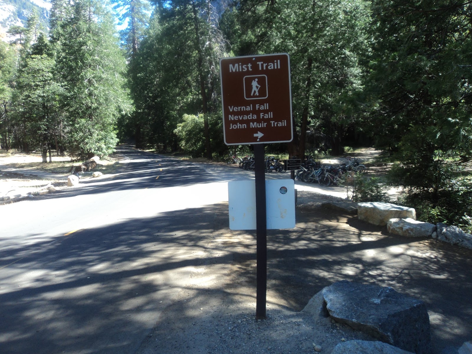 |
| Trailhead: Mist Trail |
The shuttle
bus will drop you off on the south side of the Merced River ,
but the Mist Trail starts on the north side of the Merced River . Thus, your hike starts by crossing the river
on the park road bridge. This road used
to be open to all vehicles, but these days only shuttle buses and vehicles
with handicapped placards are allowed to be driven here.
The wide
asphalt path heads upstream through a grove of pine trees with the river on
your right. The river’s water level
varies from a tranquil stream in the fall to a raging torrent during the
snowmelt season. Thus, the water volume
of Vernal and Nevada Falls Yosemite ’s
other waterfalls do.
 |
| Asphalt section of Mist Trail |
Over the
first 0.2 miles, the Valley Loop Trail exits left to head for Mirror
Lake Mount Whitney
(211 miles away and well outside the park’s boundaries). The climb now begins on a moderate to steep
grade. The trail threads its way between
Grizzly Peak
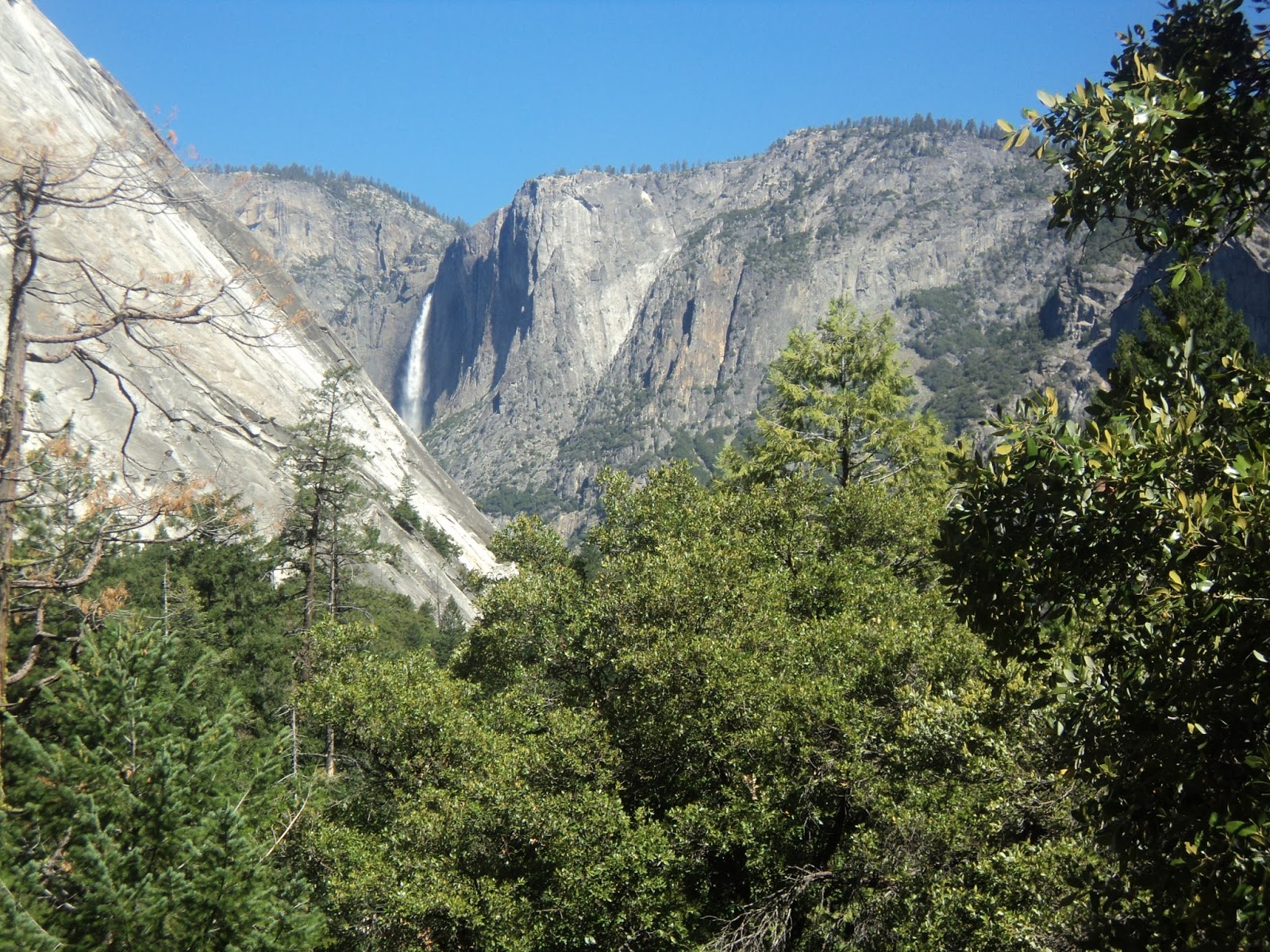 |
| Upper Yosemite Fall |
As you
begin to gain elevation out of Happy Isles, a view of Upper Yosemite Fall
materializes between the granite cliffs over your shoulders. Some cascades appear in the river as the
asphalt trail navigates through some boulder fields. At 0.6 miles, the park’s best view of
Illilouette Fall appears up a side ravine across the river. At 370 feet tall, Illilouette Fall would be a
show-stopper at most parks, but it is only a warm-up act at Yosemite .
 |
| Illilouette Fall |
More
climbing comes before a brief descent to the Vernal Fall Footbridge, which is
reached 1 mile and 350 feet of elevation gain into the hike. Standing on this bridge and looking upstream
gives this hike’s first view of Vernal Fall, hence the bridge’s name. Crowds tend to congregate here, and people in
below average physical condition sometimes turn around here. Some rocks make for nice places to sit and
rest for the remainder of the climb, and a drinking fountain at the far side of
the bridge provides the last chance to top off your water bottle. The drinking fountain was a popular amenity
on my visit: I hiked this trail on a hot early afternoon with temperatures in
the low-to-mid 90’s.
 |
| View from Vernal Fall footbridge |
Now back on
the south side of the Merced River , climbing a couple of
switchbacks brings you to a trail intersection at 1.2 miles. The Mist Trail continues straight here while
the John Muir Trail exits right. The
John Muir Trail offers an alternate route to the top of Nevada Fall, and signs
identify it as the winter route for reasons to be seen in a few minutes. I chose to form a loop by continuing straight
here and using the trail going right as a return route, thus hiking up the Mist
Trail and coming back down the John Muir Trail.
The asphalt
trail surface turns to dirt and rock just past this trail intersection. The Merced River
becomes rockier with more cascades as you approach the base of Vernal Fall. At 1.3 miles, you exit the forest to pass
around a rock outcrop and begin climbing the 600 granite steps for which this
trail is infamous. The steps are the
hardest part of this hike: some of them are more than 1 foot tall, and the
trail gains nearly 400 feet of elevation over the next 0.2 miles.
 |
| Climbing the granite steps |
If you are hiking at high river
levels like I was, this point marks your entrance to Vernal Fall’s spray zone,
and now you start to learn why this trail is called the Mist Trail. Some people bring ponchos to wear while
hiking through the waterfall’s spray, but I found that the cool snowmelt-fed
mist felt refreshing on a hot summer day.
Footing can be an issue: not only does the mist make the granite steps
slippery, but also water runs down the steps and collects in puddles that must
be waded through. In the winter the mist
can freeze, thus forcing park officials to close the trail and send hikers up
the winter route you passed earlier. On
the bright side, the open area offers fantastic views of Vernal Fall, and the
view back down toward Yosemite Valley is not bad either.
|
| Vernal Fall |
After a few hundred feet you exit
the mist by reaching land that is more beside the waterfall than down from
it. Many people use this point as a
staging area for the steepest steps, which come next. The steep, narrow set of steps carved from
the granite take you to the top of Vernal Fall, and an iron fence along the
narrowest part of trail provides protection against falling down the sheer
cliff.
At 1.6 miles, you reach an overlook
perched on the bare granite at the top of Vernal Fall. This overlook provides a fantastic view back
down the Merced River , as sheer granite cliffs line the
tight river valley. Happy Isles and Yosemite
Valley lie 1000 feet below, but they are not visible from here due
to a bend in the valley. Take some time
up here and enjoy the visual fruits of your labor.
 |
| View from top of Vernal Fall |
Most people turn around at the top
of Vernal Fall. However, Nevada Fall, another
gigantic waterfall, lies less than 2 miles upstream, and you have already done
most of the required climbing to get a good view from its base. Thus, this hike continues up the Mist Trail,
which now parallels the Merced River on bare
granite. Note that a restroom building
is located to the right here if it is needed.
 |
| The rocky Mist Trail above Vernal Fall |
The trail continues up the south
bank of the Merced River on a rocky but fairly flat
course. The sheer granite faces of Mount
Broderick
Soon you cross the Merced
River again on another wide wooden footbridge. This area is known as Silver Apron. Another 0.3 miles of gradual climbing over
slightly rocky trail brings you to a rock outcrop that gives a fantastic view
of Nevada Fall. At a height of 594 feet,
Nevada Fall is the tallest waterfall on the Merced River . The waterfall’s name comes from its location
close to the Sierra Nevada mountains and upstream from
Vernal Fall (“vernal” means spring, so this waterfall represents winter because
it comes before spring). Take some time
to enjoy this second helping of giant waterfalls.
 |
| Nevada Fall, as seen from the Mist Trail |
From this point, several options
present themselves. The easiest option
is to simply retrace your steps back down the Mist Trail to Happy Isles, but
this option will take you back through the uber-crowded Vernal Fall area. Ahead, the Mist Trail keeps going for another
mile to the top of Nevada Fall, at which point you can pick up the John Muir
Trail back down to form a lollipop loop.
However, such a route requires an additional 700 feet of elevation gain
and many more narrow, steep granite steps, so it should only be attempted by
fit, energetic, and well-prepared hikers.
A compromise option and the one described here is to retrace your steps
to the winter route at the top of Vernal Fall and follow the winter route back
down. The winter route requires another
350 feet of elevation gain, but it gets far less traffic than the Mist Trail near
Vernal Fall.
Executing the third option
suggested above, after re-crossing the river at Silver Apron, angle left to
begin climbing on the winter route. The
entire trail from Silver Apron to Clark Point is a set of hot, sunny, rocky
switchbacks. The grade is never too
steep, but it is persistent. En route to
Clark Point you pass an overlook that gives a nice side view of Vernal Fall. Distant views of Nevada Fall will also be
obtained. From this angle, stark, rocky
Liberty Cap stands just to the left of the waterfall.
 |
| Side view of Vernal Fall |
 |
| Nevada Fall, as seen from the John Muir Trail |
At 3.2 miles, you reach Clark
Point, this hike’s highest elevation, and an intersection with the John Muir
Trail. Angle right to begin heading back
down toward the Merced River . Unlike the Mist Trail, which is hiker-only,
the John Muir Trail is also open to horses, and I had to step over quite a bit
of horse manure on my visit. I also got
passed by a train of horses and mules labeled as a National Park Service
backcountry patrol. Hikers are required
to yield to horses, so step to the side of the trail and hide your staff (hiking
staffs can spook horses) if you see a horseback rider approaching.
The John Muir Trail wastes no time
in beginning its descent down a long sequence of switchbacks. Unlike the trail up to Clark Point, these
switchbacks are mostly shaded, which keeps you cooler on a hot sunny day but
also blocks most views. The trail winds
endlessly down, and finally the Merced River becomes
audible. At 4.7 miles, the horse trail
exits left just before you close the loop at the bottom of the winter route. A left turn and 1.3 miles of retracing your
steps down the asphalt section of the Mist Trail returns you to Happy Isles and
completes the hike. While you are in
Happy Isles, the Nature Center Yosemite Valley .


