Showing posts with label Missouri Hikes. Show all posts

Saturday, July 31, 2021

Garth Nature Area in Columbia, MO (Blog Hike #857)

Trails: Bear Creek Trail, Blue Ridge Trail Connector, et. al.
Hike Location: Garth Nature Area
Geographic Location: north side of Columbia, MO (38.98086, -92.33872)
Length: 1.3 miles
Difficulty: 1/10 (Easy)
Date Hiked: July 2021
Overview: A short, flat gravel loop around ponds and other wetland areas.
Area Information: https://www.como.gov/parksandrec/park/garth-nature-area/
Hike Route Map: https://www.mappedometer.com/?maproute=879678
Photo Highlight:
Hike Video: 

Directions to the trailhead: In Columbia, take I-70 to Providence Road (exit 126).  Exit and go north on Providence Rd.  Drive Providence Rd. north 0.9 miles to Blue Ridge Road and turn left on Blue Ridge Rd.  Drive Blue Ridge Rd. west 0.2 miles to the traffic circle at Garth Ave.  Take the third exit from the traffic circle and drive Garth Ave. south 0.1 miles to the signed Garth Nature Area on the right.  Park in the large parking lot for the Nature Area.

The hike: Established only in 2007, tiny Garth Nature Area protects 52 acres on the heavily residential north side of Columbia.  Before it became a park, the site was the location of Columbia's sewage treatment facility.  One of the former wastewater lagoons was transformed into one of this park's wetlands, and part of this hike uses the old access road for the wastewater lagoons.
            As its name implies, the park remains lightly developed today, with 1.6 miles of trails, a picnic area, and an off-leash dog park being its only amenities.  Garth Nature Area is also a trailhead for the Bear Creek Trail, a 4.8 mile bike trail that connects to other City of Columbia parks including Cosmo Park and Albert-Oakland Park.  The hike described here goes out on the Bear Creek Trail, but it loops back past the wetlands using the Nature Area's other trails, thus sampling all Garth Nature Area has to offer.
Bear Creek Trail leaving the trailhead
    
        From the restroom building at the right (north) end of the parking area, turn left to start heading west on the wide gravel Bear Creek Trail.  Plastic posts mark distances on the Bear Creek Trail in quarter-mile increments.  Some side trails exit left into the collection of wetlands as the main trail treads close to the natural area's boundary on the right.  On the warm morning in early July that I came here, I did some good wildlife viewing that included a family of Canada geese, some turtles, some frogs, and a woodpecker.
Canada geese
    
        At 0.25 miles, the Bear Creek Trail exits left.  To take the longest loop through the Nature Area, angle right to begin the Blue Ridge Trail Connector, which is another wide gravel trail that leads to a trailhead on Blue Ridge Road.  
Elevation changes are sufficiently small to be imperceptible throughout this hike.  The area's largest wetland lies to the left here, but the dense understory of honeysuckle permits no clear wetland views.
Bear Creek
    
        Near 0.5 miles, the Blue Ridge Trail Connector exits right to head out of Garth Nature Area.  Turn left to begin hiking another wide gravel trail that follows first the north and then the west boundaries of the Nature Area.  Bear Creek, a wide but fairly shallow prairie stream, makes an appearance on the right.  Some large oak trees live along Bear Creek and its tributaries.  Near 0.8 miles, you can take a short detour to the right on the Bear Creek Trail to reach a bridge over scenic Bear Creek.
Pond view near dog park
    
        As the Bear Creek Trail enters from the right and exits to the left, continue straight to head into the southern part of the Nature Area.  Some of the ponds in this part of the Nature Area are covered with green algae.  As the off-leash dog park comes into view on the right, look to the left for a short dirt spur trail that leads to the best wetland view on this hike.  A bench here invites you to sit, contemplate, and observe birds and wildlife.  The main trail soon returns to the south end of the parking area to close the loop and complete the hike.

Tuesday, June 29, 2021

Lake Wappapello: Johnson Tract Natural Area (Blog Hike #851)

Trail: Johnson Tract Nature Trail
Hike Location: Lake Wappapello, Johnson Tract Natural Area
Geographic Location: north of Poplar Bluff, MO (37.09523, -90.42339)
Length: 4.7 miles
Difficulty: 5/10 (Moderate)
Date Hiked: May 2021
Overview: A woodland lollipop loop on gravel trail with good wildlife viewing opportunities.
Lake Information: https://www.mvs.usace.army.mil/Missions/Recreation/Wappapello-Lake/Recreation/
Hike Route Map: https://www.mappedometer.com/?maproute=873363
Photo Highlight:
Hike Video: 

Directions to the trailhead: From Poplar Bluff, take US 67 north 30 miles to Business US 67 in Greenville.  Turn right on Business US 67, and then in another 0.6 miles turn right on Highway D.  Drive Highway D east 1.9 miles to the signed trailhead parking area for the Johnson Tract Natural Area on the right.  Park in this small gravel lot.

The hike: Built in 1941 for flood control purposes, the Wappapello Dam on the St. Francis River forms 8400 acre Lake Wappapello.  Lake Wappapello is a major fishing destination: large numbers of bass, crappie, and bluegill live in the lake.  Although some outlets show this area as part of nearby Mark Twain National Forest, in fact both the dam and the lake are owned and operated by the US Army Corps of Engineers.
            The Corps of Engineers also owns some land near the lake, and they maintain several hiking trails on this land.  Most of these trails are short, but the gravel Johnson Tract Nature Trail described here forms a lollipop loop of nearly 5 miles.  While this trail offers no lake views and minimal other views, it does offer an excellent opportunity to view wildlife on well-maintained frontcountry trail.
Trailhead at Johnson Tract Natural Area
    
        From the rear of the parking area, walk around the boulders that were placed here to block vehicles and head up the wide gravel trail.  Note the information kiosk with trail map just beyond the boulders.  The trail is marked with white plastic rectangles bearing blue letters JT, but the gravel treadway makes this trail easy to follow for its entire distance.  The initial segment of this hike follows the top of a narrow finger ridge going more up than down, and the first of two designated backcountry campsites is passed as you head up the first decent-sized hill.  Thus, while I did this trail as a moderate dayhike, it could also be an easy overnight backpack trip.
            Just past 0.5 miles, the trail forks to form its loop.  For no particular reason, I chose to turn right and use the trail going left as my return route, thus hiking the loop counterclockwise.  The wide gravel trail continues its ridgetop course, and the dense forest dominated by oak trees blocks any wide views into the surrounding hollows.  Imagine the time and effort it must have taken to haul in and lay down all of this gravel for the entire 4.7 miles!
Hiking out the finger ridge
    
        At 1.4 miles, you roll off the end of the finger ridge just before you reach a T-intersection with a two-track gravel road.  As indicated by a brown carsonite post, you need to turn left here to continue the loop.  For the next 1.3 miles the trail follows this gravel road.  Interestingly, while the 
white plastic rectangles are plentiful on the rest of the trail, they are completely absent on the gravel road.
Hiking through the floodplain
    
        Soon the 
moderate to steep descent ends in the St. Francis River's floodplain, but the river stays out of sight several hundred feet to the right.  A couple of pre-park constructions including a concrete culvert and some stones from a homestead give away that this gravel road was a driveway or vehicle road before it was a hiking trail.  Just after crossing the concrete culvert, a large grassy wildlife-viewing area appears on the right.  Although I did not see much wildlife at this spot, I saw lots of toads, lizards, termites, butterflies, and a black rat snake at other places around the loop.
Black snake crossing my path
Wildlife viewing area
    
        2.7 miles into the hike, the trail turns left to leave the old road.  The road can be discerned continuing to the right, but the road turns to dirt while the trail is paved with gravel.  Next comes a moderate to steep climb back onto the finger ridge.  The difference in elevation between the floodplain and ridge is just over 300 vertical feet, but you lose or gain this 300 feet in only a few tenths of a mile.
            After regaining the ridge, only minor undulations need to be negotiated until you close the loop at 4.2 miles.  Angle right and retrace your steps back out the entrance trail to complete the hike.  If you are up for some more hiking, the Corps of Engineers maintains 3 other short trails in this area that you can try, and nearby Lake Wappapello State Park also offers some interesting hiking opportunities.

Friday, June 25, 2021

Taum Sauk Mountain State Park: Mina Sauk Falls Trail (Blog Hike #850)

Trail: Mina Sauk Falls Trail
Hike Location: Taum Sauk Mountain State Park
Geographic Location: southwest of Ironton, MO (37.57243, -90.72724)
Length: 3 miles
Difficulty: 9/10 (Difficult)
Date Hiked: May 2021
Overview: A wet, rocky lollipop loop past Missouri's highest point to Mina Sauk Falls.
Park Information: https://mostateparks.com/park/taum-sauk-mountain-state-park
Hike Route Map: https://www.mappedometer.com/?maproute=872947
Photo Highlight:
Hike Video: 

Directions to the trailhead: From Ironton, take SR 21 south 5 miles to Highway CC and turn right on Highway CC.  Drive narrow and winding Highway CC 2.9 miles to the state park entrance on the right. Turn right to enter the park, and drive the gravel park road another mile to the Highpoint Trailhead at the road's end, where this hike begins.

The hike: When most people look on a map for Missouri's highpoint, they look first in the western part of the state farthest from the Mississippi River, and this would be the correct place to look for the highpoints of neighboring Iowa or Arkansas.  Yet Missouri's highpoint, 1772-foot Taum Sauk Mountain, stands in the southeastern part of Missouri only about 70 miles from the United States' largest river.  The explanation for this conundrum lies in the volcanic origin of Taum Sauk Mountain: volcanic activity pushed this peak higher than the sedimentary rock that underlies most of the rest of Missouri and neighboring states.
            Despite the fact that the highpoint is easily accessible by a short walk, Taum Sauk Mountain retains a remote, raw, rustic feel.  The last mile of road to the parking lot is gravel, and in terms of amenities the summit parking area offers only some vault toilets, a trail register, and a nearby primitive campground.  When I came here on a damp seasonally cool Wednesday morning in late May, only a handful of cars dotted the summit parking lot, and I had the highpoint all to myself.
            Established only in 1991, Taum Sauk Mountain State Park protects its namesake mountain, and it is part of the 7028 acre St. Francois Mountains Natural Area.  Some people just come to the park to visit Missouri's highpoint, but fit and energetic visitors will enjoy the park's other trails.  The Ozark Trail, one of Missouri's best long-distance backpacking trails, passes through the park.  Yet the park's best dayhike is the Mina Sauk Falls Trail, a somewhat difficult 3 mile lollipop loop that passes the state highpoint and its namesake falls.  Such is the hike described here.
Highpoint Trailhead
    
        Start by following the concrete path that leads past the restroom building and trail registry to the state's highpoint, which is reached in only a few hundred feet.  Missouri's highpoint is a lump of rock that looks similar to other nearby lumps of rock, but careful examination yields that this lump is in fact a few inches higher than the others.  Dense forest precludes any views from the highpoint, and a bench offers the opportunity to enjoy this spot.
Missouri's highpoint
    
        Past the highpoint, the trail surface turns to gravel.  At 0.25 miles, you reach the trail intersection that forms the loop portion of this hike.  As directed by a trail sign, I turned right to start on the gravel trail and used the dirt trail going left as my return route, thus hiking the loop counterclockwise.
            The manicured gravel path continues for a few hundred more feet, but soon the gravel ends and the trail gets wetter and rockier.  I found much of this hike to be a wet rocky grind, and I was glad I wore my waterproof hiking boots on this hike.  At 0.7 miles, you enter the wet, rocky glade on the west edge of Taum Sauk Mountain's large summit area.  The pink granite bedrock is so close to the surface here that large trees cannot grow, and thus fantastic views open up to the west.
Westward view from Taum Sauk Mountain
    
        The descent intensifies in terms of both grade and rockiness as a pair of broad switchbacks take you down the west side of the mountain.  Red plastic rectangles mark the trail, and they come in handy when you are trying to find the trail among the rocks.  At a couple of points the trail seemed to be a creek, slowing my already challenged progress even more.
Wet rocky trail
    
        At 1.4 miles, you reach a signed trail intersection at the lowest elevation on this hike, which is over 400 vertical feet below Missouri's highpoint.  The Ozark Trail goes right to continue a rocky descent, but our hike on the Mina Sauk Falls Trail turns left to begin climbing on equally rocky trail.  Just to the right of this intersection stands Mina Sauk Falls.  True to this area's volcanic origins, Mina Sauk Falls is a tall, rocky waterfall that looks more like the falls you see in the Rocky Mountains to the west than the ones in the Appalachian Mountains to the east.  Take some time to enjoy this rocky, rugged area.
Mina Sauk Falls
    
        The long, rocky climb back to the trailhead now begins as the Ozark and Mina Sauk Falls Trails run conjointly.  For the next mile Mina Sauk Creek will stay close to the right, and more rocky waterfalls and cascades will provide aquatic entertainment.  Every time you think you are almost back up to the summit area, the trail climbs a little more.
A very rocky trail
    
        2.4 miles into the hike, the Ozark Trail exits right.  As indicated by a sign, turn left to begin the final leg of the Mina Sauk Falls Trail.  The climbing is now more gradual, and wet rocky trail has been replaced by wet muddy trail.  At 2.75 miles, you close the loop.  A right turn will take you back past Missouri's highpoint to the trailhead to complete the hike.  On your drive out, if you want more views from Taum Sauk Mountain, a roadside overlook platform gives summit views to the north that are similar to the ones you got to the west on this hike.

Tuesday, June 22, 2021

Elephant Rocks State Park: Braille Trail (Blog Hike #849)

Trail: Braille Trail
Hike Location: Elephant Rocks State Park
Geographic Location: north of Ironton, MO (37.65285, -90.68925)
Length: 1.25 miles
Difficulty: 1/10 (Easy)
Date Hiked: May 2021
Overview: A lollipop loop, mostly on asphalt wheelchair-accessible trail, around red granite Elephant Rocks.
Park Information: https://mostateparks.com/park/elephant-rocks-state-park
Hike Route Map: https://www.mappedometer.com/?maproute=872815
Photo Highlight:
Hike Video: 

Directions to the trailhead: From Ironton, take SR 21 north 6 miles to the signed state park entrance on the right.  Turn right to enter the park, and park in the large paved parking lot, the park's only parking area.

The hike: Perched on a low ridge on the northeast fringe of Missouri's Ozark Mountains, tiny Elephant Rocks State Park protects 131 acres around one of the most unusual geological sites in Missouri.  The huge round granite boulders formed underground many years ago when water pouring through fractures in the softer surrounding rock eroded away the bounders' angular edges.  The surrounding rock later eroded away, leaving the boulders at the top of the hill where you see them today.  The site got the name Elephant Rocks because early visitors thought the row of granite boulders look like a parade of giant elephants.
            Before the land became a state park, the ridge was quarried for its high quality Missouri red granite, and rock from this area was used to build Missouri's Governor's Mansion in Jefferson City.  The area's stone production hit its peak in the early 1900's, and remnants from those days will be seen on this hike.  The park was established in 1967 when geologist Dr. Stafford Brown donated the land to the state.
            Today the boulders take centerstage at Elephant Rocks State Park, and the day-use park offers only some restrooms, some picnic tables, a playground, and two short hiking trails for amenities.  The Braille Trail takes you past the most famous boulders, while the Engine House Trail explores the area's quarrying history.  This hike uses all of the Braille Trail and part of the Engine House Trail to explore all the park has to offer.
Information shelter at trailhead
    
        Start by walking through the information shelter and following the asphalt trail gradually uphill.  The numerous interpretive signs on this trail are written in English and braille to make them readable by the blind, and the asphalt trail is designed to be wheelchair accessible although a couple of areas seemed a little steep to me.  In only a couple hundred feet, you reach the edge of the boulders, where the Braille Trail splits to form its loop.  As directed by an arrow on a wooden sign, I turned right to hike the loop counterclockwise.
Hiking near the perimeter of the boulder field
    
        The trail climbs gradually as it winds east through the 
oak and shagbark hickory forest that grows along the perimeter of the boulder field.  After curving left to round the south end of the boulder field, you reach a trail intersection at 0.4 miles.  This hike will eventually go straight to continue the Braille Trail, but first turn right to begin heading downhill on the asphalt Engine House Trail.
            Less than 500 feet later, you reach the old stone engine house for which this trail is named.  Built in the 1890's, this engine house serviced locomotives for the private railroad that served the quarries near Elephant Rocks.  Although the house's roof no longer remains, 3 of the house's walls still stand, and some old rails still exit the rear of the structure.  Take some time to imagine the bustling mechanical activity that would have happened here in the quarry's heyday.
Engine house

Rear of engine house
    
        Past the old engine house, the Engine House Trail turns to dirt and eventually rejoins the Braille Trail, but I did not go that way because 1) part of that trail was underwater, and 2) taking that route misses the most scenic rock formations.  Thus, I retraced my steps on the asphalt portion of the Engine House Trail to the Braille Trail and turned right to continue the Braille Trail.
Boulder pile near quarry overlook

Old quarry
    
        Two spur trails soon exit left, and although neither of them are wheelchair accessible both of them are worth taking.  The first spur trail leads to an overlook of an old quarry area, and some unusually-shaped boulders stand above the old quarry.  The second spur trail leads to the park's highest point: a bare granite rock ridge that features the famous large "elephant-shaped" boulders.  While the view from this bare rock ridge is nice, the boulders take centerstage.  Also, some names of quarry workers from the 1890's are carved into the rock, and they can be seen as you climb a short set of wooden steps up the ridge.  Take some time to explore the boulders, but mind your footing on the bare granite rock.
Elephant Rocks

Elephant Rocks and view
    
        Back on the main trail, next you need to negotiate fat man's squeeze, a somewhat narrow passage in the rocks that the very fat man I am had little trouble squeezing through.  Just shy of 1 mile, you pass another old quarry area on the right.  Unlike the old quarry you passed earlier, this one is filled with water.  Interpretive signs describe the quarry's activities and point out drill holes in rectangular rock blocks near the trail.  After the Engine House Trail reenters from the right, you round the west end of the ridge and descend gradually to close the loop.  Turn right to walk back out to the parking lot and complete the hike.
Water-filled old quarry


Saturday, June 19, 2021

Ozark National Scenic Riverways: Alley Spring and Mill (Blog Hike #848)

Trails: Overlook and Spring Branch Trails
Hike Location: Ozark National Scenic Riverways, Alley Spring and Mill
Geographic Location: west of Eminence, MO (37.15150, -91.44282)
Length: 2 miles
Difficulty: 4/10 (Easy/Moderate)
Date Hiked: May 2021
Overview: A semiloop around and above fantastic Alley Spring and its adjacent historic mill.
Mill Information: https://www.nps.gov/ozar/learn/historyculture/alley-mill.htm
Hike Route Map: https://www.mappedometer.com/?maproute=872819
Photo Highlight:
Hike Video: 

Directions to the trailhead: From Eminence, take SR 106 west 6 miles to the signed Alley Spring and Mill picnic area on the right.  Park in the large paved lot for the picnic area.

The hike: Established by an Act of Congress in 1964, Ozark National Scenic Riverways protects 80,000 acres along two rivers in southern Missouri: the Current River and the Jacks Fork River.  Experts rank these two rivers among the best float rivers in the Midwest, and canoeing and kayaking are two of the park's most popular activities.  The park receives more than 2 million visitors per year, and it is a fabulous scenic destination in the heart of a very scenic region.
            One of the reasons for the rivers' quality is the quality of this region's springs.  Indeed, the collection of springs found in Ozark National Scenic Riverways surpasses any others found north of Florida and east of the Rockies.  One of the Ozarks' best springs is Alley Spring, which is the destination featured here.  Alley Spring discharges 81 million gallons of fresh water each day, and water travels up to 15 miles through the area's vast underground cave network before exiting the spring.
            Perched on the bank of Alley Spring is Alley Mill, a red Ozarks icon that appeared as part of the U.S. Mint's America the Beautiful Quarter Series in 2017.  The grain-grinding gristmill was built by George Washington McCaskill in 1894, and it was part of a larger community that included a school, store, and blacksmith shop.  Many visitors come just to see the mill and spring, but the area also offers a short, well-developed, frontcountry trail system.  The route suggested here forms the longest possible route with minimal retracing of steps, and it offers views of the spring and mill from many different angles.
Trailhead at picnic area
    
        From the main parking lot, head up the concrete path toward the mill with the spring's runoff channel on the right and the Alley Picnic Pavilion uphill to the left.  An information kiosk offers an area map and a trail map.  Next you pass the old white school building that served the Alley Mill Hamlet.  At its height in 1903, this small school enrolled 42 students, and it also served as a meeting place for church services.
Historic Alley Schoolhouse
    
        Angle right at the next parking lot and cross a bridge to reach the iconic red, wooden, spring-side structure that is Alley Mill.  The mill has a total of 4 floors including the basement and attic, and the mill is open 
for tours at selected times.  Unfortunately, the mill was closed due to the Covid-19 pandemic on my visit, so I had to admire the mill from the outside.
Alley Mill
    
        Behind the mill stands the brown metal road sign that marks the mill/spring area's main trailhead.  Turn left to begin a clockwise journey around the Overlook Trail.  The wide gravel trail climbs using a large number of tight switchbacks.  Although the hillside is rather steep, the switchbacks keep the grade gradual to moderate.  Also, several benches provide opportunities to rest for the weary and winded, so this climb is about as easy of a climb as you can get.
View from Alley Mill overlook
    
        Just past 0.5 miles, you reach the overlook for which this trail is named.  Trees are starting to encroach on the view during the leafy months, but a narrow view can still be had of the mill and spring nearly 200 vertical feet below.  Rolling hills extend off in the distance, and interpretive signs tell you about the mill's and community's history.
Descending on Overlook Trail
    
        Past the overlook, the trail embarks on a pleasant ridgetop course for 0.4 miles before beginning its descent back to spring level.  As with the climb, this descent uses numerous switchbacks to ease the grade.  At 1.3 miles, the Overlook Trail ends at an intersection with a gravel road.  Turn right on the gravel road, but before you cross the vehicle bridge that leads back to the parking lot, turn right again to begin the Spring Branch Trail, the final leg of this hike.
Spring Branch

Cliffs beside trail
    
        True to its name, the Spring Branch Trail follows the north side of Spring Branch to its source, Alley Spring.  Spring Branch was a deep, wide, rolling watercourse on my visit, and the volume and clarity of the stream's turquoise-colored water testify to the size and quality of Alley Spring.  As you approach the spring, limestone cliffs start to squeeze the trail on the right, and some wooden steps get you over some rocky areas.
Alley Mill across Alley Spring
    
        At 1.7 miles, you reach Alley Spring.  The trail goes along the base of the cliffs around the spring, and the red mill surrounded by green trees across the light blue spring makes for postcard-quality photographs.  After circling the spring, you arrive back at the mill to close the loop.  Retrace your steps out the concrete path to the parking lot to complete the hike.

Tuesday, August 4, 2020

Graham Cave State Park: Loutre River/Indian Glade Loop (Blog Hike #808)

Trails: Loutre River, Indian Glade, and Graham Cave Trails
Hike Location: Graham Cave State Park
Geographic Location: southwest of Montgomery City, MO (38.90331, -91.57639)
Length: 2.6 miles
Difficulty: 5/10 (Moderate)
Date Hiked: July 2020
Overview: A loop hike passing the graceful entrance to Graham Cave.
Park Information: https://mostateparks.com/park/graham-cave-state-park
Hike Route Map: https://www.mappedometer.com/?maproute=943689
Photo Highlight:
Hike Video: 

Directions to the trailhead: Between St. Louis and Columbia, take I-70 to SR 161 (exit 170).  Exit and go north on SR 161, then immediately turn left on County Road TT.  CR TT dead-ends at the park entrance in 2 miles.  Follow the park road to its end at the Lower Picnic Area parking lot, where this hike begins.

The hike: The 100 foot deep, 120 foot wide, and 16 foot high rock shelter today known as Graham Cave has been attracting visitors for millennia.  Archaeological excavations done by the University of Missouri have unearthed artifacts dating to the end of the last Ice Age, and they provide evidence about how humans adapted to the colder temperatures.  As a result of these findings, the cave was designated a National Historic Landmark in 1961, and only 3 years later the cave's former owner Frances Graham Darnell donated the land to form Graham Cave State Park.  Prior to the donation, the land had been in the Graham family since 1847.
             Today the 386-acre park not only preserves the cave but also offers several nice amenities.  On point, the park features a developed campground, several picnic areas, fishing and boating on the adjacent Loutre River, and 5 hiking trails totaling over 4 miles.  The hike described here takes you past the cave, but it also explores the park's riverside and ravine areas, thus giving you a good overview of what Graham Cave State Park has to offer.
Trailhead at Lower Picnic Area
    
        Start on the Loutre River Trail, which begins at a signed trailhead at the northwest corner of the Lower Picnic Area parking lot.  Marked with red squares, the dirt trail heads into young forest that features a large number of dying red cedar trees.  Red cedar trees are among the first trees to reforest old farm fields, so this area betrays this land's agricultural past.
            At 0.3 miles, you come out at the boat ramp access road, where the trail turns left to briefly follow the road.  Just before reaching the boat ramp, turn right to walk across a sunny field and reenter the woods.  For the next 0.5 miles the trail stays in the Loutre River's floodplain, which features some large black walnut trees.  This trail could be muddy or even flooded when water tables are high, but it was mostly dry on my visit.  Occasional views of the muddy river can be had through the trees on the left.
Loutre River
    
        Ignore two trails that exit right and stay with the main trail along the river.  At 0.8 miles, the Loutre River Trail curves right and begins heading up a side ravine.  The grade increases, and the trail surface becomes rockier at this point.  Careful stepping will get you up the myriad of loose rocks that appear under foot here.
Climbing up the side ravine
    
        At 1.3 miles, you reach the upper end of the Loutre River Trail at the park's developed campground.  To continue this hike, angle left and walk around the campground loop road.  Just before you reach the campground store and entrance, look to the left for the signed start of the Indian Glade Trail, which is the next leg of this hike.
Campground trailhead for Indian Glade Trail
    
        Marked with blue plastic squares, the Indian Glade Trail heads gradually downhill as it traces the rim of another ravine.  Oak trees dominate this ridge.  The bedrock is very close to the surface in this part of the world, and large rock outcrops appear beside the trail.  Parts of this ravine are lined by cliffs and interesting rock formations.  A nice waterfall would appear at the head of the ravine during times of high water tables.
Rock outcrops beside trail

Rock formations along ravine
    
        2 miles into the hike, you cross the main park road and descend some wooden stairs on the other side.  Where the trail splits, first take the left option, which climbs slightly over bare rock to reach the top of Graham Cave.  The view to the south and east is decent, but the hot bare rock and noise from nearby I-70 detract from this area's ambiance.
            Next take the right option, which descends more wooden stairs to reach the cave's famous entrance.  The cave formed as a gap between layers of limestone and sandstone, and the lintel forms a graceful arc 16 feet above the floor.  A wire mesh fence prevents entrance into the cave, but several benches allow you to enjoy the cave entrance and the mowed-grass area outside the opening.
Graham Cave entrance
    
        There are a couple of ways to get back to the Lower Picnic Area from here.  The shortest route is to follow the asphalt trail that heads straight downhill from the cave entrance, but a more scenic route uses the Graham Cave Trail, which leaves from a signed trailhead at the east end of the mowed-grass area.  The Graham Cave Trail descends more gradually past a rock shelter that makes a nice waterfall when the creek has sufficient water.  Stay right where the Fern Ridge Trail exits left, and quickly arrive at the east end of the Lower Picnic Area to complete the hike.

Monday, July 25, 2016

Grindstone Nature Area: Grindstone Nature Trail (Blog Hike #597)

Trail: Grindstone Nature Trail
Hike Location: Grindstone Nature Area
Geographic Location: south side of Columbia, MO (38.92584, -92.31166)
Length: 1.7 miles
Difficulty: 3/10 (Easy/Moderate)
Date Hiked: June 2016
Overview: A lollipop loop through an old agricultural area and atop limestone cliffs.
Hike Route Map: http://www.mappedometer.com/?maproute=537614
Photo Highlight:

Directions to the trailhead: Near Columbia, take I-70 to US 63 (exit 128A).  Exit and go south on US 63.  Drive US 63 south 1.9 miles to SR 740.  Exit and turn right on SR 740.  Drive SR 740 west 0.9 miles to Old US 63 and turn left on Old US 63.  Drive Old US 63 south 0.4 miles to the park entrance on the right.  Turn right to enter the park, and park in the only parking lot.

The hike: Located just off campus from the University of Missouri, Grindstone Nature Area protects 199 acres along Grindstone and Hinkson Creeks.  The historic Boone’s Lick Trail, a major route across Missouri used by early settlers, passed through this area in the early 1800’s.  Corn and other crops were grown on this land for many years, and some evidence of this land’s agricultural past will be seen on this hike.  The City of Columbia purchased the land in 1975 as part of a greenbelt plan, thus forming the park.
            True to its name, Grindstone Nature Area has only a parking lot, a restroom building, a picnic shelter, and an off-leash dog area for amenities, so nature is allowed to take center stage.  Two concrete bike paths have trailheads here, and several miles of natural surface trails pass through the Nature Area.  Grindstone Nature Area also features two creeks that, like many of central Missouri’s waterways, are lined with tall limestone cliffs.  While several routes are possible, the route suggested here takes you past some of this land’s agricultural remnants and atop the limestone cliffs.
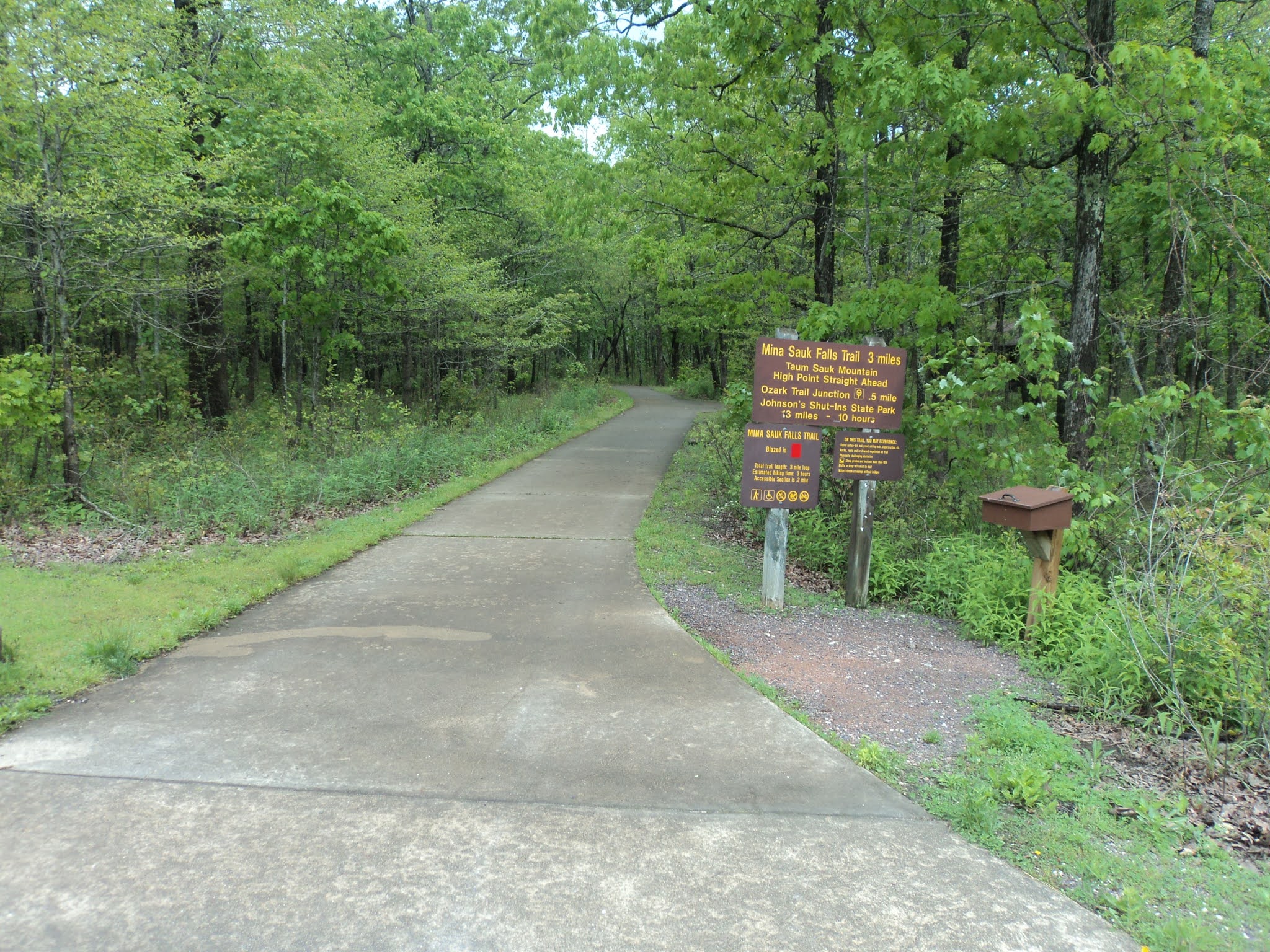
Trailhead area: Hinkson Creek Trail
            This hike starts at the rear of the parking lot on the crushed gravel Hinkson Creek Trail, which is also open to mountain bikes.  The Hinkson Creek Trail links the nature area to the University of Missouri campus.  The trail curves right to cross Grindstone Creek on an iron bridge with wooden deck.  The Ridgeline Trail exits left in this area, but it was very overgrown on my visit.
            After crossing Grindstone Creek, look for the mulch trail that exits the bike path on the right.  This mulch path is the start of the hiker-only Grindstone Nature Trail, so angle right to begin the Nature Trail.  Less than 200 feet later, you pass a tall concrete silo on the right, one of the reminders of this area’s agricultural history.
Concrete silo
            Just past the silo, the trail splits to form its loop.  This hike will continue straight on a path that heads up the right side of a prairie planting and use the narrow path exiting right into the woods as its return route.  None of the trails at Grindstone Nature Area are marked or signed.  With the many narrow and winding trails that exist here, this trail system could really benefit from some better trail markings to make trails and trail intersections easier to identify.
            The grass-dirt trail heads northwest in almost a straight line with the prairie planting on your left and the woods on your right.  Continue straight wherever side trails exit left or right.  At one point the trail seems to head into the woods on a mulch path, but it quickly comes back out into the prairie.
Hiking through the prairie
            Just shy of 0.7 miles, you reach a T-intersection at the northwest edge of the prairie with options going left and right.  The trail going left quickly leads back to the gravel Hinkson Creek Trail, and it could be used if you wanted a hike entirely in the prairie.  To also see the limestone cliffs for which this part of Missouri is famous, turn right to begin following a sewer line, a reminder of this hike’s suburban setting.
            Upon reaching the edge of the prairie, turn left to head into the woods, which features a large number of cottonwood trees.  The trail surface turns to packed dirt as it curves right to begin paralleling Hinkson Creek.  Some narrow trails exit left and right, but the main trail assumes a southeasterly course with the creek several feet to your left.  As I mentioned above, some trail markings would really help here.  Also, the packed dirt soil can become quite slippery when wet, so take your time and watch your step.
Climbing gradually
            Slowly but surely you gain elevation as you climb to the bluffs overlooking first Hinkson and then Grindstone Creeks.  There are no developed overlooks, but some spur trails take you to the edge of the cliff, which stands some 70 feet above the creek level.  At first trees block any views, but finally at 1.2 miles a clear view over an apartment complex to the east emerges.  No railings guard the edge of the cliff, so mind your position relative to the drop-off.
View from cliff top

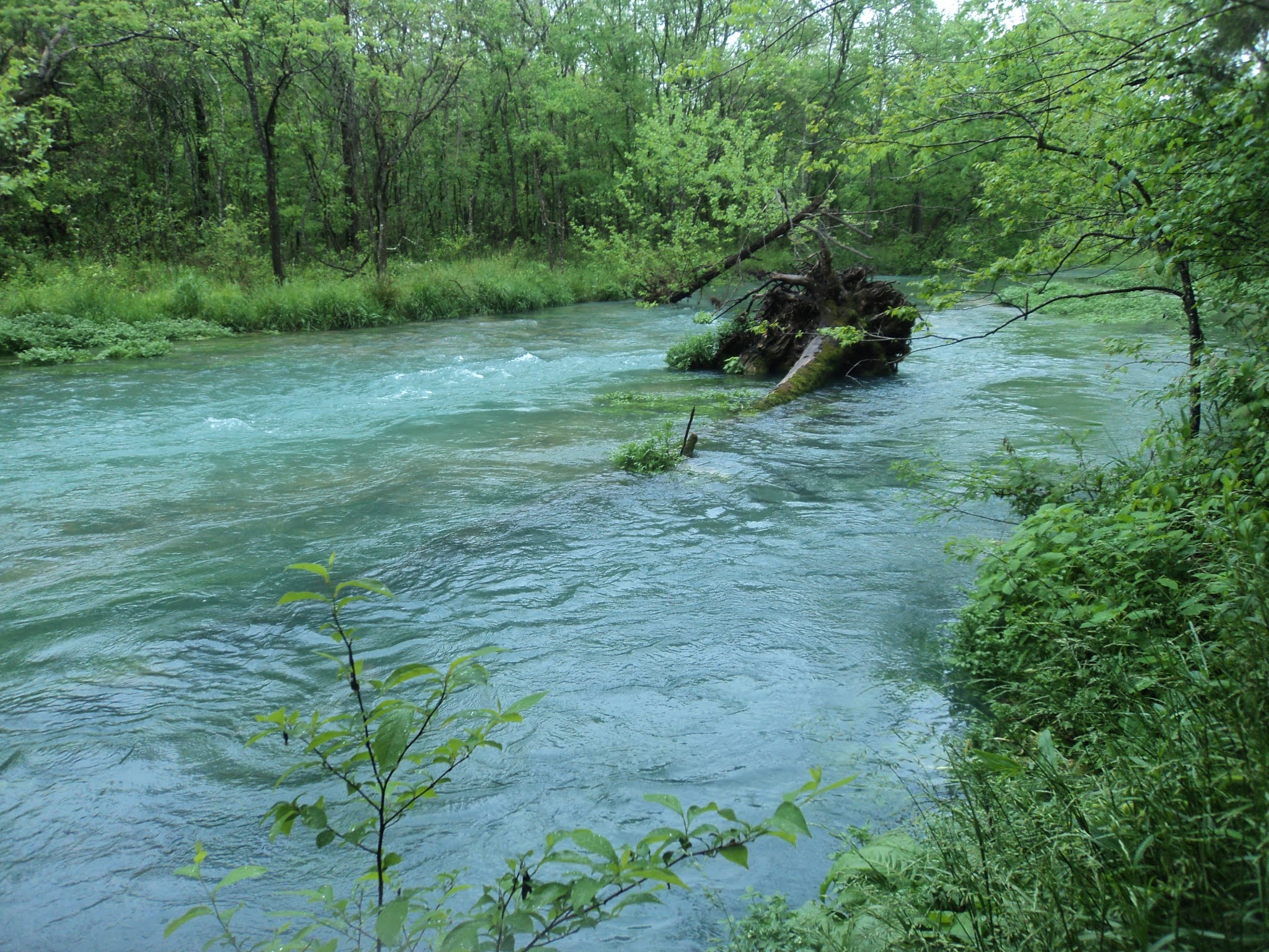
Looking down from the cliffs at Grindstone Creek
            The trail becomes a bit rockier and narrower as you continue southeast.  A brief descent precedes a brief ascent to the bluffs overlooking Grindstone Creek.  The creek waters are visible below, but trees block any expansive views.  A final descent brings you to the mulch trail beside the old concrete silo to close the loop.  A left turn returns you to the packed gravel Hinkson Creek Trail, where another left turn returns you to the parking lot to complete the hike.