Showing posts with label Illinois Hikes. Show all posts

Tuesday, November 25, 2025

Franklin Creek State Natural Area: Mill Springs Day Use Area to Dysart's Pond (Blog Hike #1087)

Trails: Mill Springs and Pioneer Pass Trails
Hike Location: Franklin Creek State Natural Area
Geographic Location: southwest of Rochelle, IL (41.85430, -89.34852)
Length: 2.5 miles
Difficulty: 4/10 (Moderate)
Date Hiked: October 2025
Overview: An out-and-back, mostly easy but with a couple of steep areas, passing Mill Pond, Mill Spring, and Dysart's Pond.
Park Information: https://dnr.illinois.gov/parks/park.franklincreek.html
Hike Route Map:
On The Go Map
Photo Highlight:
Hike Video: (coming date TBD)

Directions to the trailhead: From Rochelle, take SR 38 west 16 miles to State Street in the town of Franklin Grove.  Turn right on State St., then in 0.1 miles turn left on Old Mill Road.  Drive Old Mill Rd. west 2.6 miles to the signed park entrance on the left.  Turn left to enter the park, and park in the small gravel lot near the restroom building and picnic shelters.

The hike: Established in 1982 as Illinois' 24th state nature preserve, Franklin Creek State Natural Area protects 882 acres of lowland and upland forest along scenic Franklin Creek.  In addition to forested natural areas, the park also features a dose of history.  An abandoned quarry sits in the eastern part of the park, and the 1847 Franklin Creek Grist Mill, once the largest grist mill in Lee County, today serves as the park's visitor center and gift shop.
Franklin Creek Grist Mill
    
        True to a natural area, the park is light on amenities: only an archery range and some reservable picnic shelters lure visitors.  What the park lacks in amenities it makes up for in trails.  The park's 4.5 miles of hiking trails and 6 miles of bridle trails are accessed from 2 main trailheads, one on the east side of the natural area and the other on the west side of the natural area.  This hike starts at the Mill Springs Day Use Area, which is the western access.  This out-and-back visits Mill Spring and Mill Pond and passes both riverside and ridgetop scenery en route to Dysart's Pond, a large serene pool in Franklin Creek near the center of the natural area.
Trailhead at Mill Springs Day Use Area
    
        From the picnic shelter at the Mill Springs Day Use Area, pick up the concrete ADA-accessible Mill Springs Trail as it heads south with Franklin Creek on your left.  Lots of honeysuckle crowds the understory of this mixed broadleaf forest, and this park really shows its youth in this area.  Ignore the short spur trail that leads right to Mill Pond; we will explore that trail on our way back.
Mill Spring
    
        At 0.3 miles, the concrete trail ends at a picnic shelter beside Mill Spring.  Water comes up among the rocks at the base of the hillside before cascading down some more rocks into Franklin Creek.  Mill Spring is quite robust: I came here on a near 90-degree morning during the driest time of year, and it was still emitting a strong flow of water.
Hiking along Franklin Creek
    
        The concrete Mill Springs Trail ends at its namesake spring.  Continue upstream by crossing the outflow of Mill Spring; this will require a rock hop or stepping through a few inches of water.  You are now on the singletrack dirt Pioneer Pass Trail.  Trails at this park are unmarked, but numbered posts mark key points and intersection.  Mill Spring is post #1.
Steep ascent
    
        The trail climbs to top a steep bluff before descending back to creek level via some wooden steps.  The next climb takes you all the way to the ridgetop, and it starts with the steepest grade of the hike.  Some wooden waterbars used to aid this ascent, but some trees that fell years ago still block the waterbars, forcing hikers to take a steeper route directly up the dirt hillside.  Remember that this hike is an out-and-back, so don't go up something if you are not sure you can get back down.
Hiking along the ridgetop
    
        At 0.65 miles, you reach the ridgetop, where you will stay for the next 0.4 miles.  The ridgetop is drier and receives more sun than the creekside areas, and I saw many yellow jackets on this part of the hike.  Ignore side trails that exit right.  A couple of shallow ravines are crossed via wooden footbridges.  These bridges were shaky on my visit, but they got me across without incident.
Footbridge over ravine
    
        1.05 miles into the hike, you descend back to Franklin Creek via a long set of wooden steps.  The ridge is about 100 feet higher than the creek, and you will have to go up and down the ridge twice on this hike.  At 1.2 miles, you reach the bottom of the hill, post #14, and the spur trail to Dysart's Pond.  Turn left and quickly arrive at Dysart's Pond.  Dysart's Pond is a calm area in Franklin Creek with a vertical rock bluff on the far side.  The pond occupies a serene setting, and its location in the middle of the natural area accessible only by this trail ensures a decent amount of solitude.
Dysart's Pond
    
        The Pioneer Pass Trail continues east, and the next two destinations are an old quarry and a deep rock shelter known as Whipple Cave.  Reaching either of those destinations requires fording Franklin Creek, so come prepared for wet feet if you wish to go further east.  I turned around at Dysart's Pond and retraced my steps to the Mill Springs Day Use Area.
Mill Pond
    
        To add some variety to my return route, I took the short spur to Mill Pond on my way back.  Mill Pond is a large algae-covered man-made pond; it once provided water for the grist mill that now serves as the park's visitor center.  A small picnic shelter here encourages you to pause, admire the pond, and think about this area's history before returning to the trailhead to complete the hike.


Sunday, November 23, 2025

Illini State Park (Blog Hike #1086)

Trail: (unnamed)
Hike Location: Illini State Park
Geographic Location: across the Illinois River from Marseilles, IL (41.32094, -88.71166)
Length: 1.4 miles
Difficulty: 1/10 (Easy)
Date Hiked: October 2025
Overview: A loop hike partially along the Illinois River.
Park Information: https://dnr.illinois.gov/parks/park.illini.html
Hike Route Map:
On The Go Map
Photo Highlight:
Hike Video: (coming November 3, 2026)

Directions to the trailhead: From Marseilles, take Main Street south across the Illinois River to the signed park entrance on the left.  Turn left to enter the park, then turn left at the next 2 intersections to pass back under the river bridge you just crossed.  Park in the small gravel lot on the right near the gated entrance to the Pine Glen Campground.

The hike: Named for the Illinois Confederation, a.k.a. Illini or Illiniwek people, who lived here as late as the early 1800s, Illini State Park oozes history in every direction.  The park's north boundary is the Illinois River, and the Great Falls of the Illinois River proved a major barrier to barge navigation.  Thus, in the 1920s the Army Corps of Engineers built Marseilles Lock and Dam, which is formally known as Lock and Dam #5; it can still be seen in the north side of the park.  The Marseilles Moraine and its rich coal reserves lies in the southern part of the park.  The eastern part of the park was once the Marsatawa Country Club, which boasted one of the country's best golf courses in the early 1900s.
            The park's land has been in public hands since the early 1930s, and 2 Civilian Conservation Corps (CCC) companies worked to convert the country club's golf course into the park we see today.  The CCC built many of the park's buildings, and their camp served as a semi-correctional boys camp until the 1960s.  Construction was finished in 1934, and the park officially opened in 1935.
            Today Illini State Park offers a 58-site developed campground, fishing and boating on the Illinois River, and some picnic shelters.  For hikers, the park offers only 1 trail: the short unnamed trail described here.  Yet this trail is a good one that explores the river, the old CCC camp, and the upland woods.  I had a nice hike when I came here on a warm afternoon in early October.
Starting the loop
    
        This trail forms a loop, and I hiked the loop counterclockwise by walking north from the parking lot before turning left to enter the woods.  Trails at this park are unmarked, but they are wide and easy to follow.  The riverside forest is dominated by 
black walnut and basswood trees, and I saw a lot of squirrels scurrying through the forest.
Marseilles Canal overlook
    
        At 0.15 miles, you reach the first of three Marseilles Canal overlooks.  This canal was built to channel Illinois River boat traffic into Marseilles Lock, which lies just downstream.  The landmass you see across the canal is actually an island; the main channel of the Illinois River lies beyond the island.  If you look carefully at the side of that island, you can see the rock cut that was made to build this canal.
Hiking along the canal
    
        The trail continues west with the canal through the trees to the right.  Several downed trees had been recently removed from the trail, and the trail maintenance here was excellent.  At 0.7 miles, the trail curves left to head away from the river and start following Person Creek.  A gradual climb comes next, but the difference between maximum and minimum elevation on this hike is only about 30 feet.  Thus, all grades on these trails are gradual.
Abandoned restroom building
    
        A sweeping left curve brings you to an abandoned restroom building, parking lot, and playground at 0.85 miles.  I suspect this area is connected to the boys camp from the 1960s mentioned in the introduction, but I could not confirm my suspicion.  Next the trail heads east atop a low but steep ridge that drops about 10 feet on either side.  I could not find any information about this ridge, so maybe it is part of the moraine that lies south of the park or an old river bank.
Stone picnic shelter
    
        1.3 miles into the hike, you reach a nice stone picnic shelter that is part of the Pine Glen Youth Group Campground.  The final leg of the loop uses an old dirt road with the group camp through the trees on the right.  500 feet later, you reach the vehicle gate that blocks the old dirt road and intersect the paved group campground access road.  Angle left and do a short road walk to return to the parking lot and complete the hike.

Thursday, November 20, 2025

Buffalo Rock State Park and Effigy Tumuli (Blog Hike #1085)

Trails: Effigy and River Bluff Trails
Hike Location: Buffalo Rock State Park
Geographic Location: west of Ottawa, IL (41.32747, -88.91200)
Length: 2.3 miles
Difficulty: 2/10 (Easy)
Date Hiked: October 2025
Overview: A semi loop beside effigy tumuli with blufftop views of the Illinois River.
Park Information: https://dnr.illinois.gov/parks/park.buffalorock.html
Hike Route Map:
On The Go Map
Photo Highlight:
Hike Video: (coming June 12, 2026)

Directions to the trailhead: From downtown Ottawa, take Main Street west 0.6 miles to Clay Street and turn left on Clay St.  Drive Clay St. south 0.2 miles to Ottawa Avenue and turn right on Ottawa Ave.  Ottawa Ave. becomes Dee Bennett Road after you leave Ottawa.  Drive 3.5 miles from Clay St. to the signed park entrance on the left.  Turn left to enter the park, drive the narrow park road uphill to the top of Buffalo Rock, and park in the parking lot beside the picnic shelters and restroom building at the park road's end.

The hike: Formed as an ancient island in the Illinois River, Buffalo Rock was first discovered by European explorers in 1673 during Louis Jolliet's and Father Jacques Marquette's journey up the Illinois River.  The French explorers discovered the Illinois Confederation, a.k.a. the Illiniwek or Illini, living here, but within a few years the Illini were on the brink of defeat to the Iroquois.  In the early 1680's, the French built a military, trading, and missionary post atop the rock that became a headquarters for opponents of the Iroquois.  In 1912, the Crane Company of Chicago purchased the rock for use as a sanitarium and summer vacation home for its employees, and the company deeded the land to the State of Illinois in 1928.
            Located across the Illinois River from famous Starved Rock State Park, Buffalo Rock State Park and Effigy Tumuli protects 298 acres on and around its historic and namesake rock.  The rock's name comes from a legend that ancient peoples used the box canyon formed by the rock to trap and capture buffalos.  The park has no developed campground, but it offers some picnic shelters, a bison pen, 2 hiking trails, some blufftop river views, and the interesting effigy tumuli, which I will describe below.  This hike uses both of the park's trails to tour all major points of interest in the park.
Trail beside restroom building
    
        There are several places where you could start this hike, but I started at the restroom building at the northwest corner of the main parking lot.  A concrete path heads into the woods, and quickly it curves left to arrive at the dedication area for the effigy tumuli.  Technically a type of earth art, the effigy tumuli are a series of animal-shaped dirt mounds built in 1983 by Michael Heizer.  The tumuli are designed to be a tribute to the Mound Builder peoples who lived in eastern North America from 3500 BC until the 1700's.  The animal shapes of the tumuli are almost impossible to discern from the ground, and you will need to look at the park brochure while you are hiking if you want to know the shape of the mound you are standing beside.
Hiking through the prairie atop Buffalo Rock
    
        Continue south past the dedication area, and at 0.2 miles you reach the trail intersection that forms the loop portion of this hike.  Turn right to begin a counterclockwise journey around the loop.  The wide dirt/grass trail heads southwest through a prairie area, and this was a warm and sunny hike on the seasonally warm early October 
afternoon when I hiked here.  The park brochure tells you that you pass the frog and water strider tumuli on the left as well as the catfish tumulus on the right, but they look like formless mounds of dirt to the naked eye.
Catfish tumulus
    
        At 0.8 miles, you reach the west corner of the loop.  We will eventually turn left to continue the loop, but first angle softly right to add-on an out-and-back that takes you past the rest of the tumuli.  The trail descends slightly as it heads out the western part of Buffalo Rock, and this part of the rock has equal amounts of broadleaf trees and prairie.  The park brochure says that you pass the turtle tumulus on the left, but again it is hard to discern.
Western part of Buffalo Rock
    
        1.2 miles into the hike, you trace around a very tiny loop, almost a cul de sac, at the west end of the trail.  The mounds you see in this area form the snake tumulus, and they look more like a snake than any of the other tumuli do their animals.  Retrace your steps back east to return to the loop, then angle softly right to continue a counterclockwise journey around the loop.
Developed Illinois River overlook
    
        Just shy of 1.6 miles, you reach the developed Illinois River overlook.  This overlook is getting a little overgrown, but it still provides a mostly clear view of the river and Starved Rock State Park on the other side.  I am always amazed at how wide the Illinois River is; that width is partly due to the river's prairie setting and partly due to the river's extensive system of locks and dams.  Past the developed overlook, the trail continues east along the top of the river bluffs, which drop to the right.  Some unofficial river overlooks are passed, and I liked the view from some of the unofficial overlooks more than the view from the official overlook.
Unofficial Illinois River overlook
Bison pen
    
        2 miles into the hike, you reach another trail intersection.  The trail going straight leads down and up through a steep ravine to reach a secondary parking area, so you want to turn left to hike a more level trail back to our parking area.  Just before you finish the hike, you pass the park's bison pen on the right.  I saw several bison in the pen, and these bison form a fitting way to finish your hike at Buffalo Rock State Park.

Sunday, September 29, 2024

Matthiessen State Park: Dells Area Loop (Blog Hike #1019)

Trails: Bluff and Interior Trails
Hike Location: Matthiessen State Park, Dells Area
Geographic Location: East of Oglesby, IL (41.29594, -89.02582)
Length: 2.2 miles
Difficulty: 7/10 (Moderate/Difficult)
Date Hiked: September 2024
Overview: A lollipop loop with lots of stairs passing waterfalls in the narrow dells.
Park Information: https://dnr.illinois.gov/parks/park.matthiessen.html
Hike Route Map: https://www.mappedometer.com/?maproute=972048
Photo Highlight:
Hike Video:

Directions to the trailhead: Southwest of Chicago, take I-80 to SR 178 (exit 81).  Exit and go south on SR 178.  Drive SR 178 south 5 miles to the park entrance on the right.  Turn right to enter the park, and park at the main paved parking area where the park entrance road ends.

The hike: Often overlooked in favor of its larger nearby brother Starved Rock State Park, Matthiessen State Park (pronounced like MATH-uh-sun) protects 1700 acres along and near the Vermillion River.  The park came to be in 1918 when the heirs of Frederick William Matthiessen, an industrialist who made his riches by manufacturing zinc products in nearby LaSalle, donated his private park to the State of Illinois.  Matthiessen's private park was known as Deer Park, but the land was renamed in Matthiessen's honor in 1943.
            Matthiessen State Park is divided into 2 areas: the Dells Area and the River Area.  This hike is contained in the Dells Area; a separate trail system with separate parking lot and entrance road a couple of miles to the south explores the River Area.  The Dells Area is the more popular of the two areas for the obvious reason: the dells form a long and narrow gorge that contains many waterfalls and scenic cliffs.  While this hike is not the longest possible route through the Dells Area, it gives a good sample of the dells' scenery both from the rim and the interior of the dells.
Re-created French stockade
    
        This hike offers plenty to see, and the sights start at the rear of the parking area where 2 log structures stand.  The structure on the right is a nice log cabin with stone chimney, but the one on the left commands your attention: it is a re-created log stockade.  The French built forts similar to this one all over the Midwest during the late 1600s and early 1700s, and interpretive signs tell you about this park's and this region's history.
Descending the stairs
    
        The entrance trail passes between the 2 log structures and descends a set of wooden stairs.  After passing 2 benches, you reach the trail intersection that forms our loop through the dells.  The stairs continue descending straight, and our return route goes left.  This hike turns right to begin heading counter-clockwise around the Bluff Trail.
Hiking the Bluff Trail
    
        True to its name, the Bluff Trail forms a loop more-or-less around the dells, which you can see downhill to the left.  The portion around the north part of the dells is fairly flat, and therefore the going for now is fairly easy.  Some large oak trees live here, but so does a lot of poison ivy in the understory.  Fortunately, the trail is plenty wide enough to avoid that irritating shrub.
Northeast corner of the dells
    
        At 0.6 miles, a side trail back to the park entrance road exits right.  The Bluff Trail curves left to round the northeast corner of the dells.  The next section of trail is very improved, and it features several benches and a concrete sidewalk feel.
Matthiessen Lake
    
        1 mile into the hike, you cross a high and long concrete bridge just below the dam that forms Matthiessen Lake.  Matthiessen Lake is a small lake covered in lime green algae, and it reminds you of this land's Deer Park days.  A sign that says "Lake Falls" hangs from a wooden handrail on the lake's dam, but you can't see the waterfall from the concrete bridge.  To get to the waterfall, cross to the west end of the concrete bridge, then turn left to descend some wooden stairs into the northwest corner of the dells.  At the bottom of the stairs, turn left and make your way a couple hundred possibly wet and muddy feet upstream in the streambed to reach the base of Lake Falls.
            At about 30 feet high, Lake Falls is the tallest waterfall in the dells.  Its location directly below the dam ensures that water flows here even when other waterfalls are dry, and the sheer cliff surroundings make for a stark and impressive setting.  Take some time to enjoy the rocky and wet scenery.
Lake Falls
    
        After viewing the waterfall, head downstream into the heart of the dells on the Interior Trail.  Whereas the Bluff Trail was marked with brown trail markers, the Interior Trail is marked with green trail markers.  At times the trail shares its treadway with the stream bed, so the going can be muddy and rocky.  Some smaller waterfalls, including Giant's Bathtub, are passed, and the scenery is just as interesting if less dramatic than Lake Falls.
Giant's Bathtub
    
        Two trails exit the dells to the right.  While the choice is yours, you will need to take one of them to get back up to the Bluff Trail: the Interior Trail deadends in the dells.  Just shy of 1.5 miles, you reach the middle bridge that separates the upper and lower dells.  This bridge leads directly back to the entrance trail, and you could cross here if you wanted to shorten your hike.  Continue straight to begin treading the west bluff above the lower dells.  Cascade Falls can be heard but not seen in the dells to your left just below the middle bridge.
Peering into the lower dells
    
        A gradual descent brings you to another trail intersection at 1.6 miles.  The trail going right leads to an alternate trailhead near Deer Park Country Club, so you want to turn left to descend 181 wooden stairs and reach the concrete bridge over the 
lower dells.  These high and long concrete bridges seem very out of place in the state park today, but they do a great job of getting you across the dells while giving you top-down views into the dells.
Concrete bridge over the dells
    
        At the east side of the bridge, you could extend your hike by turning left, descending into the lower dells, and exploring the lower dells further.  I had a long distance to drive on the warm afternoon in mid-September when I came here, so I turned right to climb some wooden stairs and head back to the trailhead.  You pass more interesting rock formations, namely Strawberry Rock and the Devil's Paint Box, before closing the loop at 2.1 miles.  Turning right on the entrance trail and climbing more wooden stairs returns you to the parking lot and completes the hike.

Monday, August 3, 2020

Ferne Clyffe State Park: Hawk's Cave, Rebman, and Big Rocky Hollow Trails (Blog Hike #807)

Trails: Hawk's Cave, Rebman, and Big Rocky Hollow Trails
Hike Location: Ferne Clyffe State Park
Geographic Location: south of Goreville, IL (37.54280, -88.97987)
Length: 1.8 miles
Difficulty: 2/10 (Easy)
Date Hiked: July 2020
Overview: A trio of short trails featuring sandstone cliffs and rock shelters.
Park Information: https://dnr.illinois.gov/parks/park.ferneclyffe.html
Hike Route Map: https://www.mappedometer.com/?maproute=826240
Photo Highlight:
Hike Video:


Directions to the trailhead: In southern Illinois, take I-24 to Tunnel Hill Road (exit 7).  Exit and go west on Tunnel Hill Rd.  Drive Tunnel Hill Rd. to its end at SR 37 and turn left on SR 37.  Drive SR 37 south 0.6 miles to the signed park entrance on the right.  Turn right to enter the park, then in 0.6 miles turn left to follow signs for the park's picnic area.  Park in the parking lot at the end of the picnic area road, which is reached in another 1.2 miles.

The hike: Established in 1949, Ferne Clyffe State Park protects 2430 acres of southern Illinois' famous cliff-lined hollows.  The park came to be when the State of Illinois purchased the central piece of land from Emma Rebman, a local schoolteacher and Johnson County school superintendent who previously allowed the public to access her land on Sundays for a 10-cent admission fee.  The unusual old-English spelling of the park's name is due to a pair of brothers from Cairo who owned this land before Rebman and admired the large number of ferns that grow here.
            Today the park features some nice amenities, which include a 16-acre lake, 3 campgrounds with modern and primitive sites, and numerous picnic areas.  Yet the cliffs that made this area famous still take center stage, and to see them you will need to hike one of the park's 18 short hiking trails.  The hike described here combines three of the park's short nature trails to explore the park's central area.  On a personal note, I considered stopping here several times while driving I-24 to more distant hiking destinations, and my decision to finally stop here in July 2020 on my way to Colorado was rewarded with a short but excellent hike.
Exiting north end of parking cul de sac
    
        All three of the nature trails start near the parking lot at the end of the picnic area road, so you could hike them in any order.  I chose to hike the Hawk's Cave Trail first.  To find the start of the Hawk's Cave Trail, walk north to cross a creek on a concrete low-water bridge and look to the left for the 
Hawk's Cave Trail's signed trailhead.
Trailhead: Hawk's Cave Trail
    
        The gravel Hawk's Cave Trail climbs over some wooden waterbars, and in only a few hundred feet you reach the trail intersection that forms the Hawk's Cave Trail's loop.  I chose to continue straight and use the trail going right as my return route, thus hiking the loop clockwise.  The trail dips to cross a small creek on a wooden footbridge before climbing to approach Hawk's Cave.  The smooth gravel trail surface turns to rough dirt and rock in this area, and some poison ivy needs to be minded.
Hawk's Cave
            At 0.3 miles, you reach Hawk's Cave.  More a large rock shelter than what you would typically think of as a cave, Hawk's Cave impresses with its size and length, and it reminded me of the rock shelters of the Appalachian Mountains such as those at Big South Fork in Tennessee.  Some large slump blocks laying on Hawk's Cave's floor need to be negotiated, and you need to step carefully in this area.  After exiting the rock shelter, the trail surface turns back to gravel before you close the loop; turn left to complete the Hawk's Cave Trail.
Start of Rebman Trail
    
        Next I hiked the Rebman Trail, which starts at another signed trailhead located right beside the 
Hawk's Cave Trail's trailhead.  (Aside: the trail that heads north between these two trailheads is the Goreville Boy Scout Trail; it leads uphill to the town of Goreville and this park's original entrance.)  The Rebman Trail is named for this land's previous owner, and it provides access to the park's rock climbing and rappelling area.  Where the trail splits to form its loop, angle right to rock-hop a small stream and arrive at the base of the climbing/rappelling cliffs.  These sandstone cliffs are not as impressive as Hawk's Cave, and overall the Rebman Trail is the least scenic of the three short trails that comprise this hike.
Head of Rebman Trail's hollow
    
        The trail meanders north around some large slump blocks with the creek on your left and the climbing/rappelling cliffs on your right.  Where a seasonal rocky waterfall appears at the head of the hollow, the trail curves left to rock-hop the creek again and begin heading downstream on a more established track.  After passing the park dedication plaque on the right, you return to the trailhead for the Rebman Trail just shy of 1 mile into the hike.  Walk back across the low-water concrete bridge to return to the picnic area parking lot.
Start of Big Rocky Hollow Trail
    
        The last trail, the Big Rocky Hollow Trail, starts to the left at the very rear of the parking lot's cul de sac.  The Big Rocky Hollow Trail is the park's most popular trail because it leads to the park's largest waterfall, and it starts as a wide gravel trail with the creek to your left.  The forest in this hollow is dominated by maple and sweet gum trees, and the ferns for which this park is named are also plentiful here.
"Waterfall" at head of Big Rocky Hollow
    
        The trail crosses the creek using a concrete ford, and some rock cages that stabilize the creek's banks appear below the trail.  Ignore the Waterfall Trail that exits right and heads for the park's campground, and also ignore some unofficial trails that lead out of the hollow.  At 1.3 miles, you reach the trail's end: a wooden viewing platform at the base of the waterfall.  The creek and waterfall were completely dry on my visit, but some benches still provided nice places to sit, enjoy the surrounding sandstone cliffs, and admire the hollow's excellent acoustics.  After spending some time at the head of the hollow, retrace your steps down the Big Rocky Hollow Trail to reach the parking lot for a third time and complete the hike.

Wednesday, June 12, 2019

Kickapoo State Recreation Area: Out and Back Trail (Blog Hike #749)

Trail: Out and Back Trail
Hike Location: Kickapoo State Recreation Area
Geographic Location: west of Danville, IL (40.13872, -87.73552)
Length: 6.2 miles
Difficulty: 4/10 (Moderate)
Date Hiked: May 2019
Overview: A lollipop loop through fields and forest on the east side of the Vermilion River.
Photo Highlight:

Directions to the trailhead: In extreme eastern Illinois, take I-74 to US 150 (exit 210).  Exit and go east on US 150.  Take US 150 east 0.75 miles to the first traffic light, which is CR 1.  Turn left on CR 1.  Take CR 1 north 1.8 miles to Kickapoo Road and turn left on Kickapoo Rd.  Drive Kickapoo Rd. west 2.5 miles to the state park office, which is located on the left.  Park in the lot in front of the office.

The hike: The land of Kickapoo State Recreation Area has seen a lot of changes.   Between 500 and 1500 A.D. a Kickapoo village was located where the Middle and Salt Forks of the Vermilion River meet, hence the park’s name.  In 1819, European settlers discovered salt springs near the park.  Because salt was a valuable commodity on the frontier, this discovery led to an influx of European settlers.
            The salt springs supported the local economy until 1848, when salt production ceased.  Shortly thereafter, the land became one of the first areas to be strip mined for coal.  Early strip mining techniques devastated the natural landscape, and the scars of these mines are still visible today.  The coal extraction left a wasteland of bare hills and polluted ponds, and in 1939 the State of Illinois purchased 1290 acres of scarred land from the United Electric Coal Company.  Subsequent purchases of adjacent farmland created the current total of 2842 acres.
            The park today stands as a major recreation center, a sharp contrast to its state 70 years ago.  The once polluted waters now sustain life and provide plenty of fishing opportunities.  Two of these ponds even offer scuba diving, a rarity in a landlocked state like Illinois.  The park’s other amenities include picnic areas, a stable and many miles of trails for horseback riding, and a 6.5 mile mountain bike trail system.
            The park also offers 16 miles of trails open to hiking.  Many of the trails are 1 mile long or less, but a few options are longer.  The Riverview Trail starts at the picnic area between the river and Clear Lake and offers an easy 2 mile stroll along the Middle Fork of the Vermilion River, which bisects the park on a north to south course.  Two trails start at the park office: the Clear Lake and Out and Back Trails.  Both trails make for nice hiking, but this hike features the 6.2 mile Out and Back Trail, the park’s longest trail.
Trailhead near park office
            From the park office, walk north past the maintenance building and cross the main park road to arrive at a wooden sign announcing the beginnings of the Clear Lake and Out and Back Trails.  Both trails are rated rugged due to their length, but the difficulty of the terrain makes these trails no more strenuous than average.  Both trails start by heading right from the sign in a narrow strip of woods between the park road on the right and a steep hill to the left.  The Out and Back Trail is marked with white blazes and white signs bearing the hiker symbol.  Distance markers for the Out and Back Trail are posted every 0.25 miles, and the first of these wooden signs is reached while you are still adjacent to the park road.
4.75 mile marker on Out and Back Trail
            The trail curves left to follow and then cross the paved access road for Emerald Pond.  The Clear Lake and Out and Back Trails part ways here.  The Clear Lake Trail continues to parallel the access road before heading downhill toward Inland Sea and Clear Lake, and adding it to this hike forms an 8.6 mile double loop.  This description stays right to remain on the Out and Back Trail.
            At 0.4 miles, the Out and Back Trail crosses the access road and intersects the dirt/gravel entrance road for the group camp.  The camp road is gated, so vehicles are unlikely to be encountered.  Note that a small parking lot just outside the gate could serve as an alternate starting point for the Out and Back Trail.  Turn left on the camp road, which in another 0.1 miles arrives at the primitive group camp.  Where a sign that says “restrooms” points right, stay left.  At 0.75 miles, you exit the rear of the group camp on a two-track dirt trail.
Hiking through old farm field
            0.9 miles into the hike, the trail enters an abandoned farm field and makes the first of many intersections with the horse and mountain bike trails.  All of these intersections are well-marked with several signs.  If you have not seen a trail marker for a few minutes, you probably made a wrong turn.
            The trail climbs gently through the hot and sunny field, which teems with life of the insect and bird varieties.  Pass a wastewater area on the left; the smell was not horrific on my visit.  At 1.2 miles, the trail passes through a fence and curves left, continuing in a narrow strip of trees that once separated two farm fields.
Hiking along a wooded ravine
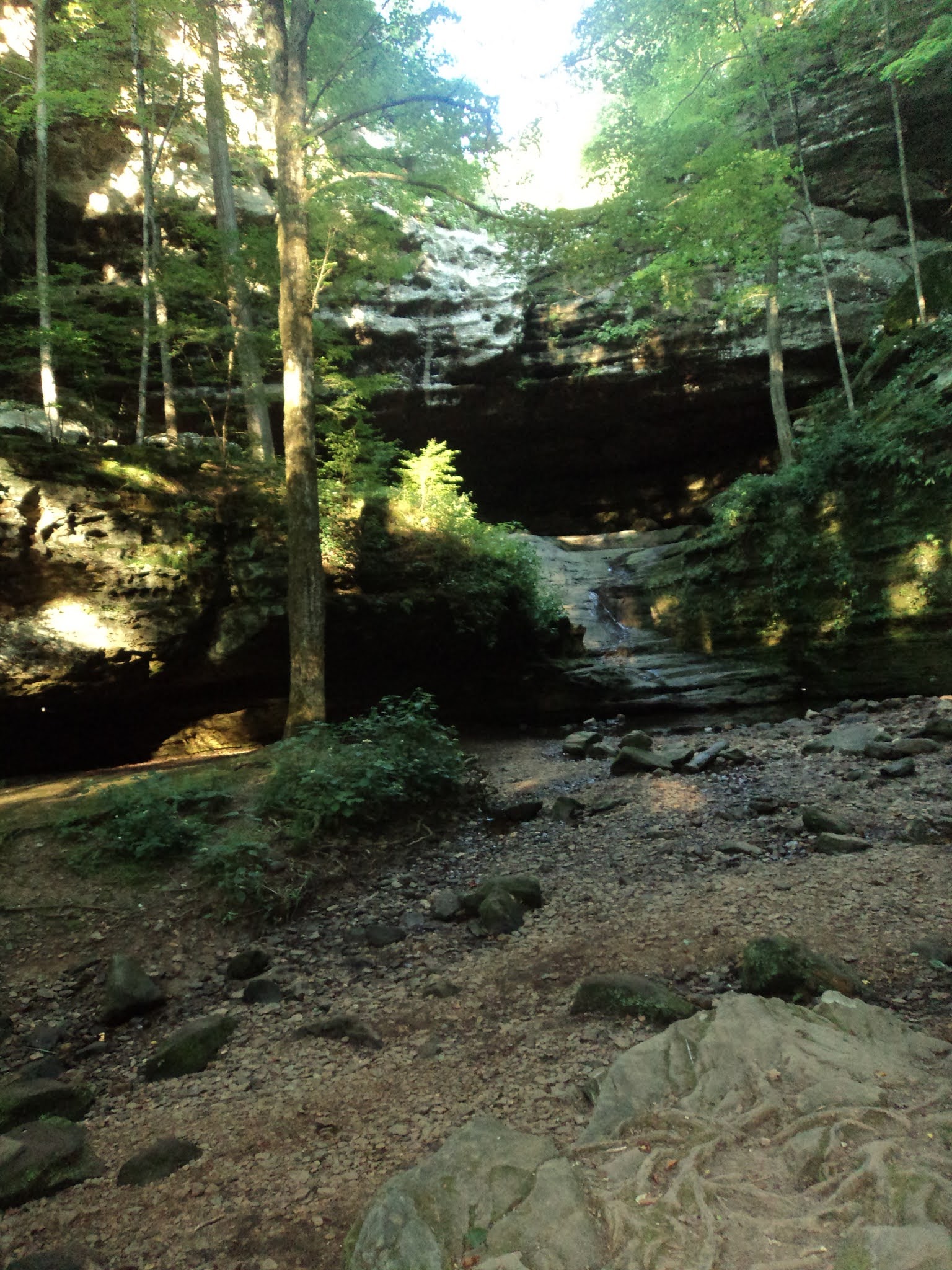
            The trail now heads west toward the Middle Fork of the Vermilion River and very slowly loses elevation.  This section of trail passes through some nice forest that features lots of oak and maple trees with a few sycamore trees, and it is my favorite part of this hike.  Soon the first steep ravine comes into view on the left.  At 1.8 miles, come to a bench overlooking this ravine.  This bench is the only bench on this hike, and therefore it makes a good place to rest.
            Just past 2 miles, the trail intersects a gravel road, where you need to turn left.  This point marks the beginning of a major trail reroute.  When I first hiked here in 2004, the Out and Back Trail exited this road to the left and crossed the river on an old concrete and steel bridge, but the bridge was demolished in 2006.  A short optional loop still exits left here, but the main Out and Back Trail heads northwest on the gravel road.
Start of main loop
            At 2.2 miles, you reach the start of the main loop.  For reasons to be seen later, I recommend hiking the loop clockwise.  The reroute is not signed as well as the route you have hiked so far, but to hike the loop clockwise you need to angle left to leave the gravel road and begin a mowed-grass trail.  If you reach some picnic tables beside a pond called Stump Pond, you are hiking the loop counterclockwise and need to backtrack a few hundred feet.
Stump Pond
            The mowed-grass trail descends moderately to enter the Middle Fork of the Vermilion River’s floodplain.  The grass was a few inches high on my visit, but the trail was easily discernible and passable.  Where a spur trail exits left to reach the river, stay right to remain on the main loop.  The trail makes a winding right-curving arc through a prairie.  The river on the left is not visible when trees have leaves, but some steep bluffs towering just beyond the river can be seen all year.
Wetland at end of gravel road
            At 3.4 miles, the trail comes out beside a wetland in an area that had recently been planted with tall, thick prairie grass on my visit.  To continue, you need to turn right and wade through the grass to reach a gravel road.  This turn is why you want to hike this loop clockwise: it would be very hard to find if you were hiking down the road.
            The rest of the loop follows the old gravel road as it heads gradually up and out of the old strip mine.  Near 4 miles, you pass some picnic tables beside Stump Pond to your left just before closing the loop.  Retrace your steps 2.2 miles to return to the park office and complete the hike.  While you are here, consider adding on the Clear Lake Trail or the Riverview Trail if you have the time and energy to do so.