Showing posts with label Florida Hikes. Show all posts

Friday, March 14, 2025

Perdido Key State Park (Blog Hike #1042)

Trail: (unnamed)
Hike Location: Perdido Key State Park
Geographic Location: Perdido Key, FL (30.29383, -87.47000)
Length: 1.8 miles
Difficulty: 2/10 (Easy)
Date Hiked: February 2025
Overview: An out-and-back along the south shore of Old River offering good bird watching.
Park Information: https://www.floridastateparks.org/parks-and-trails/perdido-key-state-park
Hike Route Map: https://www.mappedometer.com/?maproute=979496
Photo Highlight:
Hike Video:

Directions to the trailhead: Perdido Key State Park is located on Perdido Key southwest of Pensacola.  From the Alabama/Florida state line on Perdido Key, take Florida SR 292 east 3 miles to Lafitte Reef Drive.  Go north on Lafitte Reef Dr. 2 blocks to the trailhead on the right.  There is room for a couple of cars to park at this trailhead; take care not to block the gate, street, or any driveways.  If the trailhead parking lot is full, you can park at the Tourist Information Center at the corner of SR 292 and Lafitte Reef Dr. and walk the last 2 blocks to the trailhead.

The hike: Located on its namesake barrier island southwest of Pensacola, Perdido Key State Park is Florida's western-most state park.  Before the land became a park, it was owned and managed by the United States Navy as an area called the Gulf Beach Gunnery Range.  The Navy auctioned the land as excess land in 1954, and the State of Florida acquired the land to establish the park in 1980.
            As usual for a barrier island park, the beach takes centerstage, and this park protects over 2 miles of white sand Gulf of Mexico/America beach.  The park has no campground, but day-use visitors enjoy shelling, swimming, and fishing in addition to 8 picnic pavilions.  For hikers, the park offers only one short nature trail.  While the trail does not go to the beach, it does take visitors over low white sand dunes to views of Old River, and the abundance of nearby water makes this trail an excellent choice for birding.
Vehicle gate and stile at trailhead
    
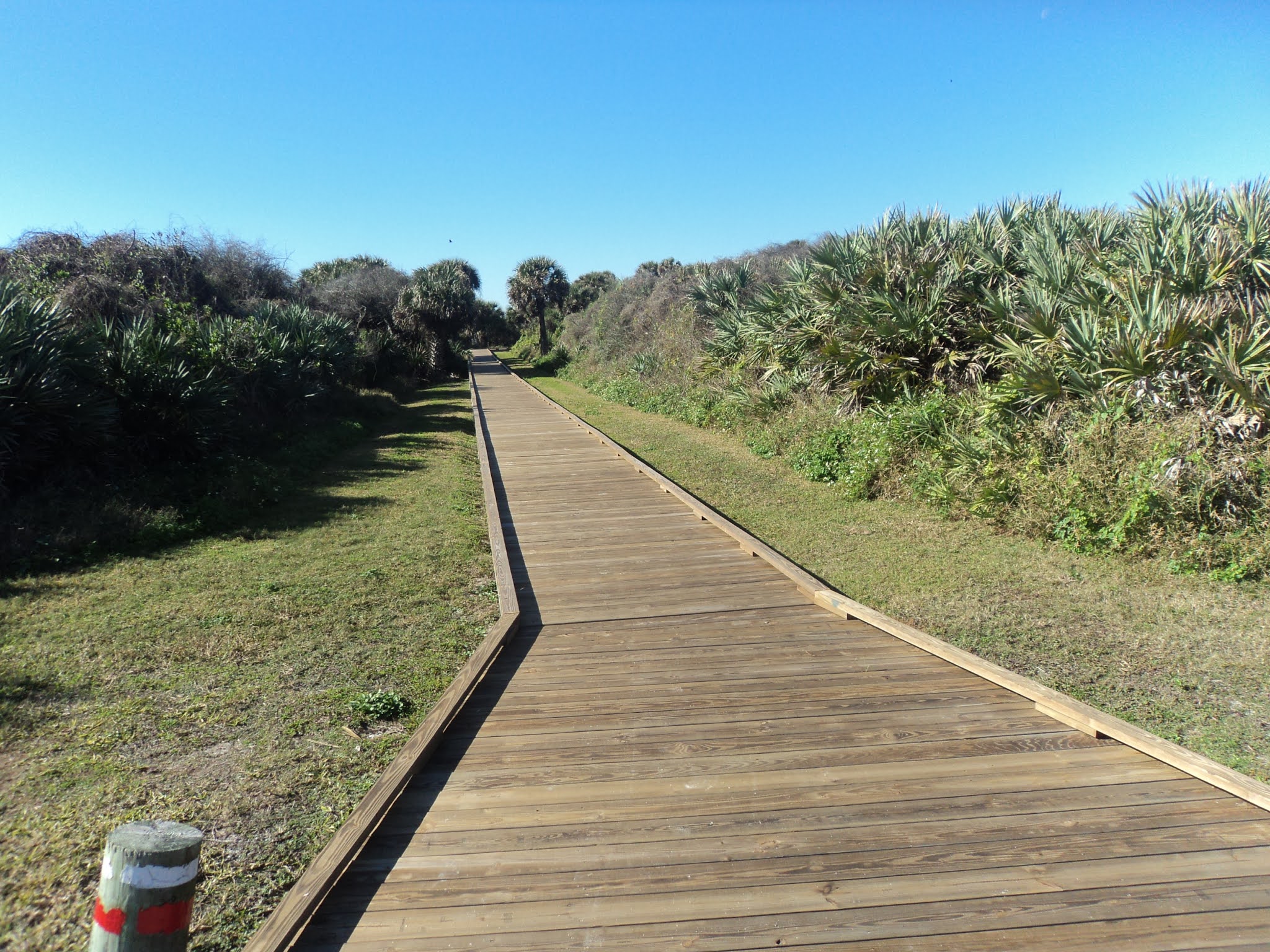
        From the small parking area on Lafitte Reef Drive, head east by walking through a stile that takes you through a fence with a locked gate.  Orange aluminum discs mark the trail, but for the most part the path is clear and obvious.  This entire hike proceeds through a 2 city-block-wide strip of sandy scrubland between Old River on your left and SR 292 on your right.  Both of those boundaries remain out of sight through pine trees and shrubs for most of this hike, but vehicle noise from SR 292 will be your constant companion.
Heading east across the sand
    
        The trail surface alternates between softer and firmer white sand, and some of the softer sand can make for unstable footing.  Most of this trail is exposed to the sun.  Many grasses cover the ground where the sand is more stable.
Old River view
    
        A meandering eastward route brings you to this hike's only view across Old River at 0.4 miles.  While this viewpoint faces north, this park's location as Florida's western-most state park becomes clear: the houses you see across the wide river are in Alabama.  This view is the most aquatic view on a mostly sandy hike, so take some time to enjoy it.
Bench at trail's end
    
        Past the Old River view, the trail continues east through more sandy and sunny coastal scrub.  At 0.9 miles, the trail unceremoniously ends at a simple black and white disc that says "end" and a wooden bench.  The bench occupies a sunny spot, and I did some great bird watching while sitting here: I saw some mourning doves, some goldfinches, an egret, some herons, and some hawks.  After bird watching to your heart's content, retrace your steps back across the sand to return to the trailhead and complete the hike.

Thursday, March 16, 2023

Florida Caverns State Park: Beech Magnolia and Bluff Trails (Blog Hike #929)

Trails: Beech Magnolia and Bluff Trails
Hike Location: Florida Caverns State Park
Geographic Location: north of Marianna, FL (30.81171, -85.22643)
Length: 1.2 miles
Difficulty: 3/10 (Easy/Moderate)
Date Hiked: February 2023
Overview: A loop hike along a rocky bluff overlooking a wetland.
Park Information: https://www.floridastateparks.org/parks-and-trails/florida-caverns-state-park
Hike Route Map: https://www.mappedometer.com/?maproute=929714
Photo Highlight:
Hike Video: 

Directions to the trailhead: From Marianna in the Florida panhandle, take SR 166 north 2.7 miles to the signed entrance for Florida Caverns State Park on the left.  Turn left to enter the park, pay the entrance fee, and then turn right on the second road that exits right.  This road quickly ends at the large blacktop parking lot for the Visitor Center; park here.

The hike: When you drive I-10 across the western part of Florida's panhandle, the gently rolling sandy dirt hills look like anything but cave country.  Yet the area's large number of springs and sinkholes provide above-ground testimony to a vast network of underground caverns.  One of the few places those caverns meet the air is at Florida Caverns north of Marianna.
            Opening in 1942, Florida Caverns State Park protects 1300 acres atop its namesake caverns, which are among the few air-filled (as opposed to water-filled) underground caverns in Florida.  The park and the adjacent golf course were built by the depression-era Civilian Conservation Corps (CCC), and the CCC also enlarged the caverns' passageways by hand to allow visitors to walk through them while standing up.  The park offers guided cave tours for a moderate fee, and the tours feature fantastic underground stalagmite and stalactite scenery.
            In addition to the cave, the park offers a 38-site developed campground, paddling and fishing on the Chipola River, an interesting museum that features both natural and human history, and 5 hiking trails totaling over 8 miles.  The park's river area and cave area both offer compelling hiking options, but the short loop described here explores the land that forms the roof of the cave.  Because this hike starts and ends at the Visitor Center, it makes a nice way to exhaust 45 minutes while you are waiting for your cave tour to begin or a nice add-on after you tour the cave.
Trailhead behind Visitor Center
    
        From the back of the Visitor Center, head uphill on the concrete path that leads to the cave tour's exit, then bear right to begin the gravel Beech Magnolia Trail.  A brown park sign marks the start of the Beech Magnolia Trail.  True to its name, the Beech Magnolia Trail makes a short loop through a forest dominated by beech and magnolia trees with a dense understory of palmetto.  A couple of small cave entrances exist in this area, but you will have to look hard to find them.
Rocky area near cave exit
    
        After a pair of left curves, the terrain gets more rocky, perhaps surprisingly so.  The rocks are uneven, so take care where you step.  At 0.5 miles, you reach the end of the Beech Magnolia Trail where it intersects the other end of the concrete path you started on.  The cave tour exit sits just to the left, and the oblong hole in the hillside makes a nice photo opportunity even if you do not take a cave tour.  To continue this hike, angle right on the concrete path, then angle right again to begin the dirt Bluff Trail.  Another brown sign marks the start of the Bluff Trail.
Cave tour exit

Wetland near Chipola River
    
       The Bluff Trail is another appropriately named trail: it traces the top of the rocky bluff that overlooks the wetland formed by the Chipola River.  The trail undulates with the bluff, and again you need to watch your footing in the rocky areas.  Ignore the Shortcut Trail, which exits left at 0.8 miles; it provides a shortcut back to the parking lot.
Tunnel Cave
    
        Just past 1 mile, you reach Tunnel Cave.  Tunnel Cave is only about 100 feet long with openings on either end, but some crawling will be required if you wish to pass through Tunnel Cave.  Past Tunnel Cave, a few hundred feet of level walking returns you to the parking lot to complete this hike.

Monday, February 20, 2023

Little Talbot Island State Park: Dune Ridge Trail (Blog Hike #924)

Trail: Dune Ridge Trail
Hike Location: Little Talbot Island State Park
Geographic Location: south of Amelia Island, FL (30.45846, -81.41400)
Length: 3.6 miles
Difficulty: 3/10 (Easy/Moderate)
Date Hiked: January 2023
Overview: A loop hike, half through coastal scrub dunes and half along the beach.
Park Information: https://www.floridastateparks.org/parks-and-trails/little-talbot-island-state-park
Hike Route Map: https://www.mappedometer.com/?maproute=940580
Photo Highlight:
Hike Video: 

Directions to the trailhead: From Amelia Island, take SR A1A south 14 miles, crossing Nassau Sound in the process, to the signed entrance for Little Talbot Island State Park. Turn left to enter the park, pay the entrance fee, and park on the near (north) side of the large paved parking area for the beach.

The hike: When I drive into most state parks, my route takes me through rural wooded areas on roads dotted with ordinary sedans, RV's, and occasional tractors.  My route into Little Talbot Island State Park from the north took me through the posh resort town of Amelia Island, and I must admit feeling a little intimidated driving my old subcompact Chevy Sonic on a road full of shiny Mercedes, Porsche, Audi, BMW, and the like.  Yet when I drove through the park entrance, the pomp and glitter faded into the usual sublime natural setting, and I found one of the hidden diamonds of northeast Florida.
            Established in 1949, Little Talbot Island State Park protects 1600 acres on its namesake island northeast of Jacksonville.  The park is the centerpiece of a group of 7 state parks known collectively as the Talbot Island State Parks.  Among that group, Little Talbot Island is known for having the best beach access, the best amenities, and the best options for hikers.  Indeed, Little Talbot Island State Park boasts a cozy 36-site developed campground, 5 miles of Atlantic Ocean beach, and several boardwalks that take you from the parking lot across the dunes to the beach.
            For hikers, Little Talbot Island State Park offers several trails totaling 7 miles, but the Dune Ridge Trail described here is widely regarded as the park's best trail and the best hiking trail in the Talbot Islands.  The trail starts in a coastal scrubland environment before proceeding into the dunes and concluding with a long walk on the undeveloped beach.  I hiked here on a seasonally warm and humid last day of January and had one of the best hikes of my Georgia/Florida State Line hiking trip.
Trailhead: Dune Ridge Trail
    
        Because this hike forms a true loop, there are 2 ways you could start from the main beach parking area.  To get the road walk over first and save the beach for last, I chose to hike the loop clockwise.  To execute such a plan, pick up the asphalt bike trail as it parallels the main park road, heading out to the left of the road you just drove in on.  After passing the gatehouse, the bike path crosses the road at a marked crosswalk.  Instead of staying with the bike path here, continue straight to leave the asphalt and begin the sandy dirt Dune Ridge Trail.  A carsonite post and an information kiosk mark this trailhead.
            This hike's next segment heads north paralleling the inland side of the sand dunes.  At first traffic noise from nearby SR A1A comes in from the left, but soon the road curves away and you hear only nature sounds.  Gradual undulations characterize this part of the hike.  Most of the trail surface is firmly packed sand, but a couple areas of softer sand will have to be negotiated.
Hiking through coastal scrubland
    
        The dense forest is dominated by live oaks, cedars, and sable palm trees with a dense understory of palmettos.  I heard more birds than I saw due to the greenery.  Distance markers appear in 1 mile increments, and occasional benches offer opportunities to rest if needed.

1 mile marker in dense greenery
    
        1.8 miles from the beach parking lot, the trail curves right to leave the scrubland and head into the dunes.  Sand towers 30 feet over the trail here, but signs warn against climbing the fragile dunes.  No tall trees grow here due to the unstable foundation, and this part of the hike can be a hot and sunny journey during the warmer months.
Looking up at a sand dune
    
        2.2 miles into the hike, you emerge onto the beach.  Unless you want to lengthen the beach hike by exploring the north end of Little Talbot Island, turn right to begin walking southbound on the beach.  I have read that this beach can get narrow at high tide, but it was at least 50 feet wide when I hiked here just after low tide.
Emerging onto the beach

Looking up the wide beach
    
        I have enjoyed every beach hike I have ever done, and this one was no exception.  Of course the beach is exposed to the sun, but a refreshing foggy mist hung in the air on my visit.  Also, the breeze blowing off the water moderates the temperatures.  Some sea gulls kept me company on the mostly deserted and undeveloped beach, and I took my time on this section of the hike.
Boardwalk to parking lot
    
        At 3.4 miles, the wooden boardwalk that leads back to the beach parking lot appears on the right.  After lingering on the beach for a few extra minutes, I walked across the boardwalk to return to the parking lot and complete the hike.  While you are here, consider also hiking the short Big Pine Trail, which starts near the campground and explores the marshes on the west side of Little Talbot Island.

Tuesday, April 6, 2021

Timucuan Ecological and Historic Preserve: Theodore Roosevelt Area (Blog Hike #840)

Trails: Willie Browne and Timucuan Trails
Hike Location: Timucuan Ecological and Historic Preserve, Theodore Roosevelt Area
Geographic Location: east side of Jacksonville, FL (30.36968, -81.48251)
Length: 2.7 miles
Difficulty: 4/10 (Moderate)
Date Hiked: January 2021
Overview: A lollipop loop rich in natural scenery, wildlife, and history.
Park Information: https://www.nps.gov/timu/index.htm
Hike Route Map: https://www.mappedometer.com/?maproute=854050
Photo Highlight:
Hike Video: 

Directions to the trailhead: On the east side of Jacksonville, take I-295 to SR 116 (Merrill Road, exit 45 southbound or exit 46 northbound).  Exit and go east on SR 116.  Drive SR 116 east 4.4 miles to Mount Pleasant Road and turn left on Mount Pleasant Rd.  The entrance to Timucuan Preserve's Theodore Roosevelt Area is 0.8 miles ahead on the right.  Drive the narrow dirt entrance road 500 feet to the parking area on the left.

The hike: Tucked in a heavily residential area on the east side of Jacksonville, Timucuan Ecological and Historic Preserve protects one of the last unspoiled wetlands on Florida's east coast.  The preserve is named for the Timucua peoples, a group of tribes that lived in this area for more than 4000 years.  When the Spanish arrived in the 1500's, the Timucua occupied 19,000 square miles of land and numbered about 200,000.  By 1800, no Timucua remained, and all we know of the Timucuan way of life is what archaeologists and Spanish records tell us.
            The preserve is divided into several areas, and it includes Fort Caroline National Memorial, Kingsley Plantation, and American Beach.  This hike features the 600-acre Theodore Roosevelt Area, which contains the preserve's best and oldest hardwood forest.  The Theodore Roosevelt Area is a fantastic under-the-radar hiking destination: I came here just trying to squeeze in one more hike on my January 2021 Florida hiking trip, and I ended up having the best hike of that trip.
Vehicle gate at trailhead
    
        From the Theodore Roosevelt parking area, walk around a metal vehicle gate and continue north on the dirt road, following the blue rectangles.  This road is called the Willie Browne Trail, and the trail is named for the man who lived and owned this land for more than 80 years.  Mr. Browne died in 1970, but by preserving the land in its natural state he ensured that we get to enjoy this area today.  The appeal of this hike quickly becomes apparent: huge spanish moss-draped oak trees line the trail, and a dense layer of palmetto and holly dominates the understory.  The wide dirt road and relatively flat terrain make the going easy.
Hiking the Willie Browne Trail
    
        After crossing small Hammock Creek on a wide wooden bridge, at 0.5 miles the trail splits to form its loop.  To get to the marsh faster, I chose to turn right and use the left trail as my return route, thus hiking the loop counterclockwise.  Quickly you pass what remains of Willie Browne's cabin site, and some interpretive signs tell you about Mr. Browne and the land's history.
Willie Browne's cabin site
    
        Past the cabin site, the trail narrows and descends moderately.  Ignore trails that exit left, and at 0.9 miles come out at the marsh that borders the south side of the St. John's River.  An observation platform gives fantastic views across the marsh, and I did some excellent bird watching here that included 
ibis, egrets, and herons.  Take some time here to see what you can see.
Egrets in the marsh

View across wetland
    
        The trail ends at the platform, so next you must retrace your steps back to the edge of the woods.  Upon reaching the edge of the woods, instead of continuing back the way you came, angle right to begin the Timucuan Trail, which is marked with green rectangles.  The Timucuan Trail passes over a shell mound similar to those built by the Timucua people, and this trail is steeper and narrower than any trail you have hiked thus far.
Starting the Timucuan Trail
    
        The Timucuan Trail heads northwest with the marsh visible through the trees on the right before climbing a sandy bluff.  This climb is surprisingly long and steep for the Jacksonville area.  At 1.5 miles you top the bluff, which is almost 100 vertical feet above the marsh.  After a brief descent, you reach a trail intersection with the Spanish Pond Trail at 1.7 miles, where the Timucuan Trail ends.  Turning right would lead just under 1 mile to Spanish Pond and the Timucuan Preserve Visitor Center, but this hike turns left to begin heading back to the Theodore Roosevelt Area.
Back on the Willie Browne Trail
    
        Marked with red rectangles, the Spanish Pond Trail undulates gently before reaching its southern end at an intersection with the Willie Browne Trail, which goes right and straight.  Turn right on the Willie Browne Trail.  After passing a fairly recent cemetery that contains the grave of Mr. Browne, you close the loop portion of this hike.  Continue straight and retrace your steps 0.5 miles on the Willie Browne Trail to complete the hike.

Sunday, April 4, 2021

Turkey Creek Sanctuary in Palm Bay, FL (Blog Hike #839)

Trails: (numerous)
Hike Location: Turkey Creek Sanctuary
Geographic Location: Palm Bay, FL (28.01703, -80.60417)
Length: 3.2 miles
Difficulty: 3/10 (Easy/Moderate)
Date Hiked: January 2021
Overview: A semiloop featuring a long boardwalk through many different habitats.
Sanctuary Information: https://www.palmbayflorida.org/Home/Components/FacilityDirectory/FacilityDirectory/86/1647?npage=2
Hike Route Map: https://www.mappedometer.com/?maproute=853858
Photo Highlight:
Hike Video: 

Directions to the trailhead: In southeast Florida, take I-95 to Palm Bay Road (exit 178).  Exit and go east on Palm Bay Rd.  Drive Palm Bay Rd. east 2.3 miles to Babcock Street and turn right on Babcock St.  Drive Babcock St. south 1.1 miles to Port Malabar Blvd. and turn left on Port Malabar Blvd.  Drive Port Malabar Blvd. east 1.1 miles to the signed entrance for Turkey Creek Sanctuary on the right.  Turn right, and park in the sanctuary's parking lot behind the Palm Bay Community Center but before the Palm Bay Library.

The hike: Owned and maintained by the City of Palm Bay, cozy Turkey Creek Sanctuary occupies 130 acres in a heavily residential area of suburban Melbourne.  The sanctuary was established only in 1981, and it protects a wide variety of habitats including sandy pine, hardwood hammock, and creekside floodplain.  The Margaret Hames Nature Center contains some interesting exhibits about these habitats, but it was closed due to the Covid pandemic on my visit.
            Turkey Creek Sanctuary is a stop on the Great Florida Birding Trail, and the sanctuary's locally famous 1.85 mile boardwalk provides a great opportunity for wildlife viewing.  Yet to explore all of the sanctuary's habitats, you will need to hike more than just the boardwalk.  This hike combines an extended trip on the boardwalk with two loops on the sanctuary's dirt trails, thus exploring all the sanctuary has to offer.  While some suburban sanctuaries make for crowded and unremarkable hikes, this sanctuary has so much to offer in addition to the boardwalk that I consider it a hidden gem of a hiking destination on Florida's east coast.
Main trailhead at Turkey Creek Sanctuary
    
        Start on the mulch trail that goes around the south side of the Nature Center building.  You may want to take a picture of the map on the information board in front of the Nature Center: this sanctuary has many unmarked trails in a small area, and I found the map useful for navigating the trail system.  Stay left at each trail intersection, including the west end of the boardwalk (this hike returns on the boardwalk), to begin hiking the Turkey Oak Trail.  A sign warns that this trail is "primitive," but it was in good shape on my visit, and I had no trouble hiking it.
Hiking the Turkey Oak Trail
    
        The sandy dirt Turkey Oak Trail winds through the northern part of the sanctuary, which features scrub pine forest with a dense understory of palmettos.  Some traffic noise from nearby Port Malabar Blvd. filters in from the left.  Ignore side trails that exit left, and follow white and brown metal arrows that indicate the main trail.
Spur boardwalk in floodplain
    
        At 0.6 miles, the Turkey Oak Trail ends at an intersection with the Sand Pine Trail.  Turn left on the Sand Pine Trail to head for the east end of the boardwalk.  On your way to the boardwalk, you pass a short spur trail that exits left and heads for Turkey Creek's floodplain.  This slightly steep spur is worth taking: it provides your only chance on this hike to get down to creek level.  The spur ends at a short wooden boardwalk, where you need to turn around and retrace your steps back to the main trail.
Main boardwalk
            0.9 miles into the hike, you step onto the east end of the boardwalk.  The wooden boardwalk is extremely wide and sturdy, and a pair of overlooks offer fantastic blufftop views of Turkey Creek, which is almost 20 feet below you.  At 1.15 miles, you reach an intersection on the boardwalk with options going straight and left.  To see the entire boardwalk, turn left to begin hiking the boardwalk loop through the hardwood hammock.
Blufftop boardwalk view of Turkey Creek
    
        The hardwood hammock features some tall oak and palm trees with a dense understory of ferns and vines.  The boardwalk descends slightly and soon reaches another overlook of Turkey Creek, this one closer to creek level.  I saw one of the sanctuary's famous and pesky raccoons from this overlook, and further down the trail I saw a gopher tortoise burrowing in the sand.  After passing the canoe launch area, the boardwalk curves right multiple times before closing the hardwood hammock boardwalk loop.  Turn left to get back to the main boardwalk, then turn left again to complete the first loop at the west end of the boardwalk.
Raccoon

Gopher tortoise
    
        You step off of the boardwalk less than 750 feet from the parking lot, so if all you want to do is hike the boardwalk, you can continue straight for a total hike of just under 2 miles.  To also explore the sanctuary's southwest corner, turn left to begin the Jogging and Exercise Trail.  As its name suggests, the Jogging and Exercise Trail features several workout stations, and it is similar to what I have seen called a Parcourse Trail in other parts of the country.
Approaching the sanctuary's west boundary
    
        The trail winds back and forth through sandy, scrubby forest until it approaches the sanctuary's west boundary, where it curves left to intersect a dirt maintenance road.  Turn left on the dirt road to begin heading east with the man-made Melbourne Tillman Canal through the trees on your right.  Upon reaching the cul de sac at the road's end, exit the back of the cul de sac on a narrow single-track dirt path.  The narrow trail winds a couple more times before intersecting the boardwalk's hardwood hammock loop again at 2.7 miles.  Turn left three times on the boardwalk to reach the boardwalk's west end for a third time, but this time continue straight to return to the parking lot and complete the hike.

Friday, March 26, 2021

Sebastian Inlet State Park: Hammock Nature Trail (Blog Hike #838)

Trail: Hammock Nature Trail
Hike Location: Sebastian Inlet State Park
Geographic Location: south of Melbourne, FL (27.87607, -80.45696)
Length: 1 mile
Difficulty: 0/10 (Easy)
Date Hiked: January 2021
Overview: A flat lollipop loop around a palmetto-filled hammock.
Park Information: https://www.floridastateparks.org/parks-and-trails/sebastian-inlet-state-park
Hike Route Map: https://www.mappedometer.com/?maproute=853857
Photo Highlight:
Hike Video: 

Directions to the trailhead: The trailhead for the Hammock Nature Trail is located on the west side of SR A1A 17 miles south of US 192 in Indialantic or 8.6 miles north of SR 510 in Wabasso Beach.  Park in the sand/gravel parking lot close to the road.  The trail starts near the picnic tables at the back left corner of the parking lot.

The hike: As I drove down Highway A1A and approached the parking lot for this hike, I was shocked to see a jam-packed parking area with nearly 50 cars.  I felt lucky to find a spot to park, and then I braced myself for the throng of people I would encounter on this nature trail.  As it turns out, everybody else parked here was surfing the Atlantic Ocean at the beach across the road, and I had the nature trail entirely to myself.
            Known mainly as a surfing and fishing destination, Sebastian Inlet State Park protects 755 acres on the barrier islands that straddle its namesake inlet.  The surfing is superb here because the contour of the ocean floor rises up, so the waves form long lines when the surf is up, thus giving the surfer a long ride.  According to 2010 state visitor records, this park is the second most visited state park in Florida.
            In terms of amenities, the park features a 51-site developed campground, several jetties and bridges for fishing, a marina with multiple boat ramps, and of course the beach for swimming and surfing.  Also, the McLarty Treasure Museum near the park's south boundary features loot from a Spanish pirate fleet that wrecked here in 1715, and the Sebastian Fishing Museum showcases the area's fishing history.  For people wanting to explore the park's natural side, the park offers several mountain bike trails and the short Hammock Nature Trail described here.
Trailhead for Hammock Nature Trail
    
        From some picnic tables and an information board at the southwest corner of the parking lot, the single track sandy dirt trail heads into the dense forest.  True to its nature trail name, a large number of interpretive signs identify and describe common flora in this forest.  Some gnarley live oaks and palm trees dominate the canopy, while large amounts of holly, resurrection fern, and saw palmetto populate the understory.  Distance markers update your progress in 0.1 mile increments.
Hiking through the hammock
    
        At 0.3 miles, you reach a T-intersection with an old road that forms the loop portion of this hike.  To follow the distance markers in increasing order, I turned right and used the trail going left as my return route, thus hiking the loop counterclockwise.  Soon the mountain bike trail enters from the right; it leads to the state park marina.  Angle left to leave the old road and stay on the Hammock Nature Trail, which is marked with white paw prints painted on posts.
Leaving the old road
    
        The Hammock Nature Trail next heads into a wet area dominated by mangroves, but this portion of the trail was closed on my visit.  Thus, I had to detour on the mountain bike trail and rejoin the nature trail on the other side of the mangrove section.  The meandering trail curves more left than right, and soon traffic noise from Highway A1A can be heard through the trees on the right.
            At 0.7 miles, you intersect the old road again.  Highway A1A is visible past a vehicle gate to the right, but this hike turns left to begin heading west on the old road.  A few hundred feet later, you close the loop.  Turn right and retrace your steps back to the parking lot to complete the hike.  While you are here, be sure to check out the famous surf and the interesting museums, both of which can be accessed with minimal additional entrance fees.

Saturday, March 13, 2021

Lake Okeechobee Scenic Trail: Nubbin Slough to Henry Creek (Blog Hike #837)

Trail: Lake Okeechobee Scenic Trail
Hike Location: north shore of Lake Okeechobee
Geographic Location: south of Okeechobee, FL (27.19279, -80.76406)
Length: 7.3 miles
Difficulty: 4/10 (Moderate)
Date Hiked: January 2021
Overview: A flat dike-top hike on asphalt trail following the north shore of Lake Okeechobee.
Trail Information: https://www.saj.usace.army.mil/LOST/
Hike Route Map: https://www.mappedometer.com/?maproute=853730
Photo Highlight:
Hike Video: 

Directions to the trailhead: This hike starts at the Lake Okeechobee Trail's Nubbin Slough Access, which is located on the south side of US 98/441 6.7 miles south of the town of Okeechobee.  Drive up and over the dike, and park in the large sand/dirt parking lot on the lake side of the dike.

The hike: Comprising the vast watery middle of the mainly swampy south Florida, Lake Okeechobee is the largest freshwater lake in Florida and the second largest lake (behind only Lake Michigan) located entirely within the contiguous 48 states.  The lake covers 730 square miles, but the average depth is only 9 feet, making it extremely shallow for its size.  Historically the lake has been the primary water source for the Everglades, but these days most of the lake's water is used for municipal water supply and agricultural irrigation via a system of man-made canals.
            The lake was surrounded by only a low mud dike until the late 1920's, when two major hurricanes caused massive flooding that killed at least 2500 people.  At that time, the State of Florida teamed with the Army Corps of Engineers to build a new 35-foot dike around the lake.  Later named Herbert Hoover Dike after then President Hoover, the dike has been effective: several large hurricanes in the early 2000's caused no major flooding around Lake Okeechobee.
            Herbert Hoover Dike is also the main route of the Lake Okeechobee Scenic Trail, which is known by the acronym LOST.  Administered by the Army Corps of Engineers, the 109 mile multiuse trail circumnavigates the lake, and it is divided into east and west sections.  This hike gives a sample of what LOST has to offer by describing a 3.6 mile segment along the lake's northeast shore.  Be warned that the elevated dike offers no protection from the elements or shade from south Florida's intense sun.  Try to plan a winter visit, and be sure to wear a hat and sunscreen on this hike throughout the year.
Heading east from Nubbin Slough Access
    
        From the parking lot at the Nubbin Slough Access, walk back up to the top of the dike, and then turn right to begin heading east on the asphalt Lake Okeechobee Scenic Trail.  After walking around a vehicle gate, you walk past the lake's water control structure at Nubbin Slough, after which your dike-top journey begins.  On one hand, the huge lake makes for unique water-everywhere scenery.  On the other hand, the terrain is dead flat, and the view with the lake on one side and lagoon on the other will not change for this entire hike.  While I enjoyed adding this hike to my been-there-done-that list, I would not have started this blog 
if all hiking was like this trail.
Lake Okeechobee scenery
    
        Near 1.5 miles, you pass the first of two sheltered wooden benches on this hike.  These shelters are the only shade you will find on this hike, and they make nice places to sit, rest, rehydrate, and observe the lake.  I did some nice waterfowl viewing here that included 
egrets, cormorants, herons, and pelicans.  Some road noise from busy US 441/98 will be your constant companion on this hike, but the wide lagoon separates the dike and the road in this area.  Thus, the road noise is not as bothersome on this hike as on some other sections of the LOST.
Egrets

Heron
    
        Distances are painted on the asphalt trail in 1 mile increments, and soon you pass milepost 51E.  The mile numbers decrease as you hike from north to south, and the E indicates that you are on the eastern arm of the LOST.  Near 2.5 miles, you reach the second sheltered wooden bench; it offers a view similar to the first one.
Sheltered bench

Lake Okeechobee

Lock at Henry Creek
    
        At 3.6 miles, you reach the lock at Henry Creek.  The water level in Lake Okeechobee is actually 3 feet higher than the lagoon to the north, and I got to watch several small boats enter the lock and be raised up to lake level.  The 
LOST continues for another 50 miles in this direction, so you can basically hike as far as you want while minding your stamina and daylight.  I chose to turn around at the Henry Creek lock; a parking area here could be used to create a car shuttle if you have multiple cars with your hiking group.

Sunday, March 7, 2021

Canaveral National Seashore: Apollo Beach Area Trails (Blog Hike #836)

Trails: Turtle Mound, Eldora House, Eldora Hammock, and Castle Windy Trails plus beach walk
Hike Location: Canaveral National Seashore, Apollo Beach Area
Geographic Location: south of New Smyrna Beach, FL (28.92789, -80.82368)
Length: 2.7 miles (including a short beach walk)
Difficulty: 1/10 (Easy)
Date Hiked: January 2021
Overview: A sequence of short nature trails exploring the wide variety of scenery at Canaveral National Seashore.
Seashore Information: https://www.nps.gov/cana/index.htm
Hike Route Map: https://www.mappedometer.com/?maproute=853581
Photo Highlight:
Hike Video: 

Directions to the trailhead: The entrance to Canaveral National Seashore's Apollo Beach Area is located at the end of SR A1A 9.4 miles south of the intersection of SR A1A and US 1 in New Smyrna Beach.  The first nature trail starts at the parallel parking area for Turtle Mound.  This parking area is located on the right 0.6 miles south of the National Seashore entrance station, where you will need to pay your entrance fee.

The hike: When most people think of Cape Canaveral, they think of the launching point for space shuttles, rockets, and satellites, and the home of the United States Space Force.  Yet just up the coast from the space center lies the longest stretch of undeveloped beach on Florida's east coast.  That beach is forever protected as part of Canaveral National Seashore, a fantastic nature-oriented destination in a very developed and touristy part of Florida.
            Created in 1975 by an act of Congress, Canaveral National Seashore protects over 57,000 acres on the barrier island separating the Indian River lagoon system and the Atlantic Ocean.  The park's crown jewel is its 24 miles of undeveloped Atlantic Ocean beach, but the entire width of the barrier island falls under its protection.  More than 1000 plant species and 300 bird species have been identified here, making this park a major destination for bird watchers and naturalists.
            The national seashore is organized into several areas, and this blog entry features the Apollo Beach Area, which includes the park's long and famous beach.  Other than a walk along the beach, there are no extended hiking opportunities in the Apollo Beach Area, but four short nature trails showcase the history and variety this barrier island has to offer.  These nature trails start at separate trailheads, and this blog entry describes them consecutively from north to south, the order in which most visitors would encounter them as they drive through the park.  All trails start at well-marked parking areas, and while I chose to drive from one trailhead to the next, you could also bike between trailheads if you have the time and energy.
Start of Turtle Mound Trail
    
        The first trail is the Turtle Mound Trail, and its signed trailhead is located at a parallel parking area on the right (west) side of the main road 0.6 miles south of the entrance station.  The Turtle Mound Trail is entirely on boardwalk, and the boardwalk goes west directly away from the road before turning right to ascend Turtle Mound.  Built by the Timucuan people between 800 and 1400 AD, the large shell mound known as Turtle Mound seems to be the highest point in the national seashore.  An observation platform provides fantastic views in all directions, and some birds including turkey vultures soared past my head high above the surrounding area.
View from top of Turtle Mound

Soaring turkey vultures
    
        After taking in the view, retrace your steps to the parking area at 0.2 miles, then drive south 1.8 miles to Eldora Village and the start of the second short nature trail.  Eldora Village is not located on the main park road but on the narrow one-way Eldora Loop Road just west of the main road.  A small signed parking area is provided.
Start of trail to Eldora Village
    
        Two trails lead from the parking area to Eldora Village: a two-track sandy dirt road on the right and a single-track dirt trail on the left.  I hiked the dirt trail to the village and hiked back to the parking area on the dirt road.  The trail heads into a dense forest dominated by saw palmetto and mangroves before crossing a deep, sunny creek on a wooden footbridge.
Crossing a sunny creek
    
        After less than 5 minutes of walking, you reach the historic Eldora Village.  Between 1877 and 1900 up to 100 people lived here, and the village was large enough to have its own post office and school.  Today all that remains is Eldora's "State House," an impressive white two story house that dates to 1913.  Palm trees dot the State House's yard, and a pier nearby offers fishing and crabbing opportunities on Mosquito Lagoon.  Pass an interpretive sign that marks the site of some older defunct structures and walk the sandy dirt road back to the trailhead to complete the second nature trail.
Eldora State House
    
        The third nature trail is the Eldora Hammock Trail, which has a separate parking area a few hundred feet down the one-way Eldora Loop Road on the right.  A hammock is an island of land that has slightly higher elevation than the land around it, and that small difference in elevation allows less flood-tolerant plants to thrive.  From the signed trailhead, the narrow dirt trail heads into the dense forest.
Start of Eldora Hammock Trail
    
        Where the trail forks to form its loop, I angled left to hike the loop clockwise.  Interpretive signs are supposed to point out common plants in the hammock, but these interpretive signs had seen their better days on my visit.  
Some gnarly live oaks dominate the canopy, and saw palmetto dominates the understory.
Hiking around the hammock
    
        In just under 0.5 miles, you close the loop.  Angle left to return to the parking area and complete the Eldora Hammock Trail.  To get to the Castle Windy Trail, the last and longest nature trail in the Apollo Beach Area, drive out to the main road, turn right, and drive south just under a mile to beach parking area #3 on the left.  The signed trailhead is located to the west across the road from the parking area.
Start of Castle Windy Trail
    
        Dead straight for its entire 0.5 mile length, the Castle Windy Trail is the only trail to cross the entire width of the barrier island from the Atlantic Ocean to Mosquito Lagoon.  Numbered posts correspond to a trail guide available from a dispenser at the trailhead, and they point out interesting plants including airplants and sour oranges, which look exactly like real oranges but
 taste nothing like them.  I spotted an armadillo and some lizards on my hike here.
Armadillo on the trail
Mosquito Lagoon at Castle Windy
    
        0.5 miles from the trailhead, you arrive at a small picnic area at Castle Windy, another (smaller) Timucuan shell mound.  This area is located on the bank of Mosquito Lagoon, and the brackish water emitted a pungent odor on my visit.  After exploring the Castle Windy area, retrace your steps to the parking area to complete the Castle Windy Trail.
Walking along the Atlantic Ocean

Pelican in the ocean
    
        Of course no visit to Canaveral National Seashore would be complete without a trip to the famous 24-mile-long beach, and the Castle Windy Trail's start at beach parking area #3 provides the perfect opportunity to add a beach walk to the end of this hike.  Just walk over the short boardwalk heading east and head down the wooden steps to the beach.  I saw several pelicans on my beach walk, and I really enjoyed my experience on the natural side of Florida's touristy east coast.