Thursday, May 1, 2025

Lyndon B. Johnson State Park and Historic Site (Blog Hike #1054)

Trail: Nature Trail
Hike Location: Lyndon B. Johnson State Park and Historic Site
Geographic Location: Stonewall, TX (30.23758, -98.62702)
Length: 2.5 miles
Difficulty: 1/10 (Easy)
Date Hiked: February 2025
Overview: A mostly flat gravel trail passing a living history farm.
Park Information: https://tpwd.texas.gov/state-parks/lyndon-b-johnson
Hike Route Map: https://www.mappedometer.com/?maproute=980446
Photo Highlight:
Hike Video:

Directions to the trailhead: The entrance to Lyndon B. Johnson State Park and Historic Site is on the north side of US 290 1 mile east of Stonewall, TX.  Park in the large parking lot in front of the Visitor Center.

The hike: Few American Presidents of the 20th century had as much influence on our society as our 36th President, Lyndon B. Johnson.  Known commonly as LBJ, Johnson is best known for implementing the Great Society social net, expanding the country's civil rights, and leading the first few years of the Vietnam War.  Yet the stuff that made Johnson who he was came from deep in the heart of Texas Hill Country.
            When Johnson was born in Stonewall, TX in 1908, Texas Hill Country was one of the most remote and wildest parts of the United States.  The area's rocky soil made farming a difficult proposition, and LBJ came from a poor family who lived in a small farmhouse with no electricity.  Johnson's upbringing gave him a grittiness and groundedness that only that lifestyle can, and many people view Johnson as the last American President to come from a frontier background.
            Two parks west of Austin, TX protect the area where LBJ grew up: a state park and a national historical park.  Both parks offer interesting sites to see, and both parks offer a system of short trails for hikers.  I came here on a cold near-freezing afternoon in mid-February, and I was happy to keep my hikes on that day short.  This hike forms a grand tour of the state park, while the next hike explores part of the national park.
Exiting the Visitor Center breezeway
    
        From the main parking lot, walk east through the Visitor Center breezeway, and then continue heading east on a wide dirt/gravel trail.  The first stop on your tour of Lyndon B. Johnson State Park and Historic Site is the Sauer-Beckman Living History Farm, and a sign indicates that you are heading in the right direction.  Most of the park consists of active or recovering farm or grazing land.  Thus, most of the land is open grassland today, but the areas around the streams are densely wooded.  At the first intersection, angle right to dip through a ravine and keep heading to the living history farm, as directed by another sign.
Sheep at Sauer-Beckman Farm
    
        At 0.3 miles, you reach the Sauer-Beckman Living History Farm.  The Sauer-Beckman Farm is designed to let you experience a 1918 German/Texas Hill Country farm similar to the farms that were here when LBJ was a kid.  The farm features live animals, including sheep and chickens, and 3 buildings: the farmhouse, the barn, and a blacksmith shop.  Costumed interpreters help bring the farm to life in season.
Farmhouse at Sauer-Beckman Farm
    
        After walking past the farmhouse, turn left to head around a short loop through the densely wooded shallow ravine.  Next you walk around the first of two longhorn pastures.  Both of these pastures had several longhorns grazing in them on my visit, and I saw lots of deer in this area as well.
Hiking through a shallow ravine
    
        At 0.8 miles, you intersect an old road at a major trail intersection.  We will eventually turn softly right here to head around the north side of the Visitor Center and parking lot, but first turn sharply right to quickly reach Ranch Road 1.  Across the road stands the historic entrance to the LBJ Ranch, which is part of the national park.  The historic entrance is not open to the public, but it offers a nice view of the Pedernales River.  Imagine the dignitaries and famous people that drove in here many years ago.

Historic LBJ Ranch entrance
LBJ statue
    
        Back at the major trail intersection, the trail heads northwest before curving left to reach an impressive statue of LBJ.  Next the trail heads around the north side of the main parking lot before crossing the lot's Ranch Road 1 exit road and heading around the second longhorn pasture.  The park map tells you that this is an official Texas Longhorn Herd, and they live in a much larger pasture than the first one you passed.
Official Texas Longhorn Herd
    
        1.7 miles into the hike, you reach the Danz Cabins, a collection of pioneer structures that date to 1865.  Thus, these structures predate both LBJ and the living history farm.  The trail curves right at the cabins and ends at a small secondary parking lot about 500 feet later.  Only 1 trail leads to this parking lot, so the only option is to retrace your steps back past the Danz Cabins and around the official Texas Longhorn Herd to return to the main parking lot and complete the hike.
Danz Cabins
    
        While you are in the area, you should drive across Ranch Road 1 to the historic LBJ ranch.  The ranch has no hiking trails, but it has an interesting tour road, a show barn, the reconstructed LBJ Birthplace, the Johnson Family Cemetery, and the Texas White House.  Thus, the ranch is replete with unique area and presidential history.


Saturday, April 26, 2025

Enchanted Rock State Natural Area: Summit Trail (Blog Hike #1053)

Trail: Summit Trail
Hike Location: Enchanted Rock State Natural Area
Geographic Location: north of Fredericksburg, TX (30.49772, -98.82019)
Length: 1.5 miles
Difficulty: 9/10 (Difficult)
Date Hiked: February 2025
Overview: A steep out-and-back, mostly over bare granite, to the top of Enchanted Rock.
Park Information: https://tpwd.texas.gov/state-parks/enchanted-rock
Hike Route Map: https://www.mappedometer.com/?maproute=980298
Photo Highlight:
Hike Video:

Directions to the trailhead: From Fredericksburg, take RM 965 north 16.8 miles to the signed park entrance on the left.  Turn left to enter the park, pay the entrance fee, and park in any of the parking lots near the main trailhead.

The hike: Just as Colorado has Pikes Peak, Yosemite has Half Dome, and Georgia has Stone Mountain, no landform screams Texas like Enchanted Rock.  The bare granite dome's location nearly 20 miles from the closest town typifies the wide open rural landscape that much of Texas is known for.  Yet in spite of its remote location, Enchanted Rock State Natural Area annually ranks as one of the most popular state parks in Texas.  Of the 11 state parks I visited on my February 2025 hiking trip to Texas Hill Country, Enchanted Rock is the only one that required me to buy a timed entrance permit.
            The park's reputation is well-earned: a steep but manageable climb up bare granite rock leads to spectacular 360-degree views as far as the eye can see.  The park was established in 1978 when the State of Texas bought 1640 acres from Charles Moss via The Nature Conservancy, and today Enchanted Rock is a National Natural Landmark.  True to the land's designation as a state natural area rather than a state park, the site has limited amenities that include only a 35-site primitive campground and a few picnic tables.
              What Enchanted Rock State Natural Area lacks in amenities it makes up for in trails: 8 trails totaling over 11 miles.  The park offers several noteworthy hikes, but the park's signature hike is the Summit Trail described here; it is the only trail that leads to the top of Enchanted Rock.  Though only 0.75 miles one-way, the Summit Trail involves climbing over steep bare rock, and you should allow at least 2 hours to hike the trail and take in the view from the top.  This hike will be a hot and sunny one during the warmer months, so dress and hydrate accordingly.
Trailhead for Summit Trail
    
        From the restroom building and picnic shelter at the rear of the parking lot, pick up the signed Summit Trail, which begins as a wide dirt track.  The Summit Trail descends some steps to dip through a wash that is dry much of the year before beginning its climb of Enchanted Rock.  The scenery is very desert in nature with a few cedar/juniper trees and some prickly pear cactus, but the surroundings feature more rocks than plants throughout this hike.
Dirt/rock trail below the bare granite
    
        After climbing some stone steps through a rocky area, you reach the smooth bare granite at 0.4 miles.  The Echo Canyon Trail exits left to cut across the corner of the bare rock, but our hike heads straight up the bare rock, as indicated by a wooden sign.  The first 20 feet on the rock are the steepest of the climb; step slowly and make sure 1 step is solid before taking the next one.  The park closes this trail after rain because wetness makes the rock too slippery for safe hiking, and shoes with good traction are necessary at all times.
Entering the bare granite
Low cliff ahead
    
        There are no blazes or trail markings on the rock, so you have to get to the summit using whatever route seems most feasible; just keep heading up.  
Looking ahead after the first steep section, you can see a low cliff that you will have to get around.  You could go around the cliff on either side, but switchbacking around the left side is slightly less steep and direct.  Thus, I chose the left option.
US Coast and Geodetics Survey marker
    
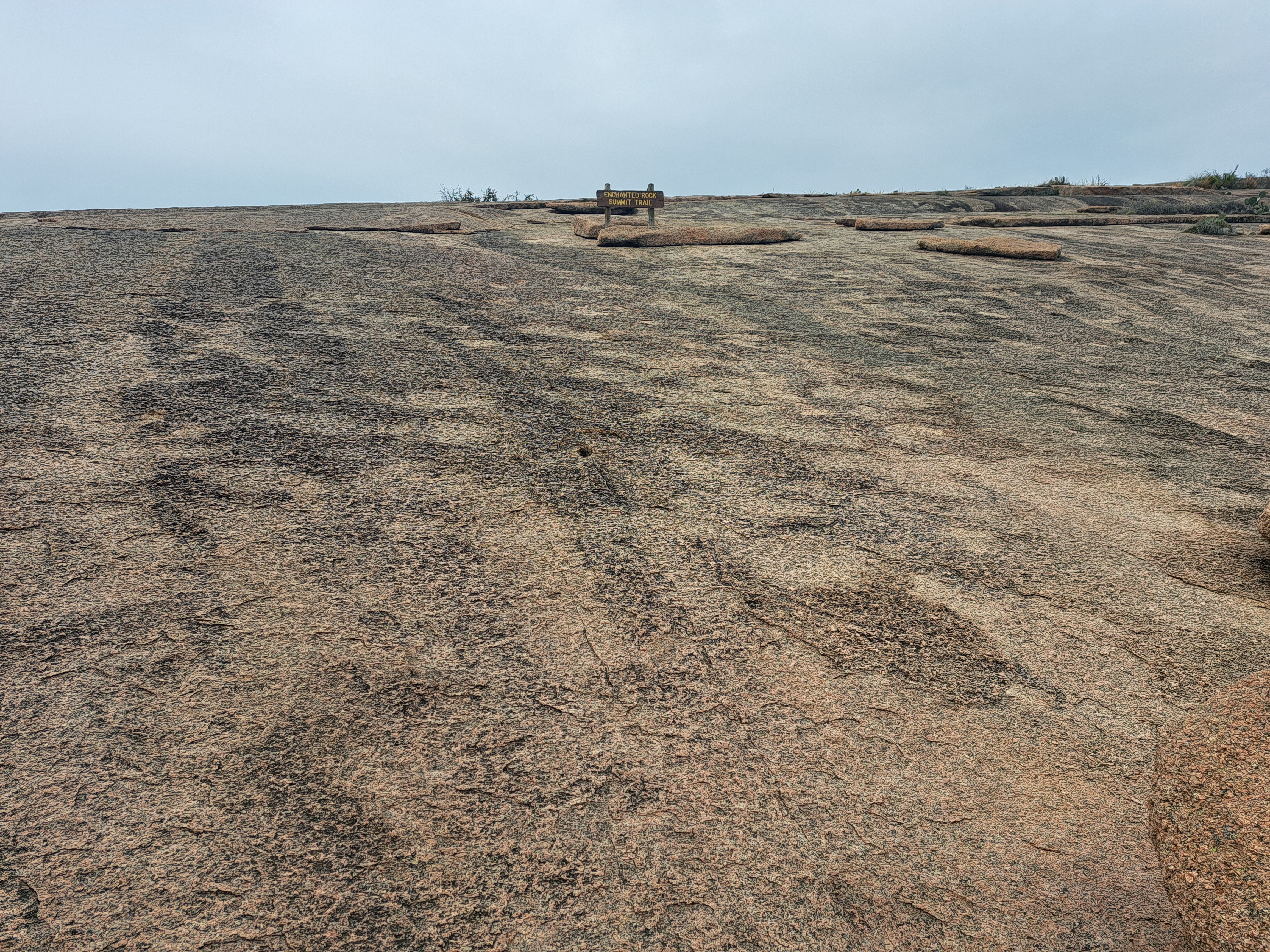
        After climbing another steep section above the cliff, the grade moderates, indicating that the summit is near.  Just shy of 0.75 miles, you reach the US Coast and Geodetics Survey metal disc marker that marks Enchanted Rock's summit.  The summit is surprisingly flat given how hard you worked to get here, and it provides 360-degree views across the heart of Texas Hill Country.  Lower bald granite domes dominate the foreground, including Little Rock to the west and Freshman Mountain to the east.  Larger mountains stand in the distance.  Some vernal pools dot the summit area, and the park brochure warns you not to disturb those fragile habitats.  These are some of the best views in Texas, so take some time and enjoy them.
View west from summit
View north from summit
    
        There is only 1 trail to Enchanted Rock's summit, so the only way down is the way you came up.  Do not underestimate the descent: the vast majority of hiking accidents occur when the hiker is going downhill.  Also, remember that there are no trail markings, and it is easy to get headed the wrong way on the bare rock.  Keep an eye on the dirt trail below the rock leading back to the restroom building and picnic shelter, and walk downhill in the general direction of that trail to stay oriented in the right direction.