Hike Location: Beavertail State Park
Geographic Location: south of Jamestown, RI (41.45181, -71.39946)
Length: 2.3 miles
Difficulty: 2/10 (Easy)
Date Hiked: July 2019
Overview: A loop hike around Beavertail Point featuring
Beavertail Lighthouse.
Park Information: https://riparks.ri.gov/parks/beavertail-state-park
Hike Route Map: https://www.mappedometer.com/?maproute=759085
Photo Highlight:

Directions to the trailhead: Jamestown occupies an
island in Narragansett Bay that is reached by taking SR 138 west out of Newport
or east out of Kingstown. After reaching
the island, go south on North Road, which becomes Beavertail Road in the center
of Jamestown the town. Drive a total of
5.6 miles from SR 138 to reach Beavertail Rd.’s end at Beavertail State
Park. I started my hike at parking lot
#2, although this hike passes through all 4 of the park’s parking lots. On warm weather weekends, you will need to
park wherever you can find a space.
The hike: Separating
two of the main waterways from the Atlantic Ocean in to Narragansett Bay, Beavertail
Point occupies a sentinel place in American maritime history. The first Beavertail Light was built here in
1749, and it was only the third lighthouse erected on what would become the
United States’ east coast. The original
wooden lighthouse burned down 4 years later, but the second structure lasted
until the current granite lighthouse was built in 1856.
Beavertail Point also became
important during World War II. Fort
Burnside was constructed on this site as part of a picket line of coastal
defenses. The defenses protected New
England’s wartime manufacturing plants, and remnants of Fort Burnside will be
seen on this hike.
Fort Burnside ceased operations in 1978,
and in 1980 Beavertail State Park was created out of Federal Surplus Land to
protect historic Beavertail Point. In
addition to preserving the lighthouse, the park offers some of Rhode Island’s
best saltwater fishing. While hiking is
not this park’s main attraction, the park offers several miles of trails. The hike described here forms a loop around
Beavertail Point, and it features all of the park’s points of interest
including the lighthouse, the World War II sites, and the park’s scenic
coastline.
 |
| View south from parking lot #2 |
From parking lot #2, Beavertail Light
looms to the south, so you may as well start by heading to the lighthouse. The rocky coast comes into view to the right
as you walk toward the Light through a small mowed grass area. Some wild roses in bloom aromatized my steps on
the warm humid afternoon in late July that I came here.
At 0.2 miles, you reach Beavertail
Light. The Light is surrounded by a
number of auxiliary buildings, and a small gift shop and museum tells the story
of the lighthouse’s history. The
lighthouse remains operational today. There
is a trail map on display in the museum, and I recommend taking a picture of it
for use on your hike because the park’s trails are neither well-marked nor
well-maintained.
 |
| Beavertail Light |
After touring the Light, continue a
clockwise route around Beavertail Point by walking up the outbound park road or
paralleling the road in the mowed grass area between the road and the
coast. Some round stone foundations in
this area are the first remnants of Fort Burnside passed on this hike. While I could not find any specific
information about any of the old Fort Burnside structures, these stones look
like foundations for a gun battery. I
had a reflective time thinking about what this area might have looked like
during World War II.
 |
| Round stone foundation |
 |
| Rocky coast at Beavertail Point |
Upon reaching parking lot #4, look for a narrow dirt trail that leaves
the mowed grass area and heads into the coastal scrub. A sign with a QR code marks this point. The narrow trail goes along the coast before
curving inland at a grassy field. Due to
the grass and the narrowness of the trail, I recommend checking yourself for
ticks after this hike. My post-hike
inspection yielded one such creepy crawly critter on my socks, and I managed to
cast it back into the grass before it bit me.
 |
| Old Fort Burnside structure |
At 0.8 miles, you reach a rusty metal structure, the most obvious
remnant of Fort Burnside. This structure
looked like an old storage building to me, but again I could not find any
sources to confirm my hunch. Past this
point, the trail widens to a two-track grassy road that leads out to the main
park road. To continue this hike, turn
right on the park road and walk the park road to parking lot #1, the north end
of which contains one of the park’s main trailheads. Re-enter the woods at a sign that warns “no
motor vehicles.”
The main trail in this part of the
park heads north with side trails branching off left and right. The trails in this area form a real maze, and
the lack of trail markings makes it very hard to stay on a chosen course. My best advice is to keep heading in the
general direction of north until, at 1.4 miles, you reach an old asphalt road
that roughly marks the park’s north boundary.
Turn left on the old asphalt road to begin heading west.
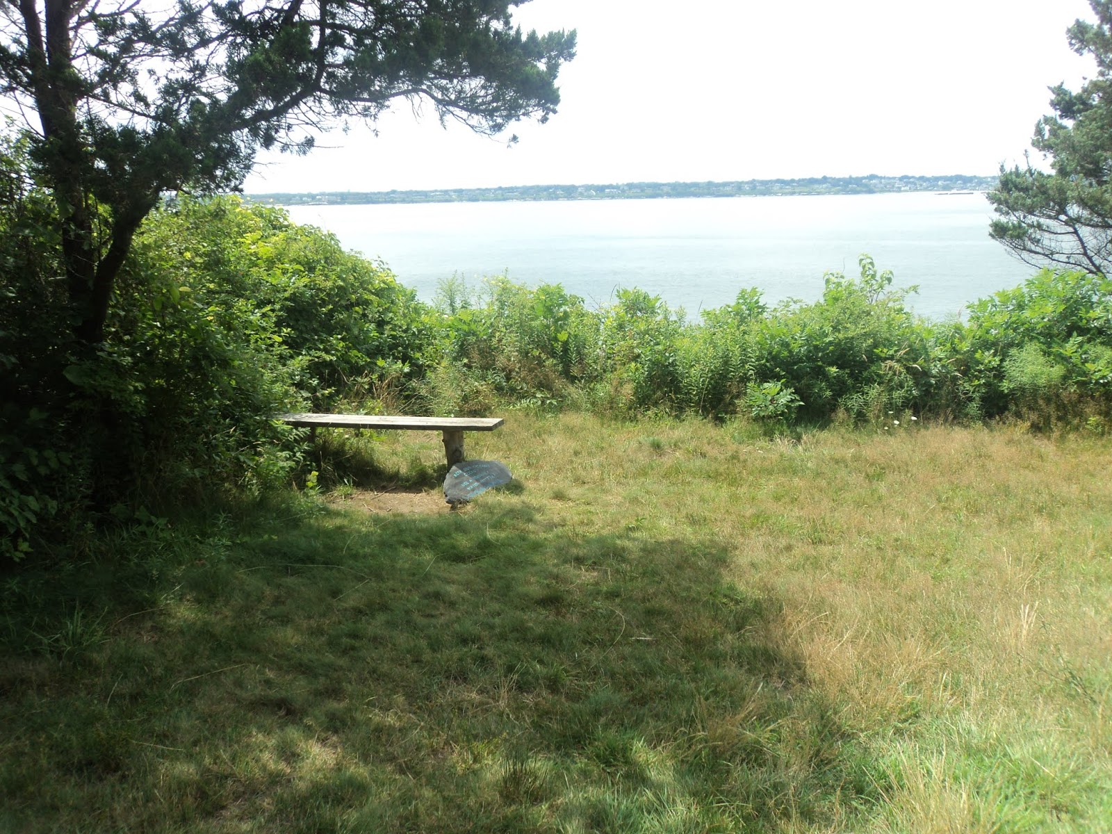 |
| Bench at end of asphalt road |
Just after the asphalt ends, you
reach a bench that provides a nice view off the west side of Beavertail
Point. The trail curves left here and
begins heading south with the rocky coast to the right. Ignore trails that exit left and head
inland. Parts of this trail are very
narrow or muddy, making for unpleasant hiking conditions. With the lighthouse and the area’s history, this
hike could be a real winner with better trail markings and maintenance. If things go according to plan, you will come
out at the north side of parking lot #2 at 2.3 miles. If you accidentally come out at the park road
as I did, you can simply walk the park road back to parking lot #2 and complete
your hike that way.


