Tuesday, June 5, 2018

Smallwood State Park: General's Walk Trail (Blog Hike #686)

Trail: General’s Walk Trail
Hike Location: Smallwood State Park
Geographic Location: southwest of Waldorf, MD (38.55846, -77.18813)
Length: 2.2 miles
Difficulty: 3/10 (Easy/Moderate)
Date Hiked: May 2018
Overview: A lollipop loop passing General Smallwood’s historic Retreat House.
Hike Route Map: https://www.mappedometer.com/?maproute=943242
Photo Highlight:

Directions to the trailhead: On the south side of Washington, D.C., take I-495 to Maryland SR 210 (exit 3).  Exit and go south on SR 210.  Drive SR 210 south 18 miles to SR 225 and turn left on SR 225.  Drive SR 225 east 1.6 miles to SR 224 and turn right on SR 224.  Drive SR 224 south 3.8 miles to the signed park entrance on the right.  Turn right to enter the park, pay the entrance fee, and follow signs for the boat ramp, where this hike begins.  Park in any of the lots near the boat ramp.

The hike: Established in 1958, cozy Smallwood State Park protects 628 acres on the south bank of Mattawoman Creek just before it empties into the Potomac River.  The park is named for General William Smallwood, a Patriot Revolutionary War major general from Maryland who later served as Maryland’s 4th Governor.  
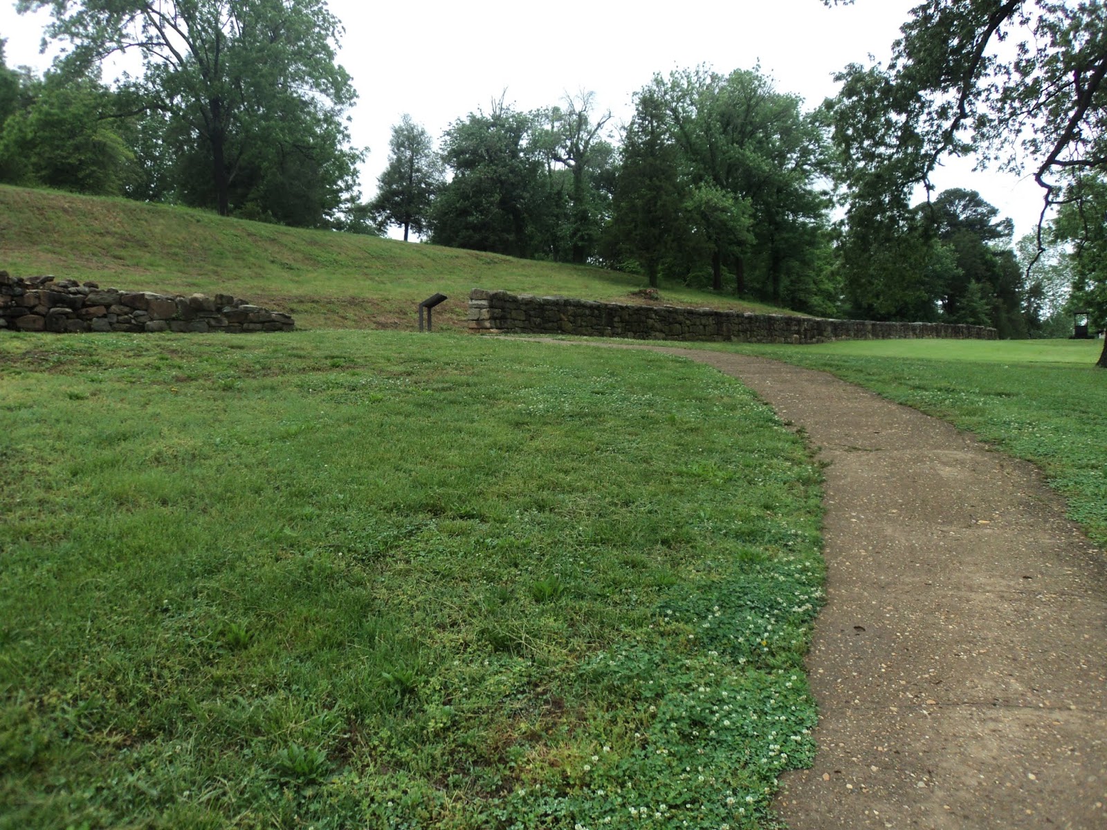
General Smallwood’s Retreat House and grave lie within the park’s boundaries, and they will be seen on this hike.
            The park makes the most of its waterside location, as it features the Sweden Point Marina, numerous fishing piers, and some boat launch ramps.  The park also offers a small campground with 15 campsites and 5 mini cabins, 3 picnic pavilions, a playground, and two short hiking trails.  The park’s longest and best hiking trail is the General’s Walk Trail described here.  The General’s Walk Trail takes you through some nice woods as it connects the boat ramp, the campground, the park office, and the historic Retreat House area, and it makes a nice shady hike on a warm summer day.  (Aside: the trail map available for download on the park’s website is far better and more detailed than the trail map you will get at the park entrance station, so be sure to download or print a trail map before you come.)
Bridge at boat ramp
            There are several places from which you could start the General’s Walk Trail, but I chose to start at the boat ramp.  Look for a wooden bridge that is located at the boat ramp area’s south side and heads over an inlet of Mattawoman Creek.  Mattawoman Creek looks more like a river at this point, and although the bridge looks old, it got me safely over the water.
Mattawoman Creek, as seen from bridge
Trail sign at campground
            Upon reaching the south side of the bridge, climb slightly on a paved path to reach the asphalt campground road, then look up and slightly right for a green wooden sign that says “General’s Walk Foot Trail.”  The single track dirt trail heads into the woods here and descends slightly to reach the bank of an unnamed creek/wetland that features a lot of trees and shrubs.  Several bird boxes have been built over the water, and I saw a family of Canada geese enjoying a humid day on the shady water.
            On my mid-May hike, I passed a stand of mountain laurel in full bloom, though it looked out of place beside the wetland.  Just past 0.5 miles, you reach a trail fork.  The left option is a spur trail that leads to a picnic shelter, so you want to stay right to continue along the wetland.  The General’s Walk Trail is marked by some white rectangular paint blazes, but there may not be a blaze at the exact point where you need one.
Climbing away from the creek
            After passing a bench along the creek, the trail angles left and begins a short but steep climb, gaining 100 feet of elevation in just over 0.1 miles.  Some wooden steps aid the ascent.  At 0.9 miles, you reach the top of the hill and enter the park’s historic area, a mowed-grass area dominated by the brick 
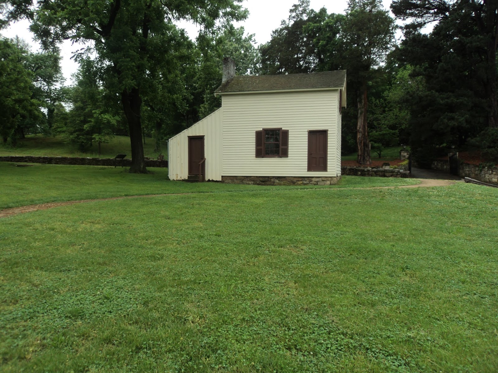
Retreat House.  The Retreat House is a restored 18th century tidewater plantation that is only open the first and third Sunday afternoons from May through September.  Even if the house is not open on your visit (it was not on mine), you can admire the structure from the outside and peep in to the adjacent herb garden.
General Smallwood's Retreat House
            Pass around the right side of the Retreat House and start following a brick path as it heads southeast away from the house.  Some other small structures are located on this site, but the brick path leads to the other large structure: the black wooden tobacco barn.  Walk around the barn and cross the nearby park road to reach a parking lot for the park’s playground and picnic pavilion #3.  Another green wooden sign similar to the one you saw at the campground marks where the trail reenters the woods.
Tobacco Barn
            Next you start my favorite part of this hike, which features some nice beech trees and some sweet gums.  After a gradual descent, the trail curves sharply left to rise slightly.  At 1.4 miles, you reach the park maintenance area and park office.  Angle right, cross the park road, and then angle left into the grassy area beside the park office to find where the trail reenters the woods again.
            Some wet areas will need to be negotiated as you pass some old wooden structures that time and the forest have reclaimed.  After dipping through a small but steep ravine, the trail comes out at the campground road.  Turn right and walk along the road to close the loop, then turn right again and walk back across the wooden bridge to return to the boat ramp and complete the hike.

Monday, June 4, 2018

Fredericksburg and Spotsylvania National Military Park: Sunken Road Trail (Blog Hike #685)

Trail: Sunken Road Trail
Hike Location: Fredericksburg and Spotsylvania National Military Park
Geographic Location: west side of Fredericksburg, VA (38.29431, -77.46760)
Length: 0.8 miles
Difficulty: 1/10 (Easy)
Date Hiked: May 2018
Overview: A short loop through a bloody Civil War battle site.
Hike Route Map: http://www.mappedometer.com/?maproute=689011
Photo Highlight:

Directions to the trailhead: Near Fredericksburg, take I-95 to SR 3 (exit 130A).  Exit and go east on SR 3.  Drive SR 3 east 1.9 miles to Lafayette Blvd. and turn left on Lafayette Blvd.  The Fredericksburg Battlefield Visitor Center is located 0.5 miles further on the left.  Park in the lot behind the Visitor Center.

The hike: It was December of 1862 when the eyes of the United States turned to the small town of Fredericksburg, VA.  The town’s location on the bank of the Rappahannock River about halfway between Richmond and Washington, D.C. made it an important center for commerce and therefore a strategically important site to control during the Civil War.  Nearly 1.5 years into the war, the Union had made little progress in diminishing the Confederacy’s ability to make war, and public confidence in the Lincoln administration’s ability to execute the war was waning, as evidenced by Lincoln’s party’s large losses during the November 1862 midterm elections.  Seeking a more aggressive approach, Lincoln replaced General George McClellan with General Ambrose Burnside as leader of the Union’s Army of the Potomac and urged him to attack south.
            On December 11 and 12, Burnside’s men crossed the Rappahannock River via pontoon bridge and took Fredericksburg after intense hand-to-hand fighting in the city streets.  Yet the Confederates still held well-fortified positions on two hills just south of the city: Marye’s Heights and Prospect Hill.  Thus, the city was not secure because it was still subject to Confederate artillery shelling and skirmishers.  On December 13, Burnside ordered an assault on these two hills that made no progress toward displacing the Confederates and ended in large numbers of Union casualties including two generals.  Two days later, Burnside withdrew his army from the city in defeat.  Though the Army of the Potomac would march south toward Richmond again in later years, the Union would never again try to get to Richmond through Fredericksburg.
            Today Marye’s Heights is the home of Fredericksburg National Cemetery and the Fredericksburg Battlefield Visitor Center.  The two-story Visitor Center features an interesting film and does a great job of describing the events surrounding the Battle of Fredericksburg.  The area around the Visitor Center offers a tour road and one short hiking trail: the 0.8 mile Sunken Road Trail.  Other parts of the park offer more substantial hikes (as suggested at the end of this post), but I only hiked this trail due to incoming thunderstorms.  The Sunken Road Trail explores the Confederate fortifications on Marye’s Heights and gives you a good idea of what the Union soldiers would have faced as they advanced on the Confederates’ positions.
Trail leaving Visitor Center parking lot
            From the back of the Visitor Center, walk across the parking lot and look for the Sunken Road Trail’s signed trailhead.  The asphalt path curves left and heads slightly uphill to reach the Sunken Road.  Turn right to head north on the gravel road.
Sunken Road and stone wall
            The Sunken Road gets its name because it passes between a steep hillside on your left and a stone wall on your right.  In 1862, the area beyond the stone wall was an open field, and Confederate soldiers used the stone wall as a fortification by taking position on the road where you are walking.  Considering the Confederate artillery stationed atop the hill to your left, you can see why the Confederates’ position was so impregnable.  Thousands of advancing Union soldiers died here, and none got within 50 feet of the stone wall.  After the battle, Confederate veterans remarked that they could have killed the entire Union army had it come across the field toward the wall.  The section of stone wall closest to the Visitor Center is a reconstruction, but part of the original wall remains a few hundred feet further north.
Stratton House
            As you continue north, the remnants of several small historic buildings appear to the right.  Heavily damaged during the battle, these buildings provided limited shelter to advancing Union troops.  When you reach the original stone wall, angle right to make a short loop past the Kirkland Monument and the site of the Ebert House and Store.  The Kirkland Monument is a statue honoring Confederate Sergeant Richard Kirkland who risked his life to bring water to wounded Union soldiers, while the Ebert House and Store was another building that provided limited shelter during the battle.
View from Confederate artillery position
            After completing the short loop, turn right to head gradually uphill toward the Confederate artillery position.  At the top of the hill, turn left to begin following a trail made of recycled tires that leads to the hilltop artillery position.  The view from the hilltop features more trees today than it did in 1862, but you can still see downtown Fredericksburg over the trees.
Fredericksburg National Cemetery
            Past the artillery position, the trail continues south to enter Fredericksburg National Cemetery, the burial place of more than 15,000 Union soldiers who died in battles fought between Richmond and Washington, D.C.  Angle left to head steeply downhill toward the Visitor Center to complete the hike.  While you are here, consider visiting other nearby Civil War battlefields including Spotsylvania Courthouse and Chancellorsville, the place where Stonewall Jackson was mortally wounded by friendly fire.  Both of those locations offer substantial dayhikes over well-developed trail systems and are worth visiting if the weather is better on your visit than it was on mine.